close
-
Layers w
- Map Content
- More Layers
- Pro
- Pro
- Pro
- Pro
- Pro
- Pro
- Pro
- Pro
-
Upgrade to

3D
Trail Conditions
- Unknown
- Snow Groomed
- Snow Packed
- Snow Covered
- Snow Cover Partial
- Freeze/thaw Cycle
- Icy
- Prevalent Mud
- Wet
- Variable
- Ideal
- Dry
- Very Dry
Trail Flow (Ridden Direction)
Trailforks scans users ridelogs to determine the most popular direction each trail is ridden. A good flowing trail network will have most trails flowing in a single direction according to their intension.
The colour categories are based on what percentage of riders are riding a trail in its intended direction.
The colour categories are based on what percentage of riders are riding a trail in its intended direction.
- > 96%
- > 90%
- > 80%
- > 70%
- > 50%
- < 50%
- bi-directional trail
- no data
Trail Last Ridden
Trailforks scans ridelogs to determine the last time a trail was ridden.
- < 2 days
- < 1 week
- < 2 weeks
- < 1 month
- < 6 months
- > 6 months
Trail Ridden Direction
The intended direction a trail should be ridden.
- Downhill Only
- Downhill Primary
- Both Directions
- Uphill Primary
- Uphill Only
- One Direction
Contribute Details
Colors indicate trail is missing specified detail.
- Description
- Photos
- Description & Photos
- Videos
Trail Popularity ?
Trailforks scans ridelogs to determine which trails are ridden the most in the last 9 months.
Trails are compared with nearby trails in the same city region with a possible 25 colour shades.
Think of this as a heatmap, more rides = more kinetic energy = warmer colors.
- most popular
- popular
- less popular
- not popular
ATV/ORV/OHV Filter
Max Vehicle Width
inches
US Cell Coverage
Legend

Radar Time
x
Activity Recordings
Trailforks users anonymized public ridelogs from the past 6 months.
- mountain biking recent
- mountain biking (>6 month)
- hiking (1 year)
- moto (1 year)
Activity Recordings
Trailforks users anonymized public skilogs from the past 12 months.
- Downhill Ski
- Backcountry Ski
- Nordic Ski
- Snowmobile
Winter Trails
Warning
A routing network for winter maps does not exist. Selecting trails using the winter trails layer has been disabled.
x
Missing Trails
Most Popular
Least Popular
Trails are colored based on popularity. The more popular a trail is, the more red. Less popular trails trend towards green.
Jump Magnitude Heatmap
Heatmap of where riders jump on trails. Zoom in to see individual jumps, click circles to view jump details.
Trails Deemphasized
Trails are shown in grey.
Only show trails with NO bikes.
Save the current map location and zoom level as your default home location whenever this page is loaded.
Save
No description for Quart has been added yet!
Login or register to submit one.
Activities Click to view
- Mountain Bike
9 trails
- Hike
10 trails
- Trail Running
10 trails
Region Details
- 1
- 5
- 3
Region Status
Open as of May 5, 2024Stats
- Avg Trail Rating
- Trails (view details)
- 10
- Trails Mountain Bike
- 9
- Trails E-Bike
- 9
- Trails Hike
- 10
- Trails Trail Running
- 10
- Total Distance
- 18 miles
- Total Descent
- 11,604 ft
- Total Vertical
- 6,441 ft
- Highest Trailhead
- 8,241 ft
- Reports
- 25
- Photos
- 12
- Ridden Counter
- 141
Popular Quart Mountain Biking Trails
Quart Mountain Bike Routes
| title | rating | distance |
|---|---|---|
| Mont Corquet-Fenis | 21 miles |
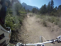
Photos of Quart Mountain Bike
trail: Mont Corquet
8 |
Aug 19, 2023 @ 10:05am
Aug 19, 2023
trail: Beato Emerico
9 |
Apr 5, 2023 @ 3:05am
Apr 5, 2023
trail: Beato Emerico
15 |
Apr 5, 2023 @ 3:05am
Apr 5, 2023
trail: Morgonaz #1
31 |
Nov 20, 2021 @ 4:51am
Nov 20, 2021
trail: Mont Corquet
78 |
Sep 16, 2020 @ 7:55am
Sep 16, 2020
trail: Mont Corquet
87 |
Sep 16, 2020 @ 7:54am
Sep 16, 2020
trail: Mont Corquet
96 |
Sep 16, 2020 @ 7:53am
Sep 16, 2020
trail: Beato Emerico
633 | | 4 comments
Sep 5, 2007 @ 6:56am
Sep 5, 2007Videos of Quart Mountain Bike
trail: Pietro
4:10 |
170 |
Jan 13, 2016
trail: Pietro
2:45 |
548 |
Jul 16, 2013
trail: Pietro
3:12 |
11438 |
Dec 30, 2012
trail: Pietro
2:03 |
1514 |
Nov 24, 2012

trail: Pietro
2:32 |
1195 |
Oct 18, 2012

trail: Pietro
3:59 |
1356 |
Oct 11, 2012
trail: Pietro
2:30 |
453 |
Jun 24, 2012

trail: Beato Emerico
7:21 |
53 |
May 22, 2023 , Quart
Recent Trail Reports
| status | trail | date | condition | info | user |
|---|---|---|---|---|---|
| Beato Emerico | May 5, 2024 @ 10:16am May 5, 2024 | Very Dry | Fiuz | ||
| Morgonaz #1 | Apr 26, 2024 @ 1:05am Apr 26, 2024 | Ideal | mangiaostie | ||
| 7 to 7B (old downhill track) | May 9, 2023 @ 11:27am May 9, 2023 | Dry | alpebike | ||
| Pietro | Apr 16, 2023 @ 7:17am Apr 16, 2023 | Dry | Fiuz | ||
| Damn Daniel | Apr 10, 2023 @ 4:46am Apr 10, 2023 | Ideal | Fiuz |
Activity Feed
| username | action | type | title | date |
|---|---|---|---|---|
| Fiuz | add | report | activity #52131135 | May 5, 2024 @ 10:16am May 5, 2024 |
| mangiaostie | add | report | activity #51702685 | Apr 26, 2024 @ 1:05am Apr 26, 2024 |
| Alpinejuice | wishlist | trail | activity #50119075 | Mar 17, 2024 @ 7:58am Mar 17, 2024 |
| Chainmark | ridden | trail | activity #48691904 | Jan 30, 2024 @ 4:17am Jan 30, 2024 |
| Alexandra22 | wishlist | trail | activity #44050484 | Sep 13, 2023 @ 2:19am Sep 13, 2023 |
Recent Comments
| username | type | title | comment | date |
|---|---|---|---|---|
| report | La descente est rapide. Il faut faire... | May 9, 2023 @ 11:29am May 9, 2023 | ||
| report | Superbe sentier avec pas mal de variété dans... | May 9, 2023 @ 11:24am May 9, 2023 |
Activity Type Stats
| activitytype | trails | distance | descent | descent distance | total vertical | rating | global rank | state rank | photos | reports | routes | ridelogs |
|---|---|---|---|---|---|---|---|---|---|---|---|---|
| Mountain Bike | 9 | 18 miles | 10,807 ft | 10 miles | 6,440 ft | #6,781 | #622 | 7 | 25 | 1 | 507 | |
| E-Bike | 9 | 16 miles | 9,751 ft | 9 miles | 6,440 ft | 5 | 23 | 89 | ||||
| Hike | 10 | 18 miles | 11,604 ft | 11 miles | 6,440 ft | #5,479 | #438 | 25 | 111 | |||
| Trail Running | 10 | 18 miles | 11,604 ft | 11 miles | 6,440 ft | #5,469 | #434 | 25 | 21 |
- By brenthillier
 NSMBA TRAILFORKS & contributors
 - Admins: apply
- #10735 - 1,713 views
- quart activity log | embed map of Quart mountain bike trails | quart mountain biking points of interest
Downloading of trail gps tracks in kml & gpx formats is enabled for Quart.
You must login to download files.