close
-
Layers w
- Map Content
- More Layers
- Pro
- Pro
- Pro
- Pro
- Pro
- Pro
- Pro
- Pro
-
Upgrade to

3D
Trail Conditions
- Unknown
- Snow Groomed
- Snow Packed
- Snow Covered
- Snow Cover Partial
- Freeze/thaw Cycle
- Icy
- Prevalent Mud
- Wet
- Variable
- Ideal
- Dry
- Very Dry
Trail Flow (Ridden Direction)
Trailforks scans users ridelogs to determine the most popular direction each trail is ridden. A good flowing trail network will have most trails flowing in a single direction according to their intension.
The colour categories are based on what percentage of riders are riding a trail in its intended direction.
The colour categories are based on what percentage of riders are riding a trail in its intended direction.
- > 96%
- > 90%
- > 80%
- > 70%
- > 50%
- < 50%
- bi-directional trail
- no data
Trail Last Ridden
Trailforks scans ridelogs to determine the last time a trail was ridden.
- < 2 days
- < 1 week
- < 2 weeks
- < 1 month
- < 6 months
- > 6 months
Trail Ridden Direction
The intended direction a trail should be ridden.
- Downhill Only
- Downhill Primary
- Both Directions
- Uphill Primary
- Uphill Only
- One Direction
Contribute Details
Colors indicate trail is missing specified detail.
- Description
- Photos
- Description & Photos
- Videos
Trail Popularity ?
Trailforks scans ridelogs to determine which trails are ridden the most in the last 9 months.
Trails are compared with nearby trails in the same city region with a possible 25 colour shades.
Think of this as a heatmap, more rides = more kinetic energy = warmer colors.
- most popular
- popular
- less popular
- not popular
ATV/ORV/OHV Filter
Max Vehicle Width
inches
US Cell Coverage
Legend

Radar Time
x
Activity Recordings
Trailforks users anonymized public ridelogs from the past 6 months.
- mountain biking recent
- mountain biking (>6 month)
- hiking (1 year)
- moto (1 year)
Activity Recordings
Trailforks users anonymized public skilogs from the past 12 months.
- Downhill Ski
- Backcountry Ski
- Nordic Ski
- Snowmobile
Winter Trails
Warning
A routing network for winter maps does not exist. Selecting trails using the winter trails layer has been disabled.
x
Missing Trails
Most Popular
Least Popular
Trails are colored based on popularity. The more popular a trail is, the more red. Less popular trails trend towards green.
Jump Magnitude Heatmap
Heatmap of where riders jump on trails. Zoom in to see individual jumps, click circles to view jump details.
Trails Deemphasized
Trails are shown in grey.
Only show trails with NO bikes.
Save the current map location and zoom level as your default home location whenever this page is loaded.
Save
No description for Redmond has been added yet!
Login or register to submit one.
Activities Click to view
- Mountain Bike
64 trails
- E-Bike
38 trails
- Horse
12 trails
- Hike
92 trails
- Trail Running
92 trails
Region Details
- 4
- 8
- 46
- 5
- 1
Region Status
Caution as of May 13, 2024Local Trail Association
Stats
- Avg Trail Rating
- Trails (view details)
- 95
- Trails Mountain Bike
- 64
- Trails E-Bike
- 38
- Trails Horse
- 12
- Trails Hike
- 92
- Trails Trail Running
- 92
- Total Distance
- 53 miles
- Total Descent
- 4,069 ft
- Total Vertical
- 584 ft
- Highest Trailhead
- 611 ft
- Reports
- 232
- Photos
- 46
- Ridden Counter
- 6,737
Sub Regions
-
Farrel McWhirter Park
- 1
-
Hartman Park
- 1
- 7
- 1
- 1
-
Juel Community Park
- 1
-
Nike Park
- 2
- 2
- 2
-
Redmond Watershed Preserve
- 2
- 31
- 1
-
Willows Fjords
- 1
- 1
Popular Redmond Mountain Biking Trails
Redmond Mountain Bike Routes
| title | rating | distance |
|---|---|---|
| WA_Willows Fjords | 4 miles | |
| race | 18 miles |
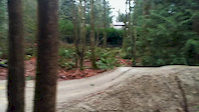
Photos of Redmond Mountain Bike
trail: Shredmond
74 |
Jul 7, 2022 @ 3:14pm
Jul 7, 2022
trail: A-Line South
105 |
Jul 7, 2022 @ 3:14pm
Jul 7, 2022
trail: A-Line South
117 |
Jul 7, 2022 @ 3:13pm
Jul 7, 2022
trail: Shredmond
121 |
Aug 7, 2021 @ 8:49am
Aug 7, 2021
trail: Nike Trail
205 |
May 3, 2021 @ 2:30pm
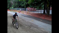
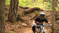
May 3, 2021Videos of Redmond Mountain Bike

trail: Shredmond
18 |
Sep 8, 2023

trail: Easy-A
3:08 |
335 |
May 15, 2017

trail: Outer Space
1:02 |
499 |
Mar 9, 2015
trail: Outer Space
0:14 |
339 |
Dec 23, 2014
trail: Outer Space
2:01 |
643 |
Jul 23, 2014

trail: Diamonds
0:57 |
560 |
Nov 13, 2013
trail: Diamonds
2:20 |
59578 |
Aug 9, 2011

trail: Diamonds
2:06 |
895 |
Jun 24, 2011
Recent Trail Reports
| status | trail | date | condition | info | user |
|---|---|---|---|---|---|
| A-Line South | May 13, 2024 @ 12:38pm May 13, 2024 | Ideal | QuinnPVR0pk | ||
| Bridle Crest Trail | Nov 8, 2023 @ 7:29pm Nov 8, 2023 | Dry | Akryhuang | ||
| Marymoor Connector Trail | Oct 8, 2023 @ 3:53am Oct 8, 2023 | Variable | aaronspruit | ||
| 520 Trail | May 21, 2023 @ 1:22am May 21, 2023 | Very Dry | tobeytransition | ||
| Pipeline Regional Trail | Jun 21, 2023 @ 3:49am Jun 21, 2023 | Variable | lbfatboyslim | ||
| West Sammamish river trail | Jun 16, 2023 @ 4:48am Jun 16, 2023 | Dry | lbfatboyslim | ||
| Outer Space | Mar 25, 2023 @ 12:52am Mar 25, 2023 | Ideal | Qmcdonnell | ||
| Easy-A | Mar 25, 2023 @ 7:52am Mar 25, 2023 | Variable | Qmcdonnell | ||
| Redmond Central Connector Trail | Jan 10, 2023 @ 4:24am Jan 10, 2023 | Ideal | lbfatboyslim | ||
| Pipeline-Watershed Connector Trail | Sep 11, 2022 @ 2:01pm Sep 11, 2022 | Ideal | Qmcdonnell |
Activity Feed
| username | action | type | title | date |
|---|---|---|---|---|
| lukeyyQrC0 | ridden | trail | activity #52804172 | May 18, 2024 @ 10:55pm 1 day |
| QuinnPVR0pk | add | report | activity #52553238 | May 13, 2024 @ 12:38pm May 13, 2024 |
| TP21 | ridden | trail | activity #51843556 | Apr 29, 2024 @ 9:07am Apr 29, 2024 |
| TP21 | ridden | trail | activity #51843543 and 7 more | Apr 29, 2024 @ 9:07am Apr 29, 2024 |
| TP21 | ridden | trail | activity #51843530 | Apr 29, 2024 @ 9:07am Apr 29, 2024 |
Recent Comments
| username | type | title | comment | date |
|---|---|---|---|---|
| trail | Trail was gated with signs that its private... | Jan 8, 2024 @ 10:57am Jan 8, 2024 | ||
| trail | This trail is sick needs some more work but it... | May 22, 2022 @ 7:59pm May 22, 2022 | ||
| trail | Trail covered by leaves. A broken little... | Mar 10, 2022 @ 11:55pm Mar 10, 2022 | ||
| report | Treeforks wouldn’t allow me to add photo.... | Oct 21, 2021 @ 5:08pm Oct 21, 2021 | ||
| skillpark | My ten year old loves this place. The blue... | Apr 21, 2021 @ 3:24pm Apr 21, 2021 |
Local Badges
-

Big Ride 30k4,417 awarded -

Epic Ride 50k1,132 awarded -

Climbing 10k Badge70 awarded -

10 Green Trails139 awarded -

Epic Ride Climb 2k3 awarded -

Epic Ride Descent 2k3 awarded
Bike & Skill Parks
| name | type | city | rating |
|---|---|---|---|
| Redmond Bike Park | skill park | Redmond |
Activity Type Stats
| activitytype | trails | distance | descent | descent distance | total vertical | rating | global rank | state rank | photos | reports | routes | ridelogs |
|---|---|---|---|---|---|---|---|---|---|---|---|---|
| Mountain Bike | 64 | 41 miles | 2,484 ft | 12 miles | 584 ft | #1,305 | #717 | 46 | 232 | 2 | 17,559 | |
| E-Bike | 38 | 26 miles | 971 ft | 7 miles | 584 ft | #1,610 | #328 | 208 | 1,088 | |||
| Horse | 12 | 8 miles | 682 ft | 2 miles | 456 ft | #109 | #88 | 36 | 27 | |||
| Hike | 92 | 52 miles | 4,065 ft | 16 miles | 584 ft | #1,160 | #716 | 228 | 3 | 593 | ||
| Trail Running | 92 | 52 miles | 4,065 ft | 16 miles | 584 ft | #1,169 | #717 | 228 | 1 | 1,065 |
- By konadelux
 & contributors
 - Admins: EMBA-C2S, EMBA-C2S
- #5719 - 6,366 views
- redmond activity log | embed map of Redmond mountain bike trails | redmond mountain biking points of interest
Downloading of trail gps tracks in kml & gpx formats is enabled for Redmond.
You must login to download files.