close
-
Layers w
- Weather Layers
- Pro
- Pro
- Pro
- Pro
- Pro
- Pro
- More Layers
- Pro
- Pro
- Pro
- Pro
-
Upgrade to

3D
Trail Conditions
- Unknown
- Snow Groomed
- Snow Packed
- Snow Covered
- Snow Cover Partial
- Freeze/thaw Cycle
- Icy
- Prevalent Mud
- Wet
- Variable
- Ideal
- Dry
- Very Dry
Trail Flow (Ridden Direction)
Trailforks scans users ridelogs to determine the most popular direction each trail is ridden. A good flowing trail network will have most trails flowing in a single direction according to their intension.
The colour categories are based on what percentage of riders are riding a trail in its intended direction.
The colour categories are based on what percentage of riders are riding a trail in its intended direction.
- > 96%
- > 90%
- > 80%
- > 70%
- > 50%
- < 50%
- bi-directional trail
- no data
Trail Last Ridden
Trailforks scans ridelogs to determine the last time a trail was ridden.
- < 2 days
- < 1 week
- < 2 weeks
- < 1 month
- < 6 months
- > 6 months
Trail Ridden Direction
The intended direction a trail should be ridden.
- Downhill Only
- Downhill Primary
- Both Directions
- Uphill Primary
- Uphill Only
- One Direction
Contribute Details
Colors indicate trail is missing specified detail.
- Description
- Photos
- Description & Photos
- Videos
Trail Popularity ?
Trailforks scans ridelogs to determine which trails are ridden the most in the last 9 months.
Trails are compared with nearby trails in the same city region with a possible 25 colour shades.
Think of this as a heatmap, more rides = more kinetic energy = warmer colors.
- most popular
- popular
- less popular
- not popular
ATV/ORV/OHV Filter
Max Vehicle Width
inches
US Cell Coverage
Legend

Radar Time
Activity Recordings
Trailforks uses anonymized public activity data.
?
Activity Recordings
Trailforks uses anonymized public activity data.
?
Personal Heatmap
▶
Activity Types
all
/
none
▶
Options
2
Date range
month
–
Winter Trails
Warning
A routing network for winter maps does not exist. Selecting trails using the winter trails layer has been disabled.
Missing Trails
Most Popular
Least Popular
Trails are colored based on popularity. The more popular a trail is, the more red. Less popular trails trend towards green.
Jump Magnitude Heatmap
Heatmap of where riders jump on trails. Zoom in to see individual jumps, click circles to view jump details.
BC Backroad Status
![map legend]()
Service Road Atlas is a free to use, community-driven service for viewing and creating reports on the numerous back-country service roads around B.C. and Alberta.

Slope Aspect
Direction the slope faces
Trails Deemphasized
Trails are shown in grey.
Only show trails with no bike usage.
Suggested Layers
Based on selected activity type
Save the current map location and zoom level as your default home location whenever this page is loaded.
Save
No description for Rigaud has been added yet!
Login or register to submit one.
Activities Click to view
- Mountain Bike
23 trails
- E-Bike
6 trails
- Gravel Bike
0 trails
- Adaptive Bike
0 trails
- Hike
11 trails
- Trail Running
10 trails
- Snowshoe
2 trails
- Nordic Ski
2 trails
Stats
- Avg Trail Rating
- Trails (view details)
- 25
- Trails Mountain Bike
- 27
- Trails E-Bike
- 6
- Trails Horse
- 1
- Trails Hike
- 11
- Trails Trail Running
- 10
- Trails Snowshoe
- 2
- Trails Nordic Ski
- 2
- Total Distance
- 25 miles
- Total Descent
- 3,159 ft
- Total Vertical
- 536 ft
- Highest Trailhead
- 698 ft
- Reports
- 390
- Photos
- 47
- Ridden Counter
- 9,610
Sub Regions
-
Mont Rigaud
- 8
- 4
- 8
- 1
Popular Rigaud Mountain Biking Trails
• 55 ★ 3.5 • 1,690 ft • 43 ft • 623 •
Moderately popular green difficulty family friendly singletrack. This mountain bike primary trail can be used uphill primary and has a easy overall physical rating with a 43 ft green climb. It features berm. Exposure: Normal Injury Risk. Trail visibility is always easy to follow. On average it takes 8 minutes to complete this trail.
• 65 ★ 4.4 • 551 ft • 0 ft • 579 •
Highly rated moderately popular black diamond difficulty singletrack. This mountain bike primary trail can be used downhill primary. On average it takes minutes to complete this trail.
• 75 ★ 3.3 • 4,898 ft • 224 ft • 576 •
going uphill the bottom of the trail is fairly technical, the middle part of it is pretty consistent and fairly easy with a 8% uphill. the last 250m of the trail is loose rock and a few switch back and berm, overall the trail is fun and...
• 80 ★ 4.2 • 4,806 ft • 14 ft • 565 •
Highly rated popular black diamond difficulty machine groomed. This mountain bike primary trail and has a easy overall physical rating with a 14 ft green climb. It features berm, bridge, jump, gap jump and ladder bridge. Trail visibility is always easy to follow. On average it takes 8 minutes to complete this trail.
• 95 ★ 3.5 • 3,363 ft • 275 ft • 542 •
Popular green difficulty doubletrack. This multi-use trail can be used one direction and has a moderate overall physical rating with a 275 ft green climb. Trail visibility is always easy to follow. On average it takes 9 minutes to complete this trail.
• 60 ★ 3.8 • 735 ft • 10 ft • 540 •
Moderately popular blue difficulty singletrack. This mountain bike primary trail. On average it takes 4 minutes to complete this trail.
• 70 ★ 4.7 • 2,402 ft • 0 ft • 503 •
This is a new flow trail at Mont Rigaud. It is characterized by smooth machine-groomed berms, several kickers and a couple of nice drops. Enter via the starting gates to the rider's left of the chairlift.
Rigaud Mountain Bike Routes
• 19 miles • 4,209 ft • 35 •
• 13 miles • 2,545 ft • 41 •
• 17 miles • 3,439 ft • 54 •
• 11 miles • 2,026 ft • 26 •
• 8 miles • 1,137 ft • 17 •
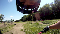
Photos of Rigaud Mountain Bike
Videos of Rigaud Mountain Bike
trail: P'tite Montée
0:05 |
510 |
Jun 19, 2013
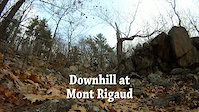
trail: Le Couloir
0:38 |
1313 |
Nov 23, 2011

trail: Rigolo
38:55 |
161 |
Jan 1, 2024 , Rigaud
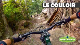
trail: Le Couloir
4:10 |
268 |
Jan 1, 2024 , Rigaud

trail: Yakima
2:22 |
362 |
Sep 6, 2023 , Rigaud

trail: L'Orée du bois
11:00 |
266 |
Sep 5, 2023 , Rigaud

trail: La Kamikaze
9:16 |
184 |
Aug 17, 2023 , Rigaud

trail: Yakima
9:16 |
142 |
Aug 17, 2023 , Rigaud
Recent Trail Reports
| status | trail | date | condition | info | user |
|---|---|---|---|---|---|
| Rigolo | Jun 16, 2026 @ 6:15pm (America/Toronto) 1 day | Variable | StephaneMarceau TRAILFORKS | ||
| Anaconda | Jun 13, 2026 @ 11:30am (America/Toronto) Jun 13, 2026 | Ideal | kab450 | ||
| Yakima | Jun 1, 2026 @ 6:30pm (America/Toronto) Jun 1, 2026 | Ideal | StephaneMarceau TRAILFORKS | ||
| José-Le-Diable | Jun 1, 2026 @ 6:30pm (America/Toronto) Jun 1, 2026 | Ideal | StephaneMarceau TRAILFORKS | ||
| Seigneurie | May 30, 2026 @ 8:40am (America/Toronto) May 30, 2026 | Unknown | andrewAzYKYO | ||
| P'tite Montée | May 23, 2026 @ 12:20pm (America/Toronto) May 23, 2026 | Ideal | kab450 | ||
| L'Horizon | May 23, 2026 @ 12:20pm (America/Toronto) May 23, 2026 | Ideal | kab450 | ||
| L'Orée du bois | May 19, 2026 @ 12:39pm (America/Toronto) May 19, 2026 | Ideal | jbgay | ||
| La Kamikaze | May 18, 2026 @ 4:45pm (America/Toronto) May 18, 2026 | Variable | StephaneMarceau TRAILFORKS | ||
| O'Keefe | May 9, 2026 @ 1:10pm (America/Toronto) May 9, 2026 | Ideal | kab450 |
Activity Feed
| username | action | type | title | date |
|---|---|---|---|---|
| StephaneMarceau | ridden | trail | activity #97154959 and 3 more | Jun 16, 2026 @ 6:48pm 1 day |
| StephaneMarceau | add | report | activity #97154636 | Jun 16, 2026 @ 6:43pm 1 day |
| kab450 | add | report | activity #96914276 and 1 more | Jun 13, 2026 @ 1:59pm Jun 13, 2026 |
| thereisnospoon79 | ridden | trail | activity #96490041 | Jun 7, 2026 @ 12:52pm Jun 7, 2026 |
| StephaneMarceau | add | report | activity #96093946 and 2 more | Jun 2, 2026 @ 10:24am Jun 2, 2026 |
Recent Comments
| username | type | title | comment | date |
|---|---|---|---|---|
| trail | Top part of track changed with cement added to... | Aug 23, 2021 @ 7:20pm Aug 23, 2021 | ||
| trail | Flowy black with some small hits along the... | Aug 19, 2020 @ 12:24pm Aug 19, 2020 | ||
| trail | Trail map says double black diamond. The steep... | Aug 19, 2020 @ 12:21pm Aug 19, 2020 | ||
| trail | This is not double black or singletrack or... | Aug 15, 2020 @ 9:07pm Aug 15, 2020 | ||
| trail | Rigaud was supposed to open today may 1st but... | May 1, 2018 @ 6:17pm May 1, 2018 |
Local Badges
-

Epic Ride Climb 2k1 awarded -

Climbing 10k Badge26 awarded -

Climbing 100k Badge1 awarded -

Epic Ride Descent 2k1 awarded -

Descent 10k Badge26 awarded -

Descent 100k Badge1 awarded
Bike & Skill Parks
| name | type | city | rating |
|---|---|---|---|
| Pump Track Mont-Rigaud | skill park | Rigaud |
Activity Type Stats
| activitytype | trails | distance | descent | descent distance | total vertical | rating | global rank | state rank | photos | reports | routes | ridelogs |
|---|---|---|---|---|---|---|---|---|---|---|---|---|
| Mountain Bike | 23 | 10 miles | 1,762 ft | 4 miles | 535 ft | #2,538 | #33 | 47 | 390 | 2 | 6,860 | |
| E-Bike | 6 | 3 miles | 302 ft | 3,094 ft | 341 ft | #6,156 | #68 | 370 | 175 | |||
| Horse | 1 | 9 miles | 643 ft | 3 miles | 358 ft | 73 | 2 | |||||
| Hike | 11 | 20 miles | 1,555 ft | 6 miles | 515 ft | #7,528 | #69 | 364 | 233 | |||
| Trail Running | 10 | 19 miles | 1,555 ft | 6 miles | 515 ft | #7,218 | #62 | 364 | 96 | |||
| Snowshoe | 2 | 14 miles | 1,398 ft | 6 miles | 390 ft | #836 | #30 | 59 | ||||
| Nordic Ski | 2 | 14 miles | 1,398 ft | 6 miles | 390 ft | #1,094 | #60 | 165 |
Frequently Asked Questions About Rigaud
▼
What are the best places to ride in Rigaud?
Rigaud has 2 areas to explore for mountain biking. The top rated areas are:
▼
What are the highest rated mountain biking trails in Rigaud?
The highest rated mountain biking trails in Rigaud are:
- José-Le-Diable (4.4/5)
- Yakima (4.4/5)
- La Vertige (4.2/5)
- La Kamikaze (4.2/5)
- Rigolo (4.1/5)
▼
What is the best time of the year to ride in Rigaud?
Based on ride log data, the most popular months to ride in Rigaud are:
- May (123 activities)
- June (120 activities)
- September (115 activities)
▼
Where can I park to ride in Rigaud?
There are 3 parking locations listed in Rigaud. The most popular parking spots are: View all parking and trailhead locations on the map to plan your visit.
Activities
- By StephaneMarceau
 TRAILFORKS & contributors
 - Admins: VQ, bigjay, StephaneMarceau, Canadmos
- #7270 - 7,692 views
- rigaud activity log | embed map of Rigaud mountain bike trails | rigaud mountain biking points of interest
Downloading of trail gps tracks in kml & gpx formats is enabled for Rigaud.
You must login to download files.