close
-
Layers w
- Weather Layers
- Pro
- Pro
- Pro
- Pro
- Pro
- Pro
- More Layers
- Pro
- Pro
- Pro
- Pro
-
Upgrade to

3D
Trail Conditions
- Unknown
- Snow Groomed
- Snow Packed
- Snow Covered
- Snow Cover Partial
- Freeze/thaw Cycle
- Icy
- Prevalent Mud
- Wet
- Variable
- Ideal
- Dry
- Very Dry
Trail Flow (Ridden Direction)
Trailforks scans users ridelogs to determine the most popular direction each trail is ridden. A good flowing trail network will have most trails flowing in a single direction according to their intension.
The colour categories are based on what percentage of riders are riding a trail in its intended direction.
The colour categories are based on what percentage of riders are riding a trail in its intended direction.
- > 96%
- > 90%
- > 80%
- > 70%
- > 50%
- < 50%
- bi-directional trail
- no data
Trail Last Ridden
Trailforks scans ridelogs to determine the last time a trail was ridden.
- < 2 days
- < 1 week
- < 2 weeks
- < 1 month
- < 6 months
- > 6 months
Trail Ridden Direction
The intended direction a trail should be ridden.
- Downhill Only
- Downhill Primary
- Both Directions
- Uphill Primary
- Uphill Only
- One Direction
Contribute Details
Colors indicate trail is missing specified detail.
- Description
- Photos
- Description & Photos
- Videos
Trail Popularity ?
Trailforks scans ridelogs to determine which trails are ridden the most in the last 9 months.
Trails are compared with nearby trails in the same city region with a possible 25 colour shades.
Think of this as a heatmap, more rides = more kinetic energy = warmer colors.
- most popular
- popular
- less popular
- not popular
ATV/ORV/OHV Filter
Max Vehicle Width
inches
US Cell Coverage
Legend

Radar Time
Activity Recordings
Trailforks uses anonymized public activity data.
?
Activity Recordings
Trailforks uses anonymized public activity data.
?
Personal Heatmap
▶
Activity Types
all
/
none
▶
Options
2
Date range
month
–
Winter Trails
Warning
A routing network for winter maps does not exist. Selecting trails using the winter trails layer has been disabled.
Missing Trails
Most Popular
Least Popular
Trails are colored based on popularity. The more popular a trail is, the more red. Less popular trails trend towards green.
Jump Magnitude Heatmap
Heatmap of where riders jump on trails. Zoom in to see individual jumps, click circles to view jump details.
BC Backroad Status
![map legend]()
Service Road Atlas is a free to use, community-driven service for viewing and creating reports on the numerous back-country service roads around B.C. and Alberta.

Slope Aspect
Direction the slope faces
Trails Deemphasized
Trails are shown in grey.
Only show trails with no bike usage.
Suggested Layers
Based on selected activity type
Save the current map location and zoom level as your default home location whenever this page is loaded.
Save
No description for Riverside has been added yet!
Login or register to submit one.
Activities Click to view
- Mountain Bike
110 trails
- E-Bike
68 trails
- Gravel Bike
1 trails
- Adaptive Bike
0 trails
- Winter Fat Bike
0 trails
- Hike
100 trails
- Trail Running
100 trails
Region Details
- 7
- 2
- 39
- 42
- 10
- 4
- 1
Region Status
Open as of 6 hoursStats
- Avg Trail Rating
- Trails (view details)
- 105
- Trails Mountain Bike
- 110
- Trails E-Bike
- 68
- Trails Gravel Bike
- 1
- Trails Horse
- 3
- Trails Hike
- 100
- Trails Trail Running
- 100
- Total Distance
- 65 miles
- Total Descent
- 10,095 ft
- Total Vertical
- 1,111 ft
- Highest Trailhead
- 1,789 ft
- Reports
- 473
- Photos
- 232
- Ridden Counter
- 9,163
Sub Regions
-
Short Lines
- 5
- 4
-
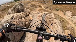
Sycamore Canyon
- 26
- 33
- 11
- 3
- 1
Popular Riverside Mountain Biking Trails
• 100 ★ 4.2 • 2,287 ft • 0 ft • 390 •
Short single tack that is essentially a grouping of berms that twists down the hillside. If you follow the trail left at the rock outcropping there are a couple of optional small drops.
• 95 ★ 4.0 • 2,461 ft • 113 ft • 348 •
Short singletrack with a couple steep rutted sections and rock faces to travel over.
• 90 ★ 4.2 • 915 ft • 4 ft • 314 •
Quick DH trail that starts off with a rock garden that leads to a roll-able double, a small rock drop, and a step up.
• 95 ★ 4.0 • 3,612 ft • 93 ft • 311 •
A fun single track, that twists and turns its way around a couple hillsides. It features a rock face, a couple of roller coasters, and optional small drops, and jumps. The trail ends with a small hill climb, that intersects . From here...
• 95 ★ 3.4 • 1 mile • 124 ft • 273 •
An easy smooth flowing XC trail that runs on the north side of the Sycamore Arroyo. There are a couple rock jumps on the trail, and a couple larger rock drops off to the side.
• 100 ★ 4.2 • 2,881 ft • 0 ft • 258 •
Singletrack that curves along the walls of a gully with just enough downslope to keep you in your higher/faster gears. The speed you carry turns rocks into senders/drops, and makes the small square edged rocks a risk for pinch flats.
Riverside Mountain Bike Routes
15 miles • 1,917 ft • 10 • Loop •
An 14 mile route covering some of the most fun blue trails in Sycamore Canyon. This route cover the...
★ 2.0 • 5 miles • 390 ft • 5 • Loop •
Small 5 mile loop. Climbing with switchback descents.
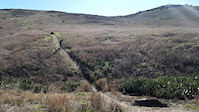
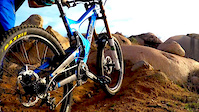
Photos of Riverside Mountain Bike
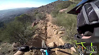
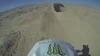
Videos of Riverside Mountain Bike

trail: Air Time
0:39 |
205 |
Jun 2, 2022
trail: Whiplash
0:05 |
186 |
Feb 16, 2017
trail: Lake Hills dh
0:37 |
146 |
Feb 12, 2016
trail: Fire Road
13:07 |
477 |
Jan 9, 2015
trail: Pole Line
0:42 |
354 |
Nov 4, 2013
trail: Chicken Hawk
11:01 |
19 |
Jun 10, 2026 , Riverside

trail: Little Sedona
0:59 |
25 |
Mar 24, 2026 , Riverside
trail: Litte Sedona "Z"
0:59 |
28 |
Mar 24, 2026 , Riverside
Recent Trail Reports
| status | trail | date | condition | info | user |
|---|---|---|---|---|---|
| Bottle Rocket | Jun 28, 2026 @ 6:59am (America/Los_Angeles) 6 hours | Dry | gymclasshero | ||
| Pipe Line | Jun 26, 2026 @ 9:16am (America/Los_Angeles) 2 days | Dry | gymclasshero | ||
| East Side Border | Apr 19, 2026 @ 7:40am (America/Los_Angeles) Apr 19, 2026 | Dry | gymclasshero | ||
| Fire Road | Apr 19, 2026 @ 7:40am (America/Los_Angeles) Apr 19, 2026 | Ideal | gymclasshero | ||
| The Connector | Apr 19, 2026 @ 7:40am (America/Los_Angeles) Apr 19, 2026 | Variable | gymclasshero | ||
| Sycamore Wall Bypass | Apr 19, 2026 @ 7:40am (America/Los_Angeles) Apr 19, 2026 | Dry | gymclasshero | ||
| Mc Twist | Apr 19, 2026 @ 7:40am (America/Los_Angeles) Apr 19, 2026 | Dry | gymclasshero | ||
| 9.75 | Apr 19, 2026 @ 7:40am (America/Los_Angeles) Apr 19, 2026 | Ideal | gymclasshero | ||
| Terry's | Apr 19, 2026 @ 7:40am (America/Los_Angeles) Apr 19, 2026 | Dry | gymclasshero | ||
| B28 | Apr 17, 2026 @ 8:39am (America/Los_Angeles) Apr 17, 2026 | Very Dry | gymclasshero |
Activity Feed
| username | action | type | title | date |
|---|---|---|---|---|
| gymclasshero | add | report | activity #98008817 | Jun 28, 2026 @ 11:20am 2 hours |
| edgargarnica889 | wishlist | route | activity #97982727 | Jun 28, 2026 @ 6:17am 7 hours |
| gymclasshero | add | report | activity #97852342 | Jun 26, 2026 @ 12:56pm 2 days |
| rkoski | vote | route | activity #96898069 | Jun 13, 2026 @ 11:11am Jun 13, 2026 |
| Bran01 | wishlist | region | activity #96851235 | Jun 13, 2026 @ 12:00am Jun 13, 2026 |
Recent Comments
| username | type | title | comment | date |
|---|---|---|---|---|
| trail | Insane rock drop | Feb 12, 2026 @ 5:21pm Feb 12, 2026 | ||
| trail | Concrete barriers added to the middle of this... | Feb 12, 2026 @ 2:19pm Feb 12, 2026 | ||
| trail | Cold War is far easier than this trail. So are... | Jan 28, 2026 @ 4:04pm Jan 28, 2026 | ||
| trail | Few features, flat turns, and deep dust. The... | May 19, 2025 @ 5:44pm May 19, 2025 | ||
| trail | Heads up the honeybee farm boxes are back.... | Apr 19, 2025 @ 7:21am Apr 19, 2025 |
Local Badges
-

Epic Ride Climb 2k3 awarded -

Climbing 10k Badge62 awarded -

Climbing 100k Badge2 awarded -

Epic Ride Descent 2k4 awarded -

Descent 10k Badge62 awarded -

Descent 100k Badge3 awarded
Bike & Skill Parks
| name | type | city | rating |
|---|---|---|---|
| kawasaki test track | skill park | Riverside | |
| Honda MX/SX Test tracks | skill park | Riverside |
Activity Type Stats
| activitytype | trails | distance | descent | descent distance | total vertical | rating | global rank | state rank | photos | reports | routes | ridelogs |
|---|---|---|---|---|---|---|---|---|---|---|---|---|
| Mountain Bike | 110 | 65 miles | 10,095 ft | 36 miles | 1,112 ft | #1,274 | #487 | 233 | 473 | 2 | 15,124 | |
| E-Bike | 68 | 23 miles | 3,819 ft | 13 miles | 958 ft | #3,128 | #1,134 | 393 | 1 | 1,264 | ||
| Gravel Bike | 1 | #572 | #1,094 | 3 | 2 | 15 | ||||||
| Horse | 3 | 3 miles | 125 ft | 1 mile | 108 ft | 48 | 1 | |||||
| Hike | 100 | 61 miles | 8,842 ft | 33 miles | 1,112 ft | #3,467 | #1,222 | 445 | 480 | |||
| Trail Running | 100 | 61 miles | 8,842 ft | 33 miles | 1,112 ft | #2,955 | #860 | 445 | 241 |
Frequently Asked Questions About Riverside
▼
What are the best places to ride in Riverside?
Riverside has 2 areas to explore for mountain biking. The top rated areas are:
▼
What are the highest rated mountain biking trails in Riverside?
The highest rated mountain biking trails in Riverside are:
- Chicken Hawk (4.3/5)
- Rock steady (4.2/5)
- Hitman DH (4.2/5)
- Pipe Line (4.2/5)
- Little Moab (4.2/5)
▼
What is the best time of the year to ride in Riverside?
Based on ride log data, the most popular months to ride in Riverside are:
- July (80 activities)
- February (63 activities)
- April (62 activities)
▼
Where can I park to ride in Riverside?
There are 4 parking locations listed in Riverside. The most popular parking spots are: View all parking and trailhead locations on the map to plan your visit.
Activities
Trails
Points of Interest
- By clarkhubbs22 & contributors
- Admins: IVMTB
- #10436 - 7,931 views
- riverside activity log | embed map of Riverside mountain bike trails | riverside mountain biking points of interest
Downloading of trail gps tracks in kml & gpx formats is enabled for Riverside.
You must login to download files.