close
-
Layers w
- Weather Layers
- Pro
- Pro
- Pro
- Pro
- Pro
- Pro
- More Layers
- Pro
- Pro
- Pro
- Pro
-
Upgrade to

3D
Trail Conditions
- Unknown
- Snow Groomed
- Snow Packed
- Snow Covered
- Snow Cover Partial
- Freeze/thaw Cycle
- Icy
- Prevalent Mud
- Wet
- Variable
- Ideal
- Dry
- Very Dry
Trail Flow (Ridden Direction)
Trailforks scans users ridelogs to determine the most popular direction each trail is ridden. A good flowing trail network will have most trails flowing in a single direction according to their intension.
The colour categories are based on what percentage of riders are riding a trail in its intended direction.
The colour categories are based on what percentage of riders are riding a trail in its intended direction.
- > 96%
- > 90%
- > 80%
- > 70%
- > 50%
- < 50%
- bi-directional trail
- no data
Trail Last Ridden
Trailforks scans ridelogs to determine the last time a trail was ridden.
- < 2 days
- < 1 week
- < 2 weeks
- < 1 month
- < 6 months
- > 6 months
Trail Ridden Direction
The intended direction a trail should be ridden.
- Downhill Only
- Downhill Primary
- Both Directions
- Uphill Primary
- Uphill Only
- One Direction
Contribute Details
Colors indicate trail is missing specified detail.
- Description
- Photos
- Description & Photos
- Videos
Trail Popularity ?
Trailforks scans ridelogs to determine which trails are ridden the most in the last 9 months.
Trails are compared with nearby trails in the same city region with a possible 25 colour shades.
Think of this as a heatmap, more rides = more kinetic energy = warmer colors.
- most popular
- popular
- less popular
- not popular
ATV/ORV/OHV Filter
Max Vehicle Width
inches
US Cell Coverage
Legend

Radar Time
Activity Recordings
Trailforks uses anonymized public activity data.
?
Activity Recordings
Trailforks uses anonymized public activity data.
?
Personal Heatmap
▶
Activity Types
all
/
none
▶
Options
2
Date range
month
–
Winter Trails
Warning
A routing network for winter maps does not exist. Selecting trails using the winter trails layer has been disabled.
Missing Trails
Most Popular
Least Popular
Trails are colored based on popularity. The more popular a trail is, the more red. Less popular trails trend towards green.
Jump Magnitude Heatmap
Heatmap of where riders jump on trails. Zoom in to see individual jumps, click circles to view jump details.
BC Backroad Status
![map legend]()
Service Road Atlas is a free to use, community-driven service for viewing and creating reports on the numerous back-country service roads around B.C. and Alberta.

Slope Aspect
Direction the slope faces
Trails Deemphasized
Trails are shown in grey.
Only show trails with no bike usage.
Suggested Layers
Based on selected activity type
Save the current map location and zoom level as your default home location whenever this page is loaded.
Save
No description for Rousse has been added yet!
Login or register to submit one.
Activities Click to view
- Mountain Bike
8 trails
- Hike
2 trails
- Trail Running
2 trails
Region Details
- 2
- 2
Region Status
Caution as of Nov 5, 2024Stats
- Trails (view details)
- 4
- Trails Mountain Bike
- 8
- Trails E-Bike
- 2
- Trails Hike
- 2
- Trails Trail Running
- 2
- Total Distance
- 2 miles
- Total Descent
- 584 ft
- Total Vertical
- 438 ft
- Highest Trailhead
- 492 ft
- Reports
- 4
- Photos
- 7
- Ridden Counter
- 9
Popular Rousse Mountain Biking Trails
• 75 ★ 0.0 • 1,342 ft • 0 ft • 5 •
Popular red difficulty singletrack. This mountain bike primary trail. It features berm, drop, jump and roller coaster. On average it takes 2 minutes to complete this trail.
• 100 ★ 0.0 • 1 mile • 240 ft • 3 •
Лесен маршрут за начинаещи. Има игриви спускания и леки изкачвания. Изключително приятен по всяко време на годината.
• 5 ★ 0.0 • 902 ft • 0 ft • 1 •
This trail starts at the end of an paved road. It starts of as an easy normal trail, but then the challenge comes. The reason this trail is rated blue is because there are 100+ steps at the staircases near the end of the trail. If you...
• 5 ★ 0.0 • 958 ft • 0 ft •
Less popular blue difficulty singletrack. This mountain bike primary trail can be used downhill only. It features jump. Trail visibility is always easy to follow.
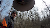
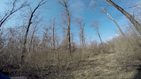
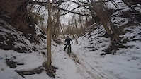
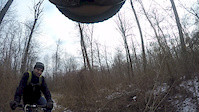
Photos of Rousse Mountain Bike
Videos of Rousse Mountain Bike
trail: The Original Hut
0:46 |
126 |
Mar 18, 2017
trail: The Original Hut
0:23 |
94 |
Mar 8, 2017
trail: The Original Hut
2:20 |
46 |
Feb 20, 2017
trail: The Original Hut
0:32 |
32 |
Dec 24, 2016
trail: The Original Hut
0:55 |
28 |
Nov 5, 2016
Recent Trail Reports
| status | trail | date | condition | info | user |
|---|---|---|---|---|---|
| Хижа Минзухар | Nov 5, 2024 @ 1:10am Nov 5, 2024 | Dry | AllmtnQ3sGBR | ||
| The Original Hut | May 1, 2021 @ 4:20am May 1, 2021 | Variable | furao |
Activity Feed
| username | action | type | title | date |
|---|---|---|---|---|
| kxwIa9 | ridden | trail | activity #94265352 | May 7, 2026 @ 10:19pm May 7, 2026 |
| dean6969 | difficultyvote | trail | activity #87584507 | Jan 21, 2026 @ 10:49am Jan 21, 2026 |
| roskatabg | add | trail | activity #81362060 | Sep 29, 2025 @ 9:14am Sep 29, 2025 |
| AllmtnQ3sGBR | ridden | trail | activity #62133658 | Nov 22, 2024 @ 6:19am Nov 22, 2024 |
| AllmtnQ3sGBR | checkin | trail | activity #61355930 | Nov 5, 2024 @ 1:10am Nov 5, 2024 |
Activity Type Stats
| activitytype | trails | distance | descent | descent distance | total vertical | rating | global rank | state rank | photos | reports | routes | ridelogs |
|---|---|---|---|---|---|---|---|---|---|---|---|---|
| Mountain Bike | 8 | 2 miles | 584 ft | 4,997 ft | 440 ft | #11,298 | #34 | 7 | 4 | 1,105 | ||
| E-Bike | 2 | 4 | 39 | |||||||||
| Hike | 2 | 2 miles | 338 ft | 3,668 ft | 397 ft | #3,313 | #18 | 4 | 12 | |||
| Trail Running | 2 | 2 miles | 338 ft | 3,668 ft | 397 ft | #2,658 | #17 | 4 |
- By allmountainer93 & contributors
- Admins: pufalot
- #16990 - 1,851 views
- rousse activity log | embed map of Rousse mountain bike trails |
Downloading of trail gps tracks in kml & gpx formats is enabled for Rousse.
You must login to download files.