close
-
Layers w
- Weather Layers
- Pro
- Pro
- Pro
- Pro
- Pro
- Pro
- More Layers
- Pro
- Pro
- Pro
- Pro
-
Upgrade to

3D
Trail Conditions
- Unknown
- Snow Groomed
- Snow Packed
- Snow Covered
- Snow Cover Partial
- Freeze/thaw Cycle
- Icy
- Prevalent Mud
- Wet
- Variable
- Ideal
- Dry
- Very Dry
Trail Flow (Ridden Direction)
Trailforks scans users activity logs to determine the most popular direction each trail is ridden. A good flowing trail network will have most trails flowing in a single direction according to their intension.
The colour categories are based on what percentage of users are riding a trail in its intended direction.
The colour categories are based on what percentage of users are riding a trail in its intended direction.
- > 96%
- > 90%
- > 80%
- > 70%
- > 50%
- < 50%
- bi-directional trail
- no data
Trail Last Ridden
Trailforks scans activity logs to determine the last time a trail was ridden.
- < 2 days
- < 1 week
- < 2 weeks
- < 1 month
- < 6 months
- > 6 months
Trail Ridden Direction
The intended direction a trail should be ridden.
- Downhill Only
- Downhill Primary
- Both Directions
- Uphill Primary
- Uphill Only
- One Direction
Contribute Details
Colors indicate trail is missing specified detail.
- Description
- Photos
- Description & Photos
- Videos
Trail Popularity ?
Trailforks scans activity logs to determine which trails are ridden the most in the last 9 months.
Trails are compared with nearby trails in the same city region with a possible 25 colour shades.
Think of this as a heatmap, more activities = more kinetic energy = warmer colors.
- most popular
- popular
- less popular
- not popular
ATV/ORV/OHV Filter
Max Vehicle Width
inches
US Cell Coverage
Legend

Radar Time
Activity Recordings
Trailforks uses anonymized public activity data.
?
Activity Recordings
Trailforks uses anonymized public activity data.
?
Personal Heatmap
▶
Activity Types
all
/
none
▶
Options
2
Date range
month
–
Winter Trails
Warning
A routing network for winter maps does not exist. Selecting trails using the winter trails layer has been disabled.
Missing Trails
Most Popular
Least Popular
Trails are colored based on popularity. The more popular a trail is, the more red. Less popular trails trend towards green.
Jump Magnitude Heatmap
Heatmap of where users jump on trails. Zoom in to see individual jumps, click circles to view jump details.
BC Backroad Status
![map legend]()
Service Road Atlas is a free to use, community-driven service for viewing and creating reports on the numerous back-country service roads around B.C. and Alberta.

Slope Aspect
Direction the slope faces
Trails Deemphasized
Trails are shown in grey.
Only show trails with no bike usage.
Suggested Layers
Based on selected activity type
Save the current map location and zoom level as your default home location whenever this page is loaded.
Save
No description for Roxborough has been added yet!
Login or register to submit one.
Activities Click to view
- Mountain Bike
66 trails
- E-Bike
54 trails
- Gravel Bike
0 trails
- Adaptive Bike
0 trails
- Winter Fat Bike
0 trails
- Horse
51 trails
- Hike
81 trails
- Trail Running
81 trails
- Dirtbike/Moto
48 trails
- ATV/ORV/OHV
33 trails
Region Details
- 6
- 8
- 36
- 14
Region Status
Open as of Jul 16, 2026Stats
- Avg Trail Rating
- Trails (view details)
- 79
- Trails Mountain Bike
- 66
- Trails E-Bike
- 54
- Trails Horse
- 51
- Trails Hike
- 81
- Trails Trail Running
- 81
- Trails Dirtbike/Moto
- 48
- Trails ATV/ORV/OHV
- 35
- Trails Snowshoe
- 2
- Trails Nordic Ski
- 1
- Total Distance
- 245 miles
- Total Descent
- 42,390 ft
- Total Vertical
- 4,185 ft
- Highest Trailhead
- 9,693 ft
- Reports
- 198
- Photos
- 99
- Completed Counter
- 7,891
Sub Regions
-
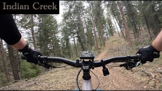
Indian Creek
- 2
- 8
-
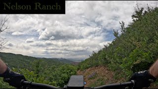
Neslon Ranch Open Space
- 3
-
Rampart Range Recreation Area
- 7
- 31
- 6
-
Roxborough State Park
- 1
Popular Roxborough Mountain Biking Trails
• 90 ★ 3.5 • 9 miles • 1,980 ft • 504 •
Popular black diamond difficulty singletrack. This multi-use trail can be used both directions and has a moderate overall physical rating with a 1,980 ft blue climb. On average it takes 2 hours44 minutes to complete this trail.
• 100 ★ 4.2 • 1 mile • 530 ft • 448 •
Highly rated popular black diamond difficulty singletrack. This mountain bike primary trail can be used both directions. On average it takes 17 minutes to complete this trail.
• 100 ★ 4.0 • 3,039 ft • 51 ft • 426 •
Popular black diamond difficulty singletrack. This mountain bike primary trail can be used both directions. On average it takes 4 minutes to complete this trail.
• 95 ★ 2.4 • 2 miles • 131 ft • 352 •
Parts are very rutted out. Stiff climb to start than 3 miles of dumb fire road. Back to a nice 1 mi of single track before crappy ruts.
• 95 ★ 3.0 • 2 miles • 125 ft • 318 •
Popular black diamond difficulty singletrack. This mountain bike primary trail can be used both directions and has a hard overall physical rating with a 125 ft black diamond climb. On average it takes 14 minutes to complete this trail.
• 90 ★ 4.0 • 3 miles • 199 ft • 285 •
Popular blue difficulty singletrack. This mountain bike primary trail can be used downhill primary. On average it takes 18 minutes to complete this trail.
• 100 ★ 3.5 • 4 miles • 1,174 ft • 274 •
Popular black diamond difficulty singletrack. This mountain bike primary trail can be used uphill primary. On average it takes 52 minutes to complete this trail.
Roxborough Mountain Bike Routes
★ 5.0 • 38 miles • 7,683 ft • 12 •
An amazing loop that has it all. Great climbs, epic views, rippin descents, a variety of wildlife, lots of...
★ 2.5 • 20 miles • 3,626 ft • 10 •
CCW, skirts the upper part of Roxy State Park.
19 miles • 3,450 ft • 3 •
The long version of the Roxborough loop. Climbing roundup instead of .
16 miles • 3,229 ft • 0 •
An out-and-back along segment #2 of the Colorado Trail.
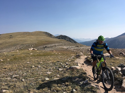
Photos of Roxborough Mountain Bike
Videos of Roxborough Mountain Bike
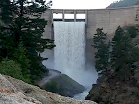
trail: Waterton Canyon
0:07 |
63 |
Jul 9, 2019
trail: Waterton Canyon
0:52 |
85 |
Sep 8, 2018
trail: CT - Platte Canyon
9:08 |
101 |
Nov 24, 2025 , Roxborough
trail: Powerline (800)
6:53 |
101 |
Sep 5, 2024 , Roxborough
trail: Ringtail
12:35 |
140 |
Jun 7, 2024 , Roxborough
trail: Stevens Gulch Lower
7:14 |
125 |
Apr 27, 2024 , Roxborough

trail: Rampart Range
8:04 |
410 |
Sep 11, 2021 , Roxborough

trail: CT - Platte Canyon
7:56 |
613 |
Jul 7, 2021 , Roxborough
Recent Trail Reports
| status | trail | date | condition | info | user |
|---|---|---|---|---|---|
| CT - Waterton Canyon | Jul 16, 2026 @ 5:41pm (America/Denver) Jul 16, 2026 | Dry | Frcg | ||
| CT - Platte Canyon | Jul 3, 2026 @ 1:50pm (America/Denver) Jul 3, 2026 | Dry | Frcg | ||
| Round Up | May 7, 2026 @ 9:30pm (America/Denver) May 7, 2026 | Unknown | ea99018 | ||
| DC5 (No Motorized) | Feb 28, 2026 @ 1:44pm (America/Denver) Feb 28, 2026 | Ideal | rightturnclive | ||
| Swallowtail (Lower Loop) | Feb 27, 2026 @ 11:17am (America/Denver) Feb 27, 2026 | Very Dry | sasunde | ||
| Swallowtail (Upper Loop) | Feb 27, 2026 @ 11:17am (America/Denver) Feb 27, 2026 | Very Dry | sasunde | ||
| Ringtail | Feb 15, 2026 @ 11:48am (America/Denver) Feb 15, 2026 | Ideal | getvert BMA | ||
| Stevens Gulch Lower | Feb 15, 2026 @ 11:48am (America/Denver) Feb 15, 2026 | Ideal | getvert BMA | ||
| Russell Gulch | Jan 6, 2026 @ 10:16am (America/Denver) Jan 6, 2026 | Dry | RankedMountainBiking69 | ||
| Turtle Mountain | Dec 24, 2025 @ 6:19pm (America/Denver) Dec 24, 2025 | Dry | adm26 |
National Scenic Trails & Official Routes
-
Colorado Trail (Bike)
- Mountain Bike
Activity Feed
| username | action | type | title | date |
|---|---|---|---|---|
| Frcg | add | report | activity #99688589 | Jul 21, 2026 @ 10:07am 1 day |
| Frcg | add | report | activity #99351121 | Jul 16, 2026 @ 8:26pm Jul 16, 2026 |
| br4dmcc4rty | wishlist | trail | activity #99164810 | Jul 14, 2026 @ 6:38am Jul 14, 2026 |
| Caleb6OzBNH | ridden | trail | activity #98575318 and 1 more | Jul 6, 2026 @ 8:08am Jul 6, 2026 |
| Frcg | add | report | activity #98494797 and 1 more | Jul 5, 2026 @ 6:27am Jul 5, 2026 |
Recent Comments
| username | type | title | comment | date |
|---|---|---|---|---|
| trail | Park ranger said he would write me a ticket if... | Jun 29, 2026 @ 3:01pm Jun 29, 2026 | ||
| trail | I climbed this after riding powerline down to... | May 23, 2026 @ 5:28am May 23, 2026 | ||
| trail | Fun trail. Great bits of high speed with... | May 23, 2026 @ 5:22am May 23, 2026 | ||
| trail | Awful fire road climb | May 23, 2026 @ 5:15am May 23, 2026 | ||
| trail | Flowy blue. One is the very few trails worth... | May 23, 2026 @ 5:15am May 23, 2026 |
Local Badges
-

Epic Ride Climb 2k101 awarded -

Climbing 10k Badge58 awarded -

Climbing 100k Badge2 awarded -

Epic Ride Descent 2k105 awarded -

Descent 10k Badge57 awarded -

Descent 100k Badge2 awarded
Activity Type Stats
| activitytype | trails | distance | descent | descent distance | total vertical | rating | global rank | state rank | photos | reports | routes | activity logs |
|---|---|---|---|---|---|---|---|---|---|---|---|---|
| Mountain Bike | 66 | 224 miles | 38,855 ft | 104 miles | 3,556 ft | #1,201 | #468 | 78 | 198 | 6 | 7,581 | |
| E-Bike | 54 | 182 miles | 30,561 ft | 80 miles | 2,759 ft | #911 | #780 | 1 | 182 | 696 | ||
| Horse | 51 | 185 miles | 31,486 ft | 84 miles | 4,186 ft | #178 | #409 | 37 | 4 | |||
| Hike | 81 | 245 miles | 42,392 ft | 114 miles | 4,186 ft | #646 | #299 | 13 | 199 | 4 | 1,350 | |
| Trail Running | 81 | 245 miles | 42,392 ft | 114 miles | 4,186 ft | #651 | #242 | 199 | 4 | 219 | ||
| Dirtbike/Moto | 48 | 173 miles | 28,770 ft | 76 miles | 2,448 ft | #119 | #72 | 7 | 42 | 207 | ||
| ATV/ORV/OHV | 33 | 105 miles | 18,009 ft | 47 miles | 2,448 ft | #170 | #73 | 25 | 5 | |||
| Snowshoe | 2 | 6 miles | 1,115 ft | 4 miles | 732 ft | 7 | ||||||
| Nordic Ski | 1 | 4 miles | 771 ft | 3 miles | 732 ft | 6 |
Frequently Asked Questions About Roxborough
▼
What are the best places to ride in Roxborough?
Roxborough has 4 areas to explore for mountain biking. The top rated areas are:
▼
What are the highest rated mountain biking trails in Roxborough?
The highest rated mountain biking trails in Roxborough are:
- Rampart Range (4.1/5)
- Log Jumper (4.1/5)
- Stevens Gulch Lower (4.1/5)
- Ringtail (4/5)
- Powerline (800) (4/5)
▼
What is the best time of the year to ride in Roxborough?
Based on activity log data, the most popular months to ride in Roxborough are:
- July (58 activities)
- June (39 activities)
- May (37 activities)
▼
Where can I park to ride in Roxborough?
There are 18 parking locations listed in Roxborough. The most popular parking spots are: View all parking and trailhead locations on the map to plan your visit.
Activities
Trails
Points of Interest
- By kyle10bike & contributors
- Admins: apply
- #9716 - 5,209 views
- roxborough activity log | embed map of Roxborough mountain bike trails | roxborough mountain biking points of interest
Downloading of trail gps tracks in kml & gpx formats is enabled for Roxborough.
You must login to download files.