
close
3D
Trail Conditions
- Unknown
- Snow Groomed
- Snow Packed
- Snow Covered
- Snow Cover Partial
- Freeze/thaw Cycle
- Icy
- Prevalent Mud
- Wet
- Variable
- Ideal
- Dry
- Very Dry
Trail Flow (Ridden Direction)
Trailforks scans users activity logs to determine the most popular direction each trail is ridden. A good flowing trail network will have most trails flowing in a single direction according to their intension.
The colour categories are based on what percentage of users are riding a trail in its intended direction.
The colour categories are based on what percentage of users are riding a trail in its intended direction.
- > 96%
- > 90%
- > 80%
- > 70%
- > 50%
- < 50%
- bi-directional trail
- no data
Trail Last Used
Trailforks scans activity logs to determine the last time a trail was ridden.
- < 2 days
- < 1 week
- < 2 weeks
- < 1 month
- < 6 months
- > 6 months
Trail Ridden Direction
The intended direction a trail should be ridden.
- Downhill Only
- Downhill Primary
- Both Directions
- Uphill Primary
- Uphill Only
- One Direction
Contribute Details
Colors indicate trail is missing specified detail.
- Description
- Photos
- Description & Photos
- Videos
Trail Popularity ?
Trailforks scans activity logs to determine which trails are ridden the most in the last 9 months.
Trails are compared with nearby trails in the same city region with a possible 25 colour shades.
Think of this as a heatmap, more activities = more kinetic energy = warmer colors.
- most popular
- popular
- less popular
- not popular
ATV/ORV/OHV Filter
Max Vehicle Width
inches
US Cell Coverage
Legend

Radar Time
Activity Recordings
Trailforks uses anonymized public activity data.
?
Activity Recordings
Trailforks uses anonymized public activity data.
?
Winter Trails
Warning
A routing network for winter maps does not exist. Selecting trails using the winter trails layer has been disabled.
Missing Trails
Most Popular
Least Popular
Trails are colored based on popularity. The more popular a trail is, the more red. Less popular trails trend towards green.
Jump Magnitude Heatmap
Heatmap of where users jump on trails. Zoom in to see individual jumps, click circles to view jump details.
BC Backroad Status
![map legend]()
Service Road Atlas is a free to use, community-driven service for viewing and creating reports on the numerous back-country service roads around B.C. and Alberta.

Slope Aspect
Direction the slope faces
Trails Deemphasized
Trails are shown in grey.
Only show trails with no bike usage.
Suggested Layers
Based on selected activity type
Save the current map location and zoom level as your default home location whenever this page is loaded.
SaveSangüesa (en euskera y de forma cooficial Zangoza)2 es una ciudad y municipio español de la Comunidad Foral de Navarra, cabeza de la merindad homónima, la cual está situada en la Navarra Media Oriental, en la comarca homónima y a 45 km de la capital de la comunidad, Pamplona. Su población en 2017 era de 5002 habitantes (INE).
La ciudad se localiza en una terraza de la margen izquierda del río Aragón, en el que desemboca el río Onsella. Aparte de por la ciudad de Sangüesa, el municipio está compuesto por las localidades de Rocaforte y Gabarderal, que a principios de 2018 sumaban entre ambas una población de 168 habitantes.
Al primitivo asentamiento conocido como Sangüesa la Vieja que se ubicaba en Rocaforte, el rey Sancho Ramírez concedió hacia el año 1090 el fuero de Jaca y Alfonso I el Batallador lo extendió en el año 1122 al denominado Burgo Nuevo, el cual se desarrolló en el emplazamiento actual de la ciudad. El título de ciudad lo obtuvo en 1665 tras una merced real y el pago de 6000 ducados.
La ciudad se localiza en una terraza de la margen izquierda del río Aragón, en el que desemboca el río Onsella. Aparte de por la ciudad de Sangüesa, el municipio está compuesto por las localidades de Rocaforte y Gabarderal, que a principios de 2018 sumaban entre ambas una población de 168 habitantes.
Al primitivo asentamiento conocido como Sangüesa la Vieja que se ubicaba en Rocaforte, el rey Sancho Ramírez concedió hacia el año 1090 el fuero de Jaca y Alfonso I el Batallador lo extendió en el año 1122 al denominado Burgo Nuevo, el cual se desarrolló en el emplazamiento actual de la ciudad. El título de ciudad lo obtuvo en 1665 tras una merced real y el pago de 6000 ducados.
This region uses the Uk/Euro style trail grading system.
Trail info last updated
Activities Click to view
- Mountain Bike
267 trails
- E-Bike
267 trails
- Adaptive Bike
10 trails
- Horse
4 trails
- Hike
275 trails
- Trail Running
275 trails
Region Details
- 167
- 4
- 64
- 31
- 1
Region Status
Open as of 2 daysStats
- Avg Trail Rating
- Trails (view details)
- 277
- Trails Mountain Bike
- 267
- Trails E-Bike
- 267
- Trails Gravel Bike
- 125
- Trails Adaptive Bike
- 10
- Trails Winter Fat Bike
- 17
- Trails Horse
- 4
- Trails Hike
- 275
- Trails Trail Running
- 275
- Total Distance
- 442 miles
- Total Descent Distance
- 213 miles
- Total Descent
- 72,228 ft
- Total Vertical
- 3,525 ft
- Highest Trailhead
- 4,645 ft
- Reports
- 673
- Photos
- 252
- Completed Counter
- 4,559
Sub Regions
-
Aibar
- 4
- 22
- 5
-
Caseda-Gallipienzo
- 32
- 17
-
Sierra de Leire
- 10
- 9
- 1
Popular Sanguesa Mountain Biking Trails
• 100 ★ 4.0 • 4,088 ft • 301 ft • 59 •
Bonito sendero de subida que remonta un pinar con suaves rampas salvo en dos puntos que tienen dos rampas mas duras. Se puede hacer en ambos sentidos, pero de bajada es peligroso por el poco espacio que queda entre los troncos para los...
• 95 ★ 3.8 • 3,714 ft • 4 ft • 55 •
Popular red difficulty singletrack. This multi-use trail can be used downhill primary and has a moderate overall physical rating. Trail visibility is sometimes hard to follow. On average it takes 7 minutes to complete this trail.
• 100 ★ 3.0 • 1,457 ft • 0 ft • 52 •
Popular blue difficulty singletrack. This multi-use trail can be used downhill primary. It features berm and jump. Trail visibility is always easy to follow. On average it takes 2 minutes to complete this trail.
• 95 ★ 3.7 • 4,767 ft • 0 ft • 46 •
Sendero divertido y pedregoso.Atencion a la estrechez por los bojes
Sanguesa Mountain Bike Routes
★ 4.0 • 14 miles • 2,547 ft • 8 • Loop •
Ruta corta pero intensa.Una subida a San Pedro para bajar por el este y recuperamos algo de altura para...
★ 3.5 • 21 miles • 3,466 ft • 11 • Loop •
Aparcamos al otro lado del río, que baja crecidito, y hacemos una aproximación larguita siguiendo un...
★ 5.0 • 17 miles • 3,448 ft • 12 • Loop •
Nueva entrega de senderos de Aibar. Con bajadas completamete nuevas y otras que retomamos del a Track 2018...
4 miles • 630 ft • 1 • Loop •
Klavillo XC, circuito de cross country apto para BTT como para Running, con subibajas cortos pero...
★ 4.0 • 18 miles • 3,807 ft • 16 • Loop •
Las mejores sendas de Gallipienzo recopiladas por un integrante del Club Kea MTB
★ 1.0 • 13 miles • 2,688 ft • 12 • Loop •
Dos subidas duras a la cima de San Pedro para bajar por las vertientes este y oeste
Photos of Sanguesa Mountain Bike
Videos of Sanguesa Mountain Bike
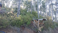

Recent Trail Reports
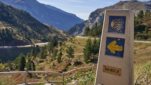
National Scenic Trails & Official Routes
-
GR 65.3 Camino Francés por Aragón
- Mountain Bike
- E-Bike
- Horse
- Hike
- Trail Running
Activity Feed
| username | action | type | title | date |
|---|---|---|---|---|
| efefunk | add | report | activity #107843326 and 9 more | Nov 15, 2026 @ 10:36am 2 days |
| vinibrokengV754z | add | report | activity #106953539 | Oct 31, 2026 @ 12:51pm Oct 31, 2026 |
| efefunk | add | report | activity #106570745 and 6 more | Oct 25, 2026 @ 9:06am Oct 25, 2026 |
| raullopezch | add | trail | activity #106244734 | Oct 19, 2026 @ 9:27pm Oct 19, 2026 |
| raullopezch | update | trail | activity #106244652 | Oct 19, 2026 @ 9:24pm Oct 19, 2026 |
Recent Comments
| username | type | title | comment | date |
|---|---|---|---|---|
| trail | Gracias a los trail builders, una bajado con... | Jul 26, 2026 @ 1:58am Jul 26, 2026 | ||
| trail | Al igual que en Saltos Inferior, han añadido... | May 5, 2025 @ 1:43am May 5, 2025 | ||
| trail | Si no has bajado por aquí recientemente, te... | May 5, 2025 @ 1:38am May 5, 2025 | ||
| trail | Otra gran bajada al estilo Cáseda. Saltos de... | May 5, 2025 @ 1:32am May 5, 2025 | ||
| trail | Increíble! | Apr 17, 2025 @ 10:16am Apr 17, 2025 |
Local Badges
-

Completionist0 awarded -

Epic Mountain Bike Climb 2k73 awarded -

Climbing 10k Badge10 awarded -

Mountain Biking 100k Badge0 awarded -

Epic Ride Descent 2k73 awarded -

Descent 10k Badge11 awarded
Activity Type Stats
| activitytype | trails | distance | descent | descent distance | total vertical | rating | global rank | state rank | photos | reports | routes | activity logs |
|---|---|---|---|---|---|---|---|---|---|---|---|---|
| Mountain Bike | 267 | 428 miles | 68,806 ft | 207 miles | 3,291 ft | #619 | #79 | 239 | 673 | 12 | 1,269 | |
| E-Bike | 267 | 428 miles | 68,806 ft | 207 miles | 3,291 ft | #132 | #71 | 3 | 670 | 11 | 281 | |
| Gravel Bike | 125 | 233 miles | 18,698 ft | 101 miles | 3,291 ft | 2 | 14 | |||||
| Adaptive Bike | 10 | 17 miles | 722 ft | 5 miles | 2,953 ft | #3,191 | #181 | 28 | ||||
| Winter Fat Bike | 17 | 21 miles | 5,003 ft | 13 miles | 2,293 ft | 3 | ||||||
| Horse | 4 | 6 miles | 600 ft | 3 miles | 1,604 ft | #2,687 | #216 | 4 | ||||
| Hike | 275 | 441 miles | 71,647 ft | 212 miles | 3,527 ft | #310 | #74 | 9 | 668 | 21 | 193 | |
| Trail Running | 275 | 441 miles | 71,647 ft | 212 miles | 3,527 ft | #242 | #69 | 669 | 1 | 87 |
Frequently Asked Questions
▼
What are the best places to ride in Sanguesa?
Sanguesa has 3 areas to explore for mountain biking. The top rated areas are:
▼
What are the highest rated mountain biking trails in Sanguesa?
The highest rated mountain biking trails in Sanguesa are:
- La Eugi (4.3/5)
- Enduro Peña (4.2/5)
- Saltos Intermedio (4.1/5)
- Valdojadero DH (4.1/5)
- La Termedia (4.1/5)
▼
Where can I park to ride in Sanguesa?
There are 10 parking locations listed in Sanguesa. The most popular parking spots are: View all parking and trailhead locations on the map to plan your visit.
▼
What is the longest trail in Sanguesa?
The longest trail in Sanguesa is MiniAvalanche Arangoiti at 4.7 miles. View all trails sorted by distance.
▼
What are the best & highest rated hiking trails in Sanguesa?
The best hiking trails in Sanguesa are:
- Los Golochos
- Canaleta Foz de Arbaiun
- La Oquia
- El Fayar
- Cañada de los Roncaleses - Monasterio de Leire
▼
What are the best & highest rated trail running trails in Sanguesa?
The best trail running trails in Sanguesa are:
- Coscojos-Urraul
- Cañada de los Roncaleses - Monasterio de Leire
- La Zubiri
- Paso del Oso Superior
- La Termedia II
▼
How many trails are in Sanguesa?
Sanguesa has a total of 277 trails. Of those, 267 are designated for mountain biking. Browse top mountain biking trails in Sanguesa to find detailed information including difficulty ratings, distances, and trail conditions.
▼
Which trail has the most elevation gain in Sanguesa?
The trail with the most elevation gain in Sanguesa is Cerro Chipiteiro with 879 ft of elevation gain. View all trails sorted by elevation gain.
▼
Which trail has the most elevation descent in Sanguesa?
The trail with the most elevation descent in Sanguesa is MiniAvalanche Arangoiti with 2,429 ft of elevation descent. View all trails sorted by elevation descent.
▼
What activities are most popular in Sanguesa?
Sanguesa supports the following activities: Mountain Biking, E-Biking, Adaptive Biking, Horseback, Hiking, Trail Running.
▼
What are the steepest mountain biking trails in Sanguesa?
The steepest mountain biking trail in Sanguesa is Collado Romastaca with an average grade of 16%. View all trails sorted by grade.
▼
Are there any trails with scenic viewpoints in Sanguesa?
Yes, there are 1 scenic viewpoints marked along trails in Sanguesa. Some popular viewpoints include: Explore more points of interest to find trails with the best views.
▼
What trails have the biggest jumps in Sanguesa?
The trails with the biggest jumps in Sanguesa are: Browse all mountain bike trails to find trails with jumps and technical features.
▼
Are the trails open in Sanguesa?
The overall region status for Sanguesa is Clear / Green. Out of 131 trails:
- Clear / Green: 113
- Minor Issue / Yellow: 12
- Significant Issue / Amber: 6
▼
What are the trail conditions in Sanguesa?
Based on trail reports from the past week in Sanguesa:
- Wet: 9 trails
▼
Can I ride an ebike in Sanguesa?
Yes, Sanguesa supports e-bike riding. There are 270 trails in Sanguesa that allow e-bikes. Check the e-bike trails listing for specific trail access details and any local regulations.
▼
What are the most popular mountain biking routes in Sanguesa?
The most popular mountain biking routes in Sanguesa are: View all mountain biking routes in Sanguesa.
▼
What is the highest summit in Sanguesa?
The highest summit in Sanguesa is Peñablanca/Kakueta at 5,187 ft elevation.
▼
What are the most popular Strava Segments in Sanguesa?
The most popular Strava segments in Sanguesa are:
- Puerto de Tapla, 1065 mts(hasta cruce 1er camino) (1,730 athletes)
- Cruce Koixta - Almorzadero (1,448 athletes)
- Foz de Lumbier (1,400 athletes)
▼
Are there accessible or adaptive trails in Sanguesa?
Yes, there are 10 accessible/adaptive trails in Sanguesa. View all adaptive trails in Sanguesa for specific accessibility information.
▼
What are the most popular mountain biking trails in Sanguesa?
The most popular mountain biking trails in Sanguesa are: View all mountain biking trails sorted by popularity.
▼
What are the best beginner ride trails in Sanguesa?
The best beginner mountain biking trails in Sanguesa are:
- CS Salinas de Ibargoiti-Moreal/Elo (4/5)
- La Plana (2.5/5)
- Txirringua (0/5)
Activities
Trails
- By Angelreing
 TFSPAIN Ezkaba & contributors
- Admins: mul0w, elyari, AMG, juanx, Angelreing, Angelreing, raullopezch
- #49604 - 1,272 views
- sanguesa activity log | embed map of Sanguesa mountain bike trails | sanguesa mountain biking points of interest
Downloading of trail gps tracks in kml & gpx formats is enabled for Sanguesa.
You must login to download files.