close
-
Layers w
- Weather Layers
- Pro
- Pro
- Pro
- Pro
- Pro
- Pro
- More Layers
- Pro
- Pro
- Pro
- Pro
-
Upgrade to

3D
Trail Conditions
- Unknown
- Snow Groomed
- Snow Packed
- Snow Covered
- Snow Cover Partial
- Freeze/thaw Cycle
- Icy
- Prevalent Mud
- Wet
- Variable
- Ideal
- Dry
- Very Dry
Trail Flow (Ridden Direction)
Trailforks scans users activity logs to determine the most popular direction each trail is ridden. A good flowing trail network will have most trails flowing in a single direction according to their intension.
The colour categories are based on what percentage of users are riding a trail in its intended direction.
The colour categories are based on what percentage of users are riding a trail in its intended direction.
- > 96%
- > 90%
- > 80%
- > 70%
- > 50%
- < 50%
- bi-directional trail
- no data
Trail Last Ridden
Trailforks scans activity logs to determine the last time a trail was ridden.
- < 2 days
- < 1 week
- < 2 weeks
- < 1 month
- < 6 months
- > 6 months
Trail Ridden Direction
The intended direction a trail should be ridden.
- Downhill Only
- Downhill Primary
- Both Directions
- Uphill Primary
- Uphill Only
- One Direction
Contribute Details
Colors indicate trail is missing specified detail.
- Description
- Photos
- Description & Photos
- Videos
Trail Popularity ?
Trailforks scans activity logs to determine which trails are ridden the most in the last 9 months.
Trails are compared with nearby trails in the same city region with a possible 25 colour shades.
Think of this as a heatmap, more activities = more kinetic energy = warmer colors.
- most popular
- popular
- less popular
- not popular
ATV/ORV/OHV Filter
Max Vehicle Width
inches
US Cell Coverage
Legend

Radar Time
Activity Recordings
Trailforks uses anonymized public activity data.
?
Activity Recordings
Trailforks uses anonymized public activity data.
?
Personal Heatmap
▶
Activity Types
all
/
none
▶
Options
2
Date range
month
–
Winter Trails
Warning
A routing network for winter maps does not exist. Selecting trails using the winter trails layer has been disabled.
Missing Trails
Most Popular
Least Popular
Trails are colored based on popularity. The more popular a trail is, the more red. Less popular trails trend towards green.
Jump Magnitude Heatmap
Heatmap of where users jump on trails. Zoom in to see individual jumps, click circles to view jump details.
BC Backroad Status
![map legend]()
Service Road Atlas is a free to use, community-driven service for viewing and creating reports on the numerous back-country service roads around B.C. and Alberta.

Slope Aspect
Direction the slope faces
Trails Deemphasized
Trails are shown in grey.
Only show trails with no bike usage.
Suggested Layers
Based on selected activity type
Save the current map location and zoom level as your default home location whenever this page is loaded.
Save
No description for Santaquin has been added yet!
Login or register to submit one.
Region Supporters & Maintainers
![Santaquin City]()
Santaquin CitySponsor
Activities Click to view
- Mountain Bike
39 trails
- E-Bike
36 trails
- Adaptive Bike
0 trails
- Horse
22 trails
- Hike
34 trails
- Trail Running
34 trails
- Dirtbike/Moto
6 trails
- ATV/ORV/OHV
6 trails
- Snowmobile
0 trails
- Snowshoe
1 trails
Region Details
- 3
- 17
- 14
- 5
Region Status
Caution as of Jul 24, 2026Stats
- Avg Trail Rating
- Trails (view details)
- 39
- Trails Mountain Bike
- 39
- Trails E-Bike
- 36
- Trails Horse
- 22
- Trails Hike
- 34
- Trails Trail Running
- 34
- Trails Dirtbike/Moto
- 6
- Trails ATV/ORV/OHV
- 6
- Trails Snowshoe
- 1
- Trails Nordic Ski
- 1
- Total Distance
- 27 miles
- Total Descent Distance
- 9 miles
- Total Descent
- 3,878 ft
- Total Vertical
- 2,204 ft
- Highest Trailhead
- 7,247 ft
- Reports
- 155
- Photos
- 43
- Completed Counter
- 1,775
Sub Regions
-
Prospector View Park
- 11
- 6
- 2
-
Santaquin Bench
- 6
- 7
- 2
Popular Santaquin Mountain Biking Trails
• 85 ★ 0.0 • 2,425 ft • 99 ft • 78 •
The main access trail for the south side of the park, connecting to all the others. Crosses the road, then a bridge, then a nice walk in the woods.
• 100 ★ 4.5 • 2,995 ft • 224 ft • 75 •
A new trail through the woods on the south side of the canyon. Much more shade than the trails on the north side. Probably the best route for hikers trying to get to the top.
• 95 ★ 3.8 • 5,089 ft • 344 ft • 66 •
Flowy cross-country trail, with some steep sections and some loops through the flat mid-hill meadow. Less machined than Little May, with more rocks and bumps.
• 65 ★ 2.5 • 1 mile • 74 ft • 65 •
A new multi-use trail climbing out of Santaquin Canyon with some great views. Grades are very reasonable for climbing. Even though it is an a generally south-facing slope, there are some shady spots.
• 100 ★ 4.0 • 1 mile • 232 ft • 58 •
A pleasant walk or ride through the woods along Santaquin Creek, mostly on top of Santaquin's water supply . Because it is generally below and across the creek from the road, it is quiet and wild. Above the structure, the creek is...
• 75 ★ 0.0 • 3,799 ft • 20 ft • 58 •
A shorter but steeper and less shady alternative to the western trail.
• 80 ★ 0.0 • 1,312 ft • 19 ft • 53 •
Easy loop through a meadow with great canyon views.
• 85 ★ 0.0 • 4,524 ft • 0 ft • 51 •
is a fast decent with a fair amount of easy to moderate tech, this trail is both directions but preferred as a downhill from the prospector junction.
Santaquin Mountain Bike Routes
3 miles • 493 ft • 6 • Loop •
Intermediate loop for climbing, cornering and braking.
2 miles • 430 ft • 4 • Loop •
Beginner loop, skills for climbing/shifting, cornering and braking.
3 miles • 570 ft • 6 • Loop •
Intermediate out and back loop, good climbs and fast descents.
5 miles • 2,031 ft • 2 •
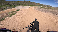
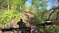
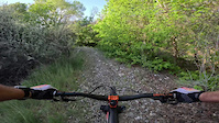
Photos of Santaquin Mountain Bike
Videos of Santaquin Mountain Bike
trail: Holladay
0:16 |
8 |
May 17, 2026
trail: Brownstone
0:41 |
10 |
May 8, 2026
trail: Belly Wash
2:01 |
11 |
May 8, 2026
trail: Silver King
2:41 |
9 |
May 8, 2026
trail: PV Jump Line
0:45 |
14 |
May 8, 2026
trail: Brownstone
0:41 |
5 |
May 8, 2026
trail: Turkey Run
0:11 |
8 |
May 8, 2026
Recent Trail Reports
| status | trail | date | condition | info | user |
|---|---|---|---|---|---|
| Little May (lower) | Jul 24, 2026 @ 10:35am (America/Boise) Jul 24, 2026 | Dry | dunk13 | ||
| Belly Wash | Jul 24, 2026 @ 10:35am (America/Boise) Jul 24, 2026 | Dry | dunk13 | ||
| Brownstone | Jul 24, 2026 @ 10:35am (America/Boise) Jul 24, 2026 | Dry | dunk13 | ||
| Little May (climb) | Jul 24, 2026 @ 10:35am (America/Boise) Jul 24, 2026 | Dry | dunk13 | ||
| Higginson Loop | Jun 20, 2026 @ 8:21am (America/Boise) Jun 20, 2026 | Dry | fletchridesagain | ||
| Little May Loop | Jun 20, 2026 @ 8:21am (America/Boise) Jun 20, 2026 | Dry | fletchridesagain | ||
| PV Beginner Line | Jun 20, 2026 @ 8:21am (America/Boise) Jun 20, 2026 | Dry | fletchridesagain | ||
| Penny Lane | May 29, 2026 @ 4:00pm (America/Denver) May 29, 2026 | Variable | mtnmantj | ||
| PV Skills Park Loop | May 8, 2026 @ 7:15am (Pacific/Midway) May 8, 2026 | Variable | fletchridesagain | ||
| PV Jump Line | May 8, 2026 @ 7:15am (Pacific/Midway) May 8, 2026 | Dry | fletchridesagain |
Activity Feed
| username | action | type | title | date |
|---|---|---|---|---|
| tremadsen | ridden | trail | activity #99910988 | Jul 24, 2026 @ 12:34pm Jul 24, 2026 |
| dunk13 | add | report | activity #99903443 and 3 more | Jul 24, 2026 @ 10:49am Jul 24, 2026 |
| mattsflyfishing | add | trail | activity #97436902 | Jun 20, 2026 @ 3:16pm Jun 20, 2026 |
| jessica196965 | wishlist | trail | activity #97429144 | Jun 20, 2026 @ 1:39pm Jun 20, 2026 |
| fletchridesagain | add | report | activity #97411691 and 6 more | Jun 20, 2026 @ 10:38am Jun 20, 2026 |
Recent Comments
| username | type | title | comment | date |
|---|---|---|---|---|
| trail | Nice easy climb to the top of Union Chief | Mar 13, 2026 @ 6:34pm Mar 13, 2026 | ||
| trail | Pretty fun if you get going fast enough. I... | Mar 13, 2026 @ 6:33pm Mar 13, 2026 | ||
| trail | A little sad this ended up being the primary... | Aug 10, 2025 @ 11:27am Aug 10, 2025 | ||
| trail | Really fun trail, everything is rollable... | Aug 10, 2025 @ 11:24am Aug 10, 2025 | ||
| trail | Looks like you rode when the trails were just... | Aug 22, 2024 @ 1:23pm Aug 22, 2024 |
Local Badges
-

Epic Mountain Bike Climb 2k0 awarded -

Climbing 10k Badge11 awarded -

Mountain Biking 100k Badge0 awarded -

Epic Ride Descent 2k0 awarded -

Descent 10k Badge11 awarded -

Descent 100k Badge0 awarded
Bike & Skill Parks
| name | type | city | rating |
|---|---|---|---|
| Mountain West MX Park | skill park | Santaquin |
Activity Type Stats
| activitytype | trails | distance | descent | descent distance | total vertical | rating | global rank | state rank | photos | reports | routes | activity logs |
|---|---|---|---|---|---|---|---|---|---|---|---|---|
| Mountain Bike | 39 | 27 miles | 3,878 ft | 9 miles | 2,205 ft | #6,263 | #2,117 | 26 | 155 | 9 | 3,212 | |
| E-Bike | 36 | 26 miles | 3,543 ft | 8 miles | 2,205 ft | #3,906 | #1,310 | 152 | 3 | 492 | ||
| Horse | 22 | 19 miles | 1,883 ft | 5 miles | 2,205 ft | #1,181 | #738 | 30 | 15 | |||
| Hike | 34 | 26 miles | 3,458 ft | 8 miles | 2,205 ft | #1,305 | #599 | 17 | 151 | 1 | 312 | |
| Trail Running | 34 | 26 miles | 3,458 ft | 8 miles | 2,205 ft | #5,812 | #1,857 | 151 | 2 | 122 | ||
| Dirtbike/Moto | 6 | 6 miles | 545 ft | 1 mile | 2,031 ft | #1,111 | #439 | 26 | 19 | |||
| ATV/ORV/OHV | 6 | 6 miles | 545 ft | 1 mile | 2,031 ft | #806 | #355 | 26 | 12 | |||
| Snowshoe | 1 | #1,724 | #988 | 27 | 1 | 21 | ||||||
| Nordic Ski | 1 | #632 | #287 | 27 | 4 |
Frequently Asked Questions About Santaquin
▼
What are the best places to ride in Santaquin?
Santaquin has 2 areas to explore for mountain biking. The top rated areas are:
▼
What are the highest rated mountain biking trails in Santaquin?
The highest rated mountain biking trails in Santaquin are:
- Little May (climb) (4.1/5)
- Brownstone (4/5)
- Diversion (3.7/5)
- Silver King (3.6/5)
- Little May (lower) (0/5)
▼
What is the best time of the year to ride in Santaquin?
Based on activity log data, the most popular months to ride in Santaquin are:
- June (10 activities)
- April (9 activities)
- September (9 activities)
▼
Where can I park to ride in Santaquin?
There are 6 parking locations listed in Santaquin. The most popular parking spots are: View all parking and trailhead locations on the map to plan your visit.
Activities
Trails
Points of Interest
- By Meadowlion & contributors
- Admins: jkwilliamz, UtahJohn, jpmcghee, jasonmalczyk, jbradley25, URMB, UVTA
- #29663 - 3,323 views
- santaquin activity log | embed map of Santaquin mountain bike trails | santaquin mountain biking points of interest
Downloading of trail gps tracks in kml & gpx formats is enabled for Santaquin.
You must login to download files.