close
-
Layers w
- Weather Layers
- Pro
- Pro
- Pro
- Pro
- Pro
- Pro
- More Layers
- Pro
- Pro
- Pro
- Pro
-
Upgrade to

3D
Trail Conditions
- Unknown
- Snow Groomed
- Snow Packed
- Snow Covered
- Snow Cover Partial
- Freeze/thaw Cycle
- Icy
- Prevalent Mud
- Wet
- Variable
- Ideal
- Dry
- Very Dry
Trail Flow (Ridden Direction)
Trailforks scans users ridelogs to determine the most popular direction each trail is ridden. A good flowing trail network will have most trails flowing in a single direction according to their intension.
The colour categories are based on what percentage of riders are riding a trail in its intended direction.
The colour categories are based on what percentage of riders are riding a trail in its intended direction.
- > 96%
- > 90%
- > 80%
- > 70%
- > 50%
- < 50%
- bi-directional trail
- no data
Trail Last Ridden
Trailforks scans ridelogs to determine the last time a trail was ridden.
- < 2 days
- < 1 week
- < 2 weeks
- < 1 month
- < 6 months
- > 6 months
Trail Ridden Direction
The intended direction a trail should be ridden.
- Downhill Only
- Downhill Primary
- Both Directions
- Uphill Primary
- Uphill Only
- One Direction
Contribute Details
Colors indicate trail is missing specified detail.
- Description
- Photos
- Description & Photos
- Videos
Trail Popularity ?
Trailforks scans ridelogs to determine which trails are ridden the most in the last 9 months.
Trails are compared with nearby trails in the same city region with a possible 25 colour shades.
Think of this as a heatmap, more rides = more kinetic energy = warmer colors.
- most popular
- popular
- less popular
- not popular
ATV/ORV/OHV Filter
Max Vehicle Width
inches
US Cell Coverage
Legend

Radar Time
Activity Recordings
Trailforks uses anonymized public activity data.
?
Activity Recordings
Trailforks uses anonymized public activity data.
?
Personal Heatmap
▶
Activity Types
all
/
none
▶
Options
2
Date range
month
–
Winter Trails
Warning
A routing network for winter maps does not exist. Selecting trails using the winter trails layer has been disabled.
Missing Trails
Most Popular
Least Popular
Trails are colored based on popularity. The more popular a trail is, the more red. Less popular trails trend towards green.
Jump Magnitude Heatmap
Heatmap of where riders jump on trails. Zoom in to see individual jumps, click circles to view jump details.
BC Backroad Status
![map legend]()
Service Road Atlas is a free to use, community-driven service for viewing and creating reports on the numerous back-country service roads around B.C. and Alberta.

Slope Aspect
Direction the slope faces
Trails Deemphasized
Trails are shown in grey.
Only show trails with no bike usage.
Suggested Layers
Based on selected activity type
Save the current map location and zoom level as your default home location whenever this page is loaded.
Save
No description for Senj has been added yet!
Login or register to submit one.
This region uses the Uk/Euro style trail grading system.
Activities Click to view
- Mountain Bike
156 trails
- E-Bike
135 trails
- Adaptive Bike
0 trails
- Hike
159 trails
- Trail Running
159 trails
- Dirtbike/Moto
12 trails
- ATV/ORV/OHV
11 trails
Region Details
- 79
- 25
- 20
- 19
- 6
Region Status
Caution as of May 4, 2026Stats
- Avg Trail Rating
- Trails (view details)
- 159
- Trails Mountain Bike
- 156
- Trails E-Bike
- 135
- Trails Horse
- 1
- Trails Hike
- 159
- Trails Trail Running
- 159
- Trails Dirtbike/Moto
- 12
- Trails ATV/ORV/OHV
- 11
- Total Distance
- 296 miles
- Total Descent Distance
- 129 miles
- Total Descent
- 40,892 ft
- Total Vertical
- 5,198 ft
- Highest Trailhead
- 5,205 ft
- Reports
- 90
- Photos
- 113
- Ridden Counter
- 961
Popular Senj Mountain Biking Trails
• 90 ★ 0.0 • 4,846 ft • 134 ft • 22 •
Popular blue difficulty doubletrack. This multi-use trail can be used both directions. On average it takes 6 minutes to complete this trail.
• 95 ★ 1.0 • 1 mile • 8 ft • 20 •
Popular green difficulty doubletrack. This multi-use trail can be used both directions. On average it takes 14 minutes to complete this trail.
• 95 ★ 0.0 • 2,382 ft • 56 ft • 11 •
Popular green difficulty doubletrack. This multi-use trail can be used both directions. On average it takes 6 minutes to complete this trail.
• 90 ★ 5.0 • 2 miles • 37 ft • 10 •
Extraordinary Singlepath trail, rocky & soil, arranged by prof. Alfons Kauder 1878-1966)
• 80 ★ 4.0 • 2 miles • 40 ft • 9 •
Popular black diamond difficulty doubletrack. This mountain bike primary trail can be used both directions. On average it takes 8 minutes to complete this trail.
• 80 ★ 0.0 • 1 mile • 59 ft • 8 • • hike
Popular blue difficulty singletrack. This hike primary trail can be used downhill only. On average it takes 14 minutes to complete this trail.
• 80 ★ 5.0 • 3,114 ft • 0 ft • 7 •
Popular black difficulty wilderness trail. This mountain bike primary trail can be used downhill only. On average it takes 7 minutes to complete this trail.
• 80 ★ 0.0 • 3 miles • 604 ft • 6 •
Popular red difficulty doubletrack. This multi-use trail can be used both directions.
Photos of Senj Mountain Bike
Videos of Senj Mountain Bike
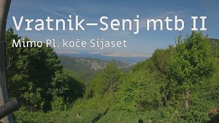
trail: Kaudersov put
6:19 |
44 |
May 12, 2025 , Senj
Recent Trail Reports
| status | trail | date | condition | info | user |
|---|---|---|---|---|---|
| Šmrika | May 4, 2026 @ 9:27pm (Europe/Zagreb) May 4, 2026 | Dry | urbe | ||
| Tadići | Apr 7, 2026 @ 7:24am (Europe/Zagreb) Apr 6, 2026 | Unknown | r2h2 | ||
| Žukalj-Rakita | May 16, 2025 @ 8:09am May 16, 2025 | Ideal | UeliOtto | ||
| Jozefina (Vukasović1787) | May 16, 2025 @ 8:09am May 16, 2025 | Ideal | UeliOtto | ||
| Kaudersov put | May 12, 2025 @ 12:37pm May 12, 2025 | Dry | urbe | ||
| Sv.Jelena downhill | Oct 28, 2024 @ 12:49am Oct 28, 2024 | Unknown | gasper-knavs AED Maribor | ||
| DH - Krivoputska draga | Oct 28, 2024 @ 12:47am Oct 28, 2024 | Unknown | gasper-knavs AED Maribor | ||
| Trbušnjak | Sep 20, 2024 @ 10:55am Sep 20, 2024 | Ideal | supermarme | ||
| Viewpoint | Sep 20, 2024 @ 10:55am Sep 20, 2024 | Ideal | supermarme | ||
| Prilaz na Kauderov put | Sep 20, 2024 @ 10:55am Sep 20, 2024 | Unknown | supermarme |
Activity Feed
| username | action | type | title | date |
|---|---|---|---|---|
| Luk7Q8QlS | wishlist | trail | activity #96291879 | Jun 5, 2026 @ 6:44am Jun 5, 2026 |
| urbe | add | photo | activity #95125842 | May 20, 2026 @ 12:14pm May 20, 2026 |
| urbe | add | report | activity #94040670 | May 4, 2026 @ 12:30pm May 4, 2026 |
| urbe | ridden | trail | activity #94039567 and 1 more | May 4, 2026 @ 11:57am May 4, 2026 |
| urbe | vote | trail | activity #94039516 | May 4, 2026 @ 11:56am May 4, 2026 |
Recent Comments
| username | type | title | comment | date |
|---|---|---|---|---|
| trail | Importabt to note - there are a LOT of Bears... | Sep 13, 2025 @ 10:26am Sep 13, 2025 | ||
| report | Not even a blue trail, just a normal gravel... | Nov 30, 2023 @ 7:47am Nov 30, 2023 |
Local Badges
-

Epic Mountain Bike Climb 2k55 awarded -

Climbing 10k Badge6 awarded -

Mountain Biking 100k Badge0 awarded -

Epic Ride Descent 2k55 awarded -

Descent 10k Badge6 awarded -

Descent 100k Badge0 awarded
Activity Type Stats
| activitytype | trails | distance | descent | descent distance | total vertical | rating | global rank | state rank | photos | reports | routes | ridelogs |
|---|---|---|---|---|---|---|---|---|---|---|---|---|
| Mountain Bike | 156 | 294 miles | 39,862 ft | 128 miles | 5,197 ft | #865 | #4 | 112 | 90 | 550 | ||
| E-Bike | 135 | 274 miles | 34,301 ft | 117 miles | 5,197 ft | #287 | #2 | 1 | 87 | 35 | ||
| Horse | 1 | 2 miles | 748 ft | 2 miles | 656 ft | |||||||
| Hike | 159 | 288 miles | 40,636 ft | 128 miles | 5,197 ft | #493 | #4 | 90 | 69 | |||
| Trail Running | 159 | 288 miles | 40,636 ft | 128 miles | 5,197 ft | #359 | #4 | 90 | 1 | |||
| Dirtbike/Moto | 12 | 49 miles | 3,642 ft | 15 miles | 3,320 ft | #202 | #4 | |||||
| ATV/ORV/OHV | 11 | 49 miles | 3,642 ft | 15 miles | 3,320 ft | #115 | #4 | 1 |
Frequently Asked Questions About Senj
▼
What are the highest rated mountain biking trails in Senj?
The highest rated mountain biking trails in Senj are:
- Kaudersov put (4.4/5)
- DH - Krivoputska draga (4.1/5)
- Klenovica-Ledenice uphill (4/5)
- Lopci-Sijaset (4/5)
- Tadići (3.7/5)
▼
What is the best time of the year to ride in Senj?
Based on ride log data, the most popular months to ride in Senj are:
- July (4 activities)
- September (4 activities)
- August (4 activities)
▼
Where can I park to ride in Senj?
There are 1 parking locations listed in Senj. The most popular parking spots are:
▼
What is the longest trail in Senj?
The longest trail in Senj is Jelovac - Rujice at 9.9 km. View all trails sorted by distance.
Activities
Trails
- By alienri TeamRodeo & contributors
- Admins: VjekoslavKrsanac
- #21959 - 3,382 views
- senj activity log | embed map of Senj mountain bike trails | senj mountain biking points of interest
Downloading of trail gps tracks in kml & gpx formats is enabled for Senj.
You must login to download files.