
close
3D
Trail Conditions
- Unknown
- Snow Groomed
- Snow Packed
- Snow Covered
- Snow Cover Partial
- Freeze/thaw Cycle
- Icy
- Prevalent Mud
- Wet
- Variable
- Ideal
- Dry
- Very Dry
Trail Flow (Ridden Direction)
Trailforks scans users activity logs to determine the most popular direction each trail is ridden. A good flowing trail network will have most trails flowing in a single direction according to their intension.
The colour categories are based on what percentage of users are riding a trail in its intended direction.
The colour categories are based on what percentage of users are riding a trail in its intended direction.
- > 96%
- > 90%
- > 80%
- > 70%
- > 50%
- < 50%
- bi-directional trail
- no data
Trail Last Used
Trailforks scans activity logs to determine the last time a trail was ridden.
- < 2 days
- < 1 week
- < 2 weeks
- < 1 month
- < 6 months
- > 6 months
Trail Ridden Direction
The intended direction a trail should be ridden.
- Downhill Only
- Downhill Primary
- Both Directions
- Uphill Primary
- Uphill Only
- One Direction
Contribute Details
Colors indicate trail is missing specified detail.
- Description
- Photos
- Description & Photos
- Videos
Trail Popularity ?
Trailforks scans activity logs to determine which trails are ridden the most in the last 9 months.
Trails are compared with nearby trails in the same city region with a possible 25 colour shades.
Think of this as a heatmap, more activities = more kinetic energy = warmer colors.
- most popular
- popular
- less popular
- not popular
ATV/ORV/OHV Filter
Max Vehicle Width
inches
US Cell Coverage
Legend

Radar Time
Activity Recordings
Trailforks uses anonymized public activity data.
?
Activity Recordings
Trailforks uses anonymized public activity data.
?
Winter Trails
Warning
A routing network for winter maps does not exist. Selecting trails using the winter trails layer has been disabled.
Missing Trails
Most Popular
Least Popular
Trails are colored based on popularity. The more popular a trail is, the more red. Less popular trails trend towards green.
Jump Magnitude Heatmap
Heatmap of where users jump on trails. Zoom in to see individual jumps, click circles to view jump details.
BC Backroad Status
![map legend]()
Service Road Atlas is a free to use, community-driven service for viewing and creating reports on the numerous back-country service roads around B.C. and Alberta.

Slope Aspect
Direction the slope faces
Trails Deemphasized
Trails are shown in grey.
Only show trails with no bike usage.
Suggested Layers
Based on selected activity type
Save the current map location and zoom level as your default home location whenever this page is loaded.
SaveFRANÇAIS: Le centre Gai-Luron offre un réseau de sentiers entretenus mécaniquement pour plusieurs activités hivernales : ski de fond classique et skate, fatbike et raquette.
Ski de fond : environ 27,2 km de pistes balisées avec niveaux débutant à expert. Les pistes sont divisées en boucles de différentes distances pour le ski classique, ainsi qu’une piste dédiée au ski de style skate.
Fatbike : sentiers damés pour la pratique du fatbike en hiver (longueur globale non spécifiée sur le site, mais le centre dispose de plusieurs kilomètres dédiés).
Raquette : parcours balisés à travers le terrain forestier.
Les sentiers traversent un décor forestier varié avec des sections de dénivelé modéré à soutenu selon les parcours choisis. Le centre est accessible au public avec différents types de passes (annuelles ou journalières), et des services tels que stationnement gratuit, abris chauffés et location d’équipement.
ENGLISH: Gai-Luron is a winter outdoor recreation center offering a mechanically groomed trail network for multiple activities, including cross-country skiing, fatbiking, and snowshoeing.
Cross-country skiing: Approximately 27.2 km of groomed trails, offering a mix of beginner, intermediate, and advanced routes. The network includes looped trails of varying lengths, with designated tracks for classic skiing as well as a dedicated skate skiing trail.
Fatbike: Groomed winter trails are available for fatbike use. Trails are maintained specifically for winter riding conditions.
Snowshoeing: Marked snowshoe trails are available through wooded terrain.
The trail system runs through a forested landscape with varied terrain and rolling elevation. Access requires a valid day pass or season pass. On-site amenities include parking, warming shelters, and equipment rental. Trails are open during the winter season, subject to snow and weather conditions.
source: Gai-Luron
Primary Trail Type: Cross-Country
eBikes Allowed:
Yes
Land Status: Private Property
 google parking directions plan a road trip here
Access Info:
2155 montée Sainte-Thérèse
Saint-Jérôme, Québec J5L 2L2
Saint-Jérôme, Québec J5L 2L2
Links
Trail info last updated
Activities Click to view
- Mountain Bike
23 trails
- E-Bike
27 trails
- Winter Fat Bike
11 trails
- Trail Running
0 trails
- Snowshoe
1 trails
- Nordic Ski
6 trails
Region Details
- 4
- 15
- 4
Region Status
Open as of 2 daysStats
- Avg Trail Rating
- Trails (view details)
- 28
- Trails Mountain Bike
- 23
- Trails E-Bike
- 27
- Trails Gravel Bike
- 4
- Trails Winter Fat Bike
- 11
- Trails Snowshoe
- 1
- Trails Nordic Ski
- 6
- Total Distance
- 21 miles
- Total Descent Distance
- 6 miles
- Total Descent
- 1,414 ft
- Total Vertical
- 234 ft
- Highest Trailhead
- 919 ft
- Reports
- 26
- Completed Counter
- 893
Popular Sentiers Gai-Luron Mountain Biking Trails
• 100 ★ 0.0 • 5,259 ft • 109 ft • 50 •
Sentier qui permet d'aller du stationnement au hub principale
• 100 ★ 0.0 • 2 miles • 138 ft • 46 •
Popular blue difficulty singletrack. This mountain bike primary trail and has a moderate overall physical rating with a 138 ft blue climb. Trail visibility is always easy to follow. On average it takes 11 minutes to complete this trail.
• 95 ★ 0.0 • 4,780 ft • 46 ft • 30 •
Popular blue difficulty singletrack. This mountain bike primary trail can be used downhill only. Trail visibility is always easy to follow.
• 100 ★ 0.0 • 2 miles • 79 ft • 28 •
Popular blue difficulty singletrack. This mountain bike primary trail can be used downhill only and has a moderate overall physical rating with a 79 ft blue climb. Trail visibility is always easy to follow.
• 90 ★ 0.0 • 2,096 ft • 69 ft • 28 •
Popular green difficulty singletrack. This mountain bike primary trail can be used both directions with a 69 ft green climb. Trail visibility is always easy to follow.
• 85 ★ 0.0 • 3,107 ft • 10 ft • 23 •
Popular blue difficulty singletrack. This multi-use trail can be used downhill only. Trail visibility is always easy to follow.
• 100 ★ 0.0 • 650 ft • 6 ft • 21 •
Popular blue difficulty singletrack. This mountain bike primary trail can be used one direction. Trail visibility is always easy to follow.
• 75 ★ 0.0 • 2,464 ft • 34 ft • 20 •
Popular blue difficulty singletrack. This mountain bike primary trail can be used uphill only with a 34 ft blue climb. Trail visibility is always easy to follow.
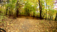
Videos of Sentiers Gai-Luron Mountain Bike
Recent Trail Reports
| status | trail | date | condition | info | user |
|---|---|---|---|---|---|
| Le Grand-Tour w | Feb 18, 2018 @ 7:25am Feb 18, 2018 | Snow Packed | ChrisSab | ||
| La Principale w | Feb 18, 2018 @ 7:25am Feb 18, 2018 | Snow Packed | ChrisSab |
Activity Feed
| username | action | type | title | date |
|---|---|---|---|---|
| StephaneMarceau | update | region | activity #105968077 | Oct 15, 2026 @ 8:11pm Oct 15, 2026 |
| Oferland | add | trail | activity #105967516 and 9 more | Oct 15, 2026 @ 7:47pm Oct 15, 2026 |
| Oferland | add | trail | activity #105059487 and 1 more | Oct 2, 2026 @ 1:44pm Oct 2, 2026 |
| PYainey | add | report | activity #100895514 | Aug 6, 2026 @ 4:22pm Aug 6, 2026 |
| joracine | add | trail | activity #88275977 | Feb 3, 2026 @ 9:54am Feb 3, 2026 |
Nearby Areas
| name | distance | ||||
|---|---|---|---|---|---|
| Parc de la Coulée | 9 | 10 | 1.5 km | ||
| Sentier Bellefeuille | 2.7 km | ||||
| Parc vélo Sommet Saint-Sauveur | 2 | 4 | 3 | 2 | 4 km |
| Sentiers de la colonie | 5 | 5 | 3 | 4.6 km | |
| Parc naturel du Lac-Jérôme | 9 | 12 | 5.8 km |
Activity Type Stats
| activitytype | trails | distance | descent | descent distance | total vertical | rating | global rank | state rank | photos | reports | routes | activity logs |
|---|---|---|---|---|---|---|---|---|---|---|---|---|
| Mountain Bike | 23 | 9 miles | 486 ft | 2 miles | 233 ft | #9,029 | #111 | 23 | 1,053 | |||
| E-Bike | 27 | 20 miles | 1,394 ft | 6 miles | 233 ft | #5,598 | #66 | 8 | 35 | |||
| Gravel Bike | 4 | 2,874 ft | 79 ft | 1,198 ft | 82 ft | #11,194 | #163 | 2 | ||||
| Winter Fat Bike | 11 | 9 miles | 486 ft | 2 miles | 233 ft | #37 | #3 | 2 | 61 | |||
| Snowshoe | 1 | 1,565 ft | 3 ft | 131 ft | 23 ft | #2,450 | #114 | 15 | 25 | |||
| Nordic Ski | 6 | 12 miles | 928 ft | 4 miles | 233 ft | #903 | #51 | 18 | 630 |
Frequently Asked Questions
▼
What are the highest rated mountain biking trails in Sentiers Gai-Luron?
The highest rated mountain biking trails in Sentiers Gai-Luron are:
- La Girouard (4.1/5)
- Le Grand-Tour (4.1/5)
- La Grande Montée (4.1/5)
- Les Ponts (4.1/5)
- La Butte (4.1/5)
▼
What is the best time of the year to ride in Sentiers Gai-Luron?
Based on activity log data, the most popular months to ride in Sentiers Gai-Luron are:
- September (69 activities)
- October (48 activities)
- August (33 activities)
▼
Where can I park to ride in Sentiers Gai-Luron?
There are 1 parking locations listed in Sentiers Gai-Luron. The most popular parking spots are:
▼
What is the longest trail in Sentiers Gai-Luron?
The longest trail in Sentiers Gai-Luron is La Principale at 2.2 miles. View all trails sorted by distance.
▼
How many trails are in Sentiers Gai-Luron?
Sentiers Gai-Luron has a total of 28 trails. Of those, 23 are designated for mountain biking. Browse top mountain biking trails in Sentiers Gai-Luron to find detailed information including difficulty ratings, distances, and trail conditions.
▼
Which trail has the most elevation gain in Sentiers Gai-Luron?
The trail with the most elevation gain in Sentiers Gai-Luron is La grande montée with 138 ft of elevation gain. View all trails sorted by elevation gain.
▼
Which trail has the most elevation descent in Sentiers Gai-Luron?
The trail with the most elevation descent in Sentiers Gai-Luron is La Girouard with 171 ft of elevation descent. View all trails sorted by elevation descent.
▼
What activities are most popular in Sentiers Gai-Luron?
Sentiers Gai-Luron supports the following activities: Mountain Biking, E-Biking, Winter Fat Biking, Trail Running, Snowshoeing, Nordic Skiing.
▼
What are the steepest mountain biking trails in Sentiers Gai-Luron?
The steepest mountain biking trail in Sentiers Gai-Luron is La Principale with an average grade of 4.3%. View all trails sorted by grade.
▼
Are the trails open in Sentiers Gai-Luron?
Out of 7 trails:
- Clear / Green: 7
▼
Can I ride an ebike in Sentiers Gai-Luron?
Yes, Sentiers Gai-Luron supports e-bike riding. There are 27 trails in Sentiers Gai-Luron that allow e-bikes. Check the e-bike trails listing for specific trail access details and any local regulations.
▼
What type of bike is most common in Sentiers Gai-Luron?
Based on activity log data, the most common bike types used in Sentiers Gai-Luron are:
- AM (22 activities)
- Fat (5 activities)
- Trials (1 activities)
▼
What are the most popular mountain biking trails in Sentiers Gai-Luron?
The most popular mountain biking trails in Sentiers Gai-Luron are: View all mountain biking trails sorted by popularity.
▼
What are the best beginner ride trails in Sentiers Gai-Luron?
The best beginner mountain biking trails in Sentiers Gai-Luron are:
- La Zigzag (4/5)
- La Principale (4/5)
- La Principale (4/5)
Activities
- By StephaneMarceau
 TRAILFORKS & contributors
- Admins: apply
- #21875 - 3,783 views
- sentiers gai-luron activity log | embed map of Sentiers Gai-Luron mountain bike trails | sentiers gai-luron mountain biking points of interest
Downloading of trail gps tracks in kml & gpx formats is enabled for Sentiers Gai-Luron.
You must login to download files.