
close
3D
Trail Conditions
- Unknown
- Snow Groomed
- Snow Packed
- Snow Covered
- Snow Cover Partial
- Freeze/thaw Cycle
- Icy
- Prevalent Mud
- Wet
- Variable
- Ideal
- Dry
- Very Dry
Trail Flow (Ridden Direction)
Trailforks scans users activity logs to determine the most popular direction each trail is ridden. A good flowing trail network will have most trails flowing in a single direction according to their intension.
The colour categories are based on what percentage of users are riding a trail in its intended direction.
The colour categories are based on what percentage of users are riding a trail in its intended direction.
- > 96%
- > 90%
- > 80%
- > 70%
- > 50%
- < 50%
- bi-directional trail
- no data
Trail Last Used
Trailforks scans activity logs to determine the last time a trail was ridden.
- < 2 days
- < 1 week
- < 2 weeks
- < 1 month
- < 6 months
- > 6 months
Trail Ridden Direction
The intended direction a trail should be ridden.
- Downhill Only
- Downhill Primary
- Both Directions
- Uphill Primary
- Uphill Only
- One Direction
Contribute Details
Colors indicate trail is missing specified detail.
- Description
- Photos
- Description & Photos
- Videos
Trail Popularity ?
Trailforks scans activity logs to determine which trails are ridden the most in the last 9 months.
Trails are compared with nearby trails in the same city region with a possible 25 colour shades.
Think of this as a heatmap, more activities = more kinetic energy = warmer colors.
- most popular
- popular
- less popular
- not popular
ATV/ORV/OHV Filter
Max Vehicle Width
inches
US Cell Coverage
Legend

Radar Time
Activity Recordings
Trailforks uses anonymized public activity data.
?
Activity Recordings
Trailforks uses anonymized public activity data.
?
Winter Trails
Warning
A routing network for winter maps does not exist. Selecting trails using the winter trails layer has been disabled.
Missing Trails
Most Popular
Least Popular
Trails are colored based on popularity. The more popular a trail is, the more red. Less popular trails trend towards green.
Jump Magnitude Heatmap
Heatmap of where users jump on trails. Zoom in to see individual jumps, click circles to view jump details.
BC Backroad Status
![map legend]()
Service Road Atlas is a free to use, community-driven service for viewing and creating reports on the numerous back-country service roads around B.C. and Alberta.

Slope Aspect
Direction the slope faces
Trails Deemphasized
Trails are shown in grey.
Only show trails with no bike usage.
Suggested Layers
Based on selected activity type
Save the current map location and zoom level as your default home location whenever this page is loaded.
SaveAKA 五指山 Five Fingers Mountain Trail.
Trail Entry "25.121070, 121.600831"
Trail Entry "25.121070, 121.600831"
Primary Trail Type: All-Mountain & Downhill
Shuttleable: YES
AKA: 五指山 Five Fingers
Land Status: City Managed
Access Info:
https://goo.gl/maps/zoEkbC3SJGP2
Trail info last updated
Activities Click to view
- Mountain Bike
24 trails
- E-Bike
20 trails
- Hike
24 trails
- Trail Running
23 trails
Region Details
- 1
- 11
- 11
- 1
Region Status
Caution as of Sep 7, 2025Stats
- Avg Trail Rating
- Trails (view details)
- 25
- Trails Mountain Bike
- 24
- Trails E-Bike
- 20
- Trails Hike
- 24
- Trails Trail Running
- 23
- Total Distance
- 13 miles
- Total Descent
- 6,594 ft
- Total Vertical
- 1,802 ft
- Highest Trailhead
- 1,895 ft
- Reports
- 44
- Photos
- 30
- Completed Counter
- 448
Popular Skilift 五指山 Mountain Biking Trails
• 65 ★ 0.0 • 1,699 ft • 0 ft • 42 •
Moderately popular black diamond difficulty mixed. This multi-use trail can be used downhill primary and has a moderate overall physical rating with a 0 ft black diamond climb. It features drop and rock garden. Trail visibility is always easy to follow. On average it takes 5 minutes to complete this trail.
• 90 ★ 0.0 • 1,886 ft • 36 ft • 23 •
Popular blue difficulty singletrack. This mountain bike primary trail can be used downhill only. It features roller coaster and skinny. Trail visibility is always easy to follow. On average it takes 6 minutes to complete this trail.
• 95 ★ 0.0 • 1,332 ft • 11 ft • 22 •
Popular blue difficulty singletrack. This mountain bike primary trail can be used downhill primary. Trail visibility is always easy to follow. On average it takes 2 minutes to complete this trail.
• 85 ★ 0.0 • 4,892 ft • 59 ft • 22 •
An easy extension to bypass the last section of Skilift of Five-finger Mt.. Some logs, stairs, and some berms could be used if you are fast. Hikers use this section often so please make sure not to surprise them too much. Be careful not...
• 100 ★ 0.0 • 1,617 ft • 14 ft • 19 •
Extension of Skilift. In-between section 2 and 3. Mind the hikers from oppsite direction especially weekend. Might be slippery when wet.
• 75 ★ 0.0 • 3,379 ft • 0 ft • 18 •
Popular blue difficulty singletrack. This mountain bike primary trail can be used downhill primary. Trail visibility is always easy to follow. On average it takes 11 minutes to complete this trail.
• 75 ★ 0.0 • 1,276 ft • 0 ft • 18 •
Popular black diamond difficulty singletrack. This mountain bike primary trail can be used downhill only. Trail visibility is always easy to follow. On average it takes 5 minutes to complete this trail.
Skilift 五指山 Mountain Bike Routes
9 miles • 1,713 ft • 0 • Point to Point •
中社頂端翠山步道(5.59k)需注意行人,翠山步道底(6.63k)需牽車上攀至6.92k處。
Photos of Skilift 五指山 Mountain Bike
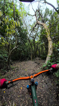
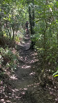
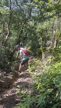
Videos of Skilift 五指山 Mountain Bike
Recent Trail Reports
| status | trail | date | condition | info | user |
|---|---|---|---|---|---|
| Extension of Skilift (打貓段) | Sep 7, 2025 @ 12:28pm Sep 7, 2025 | Ideal | didalin | ||
| Slalom XC Sec.2 | Sep 7, 2025 @ 12:28pm Sep 7, 2025 | Ideal | didalin | ||
| Slalom XC Sec.1 | Sep 7, 2025 @ 12:28pm Sep 7, 2025 | Ideal | didalin | ||
| Supao Loop | Sep 7, 2025 @ 12:28pm Sep 7, 2025 | Ideal | didalin | ||
| 雞南山(第7段)Ski Lift sec. 7 | Sep 7, 2025 @ 12:28pm Sep 7, 2025 | Variable | didalin | ||
| Rabbit hole | Dec 7, 2024 @ 8:10am Dec 7, 2024 | Variable | dhhack1225 | ||
| A proper DH | Dec 7, 2024 @ 8:10am Dec 7, 2024 | Variable | dhhack1225 | ||
| Cuca's Trail | Sep 24, 2024 @ 9:29am Sep 24, 2024 | Wet | Frank-Dalmau | ||
| Farmers Graveyards | Sep 4, 2024 @ 8:22pm Sep 4, 2024 | Ideal | Frank-Dalmau | ||
| Five Fingers (Ski lift) Sec. 6 五指山 6 段 | Mar 13, 2024 @ 4:47am Mar 13, 2024 | Ideal | yoyono1 |
Activity Feed
| username | action | type | title | date |
|---|---|---|---|---|
| JWMTB6 | wishlist | region | activity #106620890 | Oct 26, 2026 @ 2:55am Oct 26, 2026 |
| TCJames3F05Gj | wishlist | trail | activity #103527484 | Sep 11, 2026 @ 1:29am Sep 11, 2026 |
| Fttk | difficultyvote | trail | activity #102804852 | Sep 1, 2026 @ 12:52am Sep 1, 2026 |
| GRUzLS | wishlist | trail | activity #100872329 | Aug 6, 2026 @ 9:47am Aug 6, 2026 |
| JasonH1N9SV | wishlist | trail | activity #99655220 | Jul 20, 2026 @ 9:48pm Jul 20, 2026 |
Recent Comments
| username | type | title | comment | date |
|---|---|---|---|---|
| trail | ... | Apr 3, 2025 @ 10:04am Apr 3, 2025 | ||
| trail | 五指山段,唯一可以完食的路線 | Mar 24, 2025 @ 11:31pm Mar 24, 2025 | ||
| trail | ... | Mar 20, 2025 @ 9:38am Mar 20, 2025 | ||
| trail | ... | Mar 20, 2025 @ 9:34am Mar 20, 2025 | ||
| trail | Trail is blocked by the fallen tree. | Nov 23, 2024 @ 5:47am Nov 23, 2024 |
Nearby Areas
| name | distance | ||||
|---|---|---|---|---|---|
| Yang Ming Shan 陽明山 | 3 | 4 | 2 | 3.1 km | |
| DanFeng Mt. 丹鳳山 | 1 | 5 | 6 | 1 | 4.1 km |
| Maokong Gondola Trails 貓空 | 4 | 2 | 9.4 km | ||
| Guan Yin Shan | 9.6 km | ||||
| GuiShan District | 3 | 16.1 km |
Local Badges
-

Completionist0 awarded

Activity Type Stats
| activitytype | trails | distance | descent | descent distance | total vertical | rating | global rank | state rank | photos | reports | routes | activity logs |
|---|---|---|---|---|---|---|---|---|---|---|---|---|
| Mountain Bike | 24 | 12 miles | 6,522 ft | 9 miles | 1,801 ft | #2,618 | #3 | 30 | 44 | 2 | 3,955 | |
| E-Bike | 20 | 9 miles | 4,738 ft | 6 miles | 1,801 ft | #1,427 | #1 | 42 | 264 | |||
| Hike | 24 | 12 miles | 6,299 ft | 9 miles | 1,801 ft | #1,884 | #2 | 42 | 1 | 165 | ||
| Trail Running | 23 | 12 miles | 6,227 ft | 9 miles | 1,801 ft | #1,218 | #2 | 42 | 1 | 104 |
Frequently Asked Questions
▼
What are the highest rated mountain biking trails in Skilift 五指山?
The highest rated mountain biking trails in Skilift 五指山 are:
- 五指山 Ski Lift 1-2 段 (4/5)
- 雞南山(第7段)Ski Lift sec. 7 (4/5)
- 汐止新山夢湖保線道 (3.8/5)
- Supao Loop (0/5)
- Slalom XC Sec.1 (0/5)
▼
What is the best time of the year to ride in Skilift 五指山?
Based on activity log data, the most popular months to ride in Skilift 五指山 are:
- May (30 activities)
- January (13 activities)
- April (11 activities)
▼
Where can I park to ride in Skilift 五指山?
Check the Skilift 五指山 trail map for trailhead and parking information. Community members regularly update access and parking details for trails in the area.
▼
What is the longest trail in Skilift 五指山?
The longest trail in Skilift 五指山 is 五指山 Ski Lift 1-2 段 at 1.9 miles. View all trails sorted by distance.
▼
What are the best & highest rated hiking trails in Skilift 五指山?
The best hiking trails in Skilift 五指山 are:
- Zhongyongshan Trail
- Five Fingers (Ski lift) Sec. 6 五指山 6 段
- 五指山 Ski Lift 1-2 段
- Five Fingers (Ski Lift) sec. 5 五指山 5 段
- Alternative
▼
What are the best & highest rated trail running trails in Skilift 五指山?
The best trail running trails in Skilift 五指山 are:
- Five Fingers (Ski lift) Sec. 6 五指山 6 段
- Five Fingers (Ski Lift) sec. 5 五指山 5 段
- 五指山 Ski Lift 1-2 段
- 五指山 Ski Lift 3 段
- Extension of Skilift (打貓段)
▼
How many trails are in Skilift 五指山?
Skilift 五指山 has a total of 25 trails. Of those, 24 are designated for mountain biking. Browse top mountain biking trails in Skilift 五指山 to find detailed information including difficulty ratings, distances, and trail conditions.
▼
Which trail has the most elevation gain in Skilift 五指山?
The trail with the most elevation gain in Skilift 五指山 is 五指山 Ski Lift 3 段 with 185 ft of elevation gain. View all trails sorted by elevation gain.
▼
Which trail has the most elevation descent in Skilift 五指山?
The trail with the most elevation descent in Skilift 五指山 is 汐止新山夢湖保線道 with 825 ft of elevation descent. View all trails sorted by elevation descent.
▼
What activities are most popular in Skilift 五指山?
Skilift 五指山 supports the following activities: Mountain Biking, E-Biking, Hiking, Trail Running.
▼
What are the steepest mountain biking trails in Skilift 五指山?
The steepest mountain biking trail in Skilift 五指山 is Alternative with an average grade of 0.2%. View all trails sorted by grade.
▼
Are the trails open in Skilift 五指山?
The overall region status for Skilift 五指山 is Minor Issue / Yellow. Out of 14 trails:
- Clear / Green: 10
- Minor Issue / Yellow: 1
- Significant Issue / Amber: 3
▼
Can I ride an ebike in Skilift 五指山?
Yes, Skilift 五指山 supports e-bike riding. There are 21 trails in Skilift 五指山 that allow e-bikes. Check the e-bike trails listing for specific trail access details and any local regulations.
▼
What type of bike is most common in Skilift 五指山?
Based on activity log data, the most common bike types used in Skilift 五指山 are:
- AM (2 activities)
▼
What are the most popular Strava Segments in Skilift 五指山?
The most popular Strava segments in Skilift 五指山 are:
- 劍南路 (由北安路上) (3,494 athletes)
- 五指山第一段5Fingers sec.1 (258 athletes)
- 五指山第二段5Fingers sec.2 (223 athletes)
▼
What are the most popular mountain biking trails in Skilift 五指山?
The most popular mountain biking trails in Skilift 五指山 are: View all mountain biking trails sorted by popularity.
▼
What are the best beginner ride trails in Skilift 五指山?
The best beginner mountain biking trails in Skilift 五指山 are:
- Cuca's Trail (0/5)
- By davieangel & contributors
- Admins: LRT, claudedore, davieangel
- #17897 - 3,295 views
- skilift 五指山 activity log | embed map of Skilift 五指山 mountain bike trails |
Downloading of trail gps tracks in kml & gpx formats is enabled for Skilift 五指山.
You must login to download files.
