close
-
Layers w
- Map Content
- More Layers
- Pro
- Pro
- Pro
- Pro
- Pro
- Pro
- Pro
- Pro
-
Upgrade to

3D
Trail Conditions
- Unknown
- Snow Groomed
- Snow Packed
- Snow Covered
- Snow Cover Partial
- Freeze/thaw Cycle
- Icy
- Prevalent Mud
- Wet
- Variable
- Ideal
- Dry
- Very Dry
Trail Flow (Ridden Direction)
Trailforks scans users ridelogs to determine the most popular direction each trail is ridden. A good flowing trail network will have most trails flowing in a single direction according to their intension.
The colour categories are based on what percentage of riders are riding a trail in its intended direction.
The colour categories are based on what percentage of riders are riding a trail in its intended direction.
- > 96%
- > 90%
- > 80%
- > 70%
- > 50%
- < 50%
- bi-directional trail
- no data
Trail Last Ridden
Trailforks scans ridelogs to determine the last time a trail was ridden.
- < 2 days
- < 1 week
- < 2 weeks
- < 1 month
- < 6 months
- > 6 months
Trail Ridden Direction
The intended direction a trail should be ridden.
- Downhill Only
- Downhill Primary
- Both Directions
- Uphill Primary
- Uphill Only
- One Direction
Contribute Details
Colors indicate trail is missing specified detail.
- Description
- Photos
- Description & Photos
- Videos
Trail Popularity ?
Trailforks scans ridelogs to determine which trails are ridden the most in the last 9 months.
Trails are compared with nearby trails in the same city region with a possible 25 colour shades.
Think of this as a heatmap, more rides = more kinetic energy = warmer colors.
- most popular
- popular
- less popular
- not popular
ATV/ORV/OHV Filter
Max Vehicle Width
inches
US Cell Coverage
Legend

Radar Time
x
Activity Recordings
Trailforks users anonymized public ridelogs from the past 6 months.
- mountain biking recent
- mountain biking (>6 month)
- hiking (1 year)
- moto (1 year)
Activity Recordings
Trailforks users anonymized public skilogs from the past 12 months.
- Downhill Ski
- Backcountry Ski
- Nordic Ski
- Snowmobile
Winter Trails
Warning
A routing network for winter maps does not exist. Selecting trails using the winter trails layer has been disabled.
x
Missing Trails
Most Popular
Least Popular
Trails are colored based on popularity. The more popular a trail is, the more red. Less popular trails trend towards green.
Jump Magnitude Heatmap
Heatmap of where riders jump on trails. Zoom in to see individual jumps, click circles to view jump details.
Trails Deemphasized
Trails are shown in grey.
Only show trails with NO bikes.
Save the current map location and zoom level as your default home location whenever this page is loaded.
SaveThis region is Unsanctioned, Ride at your own Risk!
No description for Smolna has been added yet! Login or register to submit one.Primary Trail Type: All-Mountain & Downhill
This region uses the Uk/Euro style trail grading system.
Activities Click to view
- Mountain Bike
3 trails
- Hike
2 trails
- Trail Running
2 trails
Region Details
- 2
- 1
Region Status
Caution as of Feb 11, 2023Stats
- Avg Trail Rating
- Trails (view details)
- 3
- Trails Mountain Bike
- 3
- Trails Hike
- 2
- Trails Trail Running
- 2
- Total Distance
- 1,801 ft
- Total Descent
- 203 ft
- Total Vertical
- 129 ft
- Highest Trailhead
- 360 ft
- Reports
- 26
- Photos
- 19
- Ridden Counter
- 210
Popular Smolna Mountain Biking Trails
| status | title | difficulty | rating |
|---|---|---|---|
| Smolna Singiel DH | |||
| Mucha w Smole | |||
| Centrala |
Smolna Mountain Bike Routes
| title | rating | distance |
|---|---|---|
| XC Gdańsk 2018 | 3 miles |
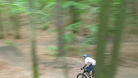
Photos of Smolna Mountain Bike
trail: Smolna Singiel DH
88 |
Dec 26, 2020 @ 4:39pm
Dec 26, 2020
trail: Smolna Singiel DH
142 |
Dec 24, 2019 @ 12:28am
Dec 24, 2019
trail: Smolna Singiel DH
178 |
Dec 24, 2019 @ 12:27am
Dec 24, 2019
trail: Smolna Singiel DH
89 |
Dec 24, 2019 @ 12:15am
Dec 24, 2019
trail: Smolna Singiel DH
78 |
Dec 24, 2019 @ 12:14am
Dec 24, 2019
trail: Smolna Singiel DH
81 |
Dec 24, 2019 @ 12:14am
Dec 24, 2019
trail: Smolna Singiel DH
116 |
Dec 24, 2019 @ 12:13am
Dec 24, 2019
trail: Smolna Singiel DH
356 |
Apr 5, 2004 @ 11:23pm
Apr 5, 2004Videos of Smolna Mountain Bike
trail: Smolna Singiel DH
1:21 |
459 |
Oct 28, 2017
Recent Trail Reports
| status | trail | date | condition | info | user |
|---|---|---|---|---|---|
| Smolna Singiel DH | Feb 11, 2023 @ 8:29pm Feb 11, 2023 | Wet | kajetan1 TRAILFORKS | ||
| Mucha w Smole | Sep 19, 2020 @ 12:44pm Sep 19, 2020 | Dry | kajetan1 TRAILFORKS |
Activity Feed
| username | action | type | title | date |
|---|---|---|---|---|
| burx93 | wishlist | route | activity #42086135 | Jul 23, 2023 @ 12:12am Jul 23, 2023 |
| macgrot | add | photo | activity #38558092 | Mar 30, 2023 @ 3:47am Mar 30, 2023 |
| ARTWIL | wishlist | trail | activity #37692214 | Feb 24, 2023 @ 10:03am Feb 24, 2023 |
| kajetan1 | add | report | activity #37404887 | Feb 12, 2023 @ 8:45am Feb 12, 2023 |
| kajetan1 | checkin | trail | activity #37404751 | Feb 12, 2023 @ 8:39am Feb 12, 2023 |
Nearby Areas
| name | distance | ||||
|---|---|---|---|---|---|
| Pachołek | 3 | 4 | 0.5 km | ||
| Elektryczne | 0.7 km | ||||
| Malinowe | 0.9 km | ||||
| Ambona | 1.1 km | ||||
| BigFoot Works BikePark | 1.1 km |
Activity Type Stats
| activitytype | trails | distance | descent | descent distance | total vertical | rating | global rank | state rank | photos | reports | routes | ridelogs |
|---|---|---|---|---|---|---|---|---|---|---|---|---|
| Mountain Bike | 3 | 1,801 ft | 203 ft | 1,496 ft | 128 ft | #4,258 | #70 | 18 | 26 | 1 | 2,382 | |
| Hike | 2 | 699 ft | 92 ft | 699 ft | 92 ft | #3,621 | #48 | 22 | 51 | |||
| Trail Running | 2 | 699 ft | 92 ft | 699 ft | 92 ft | #3,639 | #47 | 22 |
- By micolai
 TRAILFORKS Poland & contributors
 - Admins: BFW
- #19250 - 2,136 views
- smolna activity log | embed map of Smolna mountain bike trails | smolna mountain biking points of interest
Downloading of trail gps tracks in kml & gpx formats is enabled for Smolna.
You must login to download files.