close
-
Layers w
- Weather Layers
- Pro
- Pro
- Pro
- Pro
- Pro
- Pro
- More Layers
- Pro
- Pro
- Pro
- Pro
-
Upgrade to

3D
Trail Conditions
- Unknown
- Snow Groomed
- Snow Packed
- Snow Covered
- Snow Cover Partial
- Freeze/thaw Cycle
- Icy
- Prevalent Mud
- Wet
- Variable
- Ideal
- Dry
- Very Dry
Trail Flow (Ridden Direction)
Trailforks scans users ridelogs to determine the most popular direction each trail is ridden. A good flowing trail network will have most trails flowing in a single direction according to their intension.
The colour categories are based on what percentage of riders are riding a trail in its intended direction.
The colour categories are based on what percentage of riders are riding a trail in its intended direction.
- > 96%
- > 90%
- > 80%
- > 70%
- > 50%
- < 50%
- bi-directional trail
- no data
Trail Last Ridden
Trailforks scans ridelogs to determine the last time a trail was ridden.
- < 2 days
- < 1 week
- < 2 weeks
- < 1 month
- < 6 months
- > 6 months
Trail Ridden Direction
The intended direction a trail should be ridden.
- Downhill Only
- Downhill Primary
- Both Directions
- Uphill Primary
- Uphill Only
- One Direction
Contribute Details
Colors indicate trail is missing specified detail.
- Description
- Photos
- Description & Photos
- Videos
Trail Popularity ?
Trailforks scans ridelogs to determine which trails are ridden the most in the last 9 months.
Trails are compared with nearby trails in the same city region with a possible 25 colour shades.
Think of this as a heatmap, more rides = more kinetic energy = warmer colors.
- most popular
- popular
- less popular
- not popular
ATV/ORV/OHV Filter
Max Vehicle Width
inches
US Cell Coverage
Legend

Radar Time
Activity Recordings
Trailforks uses anonymized public activity data.
?
Activity Recordings
Trailforks uses anonymized public activity data.
?
Personal Heatmap
▶
Activity Types
all
/
none
▶
Options
2
Date range
month
–
Winter Trails
Warning
A routing network for winter maps does not exist. Selecting trails using the winter trails layer has been disabled.
Missing Trails
Most Popular
Least Popular
Trails are colored based on popularity. The more popular a trail is, the more red. Less popular trails trend towards green.
Jump Magnitude Heatmap
Heatmap of where riders jump on trails. Zoom in to see individual jumps, click circles to view jump details.
BC Backroad Status
![map legend]()
Service Road Atlas is a free to use, community-driven service for viewing and creating reports on the numerous back-country service roads around B.C. and Alberta.

Slope Aspect
Direction the slope faces
Trails Deemphasized
Trails are shown in grey.
Only show trails with no bike usage.
Suggested Layers
Based on selected activity type
Save the current map location and zoom level as your default home location whenever this page is loaded.
Save
No description for Sofia has been added yet!
Login or register to submit one.
Activities Click to view
- Mountain Bike
108 trails
- E-Bike
91 trails
- Gravel Bike
2 trails
- Adaptive Bike
0 trails
- Winter Fat Bike
0 trails
- Hike
98 trails
- Trail Running
97 trails
Region Details
- 26
- 1
- 16
- 42
- 16
Region Status
Caution as of Jun 5, 2026E-Bike Stats
- Global Ranking
- #800
- State Ranking
- #9
- Trails (view details)
- 91
- Trails Mountain Bike
- 108
- Trails E-Bike
- 91
- Trails Gravel Bike
- 2
- Trails Horse
- 2
- Trails Hike
- 98
- Trails Trail Running
- 97
- Trails Dirtbike/Moto
- 1
- Trails ATV/ORV/OHV
- 1
- Total Distance
- 47 miles
- Total Descent Distance
- 30 miles
- Total Descent
- 22,385 ft
- Total Vertical
- 4,035 ft
- Reports
- 722
- Ridden Counter
- 413
Articles
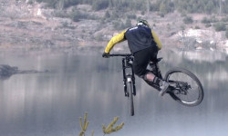
Video: Freeriding in an Eastern European Quarry
Jul 19, 2019 from pinkbike.com
Searching for Utah-esque terrain in Bulgaria.
Sub Regions
-
Pancharevo Gorge
- 1
- 2
-
Vitosha
- 1
- 9
- 19
- 12
Popular Sofia E-Biking Trails
• 100 ★ 5.0 • 1 mile • 3 ft • 15 •
" " is MTB trail in Lyulin mountain, above the "Bonsovi polyani" hut, built by TD "Boeritsa" with the help of Dobromir Dobrev from Bike Ventures and many volunteers in 2022-2023. Initially, the lower part of the track was built, which...
• 95 ★ 4.5 • 4,918 ft • 0 ft • 13 •
Popular blue difficulty singletrack. This mountain bike primary trail can be used both directions.
• 90 ★ 5.0 • 1 mile • 0 ft • 11 •
Popular blue difficulty singletrack. This mountain bike primary trail can be used downhill primary. It features berm, drop and jump. Trail visibility is always easy to follow. On average it takes 7 minutes to complete this trail.
• 95 ★ 4.0 • 2 miles • 28 ft • 10 •
Popular blue difficulty singletrack. This mountain bike primary trail can be used downhill only.
• 90 ★ 3.0 • 2 miles • 33 ft • 8 •
Popular blue difficulty family friendly singletrack. This mountain bike primary trail can be used downhill only and has a moderate overall physical rating. It features rock garden. Trail visibility is always easy to follow. On average it takes 9 minutes to complete this trail.
• 80 ★ 3.0 • 1 mile • 20 ft • 8 •
An easy family-friendly trail for kids with decent skills. Its uphill is easy fire road with small. There are some small drops (with a chicken line) and berms which are done by the locals. It has ups and downs - on some places you could...
• 80 ★ 5.0 • 2 miles • 360 ft • 8 •
Part of a classic XC loop. Includes a rock garden that you need to carry the bike for a few meters. Can be ridden in both directions.
Photos of Sofia
Videos of Sofia
trail: Krivata
14:12 |
11 |
Jun 2, 2026 , Sofia
trail: Kopitoto Enduro
11:04 |
3 |
Jun 2, 2026 , Sofia
trail: Voynegovtzi AM Trail
0:06 |
25 |
Sep 11, 2023
trail: Voynegovtzi AM Trail
0:06 |
13 |
Sep 11, 2023

trail: Voynegovtzi AM Trail
0:09 |
13 |
Sep 11, 2023
trail: Vitosha Goli Vrah
0:06 |
213 |
Nov 28, 2021
trail: Vitosha Goli Vrah
2:33 |
132 |
Mar 28, 2021
trail: Vitosha Goli Vrah
0:10 |
116 |
Jan 23, 2021
Recent Trail Reports
Activity Feed
| username | action | type | title | date |
|---|---|---|---|---|
| sh0g0 | add | trail | activity #96525934 | Jun 8, 2026 @ 1:11am Jun 8, 2026 |
| ViktorUVAlOY | wishlist | trail | activity #96519876 | Jun 7, 2026 @ 9:24pm Jun 7, 2026 |
| 1stamenov | add | report | activity #96363714 and 3 more | Jun 6, 2026 @ 6:31am Jun 6, 2026 |
| 1stamenov | add | report | activity #96363713 and 2 more | Jun 6, 2026 @ 6:31am Jun 6, 2026 |
| TZh | add | report | activity #96283208 and 5 more | Jun 5, 2026 @ 3:00am Jun 5, 2026 |
Recent Comments
| username | type | title | comment | date |
|---|---|---|---|---|
| trail | Suoer Nice Trail!! I Recommend it totally. | Jul 14, 2025 @ 12:06pm Jul 14, 2025 | ||
| trail | The best trail around Sofia! | Nov 4, 2023 @ 12:18am Nov 4, 2023 | ||
| trail | There is a fallen tree somewhere in the middle... | Sep 25, 2023 @ 4:25am Sep 25, 2023 | ||
| report | In the end at the right trail fell down tree | Sep 3, 2021 @ 3:52am Sep 3, 2021 | ||
| report | Кално | May 25, 2020 @ 1:36am May 25, 2020 |
Local E-Biking Directory
-
Bike Center - RedutaBike Shop
![Bike Center - Reduta]()
Activity Type Stats
| activitytype | trails | distance | descent | descent distance | total vertical | rating | global rank | state rank | photos | reports | routes | ridelogs |
|---|---|---|---|---|---|---|---|---|---|---|---|---|
| Mountain Bike | 108 | 67 miles | 34,341 ft | 47 miles | 4,088 ft | #1,020 | #1 | 245 | 754 | 6 | 17,061 | |
| E-Bike | 91 | 47 miles | 22,385 ft | 30 miles | 4,035 ft | #800 | #9 | 722 | 2,137 | |||
| Gravel Bike | 2 | #169 | #4 | 3 | 16 | |||||||
| Horse | 2 | 4 miles | 906 ft | 2 miles | 1,381 ft | 34 | ||||||
| Hike | 98 | 63 miles | 31,427 ft | 43 miles | 4,088 ft | #1,192 | #5 | 730 | 985 | |||
| Trail Running | 97 | 62 miles | 30,397 ft | 43 miles | 4,088 ft | #886 | #4 | 1 | 730 | 574 | ||
| Dirtbike/Moto | 1 | 2 miles | 118 ft | 1,434 ft | 1,381 ft | 33 | ||||||
| ATV/ORV/OHV | 1 | 2 miles | 656 ft | 2 miles | 656 ft | 34 |
Frequently Asked Questions About Sofia
▼
What are the best places to ride in Sofia?
Sofia has 2 areas to explore for e-biking. The top rated areas are:
▼
What are the highest rated e-biking trails in Sofia?
The highest rated e-biking trails in Sofia are:
- Pumba (0/5)
- Rollercoaster (0/5)
- Upper Rollercoaster (0/5)
- Monza Berms (0/5)
- Gradil Ilia Kilia / Built Iliya Kiliya (0/5)
▼
Where can I park to ride in Sofia?
There are 3 parking locations listed in Sofia. The most popular parking spots are: View all parking and trailhead locations on the map to plan your visit.
▼
What is the longest trail in Sofia?
The longest trail in Sofia is V100 Vladaya to Kladnitsa Single track at 6.9 miles. View all trails sorted by distance.
Activities
Trails
- By vvvaaal & contributors
- Admins: pufalot
- #4019 - 16,802 views
- sofia activity log | embed map of Sofia mountain bike trails | sofia mountain biking points of interest
Downloading of trail gps tracks in kml & gpx formats is enabled for Sofia.
You must login to download files.