close
-
Layers w
- Weather Layers
- Pro
- Pro
- Pro
- Pro
- Pro
- Pro
- More Layers
- Pro
- Pro
- Pro
- Pro
-
Upgrade to

3D
Trail Conditions
- Unknown
- Snow Groomed
- Snow Packed
- Snow Covered
- Snow Cover Partial
- Freeze/thaw Cycle
- Icy
- Prevalent Mud
- Wet
- Variable
- Ideal
- Dry
- Very Dry
Trail Flow (Ridden Direction)
Trailforks scans users ridelogs to determine the most popular direction each trail is ridden. A good flowing trail network will have most trails flowing in a single direction according to their intension.
The colour categories are based on what percentage of riders are riding a trail in its intended direction.
The colour categories are based on what percentage of riders are riding a trail in its intended direction.
- > 96%
- > 90%
- > 80%
- > 70%
- > 50%
- < 50%
- bi-directional trail
- no data
Trail Last Ridden
Trailforks scans ridelogs to determine the last time a trail was ridden.
- < 2 days
- < 1 week
- < 2 weeks
- < 1 month
- < 6 months
- > 6 months
Trail Ridden Direction
The intended direction a trail should be ridden.
- Downhill Only
- Downhill Primary
- Both Directions
- Uphill Primary
- Uphill Only
- One Direction
Contribute Details
Colors indicate trail is missing specified detail.
- Description
- Photos
- Description & Photos
- Videos
Trail Popularity ?
Trailforks scans ridelogs to determine which trails are ridden the most in the last 9 months.
Trails are compared with nearby trails in the same city region with a possible 25 colour shades.
Think of this as a heatmap, more rides = more kinetic energy = warmer colors.
- most popular
- popular
- less popular
- not popular
ATV/ORV/OHV Filter
Max Vehicle Width
inches
US Cell Coverage
Legend

Radar Time
Activity Recordings
Trailforks uses anonymized public activity data.
?
Activity Recordings
Trailforks uses anonymized public activity data.
?
Personal Heatmap
▶
Activity Types
all
/
none
▶
Options
2
Date range
month
–
Winter Trails
Warning
A routing network for winter maps does not exist. Selecting trails using the winter trails layer has been disabled.
Missing Trails
Most Popular
Least Popular
Trails are colored based on popularity. The more popular a trail is, the more red. Less popular trails trend towards green.
Jump Magnitude Heatmap
Heatmap of where riders jump on trails. Zoom in to see individual jumps, click circles to view jump details.
BC Backroad Status
![map legend]()
Service Road Atlas is a free to use, community-driven service for viewing and creating reports on the numerous back-country service roads around B.C. and Alberta.

Slope Aspect
Direction the slope faces
Trails Deemphasized
Trails are shown in grey.
Only show trails with no bike usage.
Suggested Layers
Based on selected activity type
Save the current map location and zoom level as your default home location whenever this page is loaded.
Save
No description for Sollefteå has been added yet!
Login or register to submit one.
This region uses the Uk/Euro style trail grading system.
Activities Click to view
- Mountain Bike
123 trails
- Gravel Bike
0 trails
- Adaptive Bike
0 trails
- Hike
123 trails
- Trail Running
123 trails
- Nordic Ski
64 trails
Region Details
- 48
- 36
- 24
- 6
Region Status
Open as of Aug 29, 2024Stats
- Avg Trail Rating
- Trails (view details)
- 123
- Trails Mountain Bike
- 123
- Trails E-Bike
- 1
- Trails Horse
- 1
- Trails Hike
- 123
- Trails Trail Running
- 123
- Trails Nordic Ski
- 64
- Total Distance
- 97 miles
- Total Descent
- 10,033 ft
- Total Vertical
- 1,207 ft
- Highest Trailhead
- 1,243 ft
- Reports
- 85
- Photos
- 5
- Ridden Counter
- 353
Sub Regions
-
Hallstaberget
- 16
- 10
- 3
-
Resele / Moforsen
- 1
Popular Sollefteå Mountain Biking Trails
• 95 ★ 0.0 • 2,215 ft • 4 ft • 11 •
Popular green difficulty singletrack. This multi-use trail can be used both directions with a 4 ft green climb. On average it takes 4 minutes to complete this trail.
• 70 ★ 0.0 • 3,202 ft • 90 ft • 9 •
Popular blue difficulty singletrack. This multi-use trail can be used both directions and has a moderate overall physical rating. It features rock garden. On average it takes 3 hours7 minutes to complete this trail.
• 80 ★ 0.0 • 1,526 ft • 176 ft • 8 •
Popular blue difficulty doubletrack. This multi-use trail can be used both directions with a 176 ft blue climb. Trail visibility is always easy to follow. On average it takes 5 minutes to complete this trail.
• 100 ★ 0.0 • 2,956 ft • 5 ft • 8 •
Popular blue difficulty singletrack. This multi-use trail can be used both directions and has a moderate overall physical rating with a 5 ft black diamond climb. Trail visibility is always easy to follow. On average it takes 3 minutes to complete this trail.
• 5 ★ 0.0 • 2,487 ft • 6 ft • 6 •
Härligt flowig stig alldeles intill Remsles längspår. Stigen startar så högt man kommer på Remslemon och slutar nere vid parkeringen. Går finfint att cykla upp för att sedan ge sig ut nedför med ett stort leende!
• 95 ★ 0.0 • 1,886 ft • 43 ft • 6 •
Popular red difficulty singletrack. This multi-use trail can be used both directions and has a moderate overall physical rating with a 43 ft blue climb. It features drop and rock garden. On average it takes 9 minutes to complete this trail.
• 70 ★ 0.0 • 4,885 ft • 0 ft • 6 •
Popular green difficulty singletrack. This multi-use trail can be used both directions. On average it takes 4 minutes to complete this trail.
• 95 ★ 0.0 • 4,321 ft • 14 ft • 5 •
Popular blue difficulty singletrack. This multi-use trail can be used both directions and has a moderate overall physical rating with a 14 ft black diamond climb. Trail visibility is always easy to follow. On average it takes 7 minutes to complete this trail.
Sollefteå Mountain Bike Routes
4 miles • 261 ft • 6 • Point to Point •
En slinga med blandat grusvägar, traktorvägar och stig.
61 miles • 2,774 ft • 0 • Point to Point •
Reviderad utgåva av Tour Junsele dag 2 från Sollefteå till Örnsköldsvik som anordnas av CK Örnen
Videos of Sollefteå Mountain Bike

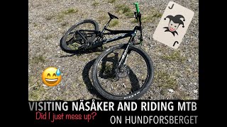
trail: Hundforsberget Ledningsgatan
7:17 |
81 |
Nov 19, 2023 , Sollefteå
trail: Hundforsberget Access 2
7:17 |
112 |
Jun 14, 2023 , Sollefteå
trail: Moforsen Blå
2:25 |
132 |
Feb 28, 2022 , Sollefteå
trail: Moforsen Blå
5:14 |
229 |
Feb 28, 2022 , Sollefteå
Recent Trail Reports
| status | trail | date | condition | info | user |
|---|---|---|---|---|---|
| Rutschkanan | Aug 29, 2024 @ 5:20pm Aug 29, 2024 | Ideal | Stubbis | ||
| Lidbergets Finfina | Jul 14, 2024 @ 5:59am Jul 14, 2024 | Ideal | Tajt | ||
| North Contour Connector | Jul 7, 2024 @ 1:51am Jul 7, 2024 | Dry | MoscowMatt | ||
| Grusväg Hallstaberget Baksidan | May 25, 2024 @ 1:15am May 25, 2024 | Ideal | Stubbis | ||
| Grusväg Jan-Gullik 2 | May 25, 2024 @ 1:15am May 25, 2024 | Ideal | Stubbis | ||
| Power-line | Jul 5, 2023 @ 11:32am Jul 5, 2023 | Variable | Urban4hKstm | ||
| Hundforsberget Access 2 | Jun 11, 2023 @ 12:48am Jun 11, 2023 | Dry | curiousrage | ||
| Tuff Start | Jul 23, 2021 @ 2:24pm Jul 23, 2021 | Variable | Blobbar | ||
| Hullsta Summit | Jul 23, 2021 @ 2:23pm Jul 23, 2021 | Dry | Blobbar | ||
| Kalhygget | Jul 23, 2021 @ 2:21pm Jul 23, 2021 | Dry | Blobbar |
Activity Feed
| username | action | type | title | date |
|---|---|---|---|---|
| OrjanX | update | trail | activity #96973271 | Jun 14, 2026 @ 8:42am 2 days |
| Cykeljohan | add | trail | activity #82402633 | Oct 15, 2025 @ 11:53am Oct 15, 2025 |
| Cykeljohan | add | trail | activity #82081006 | Oct 10, 2025 @ 12:51pm Oct 10, 2025 |
| Cykeljohan | add | trail | activity #81080928 and 13 more | Sep 25, 2025 @ 10:02am Sep 25, 2025 |
| Cykeljohan | add | trail | activity #80657518 and 4 more | Sep 19, 2025 @ 6:12am Sep 19, 2025 |
Recent Comments
| username | type | title | comment | date |
|---|---|---|---|---|
| trail | Tack, den är redan uppdelad i 6 delar. | Jun 11, 2025 @ 1:14am Jun 11, 2025 | ||
| trail | Är mitt första försök till bidrag och... | Jun 11, 2025 @ 1:12am Jun 11, 2025 | ||
| trail | Bör delas upp i respektive grusvägar och stigar. | May 18, 2025 @ 1:06am May 18, 2025 | ||
| trail | You could pick up speeds downwards this trail... | Jun 14, 2023 @ 3:31am Jun 14, 2023 |
Local Badges
-

Epic Ride Climb 2k3 awarded -

Climbing 10k Badge2 awarded -

Climbing 100k Badge0 awarded -

Epic Ride Descent 2k3 awarded -

Descent 10k Badge2 awarded -

Descent 100k Badge0 awarded
Bike & Skill Parks
| name | type | city | rating |
|---|---|---|---|
| Hallsta Skillpark | skill park | Sollefteå |
Activity Type Stats
| activitytype | trails | distance | descent | descent distance | total vertical | rating | global rank | state rank | photos | reports | routes | ridelogs |
|---|---|---|---|---|---|---|---|---|---|---|---|---|
| Mountain Bike | 123 | 88 miles | 9,764 ft | 34 miles | 1,207 ft | #10,271 | #215 | 5 | 85 | 2 | 587 | |
| E-Bike | 1 | 3,054 ft | 164 ft | 73 | 1 | 4 | ||||||
| Horse | 1 | 2 miles | 3 ft | 364 ft | 548 ft | 8 | ||||||
| Hike | 123 | 86 miles | 8,776 ft | 32 miles | 1,207 ft | #2,200 | #89 | 84 | 1 | 66 | ||
| Trail Running | 123 | 86 miles | 8,776 ft | 32 miles | 1,207 ft | #1,724 | #90 | 84 | 2 | 17 | ||
| Nordic Ski | 64 | 34 miles | 2,297 ft | 11 miles | 807 ft | #311 | #39 | 1 | 274 |
Frequently Asked Questions About Sollefteå
▼
What are the best places to ride in Sollefteå?
Sollefteå has 2 areas to explore for mountain biking. The top rated areas are:
▼
What are the highest rated mountain biking trails in Sollefteå?
The highest rated mountain biking trails in Sollefteå are:
- Lidbergets Finfina (0/5)
- Moforsen Blå (0/5)
- Spannsjöns Episka (0/5)
- Skällmyran Entré (0/5)
- Jan Gullik 1 (0/5)
▼
What is the best time of the year to ride in Sollefteå?
Based on ride log data, the most popular months to ride in Sollefteå are:
- August (12 activities)
- July (10 activities)
- October (6 activities)
▼
Where can I park to ride in Sollefteå?
There are 1 parking locations listed in Sollefteå. The most popular parking spots are:
Activities
Trails
Points of Interest
- By heltun
 & contributors
 - Admins: ollesvenskonthetrail, JALLE, OrjanX, martinlindstr, Stubbis, Mackannn
- #14990 - 3,343 views
- sollefteå activity log | embed map of Sollefteå mountain bike trails | sollefteå mountain biking points of interest
Downloading of trail gps tracks in kml & gpx formats is enabled for Sollefteå.
You must login to download files.