
close
3D
Trail Conditions
- Unknown
- Snow Groomed
- Snow Packed
- Snow Covered
- Snow Cover Partial
- Freeze/thaw Cycle
- Icy
- Prevalent Mud
- Wet
- Variable
- Ideal
- Dry
- Very Dry
Trail Flow (Ridden Direction)
Trailforks scans users activity logs to determine the most popular direction each trail is ridden. A good flowing trail network will have most trails flowing in a single direction according to their intension.
The colour categories are based on what percentage of users are riding a trail in its intended direction.
The colour categories are based on what percentage of users are riding a trail in its intended direction.
- > 96%
- > 90%
- > 80%
- > 70%
- > 50%
- < 50%
- bi-directional trail
- no data
Trail Last Used
Trailforks scans activity logs to determine the last time a trail was ridden.
- < 2 days
- < 1 week
- < 2 weeks
- < 1 month
- < 6 months
- > 6 months
Trail Ridden Direction
The intended direction a trail should be ridden.
- Downhill Only
- Downhill Primary
- Both Directions
- Uphill Primary
- Uphill Only
- One Direction
Contribute Details
Colors indicate trail is missing specified detail.
- Description
- Photos
- Description & Photos
- Videos
Trail Popularity ?
Trailforks scans activity logs to determine which trails are ridden the most in the last 9 months.
Trails are compared with nearby trails in the same city region with a possible 25 colour shades.
Think of this as a heatmap, more activities = more kinetic energy = warmer colors.
- most popular
- popular
- less popular
- not popular
ATV/ORV/OHV Filter
Max Vehicle Width
inches
US Cell Coverage
Legend

Radar Time
Activity Recordings
Trailforks uses anonymized public activity data.
?
Activity Recordings
Trailforks uses anonymized public activity data.
?
Winter Trails
Warning
A routing network for winter maps does not exist. Selecting trails using the winter trails layer has been disabled.
Missing Trails
Most Popular
Least Popular
Trails are colored based on popularity. The more popular a trail is, the more red. Less popular trails trend towards green.
Jump Magnitude Heatmap
Heatmap of where users jump on trails. Zoom in to see individual jumps, click circles to view jump details.
BC Backroad Status
![map legend]()
Service Road Atlas is a free to use, community-driven service for viewing and creating reports on the numerous back-country service roads around B.C. and Alberta.

Slope Aspect
Direction the slope faces
Trails Deemphasized
Trails are shown in grey.
Only show trails with no bike usage.
Suggested Layers
Based on selected activity type
Save the current map location and zoom level as your default home location whenever this page is loaded.
Save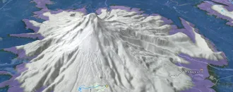
Snow & Rain 3D forecast Pro
See where it will snow, sleet or rain on Sort hour by hour, on 3D terrain.
View 3D snow forecast
Sort trails and routes are listed on Trailforks with interactive trail maps, difficulty ratings, photos, and user-reported trail conditions. The Trailforks community has mapped hundreds of trails and shared hundreds of photos in this region. Supported activity types include E-Biking, Hiking, Trail Running, Mountain Biking, Adaptive Biking, Skiing, ATVing/Offroading, Horseback, Dirtbiking and Backcountry Skiing. Trails here are often faint trail. Scenery includes alpine terrain and views. Common trail features include berms, jumps and drops. Popular destinations include Vall d'Àneu, Vall Ferrera and Baix Pallars.
This is an auto-generated description of Sort.
Login or register to submit a custom description.
Links
This region uses the Uk/Euro style trail grading system.
Trail info last updated
Activities Click to view
- Mountain Bike
588 trails
- E-Bike
678 trails
- Adaptive Bike
110 trails
- Horse
37 trails
- Hike
636 trails
- Trail Running
631 trails
- Dirtbike/Moto
6 trails
- ATV/ORV/OHV
40 trails
- Downhill Ski
71 trails
- Backcountry Ski
5 trails
Region Details
- 239
- 48
- 181
- 76
- 46
Region Status
Open as of Nov 4, 2026Stats
- Avg Trail Rating
- Trails (view details)
- 725
- Trails Mountain Bike
- 588
- Trails E-Bike
- 678
- Trails Gravel Bike
- 243
- Trails Adaptive Bike
- 111
- Trails Winter Fat Bike
- 14
- Trails Horse
- 37
- Trails Hike
- 636
- Trails Trail Running
- 631
- Trails Dirtbike/Moto
- 6
- Trails Observed Trials
- 1
- Trails ATV/ORV/OHV
- 40
- Trails Snowshoe
- 2
- Trails Downhill Ski
- 71
- Trails Backcountry Ski
- 5
- Trails Nordic Ski
- 2
- Total Distance
- 896 miles
- Total Descent
- 266,555 ft
- Total Vertical
- 7,210 ft
- Highest Trailhead
- 9,127 ft
- Reports
- 2,993
- Photos
- 511
- Completed Counter
- 7,892
Sub Regions
-
Baix Pallars
- 7
- 24
- 8
- 3
-
Espot
- 5
- 5
- 7
- 2
-
Esterri d'Aneu
- 1
- 2
- 2
-
Llavorsí
- 8
- 2
- 1
-
Sort, Soriguera i Rialp
- 1
- 4
- 1
-
Vall d'Àneu
- 9
- 30
- 15
- 5
-
Vall de Cardós
- 6
- 13
- 5
- 4
-
Vall Ferrera
- 2
- 14
- 10
- 6
-
Valls d'Aguilar
- 1
Popular Sort Mountain Biking Trails
• 100 ★ 4.9 • 4 miles • 226 ft • 169 •
Preciós camí dins del bosc. Ràpid, fluid, sinuós... Algun dels salts és més difícil. Primer km en pujada suau, pedalable.
• 100 ★ 2.5 • 1,191 ft • 0 ft • 159 •
Popular blue difficulty singletrack. This multi-use trail can be used downhill primary. Trail visibility is always easy to follow. On average it takes 1 minutes to complete this trail.
• 100 ★ 4.7 • 1,578 ft • 0 ft • 156 •
Popular red difficulty singletrack. This multi-use trail can be used downhill only and has a moderate overall physical rating. Trail visibility is always easy to follow. On average it takes 1 minutes to complete this trail.
• 100 ★ 4.7 • 2 miles • 86 ft • 137 •
Sendero que sale del Pueblo de Son o del bosque de la Mata. Se puede hacer en ambos sentidos. De Son a la Mata es todo ciclable y en el sentido contario hay algún tramo corto que es dificilmente ciclable
• 90 ★ 4.0 • 4,705 ft • 46 ft • 131 •
Sender que es fa majoritàriament des d'Estaís, de baixada és plàcid amb trams tècnics de nivell baix, de pujada té algun tram bastant complicat, depenent del nostre nivell caldrà anar a peu en algun tram puntual.
• 95 ★ 4.8 • 3 miles • 0 ft • 129 •
Baixada llarga i exigent molt divertida i en general no gaire complicada. El primer tram en flanqueig a la torreta de l'Orri amb poca pendent però exposat a la banda esquerra amb trams tècnics de nivell baix. Un cop arribat als...
• 95 ★ 4.8 • 1 mile • 15 ft • 110 •
Sender que comença bastant natural, algun petit tram de pujada suau, sense trams tècnics, bastant de flow, trobareu un parell de salts més grans i alguns més petits ben enllaçats. Baixada molt recomenable. També, a mà esquerra hi...
• 100 ★ 4.7 • 2,382 ft • 0 ft • 106 •
Baixada amb flow, molt divertida. Passareu per canals naturals, amb alguns peralts i drops.
Sort Mountain Bike Routes
★ 5.0 • 26 miles • 6,126 ft • 8 • Loop •
★ 4.0 • 24 miles • 6,652 ft • 6 • Point to Point •
Ruta exigente que parte de Alins,con un inicio muy duro por pista y luego rematando con porteo hasta el...
★ 4.0 • 15 miles • 4,537 ft • 2 • Loop •
Amazing downhill from Estanilles lake to Lladorre. To go up is long but not very hard in terms of slope....
16 miles • 2,656 ft • 1 •
Subida por carretera asfaltada des de Esterri hasta el pueblo de Son. Aquí empieza un divertido sendero,...
13 miles • 2,960 ft • 5 •
Circular per l' obaga de Llagunes, i els pobles de Soriguer i Vilamur
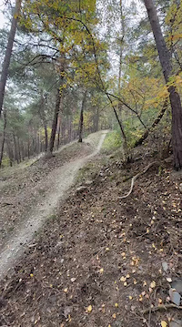
Photos of Sort Mountain Bike
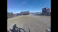
Videos of Sort Mountain Bike




Recent Trail Reports
Activity Feed
| username | action | type | title | date |
|---|---|---|---|---|
| bandidos | ridden | trail | activity #107856897 and 1 more | Nov 15, 2026 @ 1:26pm Nov 15, 2026 |
| MarikaPTCrdh | wishlist | trail | activity #107576994 | Nov 10, 2026 @ 9:44pm Nov 10, 2026 |
| MarikaPTCrdh | wishlist | trail | activity #107576993 and 1 more | Nov 10, 2026 @ 9:44pm Nov 10, 2026 |
| bandidos | vote | trail | activity #107332891 | Nov 7, 2026 @ 3:13am Nov 7, 2026 |
| Freed22 | vote | trail | activity #107276556 | Nov 5, 2026 @ 11:17pm Nov 5, 2026 |
Recent Comments
| username | type | title | comment | date |
|---|---|---|---|---|
| trail | Repassada tota la meitat inferior. La past... | Oct 31, 2026 @ 11:15am Oct 31, 2026 | ||
| trail | Bona ruta d'aventura. no hi ha sender i es pot... | Sep 21, 2026 @ 3:11am Sep 21, 2026 | ||
| trail | pista molt bonaa | Sep 13, 2026 @ 10:42pm Sep 13, 2026 | ||
| trail | Molt recomendable !! Part final molt divertida... | Aug 21, 2026 @ 8:45am Aug 21, 2026 | ||
| trail | Al inici i han arbres trencats al mitg del... | Aug 21, 2026 @ 8:44am Aug 21, 2026 |
Local Badges
-

Completionist0 awarded -

Epic Mountain Bike Climb 2k88 awarded -

Climbing 10k Badge10 awarded -

Mountain Biking 100k Badge0 awarded -

Epic Ride Descent 2k88 awarded -

Descent 10k Badge9 awarded
Bike & Skill Parks
| name | type | city | rating |
|---|---|---|---|
| MX Sort | skill park | Sort |
Local Trail Supporters
- Espot Enduro and Downhill
- Espot Enduro & Downhill
- Patanada Crew
![]()

Activity Type Stats
| activitytype | trails | distance | descent | descent distance | total vertical | rating | global rank | state rank | photos | reports | routes | activity logs |
|---|---|---|---|---|---|---|---|---|---|---|---|---|
| Mountain Bike | 588 | 787 miles | 223,383 ft | 328 miles | 6,506 ft | #187 | #27 | 495 | 2,979 | 12 | 4,312 | |
| E-Bike | 678 | 865 miles | 250,735 ft | 363 miles | 7,211 ft | #23 | #21 | 12 | 2,672 | 11 | 1,101 | |
| Gravel Bike | 243 | 496 miles | 22,648 ft | 86 miles | 6,214 ft | 25 | 97 | |||||
| Adaptive Bike | 110 | 223 miles | 12,835 ft | 44 miles | 6,214 ft | #54 | #13 | 167 | 1 | |||
| Winter Fat Bike | 14 | 24 miles | 2,733 ft | 8 miles | 4,856 ft | |||||||
| Horse | 37 | 68 miles | 7,726 ft | 19 miles | 5,476 ft | #861 | #50 | 80 | ||||
| Hike | 636 | 851 miles | 234,721 ft | 349 miles | 7,211 ft | #67 | #24 | 4 | 2,704 | 2 | 1,679 | |
| Trail Running | 631 | 839 miles | 233,560 ft | 343 miles | 7,211 ft | #54 | #24 | 2,663 | 1 | 921 | ||
| Dirtbike/Moto | 6 | 11 miles | 1,453 ft | 2 miles | 4,560 ft | #896 | #56 | 41 | ||||
| Observed Trials | 1 | 2 miles | 52 ft | 1,417 ft | 715 ft | 6 | ||||||
| ATV/ORV/OHV | 40 | 104 miles | 5,364 ft | 18 miles | 5,499 ft | #142 | #4 | 83 | 1 | |||
| Snowshoe | 2 | 4 miles | 978 ft | 3 miles | 709 ft | 13 | 16 | |||||
| Downhill Ski | 71 | 32 miles | 26,785 ft | 30 miles | 2,953 ft | #149 | #3 | 13 | 838 | |||
| Backcountry Ski | 5 | 9 miles | 2,441 ft | #146 | #9 | 13 | 1,001 | |||||
| Nordic Ski | 2 | 11 miles | 1,414 ft | 6 miles | 951 ft | 13 | 118 |
Frequently Asked Questions
▼
What are the best places to ride in Sort?
Sort has 12 areas to explore for mountain biking. The top rated areas are:
▼
What are the highest rated mountain biking trails in Sort?
The highest rated mountain biking trails in Sort are:
- Lo Farro de Tírvia (4.7/5)
- Pla de la Font - Jou (4.6/5)
- L'Orri - Sort (4.5/5)
- La Daina (4.5/5)
- Intense (4.5/5)
▼
Where can I park to ride in Sort?
▼
What is the longest trail in Sort?
The longest trail in Sort is Lo Covil-La Maniga at 5.3 miles. View all trails sorted by distance.
▼
What are the best & highest rated hiking trails in Sort?
The best hiking trails in Sort are: View all hiking trails sorted by popularity score.
▼
What are the best & highest rated trail running trails in Sort?
The best trail running trails in Sort are: View all trail running trails sorted by popularity score.
▼
What are the best & highest rated dirtbiking trails in Sort?
The best dirtbiking trails in Sort are: View all dirtbiking trails sorted by popularity score.
▼
How many trails are in Sort?
Sort has a total of 725 trails. Of those, 588 are designated for mountain biking. Browse top mountain biking trails in Sort to find detailed information including difficulty ratings, distances, and trail conditions.
▼
Which trail has the most elevation gain in Sort?
The trail with the most elevation gain in Sort is Camí planer de pista d'Arcalis a Barranc de Baén with 1,337 ft of elevation gain. View all trails sorted by elevation gain.
▼
Which trail has the most elevation descent in Sort?
The trail with the most elevation descent in Sort is Tuc de la Cometa with 3,508 ft of elevation descent. View all trails sorted by elevation descent.
▼
What activities are most popular in Sort?
Sort supports the following activities: Mountain Biking, E-Biking, Adaptive Biking, Horseback, Hiking, Trail Running, Dirtbiking, ATVing/Offroading, Skiing, Backcountry Skiing.
▼
What bike services are there in Sort?
The following bike services are available in Sort:
- Trail Association (1)
▼
What are the steepest mountain biking trails in Sort?
The steepest mountain biking trail in Sort is Pic de la Maniga (Direct) with an average grade of 13.8%. View all trails sorted by grade.
▼
Are there any trails with scenic viewpoints in Sort?
▼
What trails have the biggest jumps in Sort?
The trails with the biggest jumps in Sort are: Browse all mountain bike trails to find trails with jumps and technical features.
▼
Are the trails open in Sort?
The overall region status for Sort is Clear / Green. Out of 444 trails:
- Clear / Green: 383
- Minor Issue / Yellow: 39
- Significant Issue / Amber: 16
- Closed: 6
▼
Can I ride an ebike in Sort?
Yes, Sort supports e-bike riding. There are 711 trails in Sort that allow e-bikes. Check the e-bike trails listing for specific trail access details and any local regulations.
▼
What are the most popular mountain biking routes in Sort?
The most popular mountain biking routes in Sort are: View all mountain biking routes in Sort.
▼
What are the most popular Strava Segments in Sort?
The most popular Strava segments in Sort are:
- Pujada final a la Creu d'Eixol (6,301 athletes)
- Pujadeta camí d'Espot des d'Espui (5,859 athletes)
- Pista De Caregue Climb (5,854 athletes)
▼
What trails are closed in Sort?
There are currently 6 closed trails in Sort. The breakdown of all trail statuses is:
- Clear / Green: 383
- Minor Issue / Yellow: 39
- Significant Issue / Amber: 16
- Closed: 6
▼
Are there accessible or adaptive trails in Sort?
Yes, there are 117 accessible/adaptive trails in Sort. View all adaptive trails in Sort for specific accessibility information.
▼
Are there local clubs or events in Sort?
There are 1 local clubs or associations listed in the Sort directory. Browse the local directory for details.
▼
What are the most popular mountain biking trails in Sort?
The most popular mountain biking trails in Sort are:
- La Daina Superior
- Carrua de la fusta d'Ainet
- Campmaior - Baiasca
- La Daina
- Ginestarre - Esterri de Cardós
▼
What are the best beginner ride trails in Sort?
The best beginner mountain biking trails in Sort are:
- Prats de Salvente No Fang (3/5)
- Lo Rierol d'Arrose (1.7/5)
- Arrose (3/5)
Activities
Trails
- By Angelreing
 TFSPAIN Ezkaba & contributors
- Admins: snaker4, juanx, kai-bcn, EdgarSoler
- #71365 - 1,301 views
- sort activity log | embed map of Sort mountain bike trails | sort mountain biking points of interest
Downloading of trail gps tracks in kml & gpx formats is enabled for Sort.
You must login to download files.
