close
-
Layers w
- Weather Layers
- Pro
- Pro
- Pro
- Pro
- Pro
- Pro
- More Layers
- Pro
- Pro
- Pro
- Pro
-
Upgrade to

3D
Trail Conditions
- Unknown
- Snow Groomed
- Snow Packed
- Snow Covered
- Snow Cover Partial
- Freeze/thaw Cycle
- Icy
- Prevalent Mud
- Wet
- Variable
- Ideal
- Dry
- Very Dry
Trail Flow (Ridden Direction)
Trailforks scans users ridelogs to determine the most popular direction each trail is ridden. A good flowing trail network will have most trails flowing in a single direction according to their intension.
The colour categories are based on what percentage of riders are riding a trail in its intended direction.
The colour categories are based on what percentage of riders are riding a trail in its intended direction.
- > 96%
- > 90%
- > 80%
- > 70%
- > 50%
- < 50%
- bi-directional trail
- no data
Trail Last Ridden
Trailforks scans ridelogs to determine the last time a trail was ridden.
- < 2 days
- < 1 week
- < 2 weeks
- < 1 month
- < 6 months
- > 6 months
Trail Ridden Direction
The intended direction a trail should be ridden.
- Downhill Only
- Downhill Primary
- Both Directions
- Uphill Primary
- Uphill Only
- One Direction
Contribute Details
Colors indicate trail is missing specified detail.
- Description
- Photos
- Description & Photos
- Videos
Trail Popularity ?
Trailforks scans ridelogs to determine which trails are ridden the most in the last 9 months.
Trails are compared with nearby trails in the same city region with a possible 25 colour shades.
Think of this as a heatmap, more rides = more kinetic energy = warmer colors.
- most popular
- popular
- less popular
- not popular
ATV/ORV/OHV Filter
Max Vehicle Width
inches
US Cell Coverage
Legend

Radar Time
Activity Recordings
Trailforks uses anonymized public activity data.
?
Activity Recordings
Trailforks uses anonymized public activity data.
?
Personal Heatmap
▶
Activity Types
all
/
none
▶
Options
2
Date range
month
–
Winter Trails
Warning
A routing network for winter maps does not exist. Selecting trails using the winter trails layer has been disabled.
Missing Trails
Most Popular
Least Popular
Trails are colored based on popularity. The more popular a trail is, the more red. Less popular trails trend towards green.
Jump Magnitude Heatmap
Heatmap of where riders jump on trails. Zoom in to see individual jumps, click circles to view jump details.
BC Backroad Status
![map legend]()
Service Road Atlas is a free to use, community-driven service for viewing and creating reports on the numerous back-country service roads around B.C. and Alberta.

Slope Aspect
Direction the slope faces
Trails Deemphasized
Trails are shown in grey.
Only show trails with no bike usage.
Suggested Layers
Based on selected activity type
Save the current map location and zoom level as your default home location whenever this page is loaded.
Save
No description for Spello has been added yet!
Login or register to submit one.
This region uses the Uk/Euro style trail grading system.
Activities Click to view
- Mountain Bike
55 trails
- E-Bike
32 trails
- Adaptive Bike
0 trails
- Hike
27 trails
- Trail Running
26 trails
Region Details
- 13
- 21
- 20
- 1
Region Status
Open as of May 2, 2026Stats
- Avg Trail Rating
- Trails (view details)
- 55
- Trails Mountain Bike
- 55
- Trails E-Bike
- 32
- Trails Horse
- 1
- Trails Hike
- 27
- Trails Trail Running
- 26
- Trails Dirtbike/Moto
- 2
- Trails Observed Trials
- 1
- Trails ATV/ORV/OHV
- 1
- Total Distance
- 47 miles
- Total Descent
- 14,177 ft
- Total Vertical
- 3,194 ft
- Highest Trailhead
- 4,173 ft
- Reports
- 256
- Photos
- 18
- Ridden Counter
- 3,284
Sub Regions
-
Subasio
- 16
- 16
- 1
Popular Spello Mountain Biking Trails
• 100 ★ 0.0 • 867 ft • 49 ft • 98 •
variante per evitare la parte con scale
• 95 ★ 0.0 • 3 miles • 173 ft • 87 •
Popular green difficulty family friendly singletrack. This mountain bike primary trail can be used both directions and has a easy overall physical rating with a 173 ft green climb. It features bridge. Trail visibility is always easy to follow. On average it takes 16 minutes to complete this trail.
• 90 ★ 4.5 • 2,231 ft • 0 ft • 74 •
Collegamento dalla strada asfaltata nei pressi di Collepino fino al ponte dell'acquedotto romano
• 95 ★ 0.0 • 1,594 ft • 3 ft • 72 •
Popular green difficulty singletrack. This mountain bike primary trail can be used both directions. On average it takes 4 minutes to complete this trail.
• 70 ★ 0.0 • 1 mile • 165 ft • 62 •
Sentiero che collega la croce di Sassopiano con l'area Nord del Subasio, passando nei pressi del Rifugio Vallonica.
• 35 ★ 4.5 • 1 mile • 48 ft • 61 •
Less popular green difficulty singletrack. This multi-use trail can be used both directions and has a easy overall physical rating with a 48 ft green climb. Trail visibility is always easy to follow. On average it takes 8 minutes to complete this trail.
• 65 ★ 4.0 • 2 miles • 236 ft • 61 •
Tagliata Monte Subasio tratto dal tornante de La Spella a Sassopiano
• 75 ★ 2.0 • 2,992 ft • 223 ft • 56 •
Popular blue difficulty singletrack. This mountain bike primary trail can be used both directions. On average it takes 9 minutes to complete this trail.
Spello Mountain Bike Routes
Photos of Spello Mountain Bike
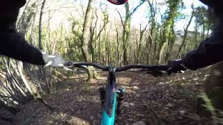
Videos of Spello Mountain Bike
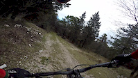
trail: Pizzichello
4:48 |
171 |
Feb 7, 2019
0:56 |
709 |
Jan 3, 2019 , Spello

trail: Macchione Trasfigurazione
2:22 |
356 |
Jan 3, 2019 , Spello
Recent Trail Reports
| status | trail | date | condition | info | user |
|---|---|---|---|---|---|
| Collegamento Fonte Bregno | May 3, 2026 @ 8:45am (Europe/San_Marino) May 2, 2026 | Ideal | Alepg88 | ||
| Vetta Subasio | May 3, 2026 @ 8:45am (Europe/San_Marino) May 2, 2026 | Ideal | Alepg88 | ||
| Connessione | May 3, 2026 @ 8:45am (Europe/San_Marino) May 2, 2026 | Ideal | Alepg88 | ||
| Pineta DH | Mar 16, 2026 @ 5:32pm (Europe/Rome) Mar 16, 2026 | Unknown | nicolag36 | ||
| Svoltarelle alte | Nov 2, 2025 @ 8:13pm (Europe/Rome) Nov 2, 2025 | Wet | nicolag36 | ||
| La Faglia | Oct 26, 2025 @ 9:20am (Europe/San_Marino) Oct 26, 2025 | Ideal | Alepg88 | ||
| Collepino - Acquedotto Romano | Oct 26, 2025 @ 9:20am (Europe/San_Marino) Oct 26, 2025 | Ideal | Alepg88 | ||
| Acquedotto romano | Oct 26, 2025 @ 9:20am (Europe/San_Marino) Oct 26, 2025 | Ideal | Alepg88 | ||
| Diretta spello-laghetto | Aug 13, 2025 @ 6:39am Aug 13, 2025 | Dry | Michelittu FFR | ||
| La Spella - Tornante Tagliata | Aug 13, 2025 @ 6:39am Aug 13, 2025 | Dry | Michelittu FFR |
Activity Feed
| username | action | type | title | date |
|---|---|---|---|---|
| Christian1967 | wishlist | trail | activity #98362056 | Jul 3, 2026 @ 1:17pm 9 hours |
| Christian1967 | add | trail | activity #98252435 | Jul 2, 2026 @ 1:05am 2 days |
| Alepg88 | add | report | activity #93940542 and 2 more | May 3, 2026 @ 6:26am May 3, 2026 |
| zeUa31 | add | photo | activity #93420473 and 1 more | Apr 26, 2026 @ 2:25am Apr 26, 2026 |
| marcoZIvHG | ridden | trail | activity #92812269 | Apr 17, 2026 @ 2:32pm Apr 17, 2026 |
Recent Comments
| username | type | title | comment | date |
|---|---|---|---|---|
| trail | E' uno stradone di sassi smossi largo 1-2m non... | Mar 23, 2026 @ 1:36am Mar 23, 2026 | ||
| trail | Piena di rilancio, slalom tra gli alberi bello... | May 12, 2024 @ 7:29am May 12, 2024 | ||
| trail | Non percorribile in salita in MTB: sentiero... | Apr 24, 2023 @ 1:49am Apr 24, 2023 | ||
| trail | Non adatto alla MTB | Apr 18, 2021 @ 10:21am Apr 18, 2021 |
Local Badges
-

Epic Ride Climb 2k104 awarded -

Climbing 10k Badge58 awarded -

Climbing 100k Badge3 awarded -

Epic Ride Descent 2k104 awarded -

Descent 10k Badge58 awarded -

Descent 100k Badge3 awarded
Activity Type Stats
| activitytype | trails | distance | descent | descent distance | total vertical | rating | global rank | state rank | photos | reports | routes | ridelogs |
|---|---|---|---|---|---|---|---|---|---|---|---|---|
| Mountain Bike | 55 | 47 miles | 14,177 ft | 22 miles | 3,196 ft | #3,656 | #209 | 18 | 256 | 2 | 3,730 | |
| E-Bike | 32 | 34 miles | 7,513 ft | 14 miles | 3,196 ft | #3,604 | #341 | 240 | 1 | 683 | ||
| Horse | 1 | 3 miles | 46 ft | 1,240 ft | 633 ft | 2 | ||||||
| Hike | 27 | 28 miles | 6,804 ft | 12 miles | 3,196 ft | #6,438 | #331 | 244 | 175 | |||
| Trail Running | 26 | 28 miles | 6,250 ft | 12 miles | 3,196 ft | #5,969 | #316 | 244 | 193 | |||
| Dirtbike/Moto | 2 | 3 miles | 82 ft | 2,103 ft | 1,906 ft | 2 | ||||||
| Observed Trials | 1 | 3 miles | 46 ft | 1,240 ft | 633 ft | |||||||
| ATV/ORV/OHV | 1 | 3 miles | 46 ft | 1,240 ft | 633 ft | 2 |
Frequently Asked Questions About Spello
▼
What are the best places to ride in Spello?
Spello has 1 areas to explore for mountain biking. The top rated areas are:
▼
What are the highest rated mountain biking trails in Spello?
The highest rated mountain biking trails in Spello are:
- Monte Pietrolungo - Laghetto (4.1/5)
- La Faglia (4.1/5)
- Sentiero 50 Fonte Bregno (4.1/5)
- Calvarone Rise (4.1/5)
- Pizzichello (4.1/5)
▼
What is the best time of the year to ride in Spello?
Based on ride log data, the most popular months to ride in Spello are:
- May (17 activities)
- November (16 activities)
- October (15 activities)
▼
Where can I park to ride in Spello?
Check the Spello trail map for trailhead and parking information. Community members regularly update access and parking details for trails in the area.
Activities
Trails
- By ceccowal FFR & contributors
- Admins: magnomagnini, RiccardoPG
- #26404 - 1,675 views
- spello activity log | embed map of Spello mountain bike trails | spello mountain biking points of interest
Downloading of trail gps tracks in kml & gpx formats is enabled for Spello.
You must login to download files.