close
-
Layers w
- Weather Layers
- Pro
- Pro
- Pro
- Pro
- Pro
- Pro
- More Layers
- Pro
- Pro
- Pro
- Pro
-
Upgrade to

3D
Trail Conditions
- Unknown
- Snow Groomed
- Snow Packed
- Snow Covered
- Snow Cover Partial
- Freeze/thaw Cycle
- Icy
- Prevalent Mud
- Wet
- Variable
- Ideal
- Dry
- Very Dry
Trail Flow (Ridden Direction)
Trailforks scans users ridelogs to determine the most popular direction each trail is ridden. A good flowing trail network will have most trails flowing in a single direction according to their intension.
The colour categories are based on what percentage of riders are riding a trail in its intended direction.
The colour categories are based on what percentage of riders are riding a trail in its intended direction.
- > 96%
- > 90%
- > 80%
- > 70%
- > 50%
- < 50%
- bi-directional trail
- no data
Trail Last Ridden
Trailforks scans ridelogs to determine the last time a trail was ridden.
- < 2 days
- < 1 week
- < 2 weeks
- < 1 month
- < 6 months
- > 6 months
Trail Ridden Direction
The intended direction a trail should be ridden.
- Downhill Only
- Downhill Primary
- Both Directions
- Uphill Primary
- Uphill Only
- One Direction
Contribute Details
Colors indicate trail is missing specified detail.
- Description
- Photos
- Description & Photos
- Videos
Trail Popularity ?
Trailforks scans ridelogs to determine which trails are ridden the most in the last 9 months.
Trails are compared with nearby trails in the same city region with a possible 25 colour shades.
Think of this as a heatmap, more rides = more kinetic energy = warmer colors.
- most popular
- popular
- less popular
- not popular
ATV/ORV/OHV Filter
Max Vehicle Width
inches
US Cell Coverage
Legend

Radar Time
Activity Recordings
Trailforks uses anonymized public activity data.
?
Activity Recordings
Trailforks uses anonymized public activity data.
?
Personal Heatmap
▶
Activity Types
all
/
none
▶
Options
2
Date range
month
–
Winter Trails
Warning
A routing network for winter maps does not exist. Selecting trails using the winter trails layer has been disabled.
Missing Trails
Most Popular
Least Popular
Trails are colored based on popularity. The more popular a trail is, the more red. Less popular trails trend towards green.
Jump Magnitude Heatmap
Heatmap of where riders jump on trails. Zoom in to see individual jumps, click circles to view jump details.
BC Backroad Status
![map legend]()
Service Road Atlas is a free to use, community-driven service for viewing and creating reports on the numerous back-country service roads around B.C. and Alberta.

Slope Aspect
Direction the slope faces
Trails Deemphasized
Trails are shown in grey.
Only show trails with no bike usage.
Suggested Layers
Based on selected activity type
Save the current map location and zoom level as your default home location whenever this page is loaded.
Save
No description for Springfield has been added yet!
Login or register to submit one.
Activities Click to view
- Mountain Bike
45 trails
- Gravel Bike
0 trails
- Adaptive Bike
0 trails
- Hike
48 trails
- Trail Running
45 trails
Region Details
- 31
- 5
- 9
Region Status
Open as of May 9, 2026Stats
- Avg Trail Rating
- Trails (view details)
- 48
- Trails Mountain Bike
- 45
- Trails E-Bike
- 1
- Trails Hike
- 48
- Trails Trail Running
- 45
- Total Distance
- 47 miles
- Total Descent
- 961 ft
- Total Vertical
- 103 ft
- Highest Trailhead
- 617 ft
- Reports
- 106
- Photos
- 57
- Ridden Counter
- 667
Sub Regions
-
Gurgens / Carpenter Park
-
Lake Trails
- 2
- 8
-
Lewis Memorial Acres
- 3
- 1
Popular Springfield Mountain Biking Trails
• 100 ★ 4.8 • 1 mile • 40 ft • 49 •
is an out and back trail (~1.2mi each way) that can be pinned from end to end, or slow it down to play on the growing number of trail features. It has ~10 berms between to sections that let you rail some corners, and a handful of...
• 90 ★ 4.8 • 1 mile • 123 ft • 46 •
The of the Lake Trail System is a quality mix of everything. From short, but fun, descents to semi-technical climbs, and a bit this and that. This loop is fairly small, but has many connectors that allow riders to mix and match trails...
• 90 ★ 4.8 • 1 mile • 48 ft • 41 •
Polecat is accessed by crossing to the Chatham bike path, turning right (head south) for about a 1/4 or so miles. You'll reach a information sign on your right with a sort of steep shoot that leads up to the trail entrance. Once at the...
• 95 ★ 3.0 • 441 ft • 6 ft • 38 •
This is a short connector trail from Mid-Line Crisis West to the Northern portion of the that has 4 small, but fun jumps. This is a ONE WAY TRAIL ONLY.
• 85 ★ 5.0 • 1,926 ft • 70 ft • 37 •
Mid-Line Crisis is composed of one main trail that leaves the on the South end right near the Cemetery, and diverges into 2 mid-line trail variations that take you back to the Northern parts of the .This variant of Mid-Line Crisis...
• 95 ★ 3.0 • 1 mile • 147 ft • 35 •
Popular blue difficulty singletrack. This mountain bike primary trail. On average it takes 12 minutes to complete this trail.
• 85 ★ 5.0 • 1,174 ft • 29 ft • 34 •
is the old outer loop of Cemetery's most Northern segment. This is now a connector trail that links you to the and , as well as linking to and trails.
• 70 ★ 5.0 • 322 ft • 0 ft • 25 •
This is a winding bench cut trail with a few fun, technical turns, and a jump. It connects the NW section of Cemetery to the NE side, and feeds into this around the middle.
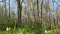
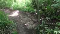
Photos of Springfield Mountain Bike
Videos of Springfield Mountain Bike
trail: Cemetery Loop
0:22 |
98 |
Jun 28, 2017

trail: Cemetery Loop
0:10 |
66 |
Jun 28, 2017
trail: Lick Creek
0:58 |
168 |
Jun 28, 2017
Recent Trail Reports
| status | trail | date | condition | info | user |
|---|---|---|---|---|---|
| Lick Creek | Jun 13, 2024 @ 1:31am Jun 13, 2024 | Variable | luenwarneke | ||
| Polecat Creek Trail | Jun 13, 2024 @ 1:31am Jun 13, 2024 | Variable | luenwarneke | ||
| Jump to Conclusion | Jun 13, 2024 @ 1:31am Jun 13, 2024 | Variable | luenwarneke | ||
| Cemetery Loop | Jun 13, 2024 @ 1:31am Jun 13, 2024 | Variable | luenwarneke | ||
| Fishing Line | Jun 13, 2024 @ 11:17am Jun 13, 2024 | Variable | luenwarneke | ||
| Mid-Line Crisis East | Feb 3, 2024 @ 2:11am Feb 3, 2024 | Variable | bsc55 | ||
| Interurban Trail | Nov 24, 2023 @ 4:34am Nov 24, 2023 | Ideal | bsc55 | ||
| Highline | Nov 24, 2023 @ 4:34am Nov 24, 2023 | Ideal | bsc55 | ||
| Sangamon Valley Trail | Sep 29, 2020 @ 2:57pm Sep 29, 2020 | Ideal | CoronaNewb | ||
| Lewis Memorial Acres Outer Loop | May 25, 2019 @ 5:33am May 25, 2019 | Wet | mtallman2 |
Activity Feed
| username | action | type | title | date |
|---|---|---|---|---|
| ScottyJ3He2 | wishlist | trail | activity #90622873 and 1 more | Mar 15, 2026 @ 6:28am Mar 15, 2026 |
| ScottyJ3He2 | wishlist | trail | activity #81247623 and 2 more | Sep 27, 2025 @ 5:24pm Sep 27, 2025 |
| marcw121 | wishlist | region | activity #72409122 | May 25, 2025 @ 3:32pm May 25, 2025 |
| marcw121 | wishlist | region | activity #72409095 | May 25, 2025 @ 3:32pm May 25, 2025 |
| Janew4 | wishlist | region | activity #62718195 | Dec 5, 2024 @ 9:59am Dec 5, 2024 |
Recent Comments
| username | type | title | comment | date |
|---|---|---|---|---|
| report | Dry but be on the lookout for walnuts | Oct 3, 2017 @ 9:48am Oct 3, 2017 |
Local Badges
-

Epic Ride Climb 2k1 awarded -

Climbing 10k Badge4 awarded -

Climbing 100k Badge0 awarded -

Epic Ride Descent 2k1 awarded -

Descent 10k Badge4 awarded -

Descent 100k Badge0 awarded
Activity Type Stats
| activitytype | trails | distance | descent | descent distance | total vertical | rating | global rank | state rank | photos | reports | routes | ridelogs |
|---|---|---|---|---|---|---|---|---|---|---|---|---|
| Mountain Bike | 45 | 46 miles | 961 ft | 17 miles | 102 ft | #3,911 | #1,312 | 57 | 106 | 2,930 | ||
| E-Bike | 1 | 6 miles | 49 ft | 3 miles | 36 ft | 101 | 3 | |||||
| Hike | 48 | 47 miles | 961 ft | 17 miles | 102 ft | #5,263 | #1,861 | 106 | 79 | |||
| Trail Running | 45 | 46 miles | 961 ft | 17 miles | 102 ft | #4,647 | #1,436 | 106 | 697 |
Frequently Asked Questions About Springfield
▼
What are the best places to ride in Springfield?
Springfield has 5 areas to explore for mountain biking. The top rated areas are:
▼
What are the highest rated mountain biking trails in Springfield?
The highest rated mountain biking trails in Springfield are:
- Lick Creek (4.4/5)
- Polecat Creek Trail (4.3/5)
- Cemetery Loop (4.3/5)
- Mid-Line Crisis East (4.1/5)
- Highline (4.1/5)
▼
What is the best time of the year to ride in Springfield?
Based on ride log data, the most popular months to ride in Springfield are:
- August (18 activities)
- July (15 activities)
- September (13 activities)
▼
Where can I park to ride in Springfield?
There are 12 parking locations listed in Springfield. The most popular parking spots are: View all parking and trailhead locations on the map to plan your visit.
Activities
- By brenthillier
 NSMBA TRAILFORKS & contributors
 - Admins: CILTA
- #3337 - 6,444 views
- springfield activity log | embed map of Springfield mountain bike trails | springfield mountain biking points of interest
Downloading of trail gps tracks in kml & gpx formats is enabled for Springfield.
You must login to download files.