close
-
Layers w
- Weather Layers
- Pro
- Pro
- Pro
- Pro
- Pro
- Pro
- More Layers
- Pro
- Pro
- Pro
- Pro
-
Upgrade to

3D
Trail Conditions
- Unknown
- Snow Groomed
- Snow Packed
- Snow Covered
- Snow Cover Partial
- Freeze/thaw Cycle
- Icy
- Prevalent Mud
- Wet
- Variable
- Ideal
- Dry
- Very Dry
Trail Flow (Ridden Direction)
Trailforks scans users ridelogs to determine the most popular direction each trail is ridden. A good flowing trail network will have most trails flowing in a single direction according to their intension.
The colour categories are based on what percentage of riders are riding a trail in its intended direction.
The colour categories are based on what percentage of riders are riding a trail in its intended direction.
- > 96%
- > 90%
- > 80%
- > 70%
- > 50%
- < 50%
- bi-directional trail
- no data
Trail Last Ridden
Trailforks scans ridelogs to determine the last time a trail was ridden.
- < 2 days
- < 1 week
- < 2 weeks
- < 1 month
- < 6 months
- > 6 months
Trail Ridden Direction
The intended direction a trail should be ridden.
- Downhill Only
- Downhill Primary
- Both Directions
- Uphill Primary
- Uphill Only
- One Direction
Contribute Details
Colors indicate trail is missing specified detail.
- Description
- Photos
- Description & Photos
- Videos
Trail Popularity ?
Trailforks scans ridelogs to determine which trails are ridden the most in the last 9 months.
Trails are compared with nearby trails in the same city region with a possible 25 colour shades.
Think of this as a heatmap, more rides = more kinetic energy = warmer colors.
- most popular
- popular
- less popular
- not popular
ATV/ORV/OHV Filter
Max Vehicle Width
inches
US Cell Coverage
Legend

Radar Time
Activity Recordings
Trailforks uses anonymized public activity data.
?
Activity Recordings
Trailforks uses anonymized public activity data.
?
Personal Heatmap
▶
Activity Types
all
/
none
▶
Options
2
Date range
month
–
Winter Trails
Warning
A routing network for winter maps does not exist. Selecting trails using the winter trails layer has been disabled.
Missing Trails
Most Popular
Least Popular
Trails are colored based on popularity. The more popular a trail is, the more red. Less popular trails trend towards green.
Jump Magnitude Heatmap
Heatmap of where riders jump on trails. Zoom in to see individual jumps, click circles to view jump details.
BC Backroad Status
![map legend]()
Service Road Atlas is a free to use, community-driven service for viewing and creating reports on the numerous back-country service roads around B.C. and Alberta.

Slope Aspect
Direction the slope faces
Trails Deemphasized
Trails are shown in grey.
Only show trails with no bike usage.
Suggested Layers
Based on selected activity type
Save the current map location and zoom level as your default home location whenever this page is loaded.
Save
No description for Stella has been added yet!
Login or register to submit one.
This region uses the Uk/Euro style trail grading system.
Activities Click to view
- Mountain Bike
51 trails
- E-Bike
44 trails
- Gravel Bike
0 trails
- Adaptive Bike
0 trails
- Winter Fat Bike
0 trails
- Hike
34 trails
- Trail Running
25 trails
Region Details
- 15
- 10
- 9
Region Status
Open as of 2 daysStats
- Avg Trail Rating
- Trails (view details)
- 38
- Trails Mountain Bike
- 51
- Trails E-Bike
- 44
- Trails Horse
- 2
- Trails Hike
- 34
- Trails Trail Running
- 25
- Total Distance
- 41 miles
- Total Descent
- 15,479 ft
- Total Vertical
- 3,790 ft
- Highest Trailhead
- 4,125 ft
- Reports
- 958
- Photos
- 74
- Ridden Counter
- 2,071
Sub Regions
-
Stella Trails Area
- 8
- 5
Popular Stella Mountain Biking Trails
• 100 ★ 4.5 • 5,194 ft • 503 ft • 69 •
Popular blue difficulty doubletrack. This mountain bike primary trail can be used both directions and has a hard overall physical rating with a 503 ft blue climb. On average it takes 18 minutes to complete this trail.
• 90 ★ 4.0 • 3 miles • 520 ft • 51 •
Popular green difficulty doubletrack. This mountain bike primary trail can be used both directions and has a moderate overall physical rating with a 520 ft green climb. On average it takes 22 minutes to complete this trail.
• 5 ★ 4.3 • 1 mile • 0 ft • 39 •
bel singletrack che si prende seguendo il sentiero agrifoglio fino a un punto molto panoramico dove si trova il cartello di inzio percorso con scritto
• 80 ★ 4.0 • 2 miles • 139 ft • 33 •
divertente discesa che ti porta al giovo ligure...sentiero quasi tutto naturale ...divertente e difficile il giusto
• 5 ★ 5.0 • 5,037 ft • 28 ft • 30 •
Less popular red difficulty singletrack. This mountain bike primary trail can be used downhill only and has a hard overall physical rating. On average it takes 19 minutes to complete this trail.
Stella Mountain Bike Routes
29 miles • 6,081 ft • 8 • Loop •
Itinerario molto interessante in quanto i dislivelli non sono mai esasperati e i sentieri sono quasi tutti...
3,688 ft • 0 •
discesa che porta sulla strada di collegamento tra stella s.bernardo-giovo
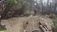
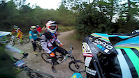
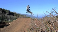
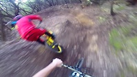
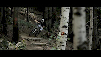
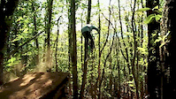
Photos of Stella Mountain Bike
Videos of Stella Mountain Bike
trail: Luca
6:11 |
526 |
Jan 29, 2015
trail: Luca
3:04 |
395 |
Oct 31, 2014

trail: Luca
3:04 |
102 |
May 13, 2014
trail: Luca
2:34 |
2436 |
Mar 8, 2014
trail: Luca
5:11 |
26651 |
Jan 29, 2014
trail: Luca
4:11 |
1120 |
Aug 26, 2012
trail: Luca
14:32 |
685 |
Mar 26, 2012

trail: Groppo
0:42 |
736 |
Jan 20, 2012
Recent Trail Reports
| status | trail | date | condition | info | user |
|---|---|---|---|---|---|
| Beigua-AV-giovo | Jul 3, 2026 @ 3:38pm (Europe/Rome) 2 days | Ideal | Marcopacos | ||
| forte lodrino dh | Jun 16, 2026 @ 2:07pm (Europe/Rome) Jun 16, 2026 | Ideal | Gio2022trek | ||
| Serpis 2^ | Jun 13, 2026 @ 7:49am (Europe/Monaco) Jun 12, 2026 | Unknown | Marcors125 | ||
| Serpis 1^ | Jun 13, 2026 @ 7:49am (Europe/Monaco) Jun 12, 2026 | Unknown | Marcors125 | ||
| Dal Giovo ai Trail di Stella | Jun 13, 2026 @ 7:49am (Europe/Monaco) Jun 12, 2026 | Ideal | Marcors125 | ||
| collegamento polzemola santa giustina | Jun 9, 2026 @ 8:48am (Europe/Rome) Jun 8, 2026 | Ideal | danilo959 | ||
| To go Generator # 2 | May 30, 2026 @ 7:34am (Europe/Monaco) May 29, 2026 | Variable | Marcors125 | ||
| Nigin | May 24, 2026 @ 8:40am (Europe/Rome) May 23, 2026 | Ideal | sughero | ||
| To Go Start | May 24, 2026 @ 8:40am (Europe/Rome) May 23, 2026 | Ideal | sughero | ||
| La Cava | May 24, 2026 @ 8:40am (Europe/Rome) May 23, 2026 | Ideal | sughero |
Activity Feed
| username | action | type | title | date |
|---|---|---|---|---|
| Marcopacos | add | report | activity #98359119 | Jul 3, 2026 @ 12:36pm 2 days |
| Gio2022trek | add | report | activity #97101082 | Jun 16, 2026 @ 5:07am Jun 16, 2026 |
| Marcors125 | add | report | activity #96881765 and 1 more | Jun 13, 2026 @ 8:38am Jun 13, 2026 |
| Marcors125 | add | report | activity #96881762 and 1 more | Jun 13, 2026 @ 8:38am Jun 13, 2026 |
| Panetz | add | report | activity #96875532 | Jun 13, 2026 @ 7:38am Jun 13, 2026 |
Recent Comments
| username | type | title | comment | date |
|---|---|---|---|---|
| trail | Non fate il secondo settore è senza... | Oct 19, 2025 @ 2:18am Oct 19, 2025 | ||
| trail | A parte il primo tratto su pietraia e gradoni... | Jun 26, 2025 @ 2:25am Jun 26, 2025 | ||
| trail | Fate attenzione chedal gradone stiamo... | Jun 20, 2025 @ 6:11am Jun 20, 2025 | ||
| trail | ATTENZIONE !!! A causa di un movimento franoso... | Apr 28, 2025 @ 4:06am Apr 28, 2025 | ||
| trail | Il secondo settore quello che arriva a Santa... | Mar 30, 2025 @ 6:37am Mar 30, 2025 |
Local Badges
-

Epic Mountain Bike Climb 2k6 awarded -

Climbing 10k Badge0 awarded -

Mountain Biking 100k Badge0 awarded -

Epic Ride Descent 2k6 awarded -

Descent 10k Badge0 awarded -

Descent 100k Badge0 awarded
Activity Type Stats
| activitytype | trails | distance | descent | descent distance | total vertical | rating | global rank | state rank | photos | reports | routes | ridelogs |
|---|---|---|---|---|---|---|---|---|---|---|---|---|
| Mountain Bike | 51 | 41 miles | 15,479 ft | 23 miles | 3,789 ft | #2,991 | #146 | 49 | 958 | 2 | 485 | |
| E-Bike | 44 | 35 miles | 12,963 ft | 20 miles | 3,327 ft | #1,789 | #179 | 25 | 932 | 1 | 345 | |
| Horse | 2 | 1 mile | 236 ft | 2,379 ft | 285 ft | 28 | ||||||
| Hike | 34 | 31 miles | 10,883 ft | 17 miles | 3,399 ft | #5,751 | #271 | 921 | 36 | |||
| Trail Running | 25 | 16 miles | 4,777 ft | 8 miles | 1,936 ft | #7,183 | #421 | 903 | 3 |
Frequently Asked Questions About Stella
▼
What are the best places to ride in Stella?
Stella has 1 areas to explore for mountain biking. The top rated areas are:
▼
What are the highest rated mountain biking trails in Stella?
The highest rated mountain biking trails in Stella are:
- Groppo (4.3/5)
- Intermedio (4.2/5)
- prati alternativi (4.2/5)
- New Luca trail (4.2/5)
- Luca (4.2/5)
▼
What is the best time of the year to ride in Stella?
Based on ride log data, the most popular months to ride in Stella are:
- August (9 activities)
- September (7 activities)
- October (7 activities)
▼
Where can I park to ride in Stella?
There are 1 parking locations listed in Stella. The most popular parking spots are:
Activities
Trails
Points of Interest
- By sughero
 & contributors
 - Admins: denitopia
- #20906 - 3,799 views
- stella activity log | embed map of Stella mountain bike trails | stella mountain biking points of interest
Downloading of trail gps tracks in kml & gpx formats is enabled for Stella.
You must login to download files.