close
-
Layers w
- Weather Layers
- Pro
- Pro
- Pro
- Pro
- Pro
- Pro
- More Layers
- Pro
- Pro
- Pro
- Pro
-
Upgrade to

3D
Trail Conditions
- Unknown
- Snow Groomed
- Snow Packed
- Snow Covered
- Snow Cover Partial
- Freeze/thaw Cycle
- Icy
- Prevalent Mud
- Wet
- Variable
- Ideal
- Dry
- Very Dry
Trail Flow (Ridden Direction)
Trailforks scans users activity logs to determine the most popular direction each trail is ridden. A good flowing trail network will have most trails flowing in a single direction according to their intension.
The colour categories are based on what percentage of users are riding a trail in its intended direction.
The colour categories are based on what percentage of users are riding a trail in its intended direction.
- > 96%
- > 90%
- > 80%
- > 70%
- > 50%
- < 50%
- bi-directional trail
- no data
Trail Last Ridden
Trailforks scans activity logs to determine the last time a trail was ridden.
- < 2 days
- < 1 week
- < 2 weeks
- < 1 month
- < 6 months
- > 6 months
Trail Ridden Direction
The intended direction a trail should be ridden.
- Downhill Only
- Downhill Primary
- Both Directions
- Uphill Primary
- Uphill Only
- One Direction
Contribute Details
Colors indicate trail is missing specified detail.
- Description
- Photos
- Description & Photos
- Videos
Trail Popularity ?
Trailforks scans activity logs to determine which trails are ridden the most in the last 9 months.
Trails are compared with nearby trails in the same city region with a possible 25 colour shades.
Think of this as a heatmap, more activities = more kinetic energy = warmer colors.
- most popular
- popular
- less popular
- not popular
ATV/ORV/OHV Filter
Max Vehicle Width
inches
US Cell Coverage
Legend

Radar Time
Activity Recordings
Trailforks uses anonymized public activity data.
?
Activity Recordings
Trailforks uses anonymized public activity data.
?
Personal Heatmap
▶
Activity Types
all
/
none
▶
Options
2
Date range
month
–
Winter Trails
Warning
A routing network for winter maps does not exist. Selecting trails using the winter trails layer has been disabled.
Missing Trails
Most Popular
Least Popular
Trails are colored based on popularity. The more popular a trail is, the more red. Less popular trails trend towards green.
Jump Magnitude Heatmap
Heatmap of where users jump on trails. Zoom in to see individual jumps, click circles to view jump details.
BC Backroad Status
![map legend]()
Service Road Atlas is a free to use, community-driven service for viewing and creating reports on the numerous back-country service roads around B.C. and Alberta.

Slope Aspect
Direction the slope faces
Trails Deemphasized
Trails are shown in grey.
Only show trails with no bike usage.
Suggested Layers
Based on selected activity type
Save the current map location and zoom level as your default home location whenever this page is loaded.
Save
No description for Stonehaven has been added yet!
Login or register to submit one.
This region uses the Uk/Euro style trail grading system.
Activities Click to view
- Mountain Bike
62 trails
- E-Bike
52 trails
- Adaptive Bike
0 trails
- Winter Fat Bike
0 trails
- Horse
13 trails
- Hike
49 trails
- Trail Running
49 trails
Region Details
- 36
- 3
- 13
- 8
- 2
Region Status
Caution as of Jul 14, 2026Stats
- Avg Trail Rating
- Trails (view details)
- 62
- Trails Mountain Bike
- 62
- Trails E-Bike
- 52
- Trails Horse
- 13
- Trails Hike
- 49
- Trails Trail Running
- 49
- Total Distance
- 69 miles
- Total Descent
- 9,852 ft
- Total Vertical
- 1,070 ft
- Highest Trailhead
- 1,318 ft
- Reports
- 104
- Photos
- 13
- Completed Counter
- 2,197
Sub Regions
-
Cheyne Hill
- 3
- 6
- 1
-
Fetteresso
- 5
- 8
- 1
Popular Stonehaven Mountain Biking Trails
• 100 ★ 3.0 • 1,489 ft • 21 ft • 64 •
Popular red difficulty singletrack. This mountain bike primary trail can be used downhill primary and has a moderate overall physical rating with a 21 ft blue climb. It features berm. On average it takes 2 minutes to complete this trail.
• 95 ★ 4.0 • 3,547 ft • 37 ft • 56 •
Narrow single track trail through the forest. The entrance is gloomy, as are other sections of the trail that are in dense forest, but the trail is good throughout. Nothing technical. Some straight stretches where you can pick up some...
• 70 ★ 0.0 • 3,136 ft • 179 ft • 55 •
Popular green difficulty mixed. This mountain bike primary trail can be used both directions and has a easy overall physical rating with a 179 ft green climb. On average it takes 8 minutes to complete this trail.
• 85 ★ 0.0 • 843 ft • 0 ft • 52 •
Popular blue difficulty singletrack. This mountain bike primary trail can be used both directions. On average it takes 1 minutes to complete this trail.
• 85 ★ 0.0 • 518 ft • 0 ft • 49 •
single track trail through open woodland and heather then down through some dense trees following a cut out line with trail features
• 75 ★ 4.0 • 2,526 ft • 12 ft • 42 •
Popular blue difficulty singletrack. This mountain bike primary trail can be used downhill primary. On average it takes 4 minutes to complete this trail.
• 55 ★ 5.0 • 5,091 ft • 58 ft • 38 •
Moderately popular blue difficulty singletrack. This mountain bike primary trail can be used both directions and has a moderate overall physical rating with a 58 ft black diamond climb. On average it takes 12 minutes to complete this trail.
Stonehaven Mountain Bike Routes
4 miles • 640 ft • 0 •
A short loop only a few miles from Stonehaven with lots of mixed routes that can be taken once in the woods.
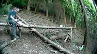
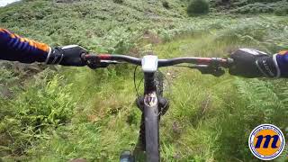
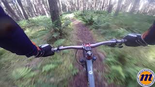
Videos of Stonehaven Mountain Bike

trail: Cheyne Original
5:13 |
134 |
Oct 27, 2017

trail: Uprising
16:26 |
1216 |
Aug 27, 2014

trail: Endor
0:27 |
738 |
Jul 17, 2013
trail: Endor
3:34 |
1295 |
Jul 17, 2013
trail: Cheyne Original
673 |
Oct 27, 2017 , Stonehaven
trail: Cheyne Original
685 |
Oct 27, 2017 , Stonehaven
Current Trail Warnings
| status | trail | date | condition | user | info |
|---|---|---|---|---|---|
| High Plains Climb | Jul 14, 2026 @ 3:11pm (Europe/London) Jul 14, 2026 | Unknown | geastthebeast | Massively overgrown, theres no trail per... | |
| Slack Downhill | Jul 14, 2026 @ 2:29pm (Europe/London) Jul 14, 2026 | Unknown | geastthebeast | no trail |
Recent Trail Reports
| status | trail | date | condition | info | user |
|---|---|---|---|---|---|
| High Plains Drifter | Jul 14, 2026 @ 3:12pm (Europe/London) Jul 14, 2026 | Dry | geastthebeast | ||
| just the pig | Jul 14, 2026 @ 2:26pm (Europe/London) Jul 14, 2026 | Ideal | geastthebeast | ||
| Fetty Mid Line | Jul 14, 2026 @ 2:00pm (Europe/London) Jul 14, 2026 | Prevalent Mud | geastthebeast | ||
| Cheyne Hill MTB XC Course | May 18, 2026 @ 9:36pm (Europe/London) May 18, 2026 | Unknown | awhymant | ||
| Acupuncture | Jul 19, 2025 @ 3:06am Jul 19, 2025 | Unknown | jamie1234a | ||
| Sheila’s Stinky Pit Reloaded | Jul 18, 2025 @ 1:32pm Jul 18, 2025 | Unknown | jamie1234a | ||
| Windfarm Access Road | Jun 3, 2025 @ 3:56pm Jun 3, 2025 | Ideal | Lusciousleeta | ||
| Forest Road | Jun 3, 2025 @ 3:56pm Jun 3, 2025 | Ideal | Lusciousleeta | ||
| Born Slippy | Apr 17, 2025 @ 9:49am Apr 17, 2025 | Prevalent Mud | RoddywzxGA1 | ||
| Forest Road | Feb 11, 2024 @ 12:48am Feb 11, 2024 | Prevalent Mud | Fordaldo |
Activity Feed
| username | action | type | title | date |
|---|---|---|---|---|
| geastthebeast | ridden | trail | activity #99167005 | Jul 14, 2026 @ 7:13am Jul 14, 2026 |
| geastthebeast | ridden | trail | activity #99166991 and 2 more | Jul 14, 2026 @ 7:13am Jul 14, 2026 |
| geastthebeast | add | report | activity #99166878 | Jul 14, 2026 @ 7:11am Jul 14, 2026 |
| geastthebeast | add | report | activity #99162707 and 3 more | Jul 14, 2026 @ 6:00am Jul 14, 2026 |
| awhymant | add | report | activity #94997745 | May 18, 2026 @ 1:38pm May 18, 2026 |
Recent Comments
| username | type | title | comment | date |
|---|---|---|---|---|
| trail | Completely ruined by forestry work. Access no... | Jul 18, 2025 @ 1:31pm Jul 18, 2025 | ||
| trail | really good flat down hill run if you give it... | Feb 9, 2025 @ 8:55am Feb 9, 2025 | ||
| trail | turned off to use this as a loop and no real... | Feb 9, 2025 @ 8:47am Feb 9, 2025 | ||
| trail | Trees down at top of section, no idea what the... | Dec 30, 2023 @ 6:06am Dec 30, 2023 | ||
| trail | Still blocked by trees. Not rideable | Oct 12, 2023 @ 5:35am Oct 12, 2023 |
Local Badges
-

Epic Ride Climb 2k39 awarded -

Climbing 10k Badge27 awarded -

Climbing 100k Badge2 awarded -

Epic Ride Descent 2k39 awarded -

Descent 10k Badge27 awarded -

Descent 100k Badge2 awarded
Activity Type Stats
| activitytype | trails | distance | descent | descent distance | total vertical | rating | global rank | state rank | photos | reports | routes | activity logs |
|---|---|---|---|---|---|---|---|---|---|---|---|---|
| Mountain Bike | 62 | 69 miles | 9,852 ft | 32 miles | 1,070 ft | #3,562 | #121 | 13 | 104 | 7,333 | ||
| E-Bike | 52 | 63 miles | 8,074 ft | 27 miles | 951 ft | #2,380 | #86 | 86 | 702 | |||
| Horse | 13 | 16 miles | 1,591 ft | 6 miles | 669 ft | #1,326 | #69 | 15 | ||||
| Hike | 49 | 66 miles | 9,006 ft | 30 miles | 1,070 ft | #3,876 | #83 | 89 | 530 | |||
| Trail Running | 49 | 66 miles | 9,006 ft | 30 miles | 1,070 ft | #3,265 | #70 | 89 | 246 |
Frequently Asked Questions About Stonehaven
▼
What are the best places to ride in Stonehaven?
Stonehaven has 2 areas to explore for mountain biking. The top rated areas are:
▼
What are the highest rated mountain biking trails in Stonehaven?
The highest rated mountain biking trails in Stonehaven are:
- Middle - Top (4.1/5)
- Cheyne Original (4.1/5)
- Fetty Mid Line (4/5)
- Endor (4/5)
- Daves Dropped One (4/5)
▼
What is the best time of the year to ride in Stonehaven?
Based on ride log data, the most popular months to ride in Stonehaven are:
- September (24 activities)
- May (23 activities)
- July (20 activities)
▼
Where can I park to ride in Stonehaven?
There are 4 parking locations listed in Stonehaven. The most popular parking spots are: View all parking and trailhead locations on the map to plan your visit.
Activities
- By tcab39 & contributors
- Admins: DMBinS, FLS, ATA, NEAT
- #12496 - 6,394 views
- stonehaven activity log | embed map of Stonehaven mountain bike trails | stonehaven mountain biking points of interest
Downloading of trail gps tracks in kml & gpx formats is enabled for Stonehaven.
You must login to download files.