close
-
Layers w
- Weather Layers
- Pro
- Pro
- Pro
- Pro
- Pro
- Pro
- More Layers
- Pro
- Pro
- Pro
- Pro
-
Upgrade to

3D
Trail Conditions
- Unknown
- Snow Groomed
- Snow Packed
- Snow Covered
- Snow Cover Partial
- Freeze/thaw Cycle
- Icy
- Prevalent Mud
- Wet
- Variable
- Ideal
- Dry
- Very Dry
Trail Flow (Ridden Direction)
Trailforks scans users ridelogs to determine the most popular direction each trail is ridden. A good flowing trail network will have most trails flowing in a single direction according to their intension.
The colour categories are based on what percentage of riders are riding a trail in its intended direction.
The colour categories are based on what percentage of riders are riding a trail in its intended direction.
- > 96%
- > 90%
- > 80%
- > 70%
- > 50%
- < 50%
- bi-directional trail
- no data
Trail Last Ridden
Trailforks scans ridelogs to determine the last time a trail was ridden.
- < 2 days
- < 1 week
- < 2 weeks
- < 1 month
- < 6 months
- > 6 months
Trail Ridden Direction
The intended direction a trail should be ridden.
- Downhill Only
- Downhill Primary
- Both Directions
- Uphill Primary
- Uphill Only
- One Direction
Contribute Details
Colors indicate trail is missing specified detail.
- Description
- Photos
- Description & Photos
- Videos
Trail Popularity ?
Trailforks scans ridelogs to determine which trails are ridden the most in the last 9 months.
Trails are compared with nearby trails in the same city region with a possible 25 colour shades.
Think of this as a heatmap, more rides = more kinetic energy = warmer colors.
- most popular
- popular
- less popular
- not popular
ATV/ORV/OHV Filter
Max Vehicle Width
inches
US Cell Coverage
Legend

Radar Time
Activity Recordings
Trailforks uses anonymized public activity data.
?
Activity Recordings
Trailforks uses anonymized public activity data.
?
Personal Heatmap
▶
Activity Types
all
/
none
▶
Options
2
Date range
month
–
Winter Trails
Warning
A routing network for winter maps does not exist. Selecting trails using the winter trails layer has been disabled.
Missing Trails
Most Popular
Least Popular
Trails are colored based on popularity. The more popular a trail is, the more red. Less popular trails trend towards green.
Jump Magnitude Heatmap
Heatmap of where riders jump on trails. Zoom in to see individual jumps, click circles to view jump details.
BC Backroad Status
![map legend]()
Service Road Atlas is a free to use, community-driven service for viewing and creating reports on the numerous back-country service roads around B.C. and Alberta.

Slope Aspect
Direction the slope faces
Trails Deemphasized
Trails are shown in grey.
Only show trails with no bike usage.
Suggested Layers
Based on selected activity type
Save the current map location and zoom level as your default home location whenever this page is loaded.
Save
No description for Strzelin has been added yet!
Login or register to submit one.
This region uses the Uk/Euro style trail grading system.
Activities Click to view
- Mountain Bike
49 trails
- E-Bike
49 trails
- Adaptive Bike
0 trails
- Hike
29 trails
- Trail Running
29 trails
Region Details
- 21
- 14
- 11
- 3
Region Status
Open as of Jun 21, 2026Stats
- Avg Trail Rating
- Trails (view details)
- 49
- Trails Mountain Bike
- 49
- Trails E-Bike
- 49
- Trails Hike
- 29
- Trails Trail Running
- 29
- Total Distance
- 48 miles
- Total Descent
- 6,450 ft
- Total Vertical
- 701 ft
- Highest Trailhead
- 1,297 ft
- Reports
- 702
- Photos
- 134
- Ridden Counter
- 4,626
Sub Regions
-
Single Track Strzelin
- 10
- 6
- 2
Popular Strzelin Mountain Biking Trails
• 90 ★ 4.6 • 2 miles • 65 ft • 312 •
Highly rated popular blue difficulty machine groomed. This mountain bike primary trail can be used downhill only and has a moderate overall physical rating. It features berm and drop. Trail visibility is always easy to follow. On average it takes 13 minutes to complete this trail.
• 95 ★ 4.9 • 2 miles • 268 ft • 301 •
Highly rated popular green difficulty machine groomed. This mountain bike primary trail. Trail visibility is always easy to follow. On average it takes 7 minutes to complete this trail.
• 90 ★ 4.5 • 1,844 ft • 66 ft • 276 •
Podjazd typu singletrack (wyrównany maszynowo) do po ukończeniu . Uwaga, ścieżka jednokierunkowa, podjazdowa. Jedynie trasa Strzelińskich Maratonów Rowerowych biegnie często w przeciwnym kierunku.
• 85 ★ 4.7 • 1 mile • 328 ft • 259 •
Naturalna, malownicza ścieżka, oznaczona żółto-niebieskimi strzałkami, prowadzącymi do .
• 75 ★ 4.9 • 1 mile • 28 ft • 158 •
Highly rated popular green difficulty family friendly singletrack. This mountain bike primary trail can be used downhill primary and has a easy overall physical rating with a 28 ft green climb. On average it takes 8 minutes to complete this trail.
Strzelin Mountain Bike Routes
★ 4.0 • 17 miles • 1,917 ft • 12 • Loop •
Pętla po Single Track Strzelin wzbogacona o ścieżki przygotowane przez lokalsów, start i powrót pod...
★ 4.0 • 19 miles • 2,694 ft • 10 • Loop •
Start na parkingu na końcu S3. Jazda ścieżką leśna do S1, zjazd singlem dalej podjazd na gromnik....
★ 5.0 • 14 miles • 1,491 ft • 10 • Loop •
Podstawowa pętla po Single Track Strzelin, start i powrót pod Leśniczówką w Gościęcicach. Trasa...
★ 5.0 • 8 miles • 1,212 ft • 9 • Loop •
Wymagająca, interwałowa trasa w formie pętli w północnej części Wzgórz Strzelińskich. W...
31 miles • 4,108 ft • 19 • Out & Back •
Course set up to cover as much trails as possible and achieve highest possible ascent. Not hard...
19 miles • 2,263 ft • 0 • Out & Back •
Ciekawa trasa od Kuropatnika przez oraz Kopę Nowoleską.
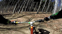
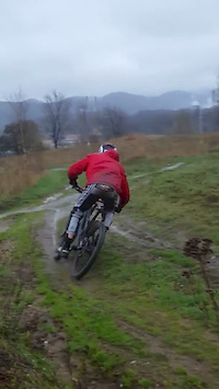
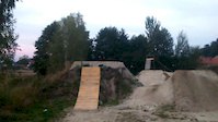
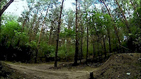
Photos of Strzelin Mountain Bike
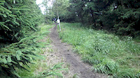
Videos of Strzelin Mountain Bike

trail: Podjazdówka do S2
0:15 |
58 |
Jun 24, 2018
trail: Podjazdówka do S2
0:39 |
139 |
Apr 13, 2017
trail: Podjazdówka do S2
0:20 |
49 |
Apr 10, 2016
trail: Podjazdówka do S2
0:19 |
223 |
Oct 5, 2015
trail: Podjazdówka do S2
0:14 |
30 |
Sep 29, 2015
trail: Podjazdówka do S2
3:21 |
155 |
Dec 29, 2014
trail: Podjazdówka do S2
0:32 |
2381 |
Aug 11, 2013
trail: Podjazdówka do S2
0:11 |
161 |
Jul 17, 2013
Recent Trail Reports
| status | trail | date | condition | info | user |
|---|---|---|---|---|---|
| S2 | Jun 14, 2026 @ 9:16am (Europe/Prague) Jun 14, 2026 | Variable | grzeole | ||
| Forest Road | Jun 14, 2026 @ 9:16am (Europe/Prague) Jun 14, 2026 | Variable | grzeole | ||
| Podjazdówka do S2 | Jun 14, 2026 @ 9:16am (Europe/Prague) Jun 14, 2026 | Variable | grzeole | ||
| S1 - Kopa Nowoleska | Jun 14, 2026 @ 9:16am (Europe/Prague) Jun 14, 2026 | Variable | grzeole | ||
| Wyjazdówka | Jun 14, 2026 @ 9:16am (Europe/Prague) Jun 14, 2026 | Variable | grzeole | ||
| Access Road | Jun 14, 2026 @ 9:16am (Europe/Prague) Jun 14, 2026 | Variable | grzeole | ||
| S5 | Jun 14, 2026 @ 9:16am (Europe/Prague) Jun 14, 2026 | Variable | grzeole | ||
| S4 | Jun 14, 2026 @ 9:16am (Europe/Prague) Jun 14, 2026 | Variable | grzeole | ||
| S3 | May 22, 2026 @ 8:41am (Europe/Warsaw) May 21, 2026 | Ideal | lichensky | ||
| Pogródka | May 11, 2026 @ 2:03pm (Europe/Warsaw) May 11, 2026 | Ideal | Adrow007 |
Activity Feed
| username | action | type | title | date |
|---|---|---|---|---|
| Confused_Whale | wishlist | region | activity #97838026 | Jun 26, 2026 @ 8:57am Jun 26, 2026 |
| bimcio | wishlist | route | activity #97791667 | Jun 25, 2026 @ 1:55pm Jun 25, 2026 |
| lespod | wishlist | route | activity #97776759 | Jun 25, 2026 @ 10:09am Jun 25, 2026 |
| grzeole | add | report | activity #97161962 and 7 more | Jun 16, 2026 @ 9:37pm Jun 16, 2026 |
| belfer | wishlist | route | activity #96752855 | Jun 11, 2026 @ 11:49am Jun 11, 2026 |
Recent Comments
| username | type | title | comment | date |
|---|---|---|---|---|
| trail | Świetnie zrobiona ścieżka i rozgrzewka... | Sep 27, 2025 @ 8:04am Sep 27, 2025 | ||
| trail | Ok, dzięki, zmieniłem na "permanently closed". | Sep 14, 2025 @ 2:54pm Sep 14, 2025 | ||
| trail | Ta ścieżka już nie istnieje. Does not... | Sep 14, 2025 @ 1:13pm Sep 14, 2025 | ||
| trail | Trasa po remoncie zyskała wysokie bandy,... | Apr 19, 2025 @ 5:25am Apr 19, 2025 | ||
| trail | Ostatnia sekcja od rozwidlenia jest dosyc... | Aug 31, 2024 @ 5:55am Aug 31, 2024 |
Local Badges
-

Epic Ride Climb 2k3 awarded -

Climbing 10k Badge10 awarded -

Climbing 100k Badge2 awarded -

Epic Ride Descent 2k3 awarded -

Descent 10k Badge10 awarded -

Descent 100k Badge2 awarded
Bike & Skill Parks
| name | type | city | rating |
|---|---|---|---|
| Pumptrack Strzelin | skill park | Strzelin |
Activity Type Stats
| activitytype | trails | distance | descent | descent distance | total vertical | rating | global rank | state rank | photos | reports | routes | ridelogs |
|---|---|---|---|---|---|---|---|---|---|---|---|---|
| Mountain Bike | 49 | 48 miles | 6,450 ft | 19 miles | 702 ft | #1,849 | #27 | 131 | 702 | 8 | 3,158 | |
| E-Bike | 49 | 23 miles | 2,684 ft | 9 miles | 673 ft | #2,630 | #295 | 577 | 4 | 128 | ||
| Hike | 29 | 30 miles | 2,756 ft | 10 miles | 702 ft | #4,397 | #79 | 562 | 78 | |||
| Trail Running | 29 | 30 miles | 2,756 ft | 10 miles | 702 ft | #3,853 | #67 | 562 | 20 |
Frequently Asked Questions About Strzelin
▼
What are the best places to ride in Strzelin?
Strzelin has 1 areas to explore for mountain biking. The top rated areas are:
▼
What are the highest rated mountain biking trails in Strzelin?
The highest rated mountain biking trails in Strzelin are:
- Wąwóz STS (4.6/5)
- S3 (4.5/5)
- Singiel Prezesów (4.5/5)
- Garnczarek (4.4/5)
- S1 - Kopa Nowoleska (4.4/5)
▼
What is the best time of the year to ride in Strzelin?
Based on ride log data, the most popular months to ride in Strzelin are:
- May (53 activities)
- July (31 activities)
- November (30 activities)
▼
Where can I park to ride in Strzelin?
There are 7 parking locations listed in Strzelin. The most popular parking spots are: View all parking and trailhead locations on the map to plan your visit.
Activities
Trails
- By micolai
 TRAILFORKS Poland & contributors
 - Admins: xaoo
- #25175 - 5,857 views
- strzelin activity log | embed map of Strzelin mountain bike trails | strzelin mountain biking points of interest
Downloading of trail gps tracks in kml & gpx formats is enabled for Strzelin.
You must login to download files.