close
-
Layers w
- Weather Layers
- Pro
- Pro
- Pro
- Pro
- Pro
- Pro
- More Layers
- Pro
- Pro
- Pro
- Pro
-
Upgrade to

3D
Trail Conditions
- Unknown
- Snow Groomed
- Snow Packed
- Snow Covered
- Snow Cover Partial
- Freeze/thaw Cycle
- Icy
- Prevalent Mud
- Wet
- Variable
- Ideal
- Dry
- Very Dry
Trail Flow (Ridden Direction)
Trailforks scans users ridelogs to determine the most popular direction each trail is ridden. A good flowing trail network will have most trails flowing in a single direction according to their intension.
The colour categories are based on what percentage of riders are riding a trail in its intended direction.
The colour categories are based on what percentage of riders are riding a trail in its intended direction.
- > 96%
- > 90%
- > 80%
- > 70%
- > 50%
- < 50%
- bi-directional trail
- no data
Trail Last Ridden
Trailforks scans ridelogs to determine the last time a trail was ridden.
- < 2 days
- < 1 week
- < 2 weeks
- < 1 month
- < 6 months
- > 6 months
Trail Ridden Direction
The intended direction a trail should be ridden.
- Downhill Only
- Downhill Primary
- Both Directions
- Uphill Primary
- Uphill Only
- One Direction
Contribute Details
Colors indicate trail is missing specified detail.
- Description
- Photos
- Description & Photos
- Videos
Trail Popularity ?
Trailforks scans ridelogs to determine which trails are ridden the most in the last 9 months.
Trails are compared with nearby trails in the same city region with a possible 25 colour shades.
Think of this as a heatmap, more rides = more kinetic energy = warmer colors.
- most popular
- popular
- less popular
- not popular
ATV/ORV/OHV Filter
Max Vehicle Width
inches
US Cell Coverage
Legend

Radar Time
Activity Recordings
Trailforks uses anonymized public activity data.
?
Activity Recordings
Trailforks uses anonymized public activity data.
?
Personal Heatmap
▶
Activity Types
all
/
none
▶
Options
2
Date range
month
–
Winter Trails
Warning
A routing network for winter maps does not exist. Selecting trails using the winter trails layer has been disabled.
Missing Trails
Most Popular
Least Popular
Trails are colored based on popularity. The more popular a trail is, the more red. Less popular trails trend towards green.
Jump Magnitude Heatmap
Heatmap of where riders jump on trails. Zoom in to see individual jumps, click circles to view jump details.
BC Backroad Status
![map legend]()
Service Road Atlas is a free to use, community-driven service for viewing and creating reports on the numerous back-country service roads around B.C. and Alberta.

Slope Aspect
Direction the slope faces
Trails Deemphasized
Trails are shown in grey.
Only show trails with no bike usage.
Suggested Layers
Based on selected activity type
Save the current map location and zoom level as your default home location whenever this page is loaded.
Save
No description for Tabernash has been added yet!
Login or register to submit one.
Activities Click to view
- Mountain Bike
16 trails
- Gravel Bike
0 trails
- Adaptive Bike
- Winter Fat Bike
0 trails
- Hike
12 trails
- Trail Running
12 trails
Region Details
- 2
- 8
- 3
Region Status
Open as of May 24, 2026Stats
- Avg Trail Rating
- Trails (view details)
- 13
- Trails Mountain Bike
- 16
- Trails E-Bike
- 1
- Trails Hike
- 12
- Trails Trail Running
- 12
- Total Distance
- 14 miles
- Total Descent Distance
- 6 miles
- Total Descent
- 2,545 ft
- Total Vertical
- 724 ft
- Highest Trailhead
- 9,220 ft
- Reports
- 100
- Photos
- 20
- Ridden Counter
- 1,450
Sub Regions
-
Phases
- 8
- 3
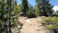
Popular Tabernash Mountain Biking Trails
• 95 ★ 2.7 • 4,049 ft • 0 ft • 311 •
Popular blue difficulty singletrack. This mountain bike primary trail can be used both directions. On average it takes 6 minutes to complete this trail.
• 100 ★ 2.4 • 919 ft • 32 ft • 270 •
Popular black diamond difficulty hike-a-bike. This mountain bike primary trail can be used both directions and has a hard overall physical rating with a 32 ft black diamond climb. On average it takes 1 minutes to complete this trail.
• 90 ★ 4.3 • 2 miles • 0 ft • 267 •
Popular blue difficulty singletrack. This mountain bike primary trail and has a moderate overall physical rating with a 0 ft blue climb. It features berm, bridge, jump and rock garden. Adaptive MTB rating: amtb green. Trail visibility is always easy to follow. On average it takes 12 minutes to complete this trail.
• 80 ★ 4.0 • 1 mile • 0 ft • 263 •
Popular blue difficulty alpine singletrack. This mountain bike primary trail can be used both directions and has a moderate overall physical rating with a 0 ft black diamond climb. It features rock garden. Adaptive MTB rating: amtb blue. Winter use: Backcountry snow grooming. Trail visibility is always easy to follow. On average it takes 9 minutes to complete this trail.
• 75 ★ 3.7 • 2,871 ft • 215 ft • 236 •
Steep but smooth primarily climbing oriented trail. Some tough switch backs.
• 60 ★ 3.0 • 1 mile • 337 ft • 198 •
Great flow trail that meets up with at the top. It has some overlap with the older Phase-In trail.
• 35 ★ 3.5 • 5,121 ft • 3 ft • 177 •
Less popular blue difficulty singletrack. This mountain bike primary trail can be used both directions. On average it takes 6 minutes to complete this trail.
• 50 ★ 1.0 • 1,001 ft • 0 ft • 165 •
Moderately popular blue difficulty singletrack. This mountain bike primary trail can be used both directions. On average it takes 1 minutes to complete this trail.
Tabernash Mountain Bike Routes
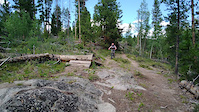
Photos of Tabernash Mountain Bike
Videos of Tabernash Mountain Bike
trail: Salad Bowl West
0:07 |
86 |
Aug 7, 2022
trail: Salad Bowl West
0:08 |
74 |
Aug 7, 2022
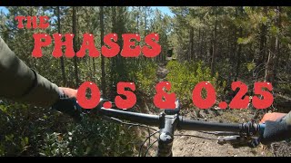
trail: Phase .5
13:12 |
229 |
Aug 28, 2022 , Tabernash
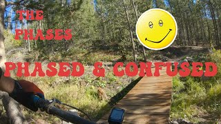
trail: Phased and Confused
7:45 |
319 |
Aug 28, 2022 , Tabernash
Recent Trail Reports
| status | trail | date | condition | info | user |
|---|---|---|---|---|---|
| New Phase 0.25 | May 24, 2026 @ 10:36am (America/Denver) May 24, 2026 | Ideal | Armin1 | ||
| Lower Fruit Loop | May 24, 2026 @ 10:36am (America/Denver) May 24, 2026 | Ideal | Armin1 | ||
| Froot Loop | May 24, 2026 @ 10:36am (America/Denver) May 24, 2026 | Ideal | Armin1 | ||
| Salad Bowl West | May 24, 2026 @ 10:36am (America/Denver) May 24, 2026 | Ideal | Armin1 | ||
| Salad Bowl East | May 24, 2026 @ 10:36am (America/Denver) May 24, 2026 | Ideal | Armin1 | ||
| Phase .5 | Oct 10, 2025 @ 1:34pm (America/Denver) Oct 10, 2025 | Ideal | ErroEtSpero | ||
| Phased and Confused | Oct 10, 2025 @ 1:34pm (America/Denver) Oct 10, 2025 | Ideal | ErroEtSpero | ||
| USFS 2751 | Oct 10, 2025 @ 1:34pm (America/Denver) Oct 10, 2025 | Ideal | ErroEtSpero | ||
| Ridge Runner | May 21, 2025 @ 7:47pm May 21, 2025 | Dry | spillcoleman | ||
| Phrooty Pebbles | Aug 31, 2023 @ 4:56am Aug 31, 2023 | Dry | earrieta |
Activity Feed
| username | action | type | title | date |
|---|---|---|---|---|
| Nasdaqian | comment | trail | activity #96927201 and 3 more | Jun 13, 2026 @ 5:03pm 22 hours |
| Nasdaqian | vote | trail | activity #96927173 and 5 more | Jun 13, 2026 @ 5:03pm 22 hours |
| Armin1 | add | report | activity #95446438 and 4 more | May 24, 2026 @ 2:33pm May 24, 2026 |
| jaymonger | ridden | trail | activity #94364484 | May 9, 2026 @ 11:46am May 9, 2026 |
| Mtnoak | wishlist | region | activity #93918612 | May 2, 2026 @ 9:48pm May 2, 2026 |
Recent Comments
| username | type | title | comment | date |
|---|---|---|---|---|
| trail | Lots of cool alternate lines down rock slabs... | Jun 13, 2026 @ 5:09pm 22 hours | ||
| trail | Not the best descent. The switchbacks are... | Jun 13, 2026 @ 5:06pm 22 hours | ||
| trail | Sweet flow trail that's easy to climb. | Jun 13, 2026 @ 5:05pm 22 hours | ||
| trail | it starts off weak but the second half is... | Jun 13, 2026 @ 5:03pm 22 hours | ||
| trail | bottom half is the best bit of trail in the... | Aug 4, 2025 @ 9:34am Aug 4, 2025 |
Local Badges
-

Epic Mountain Bike Climb 2k0 awarded -

Climbing 10k Badge0 awarded -

Mountain Biking 100k Badge0 awarded -

Epic Ride Descent 2k0 awarded -

Descent 10k Badge0 awarded -

Descent 100k Badge0 awarded
Activity Type Stats
| activitytype | trails | distance | descent | descent distance | total vertical | rating | global rank | state rank | photos | reports | routes | ridelogs |
|---|---|---|---|---|---|---|---|---|---|---|---|---|
| Mountain Bike | 16 | 14 miles | 2,546 ft | 6 miles | 725 ft | #6,218 | #2,104 | 20 | 100 | 1 | 712 | |
| E-Bike | 1 | 2 miles | 666 ft | 64 | 35 | |||||||
| Hike | 12 | 10 miles | 2,087 ft | 6 miles | 725 ft | #11,086 | #3,953 | 95 | 81 | |||
| Trail Running | 12 | 10 miles | 2,087 ft | 6 miles | 725 ft | #10,674 | #3,667 | 95 | 20 |
Frequently Asked Questions About Tabernash
▼
What are the best places to ride in Tabernash?
Tabernash has 1 areas to explore for mountain biking. The top rated areas are:
▼
What are the highest rated mountain biking trails in Tabernash?
The highest rated mountain biking trails in Tabernash are:
- Ridge Runner (4.2/5)
- New Phase 0.25 (4.1/5)
- Salad Spinner (4/5)
- Phrooty Pebbles (4/5)
- Lower Fruit Loop (4/5)
▼
What is the best time of the year to ride in Tabernash?
Based on ride log data, the most popular months to ride in Tabernash are:
- October (5 activities)
- August (3 activities)
▼
Where can I park to ride in Tabernash?
There are 1 parking locations listed in Tabernash. The most popular parking spots are:
- By SimonsJ
 & contributors
 - Admins: FVMTB
- #52167 - 1,516 views
- tabernash activity log | embed map of Tabernash mountain bike trails | tabernash mountain biking points of interest
Downloading of trail gps tracks in kml & gpx formats is enabled for Tabernash.
You must login to download files.