close
-
Layers w
- Weather Layers
- Pro
- Pro
- Pro
- Pro
- Pro
- Pro
- More Layers
- Pro
- Pro
- Pro
- Pro
-
Upgrade to

3D
Trail Conditions
- Unknown
- Snow Groomed
- Snow Packed
- Snow Covered
- Snow Cover Partial
- Freeze/thaw Cycle
- Icy
- Prevalent Mud
- Wet
- Variable
- Ideal
- Dry
- Very Dry
Trail Flow (Ridden Direction)
Trailforks scans users activity logs to determine the most popular direction each trail is ridden. A good flowing trail network will have most trails flowing in a single direction according to their intension.
The colour categories are based on what percentage of users are riding a trail in its intended direction.
The colour categories are based on what percentage of users are riding a trail in its intended direction.
- > 96%
- > 90%
- > 80%
- > 70%
- > 50%
- < 50%
- bi-directional trail
- no data
Trail Last Ridden
Trailforks scans activity logs to determine the last time a trail was ridden.
- < 2 days
- < 1 week
- < 2 weeks
- < 1 month
- < 6 months
- > 6 months
Trail Ridden Direction
The intended direction a trail should be ridden.
- Downhill Only
- Downhill Primary
- Both Directions
- Uphill Primary
- Uphill Only
- One Direction
Contribute Details
Colors indicate trail is missing specified detail.
- Description
- Photos
- Description & Photos
- Videos
Trail Popularity ?
Trailforks scans activity logs to determine which trails are ridden the most in the last 9 months.
Trails are compared with nearby trails in the same city region with a possible 25 colour shades.
Think of this as a heatmap, more activities = more kinetic energy = warmer colors.
- most popular
- popular
- less popular
- not popular
ATV/ORV/OHV Filter
Max Vehicle Width
inches
US Cell Coverage
Legend

Radar Time
Activity Recordings
Trailforks uses anonymized public activity data.
?
Activity Recordings
Trailforks uses anonymized public activity data.
?
Personal Heatmap
▶
Activity Types
all
/
none
▶
Options
2
Date range
month
–
Winter Trails
Warning
A routing network for winter maps does not exist. Selecting trails using the winter trails layer has been disabled.
Missing Trails
Most Popular
Least Popular
Trails are colored based on popularity. The more popular a trail is, the more red. Less popular trails trend towards green.
Jump Magnitude Heatmap
Heatmap of where users jump on trails. Zoom in to see individual jumps, click circles to view jump details.
BC Backroad Status
![map legend]()
Service Road Atlas is a free to use, community-driven service for viewing and creating reports on the numerous back-country service roads around B.C. and Alberta.

Slope Aspect
Direction the slope faces
Trails Deemphasized
Trails are shown in grey.
Only show trails with no bike usage.
Suggested Layers
Based on selected activity type
Save the current map location and zoom level as your default home location whenever this page is loaded.
Save
No description for The Beartooths has been added yet!
Login or register to submit one.
 google parking directions
google parking directions Activities Click to view
- Mountain Bike
16 trails
- E-Bike
0 trails
- Horse
20 trails
- Hike
34 trails
- Trail Running
34 trails
- Snowmobile
4 trails
Region Details
- 1
- 13
- 2
Region Status
Open as of Jun 4, 2026Stats
- Trails (view details)
- 28
- Trails Mountain Bike
- 16
- Trails Horse
- 20
- Trails Hike
- 34
- Trails Trail Running
- 34
- Trails ATV/ORV/OHV
- 1
- Trails Snowmobile
- 4
- Total Distance
- 111 miles
- Total Descent Distance
- 51 miles
- Total Descent
- 21,842 ft
- Total Vertical
- 4,909 ft
- Highest Trailhead
- 10,843 ft
- Reports
- 22
- Photos
- 58
- Completed Counter
- 100
Popular The Beartooths Mountain Biking Trails
• 75 ★ 4.4 • 16 miles • 1,059 ft • 152 •
Classicly shuttled, but Maurice Mountain Trail (the majority of the vertical) can be done as an out and back for a lot less faffing, and way more bang for your buck. is the upper portion above treeline, pretty rocky with lots of ups and...
• 40 ★ 3.0 • 2 miles • 488 ft • 11 •
4/4 stars for the scenery. Suggested direction Island Lake-Beartooth Lake, either shuttle or ride a short section of the Beartooth Highway to get back to Island Lake. Some rough sections in the first couple of miles. Bring a fly rod...
• 40 ★ 4.0 • 4 miles • 3,188 ft • 11 •
A super fun and rocky descent, pretty tough climb. Definitely a viable optional downhill, instead of Maurice, if you’re shuttling .
• 5 ★ 0.0 • 3 miles • 250 ft • 6 •
Less popular blue difficulty singletrack. This multi-use trail can be used both directions. On average it takes 1 hour1 minutes to complete this trail.
• 5 ★ 3.0 • 2 miles • 30 ft • 4 • • hike
Less popular blue difficulty alpine singletrack. This hike primary trail can be used both directions and has a moderate overall physical rating. Trail visibility is sometimes hard to follow.
• 45 ★ 0.0 • 1 mile • 16 ft • 3 •
Moderately popular blue difficulty singletrack. This multi-use trail can be used both directions. On average it takes 8 minutes to complete this trail.
• 5 ★ 0.0 • 8 miles • 4,216 ft • 2 •
Less popular blue difficulty singletrack. This multi-use trail can be used both directions.
• 45 ★ 0.0 • 5 miles • 272 ft • 2 •
Moderately popular blue difficulty singletrack. This multi-use trail can be used both directions.
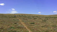
Photos of The Beartooths Mountain Bike
Videos of The Beartooths Mountain Bike
0:00 |
402 |
Sep 24, 2018
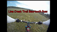
6:23 |
722 |
Jul 24, 2015
Recent Trail Reports
| status | trail | date | condition | info | user |
|---|---|---|---|---|---|
| Corral Creek | Jun 4, 2026 @ 6:48am (America/Boise) Jun 4, 2026 | Dry | Bikeram | ||
| Line Creek Plateau-Maurice Mountain | Sep 21, 2025 @ 2:28pm (America/Denver) Sep 21, 2025 | Unknown | landonstev | ||
| Beartooth Loop/Houser Lake Trail | Jul 20, 2024 @ 3:39pm Jul 20, 2024 | Unknown | kirkastroth |
Activity Feed
| username | action | type | title | date |
|---|---|---|---|---|
| russevertz | wishlist | trail | activity #99094492 | Jul 13, 2026 @ 6:36am Jul 13, 2026 |
| jwheat28 | wishlist | trail | activity #98297332 | Jul 2, 2026 @ 3:31pm Jul 2, 2026 |
| Rk15n | wishlist | trail | activity #98033726 | Jun 28, 2026 @ 4:41pm Jun 28, 2026 |
| Bikeram | add | report | activity #96232721 | Jun 4, 2026 @ 9:13am Jun 4, 2026 |
| Bluegroneman | wishlist | trail | activity #95563056 | May 26, 2026 @ 7:24am May 26, 2026 |
Recent Comments
| username | type | title | comment | date |
|---|---|---|---|---|
| trail | Trail is no worse than others in the area. A... | Jul 7, 2025 @ 3:52pm Jul 7, 2025 | ||
| trail | Not for everyone, this trail is slow and... | Jul 7, 2025 @ 3:51pm Jul 7, 2025 | ||
| trail | Good adventure riding -- water crossings,... | Jul 2, 2025 @ 1:10pm Jul 2, 2025 | ||
| trail | As a hiking trail this is 5 star for views and... | Sep 24, 2024 @ 8:53pm Sep 24, 2024 | ||
| trail | Double diamond tech down to the lake. Killer... | Sep 24, 2024 @ 8:46pm Sep 24, 2024 |
Nearby Areas
| name | distance | ||||
|---|---|---|---|---|---|
| Silver Run Trails | 2 | 6 | 5 | 11.1 km | |
| Red Lodge Mountain | 2 | 8 | 1 | 14.6 km | |
| Shoshone National Forest | 37 | 2 | 15.8 km | ||
| Absaroka-Beartooth Wilderness Area | 16 km | ||||
| Red Lodge City Trails | 5 | 16.1 km |
Activity Type Stats
| activitytype | trails | distance | descent | descent distance | total vertical | rating | global rank | state rank | photos | reports | routes | activity logs |
|---|---|---|---|---|---|---|---|---|---|---|---|---|
| Mountain Bike | 16 | 80 miles | 18,074 ft | 40 miles | 4,908 ft | #11,619 | #4,731 | 58 | 22 | 47 | ||
| Horse | 20 | 101 miles | 21,220 ft | 48 miles | 4,908 ft | #545 | #290 | 15 | ||||
| Hike | 34 | 111 miles | 21,841 ft | 51 miles | 4,908 ft | #1,813 | #783 | 22 | 116 | |||
| Trail Running | 34 | 111 miles | 21,841 ft | 51 miles | 4,908 ft | #1,435 | #391 | 22 | 13 | |||
| ATV/ORV/OHV | 1 | 16 miles | 4,705 ft | 10 miles | 3,891 ft | 3 | ||||||
| Snowmobile | 4 | #441 | #227 |
Frequently Asked Questions About The Beartooths
▼
What are the highest rated mountain biking trails in The Beartooths?
The highest rated mountain biking trails in The Beartooths are:
- Line Creek Plateau-Maurice Mountain (4.2/5)
- Corral Creek (4/5)
- Beartooth Rec Loop (3.8/5)
- Beauty Lake Trail (3.7/5)
- Beartooth Rec Loop (3.7/5)
▼
Where can I park to ride in The Beartooths?
There are 13 parking locations listed in The Beartooths. The most popular parking spots are: View all parking and trailhead locations on the map to plan your visit.
▼
What is the longest trail in The Beartooths?
The longest trail in The Beartooths is Line Creek Plateau-Maurice Mountain at 15.9 miles. View all trails sorted by distance.
▼
What are the best & highest rated hiking trails in The Beartooths?
The best hiking trails in The Beartooths are:
- Beartooth High Lake Trail
- Beartooth Cr Trail
- Beartooth Rec Loop
- Beauty Lake Trail
- Glacier Lake Trail
Activities
Trails
Points of Interest
- By markholloway
 Trailforks Map Team & contributors
 - Admins: Beartooth, Beartooth
- #46167 - 1,168 views
- the beartooths activity log | embed map of The Beartooths mountain bike trails | the beartooths mountain biking points of interest
Downloading of trail gps tracks in kml & gpx formats is enabled for The Beartooths.
You must login to download files.