close
-
Layers w
- Weather Layers
- Pro
- Pro
- Pro
- Pro
- Pro
- Pro
- More Layers
- Pro
- Pro
- Pro
- Pro
-
Upgrade to

3D
Trail Conditions
- Unknown
- Snow Groomed
- Snow Packed
- Snow Covered
- Snow Cover Partial
- Freeze/thaw Cycle
- Icy
- Prevalent Mud
- Wet
- Variable
- Ideal
- Dry
- Very Dry
Trail Flow (Ridden Direction)
Trailforks scans users ridelogs to determine the most popular direction each trail is ridden. A good flowing trail network will have most trails flowing in a single direction according to their intension.
The colour categories are based on what percentage of riders are riding a trail in its intended direction.
The colour categories are based on what percentage of riders are riding a trail in its intended direction.
- > 96%
- > 90%
- > 80%
- > 70%
- > 50%
- < 50%
- bi-directional trail
- no data
Trail Last Ridden
Trailforks scans ridelogs to determine the last time a trail was ridden.
- < 2 days
- < 1 week
- < 2 weeks
- < 1 month
- < 6 months
- > 6 months
Trail Ridden Direction
The intended direction a trail should be ridden.
- Downhill Only
- Downhill Primary
- Both Directions
- Uphill Primary
- Uphill Only
- One Direction
Contribute Details
Colors indicate trail is missing specified detail.
- Description
- Photos
- Description & Photos
- Videos
Trail Popularity ?
Trailforks scans ridelogs to determine which trails are ridden the most in the last 9 months.
Trails are compared with nearby trails in the same city region with a possible 25 colour shades.
Think of this as a heatmap, more rides = more kinetic energy = warmer colors.
- most popular
- popular
- less popular
- not popular
ATV/ORV/OHV Filter
Max Vehicle Width
inches
US Cell Coverage
Legend

Radar Time
Activity Recordings
Trailforks uses anonymized public activity data.
?
Activity Recordings
Trailforks uses anonymized public activity data.
?
Personal Heatmap
▶
Activity Types
all
/
none
▶
Options
2
Date range
month
–
Winter Trails
Warning
A routing network for winter maps does not exist. Selecting trails using the winter trails layer has been disabled.
Missing Trails
Most Popular
Least Popular
Trails are colored based on popularity. The more popular a trail is, the more red. Less popular trails trend towards green.
Jump Magnitude Heatmap
Heatmap of where riders jump on trails. Zoom in to see individual jumps, click circles to view jump details.
BC Backroad Status
![map legend]()
Service Road Atlas is a free to use, community-driven service for viewing and creating reports on the numerous back-country service roads around B.C. and Alberta.

Slope Aspect
Direction the slope faces
Trails Deemphasized
Trails are shown in grey.
Only show trails with no bike usage.
Suggested Layers
Based on selected activity type
Save the current map location and zoom level as your default home location whenever this page is loaded.
SaveArrondissement administratif de Thuin:
Anderlues, Beaumont, Binche, Chimay, Erquelinnes, Estinnes, Froidchapelle, Ham-sur-Heure-Nalinnes, Lobbes, Merbes-le-Château, Momignies, Morlanwelz, Sivry-Rance, Thuin
Anderlues, Beaumont, Binche, Chimay, Erquelinnes, Estinnes, Froidchapelle, Ham-sur-Heure-Nalinnes, Lobbes, Merbes-le-Château, Momignies, Morlanwelz, Sivry-Rance, Thuin
This region uses the Uk/Euro style trail grading system.
Activities Click to view
- Mountain Bike
16 trails
- E-Bike
10 trails
- Adaptive Bike
0 trails
- Hike
7 trails
- Trail Running
7 trails
Region Details
- 1
- 7
- 4
- 1
- 3
Region Status
Open as of Jun 14, 2026E-Bike Stats
- Global Ranking
- #2,079
- State Ranking
- #30
- Trails (view details)
- 10
- Trails Mountain Bike
- 16
- Trails E-Bike
- 10
- Trails Horse
- 1
- Trails Hike
- 7
- Trails Trail Running
- 7
- Lifts
- 1
- Total Distance
- 4 miles
- Total Descent Distance
- 3 miles
- Total Descent
- 1,050 ft
- Total Vertical
- 440 ft
- Reports
- 51
- Ridden Counter
- 45
Popular Thuin E-Biking Trails
• 5 ★ 2.7 • 1,388 ft • 0 ft • 5 •
Popular green difficulty singletrack. This mountain bike primary trail can be used downhill only. It features berm. On average it takes 1 minutes to complete this trail.
• 100 ★ 0.0 • 2,740 ft • 21 ft • 4 •
Basically a huge rock garden from top to bottom. Fun but not family friendly. Un gros pierrier du début à la fin. Fun mais pas pour les sorties en familles
• 90 ★ 0.0 • 1,020 ft • 0 ft • 3 •
small singletrack with a few tight switchback turns. Can be french linned by going directly down the hill, cutting the trail in the middle.
• 5 ★ 0.0 • 814 ft • 0 ft • 3 •
Increasingly more rocks as you go down De plus en plus de cailloux au fur et à mesure de la descente
• 75 ★ 0.0 • 1,624 ft • 9 ft • 2 •
Simple singletrack, flowy and enjoyable in both directions
• 5 ★ 0.0 • 2,841 ft • 27 ft • 2 •
Tight singletrack only thing a bit spicy is a little section a bit more steep before crossing the river. Petit singletrack assez serré. Seul section un peu plus difficile sera un endroit un peu plus pentu avant de traverser la rivière.
• 60 ★ 0.0 • 3,222 ft • 22 ft • 1 •
Small trail starting at the parking of the bike park and ending at the ravel down bellow. Very well maintained trail that will be as muh fun for beginners as for more advanced riders. small jumps and berms keep the ride interesting.
• 5 ★ 0.0 • 505 ft • 0 ft • 1 •
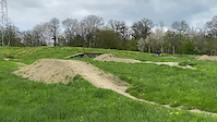
New 2023 variant of . here's the feature you'll see on the trail : a 5/6m wooden table, a 6m dirt table, a gap step up after a bridge, a drop then a small step up. All linked by beautiful berms.
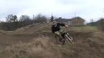
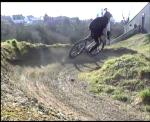
Videos of Thuin
trail: Keep cool (New variant)
0:12 |
72 |
May 1, 2023

trail: Dual Slalom
4:43 |
170 |
May 14, 2013

trail: Dual Slalom
2:12 |
1109 |
Jul 7, 2009
trail: Dual Slalom
4:22 |
535 |
Feb 16, 2009
trail: Dual Slalom
0:50 |
1042 |
Feb 18, 2008
Recent Trail Reports
| status | trail | date | condition | info | user |
|---|---|---|---|---|---|
| Keep cool (New variant) | May 1, 2023 @ 1:54pm May 1, 2023 | Ideal | Buzboz | ||
| Greenshow | May 1, 2023 @ 1:54pm May 1, 2023 | Ideal | Buzboz | ||
| Bord de l'eau | Apr 28, 2023 @ 7:32pm Apr 28, 2023 | Wet | ThomasESXZOT | ||
| DH vers les Badon | Apr 29, 2023 @ 2:32am Apr 29, 2023 | Ideal | ThomasESXZOT | ||
| Carpet Lift | Feb 12, 2022 @ 5:38am Feb 12, 2022 | Dry | TheHill MTBTheHill | ||
| Connector | Feb 12, 2022 @ 5:38am Feb 12, 2022 | Variable | TheHill MTBTheHill |
Activity Feed
| username | action | type | title | date |
|---|---|---|---|---|
| flichtle | wishlist | trail | activity #90021817 | Mar 5, 2026 @ 11:30am Mar 5, 2026 |
| Jochend | wishlist | region | activity #89131496 | Feb 18, 2026 @ 9:34am Feb 18, 2026 |
| Kristof87 | ridden | trail | activity #45026117 and 4 more | Oct 8, 2023 @ 11:19pm Oct 8, 2023 |
| Buzboz | add | trail | activity #40610902 and 3 more | Jun 4, 2023 @ 11:06am Jun 4, 2023 |
| Buzboz | add | report | activity #39564029 and 7 more | May 1, 2023 @ 1:55pm May 1, 2023 |
Activity Type Stats
| activitytype | trails | distance | descent | descent distance | total vertical | rating | global rank | state rank | photos | reports | routes | ridelogs |
|---|---|---|---|---|---|---|---|---|---|---|---|---|
| Mountain Bike | 16 | 5 miles | 1,368 ft | 3 miles | 440 ft | #6,353 | #35 | 5 | 51 | 2 | 3,193 | |
| E-Bike | 10 | 4 miles | 1,050 ft | 3 miles | 440 ft | #2,079 | #30 | 51 | 198 | |||
| Horse | 1 | 2,740 ft | 217 ft | 2,044 ft | 217 ft | 10 | ||||||
| Hike | 7 | 4 miles | 948 ft | 2 miles | 440 ft | #3,514 | #35 | 43 | 123 | |||
| Trail Running | 7 | 4 miles | 948 ft | 2 miles | 440 ft | #2,988 | #35 | 43 | 15 |
Frequently Asked Questions About Thuin
▼
What are the best places to ride in Thuin?
Thuin has 1 areas to explore for e-biking.
▼
What are the highest rated e-biking trails in Thuin?
The highest rated e-biking trails in Thuin are:
- Petit Poggio (0/5)
- Descent stones (0/5)
- Bord de l'eau (0/5)
- DH vers les Badon (0/5)
- Greenshow (0/5)
▼
What is the best time of the year to ride in Thuin?
Based on ride log data, the most popular months to ride in Thuin are:
- May (10 activities)
- July (8 activities)
- June (7 activities)
▼
Where can I park to ride in Thuin?
There are 1 parking locations listed in Thuin. The most popular parking spots are:
- By Jenstin
 TRAILFORKS & contributors
 - Admins: apply
- #24388 - 2,013 views
- thuin activity log | embed map of Thuin mountain bike trails | thuin mountain biking points of interest polygons
Downloading of trail gps tracks in kml & gpx formats is enabled for Thuin.
You must login to download files.