close
-
Layers w
- Weather Layers
- Pro
- Pro
- Pro
- Pro
- Pro
- Pro
- More Layers
- Pro
- Pro
- Pro
- Pro
-
Upgrade to

3D
Trail Conditions
- Unknown
- Snow Groomed
- Snow Packed
- Snow Covered
- Snow Cover Partial
- Freeze/thaw Cycle
- Icy
- Prevalent Mud
- Wet
- Variable
- Ideal
- Dry
- Very Dry
Trail Flow (Ridden Direction)
Trailforks scans users ridelogs to determine the most popular direction each trail is ridden. A good flowing trail network will have most trails flowing in a single direction according to their intension.
The colour categories are based on what percentage of riders are riding a trail in its intended direction.
The colour categories are based on what percentage of riders are riding a trail in its intended direction.
- > 96%
- > 90%
- > 80%
- > 70%
- > 50%
- < 50%
- bi-directional trail
- no data
Trail Last Ridden
Trailforks scans ridelogs to determine the last time a trail was ridden.
- < 2 days
- < 1 week
- < 2 weeks
- < 1 month
- < 6 months
- > 6 months
Trail Ridden Direction
The intended direction a trail should be ridden.
- Downhill Only
- Downhill Primary
- Both Directions
- Uphill Primary
- Uphill Only
- One Direction
Contribute Details
Colors indicate trail is missing specified detail.
- Description
- Photos
- Description & Photos
- Videos
Trail Popularity ?
Trailforks scans ridelogs to determine which trails are ridden the most in the last 9 months.
Trails are compared with nearby trails in the same city region with a possible 25 colour shades.
Think of this as a heatmap, more rides = more kinetic energy = warmer colors.
- most popular
- popular
- less popular
- not popular
ATV/ORV/OHV Filter
Max Vehicle Width
inches
US Cell Coverage
Legend

Radar Time
Activity Recordings
Trailforks uses anonymized public activity data.
?
Activity Recordings
Trailforks uses anonymized public activity data.
?
Personal Heatmap
▶
Activity Types
all
/
none
▶
Options
2
Date range
month
–
Winter Trails
Warning
A routing network for winter maps does not exist. Selecting trails using the winter trails layer has been disabled.
Missing Trails
Most Popular
Least Popular
Trails are colored based on popularity. The more popular a trail is, the more red. Less popular trails trend towards green.
Jump Magnitude Heatmap
Heatmap of where riders jump on trails. Zoom in to see individual jumps, click circles to view jump details.
BC Backroad Status
![map legend]()
Service Road Atlas is a free to use, community-driven service for viewing and creating reports on the numerous back-country service roads around B.C. and Alberta.

Slope Aspect
Direction the slope faces
Trails Deemphasized
Trails are shown in grey.
Only show trails with no bike usage.
Suggested Layers
Based on selected activity type
Save the current map location and zoom level as your default home location whenever this page is loaded.
Save
No description for Torbole has been added yet!
Login or register to submit one.
This region uses the Uk/Euro style trail grading system.
Activities Click to view
- Mountain Bike
112 trails
- E-Bike
105 trails
- Gravel Bike
1 trails
- Adaptive Bike
- Winter Fat Bike
0 trails
- Horse
28 trails
- Hike
111 trails
- Trail Running
108 trails
- Observed Trials
4 trails
Region Details
- 33
- 9
- 10
- 17
- 1
Region Status
Open as of 2 daysStats
- Avg Trail Rating
- Trails (view details)
- 112
- Trails Mountain Bike
- 112
- Trails E-Bike
- 105
- Trails Gravel Bike
- 1
- Trails Horse
- 28
- Trails Hike
- 111
- Trails Trail Running
- 108
- Trails Dirtbike/Moto
- 3
- Trails Observed Trials
- 4
- Trails ATV/ORV/OHV
- 1
- Total Distance
- 194 miles
- Total Descent
- 90,058 ft
- Total Vertical
- 6,539 ft
- Highest Trailhead
- 6,742 ft
- Reports
- 1,358
- Photos
- 473
- Ridden Counter
- 7,194
Sub Regions
-
Garda Trentino Outdoor Region
- 10
- 10
- 17
- 6
- 23
- 1
Popular Torbole Mountain Biking Trails
• 100 ★ 4.1 • 2 miles • 277 ft • 1,782 •
famous military road. shared double track with hikers.
• 100 ★ 4.0 • 4 miles • 3,532 ft • 1,189 •
Mosty gravel road with nice gradient, the last 1,5 km is very steep
• 95 ★ 4.2 • 4,859 ft • 109 ft • 774 •
This is the official bike route to/from Rocchetta, and a hiking trail also -so watch for people and MTBikers in front of you! Going down there are some roots and rocks, and one can go really fast - as long as there is no one else on the...
• 75 ★ 4.5 • 3 miles • 0 ft • 651 •
Technical trail part of Alto Garda Bike Park. The trail start with a very steep and rocky section. Then the upper middle part is a very nice technical track. After the jumps begin the hardest part(lower middle) of with many consecutive...
• 100 ★ 5.0 • 4 miles • 61 ft • 628 •
The Torbole-Sarche pedestrian and cycle path is one of the best-loved trails in Garda Trentino. An easy route through natural surroundings it is perfect for a relaxing bicycle trip The Torbole - Sarche cycle path follows the River Sarca...
• 90 ★ 3.9 • 2,513 ft • 0 ft • 579 •
Very short trail. Only first part from start to first road is available. Every other section is permanently closed and forbidden to ride with a bike. Unfortunately. So you are forced to ride paved road bottom of the hill.
• 95 ★ 4.0 • 2 miles • 1,427 ft • 577 •
Popular white difficulty dirt/gravel road. This multi-use trail can be used both directions and has a hard overall physical rating with a 1,427 ft green climb. Trail visibility is always easy to follow. On average it takes 49 minutes to complete this trail.
Torbole Mountain Bike Routes
★ 4.0 • 25 miles • 5,908 ft • 1 • Loop •
Nice loop starting from riva or arco. Climb monte Velo from Massone up to passo due sassi and then to...
★ 3.0 • 18 miles • 1,406 ft • 2 • Loop •
A simple tour, accessible to many. Starting from Arco, the route covers both sides of the Sarca valley,...
23 miles • 4,567 ft • 2 •
You will start the climb in Torbole and follow the way to Monte Altissimo. Once you arrive at the radio...
30 miles • 5,178 ft • 0 • Loop •
Nice XC tour that let you discover an hidden part of North Garda Lake territory. It goes through some...
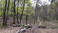
Photos of Torbole Mountain Bike
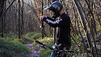
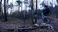
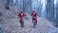
Videos of Torbole Mountain Bike
trail: Training Trail
5:25 |
25 |
Jan 2, 2026
trail: Training Trail
0:15 |
20 |
Jan 1, 2026
trail: Sentiero Lastroni
2:15 |
30 |
Dec 31, 2025
trail: 409b Piazzole Trail
6:44 |
530 |
Mar 9, 2022
trail: Val del Diaol
0:19 |
366 |
Jan 16, 2022
trail: Seicentouno (601)
0:10 |
480 |
Dec 9, 2020
trail: Val del Diaol
0:34 |
253 |
Jan 16, 2020
trail: Val del Diaol
3:35 |
197 |
Dec 26, 2018
Current Trail Warnings
| status | trail | date | condition | user | info |
|---|---|---|---|---|---|
| 409b Piazzole Trail Upper | Jun 22, 2026 @ 3:17pm (Europe/Rome) 2 days | Unknown | notyoungnotalent | Large tree across the trail, possible to... | |
| Val del Diaol Connection | Jun 19, 2026 @ 10:53am (Europe/Vaduz) Jun 19, 2026 | Variable | glennverner | So many bushes is blocking some part of... | |
| Altissimo - 601 | Jun 19, 2026 @ 10:53am (Europe/Vaduz) Jun 19, 2026 | Unknown | glennverner | From top it's loose rocks, witch is ok,... |
Recent Trail Reports
| status | trail | date | condition | info | user |
|---|---|---|---|---|---|
| Val del Diaol | Jun 19, 2026 @ 10:53am (Europe/Vaduz) Jun 19, 2026 | Variable | glennverner | ||
| Epic rolling stones | Jun 11, 2026 @ 11:02am (Europe/Rome) Jun 11, 2026 | Ideal | EconoDN | ||
| The Coast Trail | Jun 11, 2026 @ 11:02am (Europe/Rome) Jun 11, 2026 | Dry | EconoDN | ||
| Naranch | Jun 11, 2026 @ 11:02am (Europe/Rome) Jun 11, 2026 | Ideal | EconoDN | ||
| Naranch Connection | Jun 11, 2026 @ 11:02am (Europe/Rome) Jun 11, 2026 | Ideal | EconoDN | ||
| Hammer Connection | Jun 11, 2026 @ 11:02am (Europe/Rome) Jun 11, 2026 | Variable | EconoDN | ||
| 409b Piazzole Trail | May 27, 2026 @ 7:47pm (Europe/Rome) May 27, 2026 | Ideal | x7c7oMR | ||
| Monte Brione Trail | May 27, 2026 @ 1:50pm (Europe/Rome) May 27, 2026 | Unknown | Reini1337 | ||
| La Guarda | May 26, 2026 @ 10:45am (Europe/Rome) May 26, 2026 | Ideal | nightout80 | ||
| Nago - Parcheggio Varagna | May 26, 2026 @ 10:45am (Europe/Rome) May 26, 2026 | Ideal | nightout80 |
Activity Feed
| username | action | type | title | date |
|---|---|---|---|---|
| Paua | ridden | trail | activity #97642762 | Jun 23, 2026 @ 11:51am 8 hours |
| notyoungnotalent | add | report | activity #97556987 | Jun 22, 2026 @ 6:17am 2 days |
| nsimon | ridden | trail | activity #97546975 | Jun 22, 2026 @ 12:28am 2 days |
| mostlynejc | wishlist | trail | activity #97544403 and 1 more | Jun 21, 2026 @ 10:59pm 2 days |
| mostlynejc | wishlist | trail | activity #97411275 and 2 more | Jun 20, 2026 @ 10:33am Jun 20, 2026 |
Recent Comments
| username | type | title | comment | date |
|---|---|---|---|---|
| trail | Vista mozzafiato! Resto cosi cosi….. fatto o... | Jun 7, 2026 @ 11:29am Jun 7, 2026 | ||
| trail | Bel pezzo se asciutto. Fatto ieri con mio... | Jun 1, 2026 @ 7:31am Jun 1, 2026 | ||
| trail | Bella divertente con tanto flow. | Jun 1, 2026 @ 7:28am Jun 1, 2026 | ||
| trail | Fatto ieri e oggi con mio figlio. Molto bello... | Jun 1, 2026 @ 7:27am Jun 1, 2026 | ||
| trail | Fatto ieri con mio figlio. Veramente bello,... | Jun 1, 2026 @ 6:01am Jun 1, 2026 |
Local Badges
-

Descent 10k Badge13 awarded -

Epic Mountain Bike Climb 2k155 awarded -

Climbing 10k Badge12 awarded -

Mountain Biking 100k Badge1 awarded -

Epic Ride Descent 2k155 awarded -

Big Ride 30k336 awarded
Bike & Skill Parks
| name | type | city | rating |
|---|---|---|---|
| Crossodromo ai Laghi | skill park | Torbole | |
| BMX Track | skill park | Torbole |
Activity Type Stats
| activitytype | trails | distance | descent | descent distance | total vertical | rating | global rank | state rank | photos | reports | routes | ridelogs |
|---|---|---|---|---|---|---|---|---|---|---|---|---|
| Mountain Bike | 112 | 182 miles | 81,749 ft | 84 miles | 6,539 ft | #705 | #12 | 477 | 1,358 | 6 | 18,427 | |
| E-Bike | 105 | 177 miles | 79,892 ft | 81 miles | 6,539 ft | #552 | #52 | 4 | 1,236 | 2 | 3,922 | |
| Gravel Bike | 1 | #419 | #149 | 185 | ||||||||
| Horse | 28 | 48 miles | 15,351 ft | 19 miles | 6,470 ft | #905 | #27 | 182 | ||||
| Hike | 111 | 173 miles | 85,052 ft | 88 miles | 6,539 ft | #1,017 | #30 | 1,344 | 1,246 | |||
| Trail Running | 108 | 164 miles | 75,682 ft | 78 miles | 6,539 ft | #860 | #24 | 1,304 | 434 | |||
| Dirtbike/Moto | 3 | 9 miles | 213 ft | 3,848 ft | 4,580 ft | 1 | 119 | |||||
| Observed Trials | 4 | 4 miles | 157 ft | 3,973 ft | 3,097 ft | #72 | #4 | 14 | 1 | |||
| ATV/ORV/OHV | 1 | 7 miles | 636 ft | 4,364 ft | 3,235 ft | 120 |
Frequently Asked Questions About Torbole
▼
What are the best places to ride in Torbole?
Torbole has 1 areas to explore for mountain biking. The top rated areas are:
▼
What are the highest rated mountain biking trails in Torbole?
The highest rated mountain biking trails in Torbole are:
- 409b Piazzole Trail (4.4/5)
- Val del Diaol (4.4/5)
- Teacher's Trail (4.4/5)
- Ciclabile Valle del Sarca (Torbole - Arco) (4.4/5)
- PerElisa (4.3/5)
▼
What is the best time of the year to ride in Torbole?
Based on ride log data, the most popular months to ride in Torbole are:
- July (128 activities)
- September (102 activities)
- October (84 activities)
▼
Where can I park to ride in Torbole?
There are 12 parking locations listed in Torbole. The most popular parking spots are: View all parking and trailhead locations on the map to plan your visit.
Activities
Trails
- By micheletraversi
 SGREBENZONE & contributors
 - Admins: caval, larry81541, micheletraversi
- #69706 - 2,307 views
- torbole activity log | embed map of Torbole mountain bike trails | torbole mountain biking points of interest
Downloading of trail gps tracks in kml & gpx formats is enabled for Torbole.
You must login to download files.