
close
3D
Trail Conditions
- Unknown
- Snow Groomed
- Snow Packed
- Snow Covered
- Snow Cover Partial
- Freeze/thaw Cycle
- Icy
- Prevalent Mud
- Wet
- Variable
- Ideal
- Dry
- Very Dry
Trail Flow (Ridden Direction)
Trailforks scans users activity logs to determine the most popular direction each trail is ridden. A good flowing trail network will have most trails flowing in a single direction according to their intension.
The colour categories are based on what percentage of users are riding a trail in its intended direction.
The colour categories are based on what percentage of users are riding a trail in its intended direction.
- > 96%
- > 90%
- > 80%
- > 70%
- > 50%
- < 50%
- bi-directional trail
- no data
Trail Last Used
Trailforks scans activity logs to determine the last time a trail was ridden.
- < 2 days
- < 1 week
- < 2 weeks
- < 1 month
- < 6 months
- > 6 months
Trail Ridden Direction
The intended direction a trail should be ridden.
- Downhill Only
- Downhill Primary
- Both Directions
- Uphill Primary
- Uphill Only
- One Direction
Contribute Details
Colors indicate trail is missing specified detail.
- Description
- Photos
- Description & Photos
- Videos
Trail Popularity ?
Trailforks scans activity logs to determine which trails are ridden the most in the last 9 months.
Trails are compared with nearby trails in the same city region with a possible 25 colour shades.
Think of this as a heatmap, more activities = more kinetic energy = warmer colors.
- most popular
- popular
- less popular
- not popular
ATV/ORV/OHV Filter
Max Vehicle Width
inches
US Cell Coverage
Legend

Radar Time
Activity Recordings
Trailforks uses anonymized public activity data.
?
Activity Recordings
Trailforks uses anonymized public activity data.
?
Winter Trails
Warning
A routing network for winter maps does not exist. Selecting trails using the winter trails layer has been disabled.
Missing Trails
Most Popular
Least Popular
Trails are colored based on popularity. The more popular a trail is, the more red. Less popular trails trend towards green.
Jump Magnitude Heatmap
Heatmap of where users jump on trails. Zoom in to see individual jumps, click circles to view jump details.
BC Backroad Status
![map legend]()
Service Road Atlas is a free to use, community-driven service for viewing and creating reports on the numerous back-country service roads around B.C. and Alberta.

Slope Aspect
Direction the slope faces
Trails Deemphasized
Trails are shown in grey.
Only show trails with no bike usage.
Suggested Layers
Based on selected activity type
Save the current map location and zoom level as your default home location whenever this page is loaded.
SaveTorriglia trails and routes are listed on Trailforks with interactive trail maps, difficulty ratings, photos, and user-reported trail conditions. The Trailforks community has shared hundreds of photos from this region. Supported activity types include Mountain Biking, Hiking, Trail Running, E-Biking, Winter Fat Biking and Adaptive Biking. Scenery includes views. Popular destinations include Antola Bike Trails Area.
This is an auto-generated description of Torriglia.
Login or register to submit a custom description.
This region uses the Uk/Euro style trail grading system.
Trail info last updated
Activities Click to view
- Mountain Bike
35 trails
- E-Bike
19 trails
- Adaptive Bike
6 trails
- Winter Fat Bike
9 trails
- Hike
30 trails
- Trail Running
30 trails
Region Details
- 7
- 1
- 23
- 4
Region Status
Caution as of Nov 3, 2026Stats
- Avg Trail Rating
- Trails (view details)
- 35
- Trails Mountain Bike
- 35
- Trails E-Bike
- 19
- Trails Gravel Bike
- 7
- Trails Adaptive Bike
- 6
- Trails Winter Fat Bike
- 9
- Trails Hike
- 30
- Trails Trail Running
- 30
- Total Distance
- 68 miles
- Total Descent
- 25,684 ft
- Total Vertical
- 4,840 ft
- Highest Trailhead
- 5,193 ft
- Reports
- 302
- Photos
- 107
- Completed Counter
- 1,594
Sub Regions
-
Antola Bike Trails Area
- 1
- 19
- 4
Popular Torriglia Mountain Biking Trails
• 95 ★ 4.0 • 3,966 ft • 43 ft • 85 •
Popular blue difficulty singletrack. This mountain bike primary trail can be used downhill primary. It features berm and jump. On average it takes 3 minutes to complete this trail.
• 90 ★ 4.2 • 4,150 ft • 24 ft • 78 •
Popular blue difficulty singletrack. This mountain bike primary trail can be used downhill primary. On average it takes 12 minutes to complete this trail.
• 100 ★ 4.5 • 2,081 ft • 7 ft • 77 •
Popular blue difficulty singletrack. This mountain bike primary trail can be used downhill primary. On average it takes 3 minutes to complete this trail.
• 75 ★ 5.0 • 2 miles • 156 ft • 55 •
Sentiero molto bello che dalla vetta del M. Antola percorre il sentiero più logico verso Avosso e Donnetta passando dal Rif. Antola (evitabile tralasciando la deviazione e proseguendo sempre dritti) . A case del Piccetto seguendo il...
• 90 ★ 3.5 • 4,642 ft • 0 ft • 54 •
Popular blue difficulty singletrack. This mountain bike primary trail can be used downhill primary and has a moderate overall physical rating with a 0 ft blue climb. Trail visibility is always easy to follow. On average it takes 7 minutes to complete this trail.
• 80 ★ 0.0 • 2 miles • 332 ft • 43 •
Sentiero solitamente largo e con fondo regolare con saliscendi nel bosco, un paio di ripidi tecnici all'incirca a metà, di cui il secondo molto lungo e smosso. Alla fine si può proseguire sulla strada che si trova davanti verso il...
• 65 ★ 4.0 • 4,566 ft • 62 ft • 40 •
Moderately popular blue difficulty singletrack. This mountain bike primary trail can be used downhill only. On average it takes 3 minutes to complete this trail.
• 35 ★ 3.0 • 3,701 ft • 0 ft • 36 •
Trail divertentissimo che attacca con delle stupende compressioni. Attenzione al bagnato. Fatevi accompagnare dai ragazzi di Antola Bike Park, a Torriglia presso Bar Garitta.
Torriglia Mountain Bike Routes
4,649 ft • 4 •
La parte terminale del Trail originale è stata abbandonata ed è stata così modificata
15 miles • 2,187 ft • 0 •
Bellissimo single-track che porta dalla cima del Monte Antola fino al Monte Banca dove con una bellissima...
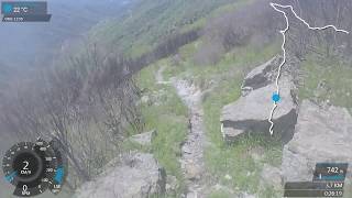
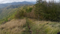
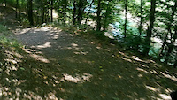
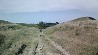
Photos of Torriglia Mountain Bike
Videos of Torriglia Mountain Bike


Recent Trail Reports
| status | trail | date | condition | info | user |
|---|---|---|---|---|---|
| Avosso | Sep 9, 2026 @ 6:46pm (Europe/Rome) Sep 9, 2026 | Variable | danilo959 | ||
| Caucaso - Cavallina- Croci - S.Rocco | Sep 3, 2026 @ 4:51pm (Europe/Rome) Sep 3, 2026 | Ideal | marionide | ||
| Ferrada - Passo Della Scoglina | Sep 3, 2026 @ 4:50pm (Europe/Rome) Sep 3, 2026 | Ideal | marionide | ||
| Santa Maria | Aug 7, 2026 @ 7:33pm (Europe/Rome) Aug 7, 2026 | Ideal | Panetz | ||
| Accesso al Monte Lavagnola | Jul 10, 2026 @ 9:03pm (Europe/Rome) Jul 10, 2026 | Ideal | Corrado64 | ||
| Access trail for Spingibello (and the Bull park too) | Jul 10, 2026 @ 9:02pm (Europe/Rome) Jul 10, 2026 | Ideal | Corrado64 | ||
| Spingibello | Jul 10, 2026 @ 8:58pm (Europe/Rome) Jul 10, 2026 | Ideal | Corrado64 | ||
| Toro 1 | Jul 10, 2026 @ 8:57pm (Europe/Rome) Jul 10, 2026 | Dry | Corrado64 | ||
| Amazzonika | Jul 10, 2026 @ 8:54pm (Europe/Rome) Jul 10, 2026 | Very Dry | Corrado64 | ||
| AV Portello Scofera | Jun 21, 2026 @ 8:59am (Europe/Monaco) Jun 20, 2026 | Ideal | elbati |
Activity Feed
| username | action | type | title | date |
|---|---|---|---|---|
| MZ2005 | vote | trail | activity #106000985 | Oct 16, 2026 @ 11:52am Oct 16, 2026 |
| danilo959 | add | report | activity #103418532 | Sep 9, 2026 @ 9:46am Sep 9, 2026 |
| marionide | add | report | activity #102959112 and 1 more | Sep 3, 2026 @ 7:50am Sep 3, 2026 |
| PabloSupertrampgbqn5j | wishlist | route | activity #102841871 | Sep 1, 2026 @ 12:25pm Sep 1, 2026 |
| usTte3 | add | photo | activity #102138957 and 7 more | Aug 23, 2026 @ 5:22am Aug 23, 2026 |
Recent Comments
| username | type | title | comment | date |
|---|---|---|---|---|
| trail | Trail in extremely poor condition. Do not... | Dec 28, 2025 @ 1:47pm Dec 28, 2025 | ||
| trail | Do not ride this trail Iit has had, a large... | Dec 28, 2025 @ 1:45pm Dec 28, 2025 | ||
| trail | What out when leaving the old village of... | Jan 25, 2025 @ 7:09am Jan 25, 2025 | ||
| trail | In alcuni punti diventa difficile individuare... | Nov 12, 2024 @ 9:57am Nov 12, 2024 | ||
| trail | erreno molto selvaggio ma percorribile | Nov 12, 2024 @ 9:53am Nov 12, 2024 |
Local Badges
-

10 Blue Trails20 awarded -

Epic Ride Climb 2k263 awarded -

Climbing 10k Badge32 awarded -

Climbing 100k Badge3 awarded -

Epic Ride Descent 2k274 awarded -

Descent 10k Badge32 awarded
Activity Type Stats
| activitytype | trails | distance | descent | descent distance | total vertical | rating | global rank | state rank | photos | reports | routes | activity logs |
|---|---|---|---|---|---|---|---|---|---|---|---|---|
| Mountain Bike | 35 | 68 miles | 25,682 ft | 37 miles | 4,839 ft | #3,494 | #192 | 37 | 302 | 2 | 2,182 | |
| E-Bike | 19 | 36 miles | 10,292 ft | 18 miles | 3,205 ft | #2,333 | #246 | 69 | 241 | 1 | 438 | |
| Gravel Bike | 7 | 24 miles | 3,038 ft | 7 miles | 3,271 ft | #5,613 | #429 | 28 | 1 | |||
| Adaptive Bike | 6 | 15 miles | 2,310 ft | 5 miles | 1,713 ft | #3,506 | #231 | 48 | ||||
| Winter Fat Bike | 9 | 18 miles | 8,232 ft | 13 miles | 3,724 ft | #1,888 | #92 | 85 | ||||
| Hike | 30 | 57 miles | 22,615 ft | 33 miles | 4,839 ft | #4,614 | #194 | 1 | 289 | 179 | ||
| Trail Running | 30 | 57 miles | 22,615 ft | 33 miles | 4,839 ft | #4,028 | #175 | 284 | 33 |
Frequently Asked Questions
▼
What are the best places to ride in Torriglia?
Torriglia has 1 areas to explore for mountain biking. The top rated areas are:
▼
What are the highest rated mountain biking trails in Torriglia?
The highest rated mountain biking trails in Torriglia are:
- Caucaso - Cavallina- Croci - S.Rocco (4.3/5)
- La Panchine alternate entrance (4.2/5)
- Toro 2 (4.2/5)
- M. Antola - P.sso del Colletto (4.1/5)
- Amazzonika (4.1/5)
▼
What is the best time of the year to ride in Torriglia?
Based on activity log data, the most popular months to ride in Torriglia are:
- August (14 activities)
- July (13 activities)
- May (10 activities)
▼
Where can I park to ride in Torriglia?
Check the Torriglia trail map for trailhead and parking information. Community members regularly update access and parking details for trails in the area.
▼
What is the longest trail in Torriglia?
The longest trail in Torriglia is Costa Gallina at 8.9 km. View all trails sorted by distance.
▼
What are the best & highest rated hiking trails in Torriglia?
The best hiking trails in Torriglia are: View all hiking trails sorted by popularity score.
▼
What are the best & highest rated trail running trails in Torriglia?
The best trail running trails in Torriglia are: View all trail running trails sorted by popularity score.
▼
How many trails are in Torriglia?
Torriglia has a total of 35 trails. Browse top mountain biking trails in Torriglia to find detailed information including difficulty ratings, distances, and trail conditions.
▼
Which trail has the most elevation gain in Torriglia?
The trail with the most elevation gain in Torriglia is Casa del Romano To Antola with 288 m of elevation gain. View all trails sorted by elevation gain.
▼
Which trail has the most elevation descent in Torriglia?
The trail with the most elevation descent in Torriglia is Le Panchine with 780 m of elevation descent. View all trails sorted by elevation descent.
▼
What activities are most popular in Torriglia?
Torriglia supports the following activities: Mountain Biking, E-Biking, Adaptive Biking, Winter Fat Biking, Hiking, Trail Running.
▼
What are the steepest mountain biking trails in Torriglia?
The steepest mountain biking trail in Torriglia is Spigo with an average grade of 9.1%. View all trails sorted by grade.
▼
Are the trails open in Torriglia?
The overall region status for Torriglia is Minor Issue / Yellow. Out of 32 trails:
- Clear / Green: 22
- Minor Issue / Yellow: 6
- Significant Issue / Amber: 2
- Closed: 2
▼
Can I ride an ebike in Torriglia?
Yes, Torriglia supports e-bike riding. There are 15 trails in Torriglia that allow e-bikes. Check the e-bike trails listing for specific trail access details and any local regulations.
▼
What are the most popular mountain biking routes in Torriglia?
The most popular mountain biking routes in Torriglia are: View all mountain biking routes in Torriglia.
▼
What type of bike is most common in Torriglia?
Based on activity log data, the most common bike types used in Torriglia are:
- AM (4 activities)
- DH (1 activities)
▼
What is the highest summit in Torriglia?
The highest summit in Torriglia is Poggio Rondino at 1,623 m elevation.
▼
What are the most popular Strava Segments in Torriglia?
The most popular Strava segments in Torriglia are:
- DH Passo del Portello - SS45 (2,343 athletes)
- passo portello short (real) (1,460 athletes)
- Quota1000 a galleria (1,283 athletes)
▼
What trails are closed in Torriglia?
There are currently 2 closed trails in Torriglia. The breakdown of all trail statuses is:
- Clear / Green: 22
- Minor Issue / Yellow: 6
- Significant Issue / Amber: 2
- Closed: 2
▼
Are there accessible or adaptive trails in Torriglia?
Yes, there are 6 accessible/adaptive trails in Torriglia. View all adaptive trails in Torriglia for specific accessibility information.
▼
What are the most popular mountain biking trails in Torriglia?
The most popular mountain biking trails in Torriglia are: View all mountain biking trails sorted by popularity.
▼
What are the best beginner ride trails in Torriglia?
The best beginner mountain biking trails in Torriglia are: View all beginner mountain biking trails in Torriglia.
Activities
Trails
Points of Interest
- By tvrbo & contributors
- Admins: denitopia, linomak
- #20792 - 3,484 views
- torriglia activity log | embed map of Torriglia mountain bike trails |
Downloading of trail gps tracks in kml & gpx formats is enabled for Torriglia.
You must login to download files.
