
more stats
1.5 miles
Distance
762 ft
Climb
-45 ft
Descent
3,630 ft
High Point
717 ft
Altitude change
2,912 ft
Altitude min
2,912 ft
Altitude start
3,629 ft
Altitude end
9.1%
Grade
-13.9%
Grade max
60.6%
Grade min
1 mile
Distance climb
1,519 ft
Distance down
367 ft
Distance flat

Spigo Details

  • Activities
    • Mountain Bike
    • E-Bike
    • Hike
    • Trail Running
  • Riding Area
  • Difficulty Rating
  • Local Popularity
    5 in Mountain Biking heatmap [+]
    • 50 in E-Biking
    • 5 in Trail Running
    • 5 in Hiking
  • Global Ranking
    #369744 in Mountain Biking [+]
    • #119355 in E-Biking
    • #393503 in Trail Running
    • #391165 in Hiking
  • National Ranking
    #24,441 in Mountain Biking · Italy [+]
    • #12,026 in E-Biking
    • #16,233 in Trail Running
    • #16,056 in Hiking
  • Hiking SAC Scale
    T2 Mountain Hiking
  • Trail Type
    Singletrack
  • Bike Type
    AM
  • Direction
    Both Directions
  • Climb Difficulty
    Blue
  • Physical Rating
    Moderate
  • Trail Visibility
    Always easy to follow
  • Dogs Allowed
    Yes
  • eBike Allowed
    Yes up to Class 1

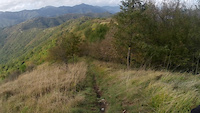
Il sentiero può essere percorso in entrambe le direzioni, meglio dal Monte Spigo a Fricciaro (discesa) ma con e-bike può essere fattibile anche al contrario più che altro per raggiungere la Cappelletta di Panteca e poi Torriglia. La discesa presenta una prima parte con qualche breve tratto ripido e una seconda molto veloce e lineare.

Tags

Recent Activity on Trail

Past Week
  • 0 rides
  •  
6 Months
  • 0 rides
  •  
All
  • 1 rides
  • Last: Jul 1, 2023
update trails status or condition

Spigo Trail Reports

statusdatedescription
Oct 14, 2024 @ 2:36pm
Oct 14, 2024
Bel trail naturale, all'inizio piuttosto ripido ma scorrevole, poi entra nel bosco diventando un pò più complicato, ma sempre fattibile tutto in...
more »
Status:
on Oct 14, 2024
no votes yet
Your vote: 0

view (8)
close
      Directions to spigo trailhead (44.518630, 9.116410)

      Photos

      6 more »
      report
      ebike
      34 |
      Oct 14, 2024 @ 2:41pm
      Oct 14, 2024
      report
      ebike
      37 |
      Oct 14, 2024 @ 2:41pm
      Oct 14, 2024
      report
      ebike
      39 |
      Oct 14, 2024 @ 2:41pm
      Oct 14, 2024
      report
      ebike
      45 |
      Oct 14, 2024 @ 2:41pm
      Oct 14, 2024

      Videos

      1 more »
      ebike
      0:50 | 8 | Oct 14, 2024 , Torriglia

      Reviews / Comments

      No reviews yet, be the first to write a review or ask a question.
      Use trail reports to comment on trail conditions.


      We hope you've been enjoying Trailforks!

      Create a FREE account to view all trail reviews and much more.

      • By Trusce58 & contributors
      • #345564 - 586 views

      Frequently Asked Questions

      ▼ Where is Spigo located?
      Spigo is located in Torriglia, Italy. It is part of the Torriglia trail network. The trailhead is located at coordinates 44.51863, 9.11641.
      ▼ How hard is Spigo?
      Spigo is rated as Blue difficulty. The physical rating is Moderate. The average grade is 9.1%. The climb difficulty is rated Blue.
      ▼ What is the elevation gain for Spigo?
      Spigo has 762 ft of elevation gain. The trail has 45 ft of elevation descent. The elevation ranges from 2,912 ft to 3,630 ft.
      ▼ Is Spigo a point to point trail?
      Spigo is not a point to point trail. The direction is Both Directions. The trail type is singletrack.
      ▼ How long is Spigo?
      Spigo is 1.5 miles long. The trail type is singletrack.
      ▼ Are dogs allowed on Spigo?
      Yes, dogs are allowed on Spigo. Please keep dogs on a leash where required and clean up after them.
      ▼ How do I access Spigo? Where is the closest parking trailhead?
      The closest parking and trailhead locations to Spigo are: View all parking locations in the area.
      ▼ How busy is Spigo?
      Spigo is a less popular trail with lighter traffic. There have been 9 recorded activities on this trail. The trail has received 8 check-ins. View recent activity on this trail.

      Hit the Trail

      Open in App

      Get this trail on your phone instantly.

      open trail in app

      Download Trail

      Save to wishlist, Garmin & download.
      save the trail

      Find Related Routes

      Find routes and users activities that include this trail.
      find routes for this trail

      You must enter a description before submitting.

