close
-
Layers w
- Weather Layers
- Pro
- Pro
- Pro
- Pro
- Pro
- Pro
- More Layers
- Pro
- Pro
- Pro
- Pro
-
Upgrade to

3D
Trail Conditions
- Unknown
- Snow Groomed
- Snow Packed
- Snow Covered
- Snow Cover Partial
- Freeze/thaw Cycle
- Icy
- Prevalent Mud
- Wet
- Variable
- Ideal
- Dry
- Very Dry
Trail Flow (Ridden Direction)
Trailforks scans users ridelogs to determine the most popular direction each trail is ridden. A good flowing trail network will have most trails flowing in a single direction according to their intension.
The colour categories are based on what percentage of riders are riding a trail in its intended direction.
The colour categories are based on what percentage of riders are riding a trail in its intended direction.
- > 96%
- > 90%
- > 80%
- > 70%
- > 50%
- < 50%
- bi-directional trail
- no data
Trail Last Ridden
Trailforks scans ridelogs to determine the last time a trail was ridden.
- < 2 days
- < 1 week
- < 2 weeks
- < 1 month
- < 6 months
- > 6 months
Trail Ridden Direction
The intended direction a trail should be ridden.
- Downhill Only
- Downhill Primary
- Both Directions
- Uphill Primary
- Uphill Only
- One Direction
Contribute Details
Colors indicate trail is missing specified detail.
- Description
- Photos
- Description & Photos
- Videos
Trail Popularity ?
Trailforks scans ridelogs to determine which trails are ridden the most in the last 9 months.
Trails are compared with nearby trails in the same city region with a possible 25 colour shades.
Think of this as a heatmap, more rides = more kinetic energy = warmer colors.
- most popular
- popular
- less popular
- not popular
ATV/ORV/OHV Filter
Max Vehicle Width
inches
US Cell Coverage
Legend

Radar Time
Activity Recordings
Trailforks uses anonymized public activity data.
?
Activity Recordings
Trailforks uses anonymized public activity data.
?
Personal Heatmap
▶
Activity Types
all
/
none
▶
Options
2
Date range
month
–
Winter Trails
Warning
A routing network for winter maps does not exist. Selecting trails using the winter trails layer has been disabled.
Missing Trails
Most Popular
Least Popular
Trails are colored based on popularity. The more popular a trail is, the more red. Less popular trails trend towards green.
Jump Magnitude Heatmap
Heatmap of where riders jump on trails. Zoom in to see individual jumps, click circles to view jump details.
BC Backroad Status
![map legend]()
Service Road Atlas is a free to use, community-driven service for viewing and creating reports on the numerous back-country service roads around B.C. and Alberta.

Slope Aspect
Direction the slope faces
Trails Deemphasized
Trails are shown in grey.
Only show trails with no bike usage.
Suggested Layers
Based on selected activity type
Save the current map location and zoom level as your default home location whenever this page is loaded.
SaveThis region is Unsanctioned, Ride at your own Risk!
No description for UCSC has been added yet! Login or register to submit one.AKA: Campus
Land Manager: Regents of the University of California
 google parking directions
 Activities Click to view
- Mountain Bike
26 trails
- E-Bike
6 trails
- Horse
10 trails
- Hike
27 trails
- Trail Running
27 trails
Region Details
- 5
- 2
- 13
Region Status
Open as of Jun 7, 2026Stats
- Avg Trail Rating
- Trails (view details)
- 20
- Trails Mountain Bike
- 26
- Trails E-Bike
- 6
- Trails Horse
- 10
- Trails Hike
- 27
- Trails Trail Running
- 27
- Total Distance
- 7 miles
- Total Descent Distance
- 5 miles
- Total Descent
- 1,064 ft
- Total Vertical
- 756 ft
- Highest Trailhead
- 1,130 ft
- Reports
- 173
- Photos
- 29
- Ridden Counter
- 36,327
Popular UCSC Mountain Biking Trails
• 80 ★ 0.0 • 2,264 ft • 78 ft • 151 • • hike
Popular blue difficulty singletrack. This hike primary trail can be used both directions.
• 45 ★ 0.0 • 2,572 ft • 3 ft • 69 • • hike
Moderately popular blue difficulty singletrack. This hike primary trail can be used both directions.
• 30 ★ 0.0 • 2,516 ft • 91 ft • 23 • • hike
Less popular blue difficulty singletrack. This hike primary trail can be used both directions.
• 30 ★ 0.0 • 3,284 ft • 168 ft • 16 •
Less popular blue difficulty singletrack. This mountain bike primary trail can be used both directions.
UCSC Mountain Bike Routes
★ 1.0 • 13 miles • 2,494 ft • 8 •
UCSC Route, MailBoxes + Side Winder + Magic Carpet + Sweetness
7 miles • 1,644 ft • 5 •
UCSC Route, MailBoxes + Side Winder + Magic Carpet + Sweetness
• 11 miles • 1,038 ft • 0 •
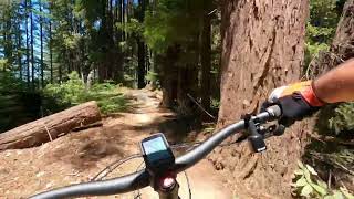
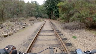
Photos of UCSC Mountain Bike
Videos of UCSC Mountain Bike
Recent Trail Reports
| status | trail | date | condition | info | user |
|---|---|---|---|---|---|
| Chinquapin Road | Jun 7, 2026 @ 12:01pm (America/Los_Angeles) Jun 7, 2026 | Dry | ABHORRANCE831 | ||
| Red Hill Road | Aug 11, 2025 @ 2:05pm Aug 11, 2025 | Ideal | cire831 | ||
| Spring Road | Nov 27, 2024 @ 12:20pm Nov 27, 2024 | Ideal | ABHORRANCE831 | ||
| Fuel Break Road | Nov 3, 2024 @ 11:57am Nov 3, 2024 | Ideal | ABHORRANCE831 | ||
| West Road | Oct 26, 2024 @ 3:08pm Oct 26, 2024 | Dry | ABHORRANCE831 |
Activity Feed
| username | action | type | title | date |
|---|---|---|---|---|
| Augustinep | wishlist | route | activity #97652996 | Jun 23, 2026 @ 2:39pm Jun 23, 2026 |
| isilverman | wishlist | route | activity #97477239 | Jun 21, 2026 @ 6:13am Jun 21, 2026 |
| Reyny0WHs | wishlist | route | activity #96612572 | Jun 9, 2026 @ 9:51am Jun 9, 2026 |
| ABHORRANCE831 | add | report | activity #96507229 | Jun 7, 2026 @ 4:37pm Jun 7, 2026 |
| Mnstrpat | wishlist | trail | activity #96345574 and 1 more | Jun 6, 2026 @ 12:11am Jun 6, 2026 |
Recent Comments
| username | type | title | comment | date |
|---|---|---|---|---|
| trail | Yooo, not sure what a snapchat map is. Mind... | Jul 28, 2021 @ 1:36pm Jul 28, 2021 | ||
| trail | Awesome trails all over the place, no one... | Sep 6, 2020 @ 5:55pm Sep 6, 2020 | ||
| trail | Use the snapchat map for a great map of... | Feb 28, 2020 @ 7:19pm Feb 28, 2020 | ||
| report | Yes hv | May 6, 2018 @ 7:12pm May 6, 2018 |
Nearby Areas
| name | distance | ||||
|---|---|---|---|---|---|
| Bear Mountain | 1.7 km | ||||
| Henry Cowell Redwoods State Park | 2 | 12 | 8 | 1.8 km | |
| Pogonip Open Space | 1 | 2 | 2.2 km | ||
| Wilder Ranch | 8 | 12 | 1 | 2.3 km | |
| Scotts Valley Pump Track | 3.2 km |
Activity Type Stats
| activitytype | trails | distance | descent | descent distance | total vertical | rating | global rank | state rank | photos | reports | routes | ridelogs |
|---|---|---|---|---|---|---|---|---|---|---|---|---|
| Mountain Bike | 26 | 7 miles | 1,063 ft | 5 miles | 755 ft | #4,697 | #1,677 | 29 | 173 | 4 | 11,524 | |
| E-Bike | 6 | 4,944 ft | 46 ft | 246 ft | #5,274 | #1,458 | 166 | 1,722 | ||||
| Horse | 10 | 5 miles | 814 ft | 4 miles | 295 ft | #1,714 | #898 | 25 | ||||
| Hike | 27 | 7 miles | 1,063 ft | 5 miles | 755 ft | #8,528 | #3,204 | 173 | 211 | |||
| Trail Running | 27 | 7 miles | 1,063 ft | 5 miles | 755 ft | #8,952 | #3,187 | 173 | 198 |
Frequently Asked Questions About UCSC
▼
What are the highest rated mountain biking trails in UCSC?
The highest rated mountain biking trails in UCSC are:
- 44 Logs (0/5)
- Camper Park (0/5)
- Star Wars (0/5)
- Across Campus (0/5)
▼
What is the best time of the year to ride in UCSC?
Based on ride log data, the most popular months to ride in UCSC are:
- November (49 activities)
- June (41 activities)
- July (41 activities)
▼
Where can I park to ride in UCSC?
▼
What is the longest trail in UCSC?
The longest trail in UCSC is Camper Park at 3,284 ft. View all trails sorted by distance.
Activities
- By brenthillier
 NSMBA TRAILFORKS & contributors
 - Admins: apply
- #8287 - 65,622 views
- ucsc activity log | embed map of UCSC mountain bike trails | ucsc mountain biking points of interest
Downloading of trail gps tracks in kml & gpx formats is enabled for UCSC.
You must login to download files.