
close
3D
Trail Conditions
- Unknown
- Snow Groomed
- Snow Packed
- Snow Covered
- Snow Cover Partial
- Freeze/thaw Cycle
- Icy
- Prevalent Mud
- Wet
- Variable
- Ideal
- Dry
- Very Dry
Trail Flow (Ridden Direction)
Trailforks scans users activity logs to determine the most popular direction each trail is ridden. A good flowing trail network will have most trails flowing in a single direction according to their intension.
The colour categories are based on what percentage of users are riding a trail in its intended direction.
The colour categories are based on what percentage of users are riding a trail in its intended direction.
- > 96%
- > 90%
- > 80%
- > 70%
- > 50%
- < 50%
- bi-directional trail
- no data
Trail Last Used
Trailforks scans activity logs to determine the last time a trail was ridden.
- < 2 days
- < 1 week
- < 2 weeks
- < 1 month
- < 6 months
- > 6 months
Trail Ridden Direction
The intended direction a trail should be ridden.
- Downhill Only
- Downhill Primary
- Both Directions
- Uphill Primary
- Uphill Only
- One Direction
Contribute Details
Colors indicate trail is missing specified detail.
- Description
- Photos
- Description & Photos
- Videos
Trail Popularity ?
Trailforks scans activity logs to determine which trails are ridden the most in the last 9 months.
Trails are compared with nearby trails in the same city region with a possible 25 colour shades.
Think of this as a heatmap, more activities = more kinetic energy = warmer colors.
- most popular
- popular
- less popular
- not popular
ATV/ORV/OHV Filter
Max Vehicle Width
inches
US Cell Coverage
Legend

Radar Time
Activity Recordings
Trailforks uses anonymized public activity data.
?
Activity Recordings
Trailforks uses anonymized public activity data.
?
Winter Trails
Warning
A routing network for winter maps does not exist. Selecting trails using the winter trails layer has been disabled.
Missing Trails
Most Popular
Least Popular
Trails are colored based on popularity. The more popular a trail is, the more red. Less popular trails trend towards green.
Jump Magnitude Heatmap
Heatmap of where users jump on trails. Zoom in to see individual jumps, click circles to view jump details.
BC Backroad Status
![map legend]()
Service Road Atlas is a free to use, community-driven service for viewing and creating reports on the numerous back-country service roads around B.C. and Alberta.

Slope Aspect
Direction the slope faces
Trails Deemphasized
Trails are shown in grey.
Only show trails with no bike usage.
Suggested Layers
Based on selected activity type
Save the current map location and zoom level as your default home location whenever this page is loaded.
SaveThe population center of Finland. Inside the ring roads you have the most ridden areas of central parks of Helsinki, Espoo and Vantaa. Outside the ring roads you have plenty of riding areas that allow you to make large point to point trips and loops. 2 national parks of Sipoonkorpi and Nuuksio. Area has plenty of long gravel route options.
Trail info last updated
Region Details
- 896
- 507
- 1,843
- 2,246
- 460
- 85
- 24
- 7
Stats
- Avg Trail Rating
- Trails (view details)
- 6,124
- Trails Mountain Bike
- 6,094
- Trails E-Bike
- 5,927
- Trails Gravel Bike
- 1,504
- Trails Adaptive Bike
- 99
- Trails Winter Fat Bike
- 189
- Trails Horse
- 5
- Trails Hike
- 5,947
- Trails Trail Running
- 5,987
- Trails Dirtbike/Moto
- 105
- Trails ATV/ORV/OHV
- 1
- Trails Snowshoe
- 330
- Trails Downhill Ski
- 16
- Trails Backcountry Ski
- 310
- Trails Nordic Ski
- 511
- Total Distance
- 1,994 miles
- Total Descent
- 129,207 ft
- Total Vertical
- 547 ft
- Highest Trailhead
- 551 ft
- Reports
- 4,494
- Photos
- 378
- Completed Counter
- 58,516
Popular Trail Networks
view all areas »Sub Regions
- Greater Helsinki (4,369)
- Espoo (1,179)
- Espoon Keskuspuisto (54)
- Karakallio (12)
- Kasavuori (13)
- Lintuvaara/Leppävaara (23)
- Lupauksenvuori (0)
- Nuuksio Bikepark (10)
- Nuuksion Alue (168)
- Vaakkoin Alue (73)
- Helsinki (708)
- Bunker Hill - Pikisaari (14)
- Haltiala/Paloheinä (129)
- Helsingin Keskuspuisto (254)
- Kivikko (16)
- Laajasalo (8)
- Littoistenjärvi (2)
- Malminkartanonhuippu (6)
- Pääskyvuori - Kohmo (15)
- Paloheinä Trail Center (10)
- Ruissalo (1)
- Suurmetsä (10)
- Turku Bike Park (10)
- Veräjämäki (11)
- Vuosaari (93)
- Järvenpää (311)
- Kerava (1)
- Korso (141)
- Sipoo (314)
- Sipoonkorven Alue (280)
- Söderkulla (26)
- Tuusula (162)
- Vantaa (419)
- Vihti (142)
- PetikkoSerena Alue (188)
- Espoo (1,179)
- Nurmijärvi (571)
- Klaukkala (341)
- Tornikeskus (27)
- Rajamäki (212)
- Klaukkala (341)
- Porvoo (27)
- Pornainen (16)
- Hyötinmäki (9)
- Kivisniemi (5)
- Porvoo (11)
- Kokonniemi Bike Park (10)
- Pornainen (16)
- Raseborg (34)
- Påminne bikepark (34)
- Hanko (308)
- Hyvinkaa (23)
- Hyvinkää (377)
- Erkylä (205)
- Hyvinkää Pohjoinen (4)
- Inkoo (34)
- Kaarina (2)
- Kirkkonummi (700)
- Porkkala (30)
- Lohja (87)
- Mäntsälä (12)
- Nurmijärvi (44)
- Raasepori (185)
- Riihimäki (170)
Popular Uusimaa Mountain Biking Trails
• 95 ★ 3.4 • 1,207 ft • 9 ft • 107 •
Popular blue difficulty singletrack. This mountain bike primary trail can be used downhill primary. It features berm, drop and jump. On average it takes 1 minutes to complete this trail.
• 90 ★ 0.0 • 736 ft • 0 ft • 99 •
Popular green difficulty singletrack. This mountain bike primary trail can be used downhill primary. It features berm and drop. On average it takes 1 minutes to complete this trail.
• 100 ★ 5.0 • 928 ft • 0 ft • 97 •
Tuttuja polkuja, sivuaa joitain Strava segmenttejä, mutta on pidempi kuin paikalliset segmentit. Tässä saa jo polkea tosissaan.
• 95 ★ 3.5 • 3,668 ft • 43 ft • 96 •
Keskuspuiston pohjoisosan "perus metsäpolku", joka on suurelta osin aika hermeettistä juurakkoa. Alueella risteilee paljon polkuja joten reittiä ei ole välttämättä hirveän helppo seurata, mutta päälinjaa seuraillen löytää...
• 90 ★ 0.0 • 835 ft • 4 ft • 96 •
Popular blue difficulty singletrack. This mountain bike primary trail can be used downhill primary. It features berm, drop and jump. On average it takes 1 minutes to complete this trail.
• 95 ★ 4.7 • 620 ft • 0 ft • 95 •
Sisältää useita Strava-segmenttejä, molempiin suuntiin.
• 95 ★ 0.0 • 1,053 ft • 0 ft • 95 •
Vauhdikas flowbaana Paloheinän huipulta nousuladun alkuun. Sadekelillä alaosan muta on liukasta ja tahmeeta...
• 100 ★ 0.0 • 547 ft • 0 ft • 92 •
Helpoin sininen reitti. Rullaavaan polkua jossa on muutama tekninen osuus, lopussa mukava lasku. Suositusaika: n. 40 min. Easiest Blue route. Nicely rolling trail with couple of technical sections, nice mellow downhill at the end.
Uusimaa Mountain Bike Routes
VO2 max Norjalainen 29km Loop Featured
18 miles • 571 ft • 10 • Loop •
Norwegian VO2 max of 4x4min intervals with 3 minute rest in terrain. Heart rate around 90%. Rest below...
25 miles • 903 ft • 28 • Loop •
4 about 4km about 12 minute Super Segments on an ebike. Elite riders on a normal bike probably a few...
34 miles • 1,661 ft • 14 • Loop •
Training route for Himos Epic event. 50km might feel like a fairly standard ride but when you are racing...
31 miles • 1,646 ft • 14 • Loop •
Training route for Himos Epic event. 50km might feel like a fairly standard ride but when you are racing...
ErkyläSpeedways Featured
30 miles • 1,019 ft • 17 • Loop •
The easiest and fastest sections of Erkylä. Tour through the best fast flowing trails of the area. Couple...
★ 4.0 • 10 miles • 602 ft • 6 • Point to Point •
Helsingin Keskuspuiston MTB-reittiä mukaileva reitti. Sopii vähän kokemattomammallekin...
Photos of Uusimaa Mountain Bike
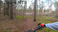
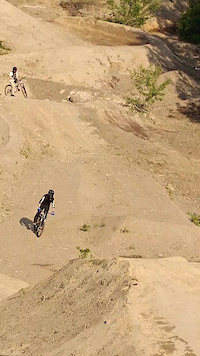
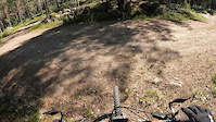
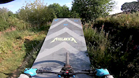
Videos of Uusimaa Mountain Bike


Recent Trail Reports
Activity Feed
| username | action | type | title | date |
|---|---|---|---|---|
| Larppamatic | add | report | activity #107055834 and 8 more | Nov 1, 2026 @ 11:45pm 1 day |
| Larppamatic | add | report | activity #107055833 and 1 more | Nov 1, 2026 @ 11:45pm 1 day |
| mcharza | add | report | activity #106999384 | Nov 1, 2026 @ 5:53am 2 days |
| mcharza | add | report | activity #106999382 | Nov 1, 2026 @ 5:53am 2 days |
| mcharza | add | report | activity #106919546 and 2 more | Oct 31, 2026 @ 6:27am Oct 31, 2026 |
Recent Comments
| username | type | title | comment | date |
|---|---|---|---|---|
| skillpark | nice | Jun 30, 2024 @ 5:14am Jun 30, 2024 | ||
| report | All man's right is Finnish law. Only the state... | Dec 12, 2022 @ 9:13am Dec 12, 2022 | ||
| report | Dangerous and hostile trail.. This forest area... | Nov 18, 2020 @ 1:19am Nov 18, 2020 |
Local Badges
-

Descent 10k Badge0 awarded -

Epic Ride Descent 2k0 awarded -
Descent 10k Badge0 awarded -
Descent 10k Badge1 awarded -
Descent 10k Badge1 awarded -
Descent 10k Badge2 awarded
Bike & Skill Parks
| name | type | city | rating |
|---|---|---|---|
| Kokonniemi Bike Park | bike park | Porvoo | |
| Paltan dirt rata | skill park | Helsinki | |
| Hyvinkää pump track | skill park | Hyvinkää | |
| Koskelan dirtti | skill park | Helsinki | |
| Savelan Pumptrack | skill park | Helsinki |
Local Mountain Biking Directory
-
Porvoon Pyöräkeskus
-
Pikkufillari.fi
-
Ridemore
-
Hi5bikesBike Shop
-
FoxcompBike Shop
-
Pyorahuolto.comBike Shop
Activity Type Stats
| activitytype | trails | distance | descent | descent distance | total vertical | rating | global rank | state rank | photos | reports | routes | activity logs |
|---|---|---|---|---|---|---|---|---|---|---|---|---|
| Mountain Bike | 6,094 | 1,986 miles | 128,619 ft | 798 miles | 548 ft | 372 | 4,492 | 121 | 70,080 | |||
| E-Bike | 5,927 | 1,921 miles | 118,707 ft | 768 miles | 548 ft | 2 | 4,424 | 99 | 12,308 | |||
| Gravel Bike | 1,504 | 553 miles | 29,865 ft | 220 miles | 492 ft | 18 | 3 | 1,553 | ||||
| Adaptive Bike | 99 | 39 miles | 2,759 ft | 15 miles | 433 ft | 113 | 3 | |||||
| Winter Fat Bike | 189 | 100 miles | 8,773 ft | 38 miles | 430 ft | 499 | 63 | |||||
| Horse | 5 | 1 mile | 154 ft | 3,520 ft | 220 ft | 77 | ||||||
| Hike | 5,947 | 1,928 miles | 119,242 ft | 769 miles | 548 ft | 2 | 4,428 | 10 | 1,591 | |||
| Trail Running | 5,987 | 1,941 miles | 120,525 ft | 776 miles | 548 ft | 4,442 | 12 | 3,789 | ||||
| Dirtbike/Moto | 105 | 26 miles | 1,752 ft | 11 miles | 302 ft | 76 | 6 | |||||
| ATV/ORV/OHV | 1 | 614 ft | 43 ft | 440 ft | 43 ft | 76 | 1 | |||||
| Snowshoe | 330 | 121 miles | 7,595 ft | 48 miles | 492 ft | 5 | 98 | |||||
| Downhill Ski | 16 | 8 miles | 525 ft | 3 miles | 292 ft | 1 | 499 | |||||
| Backcountry Ski | 310 | 117 miles | 7,352 ft | 46 miles | 492 ft | 5 | 45 | |||||
| Nordic Ski | 511 | 172 miles | 10,646 ft | 70 miles | 492 ft | 7 | 3,116 |
Activities
- Uusimaa Mountain Biking Trails
- Uusimaa E-Biking Trails
- Uusimaa Gravel Biking Trails
- Uusimaa Adaptive Biking Trails
- Uusimaa Winter Fat Biking Trails
- Uusimaa Horseback Trails
- Uusimaa Hiking Trails
- Uusimaa Trail Running Trails
- Uusimaa Dirtbiking Trails
- Uusimaa Snowshoeing Trails
- Uusimaa Skiing Trails
- Uusimaa Backcountry Skiing Trails
- Uusimaa Nordic Skiing Trails
Trails
- By brenthillier
 NSMBA TRAILFORKS & contributors
- Admins: Bunabe
- #11113 - 14,128 views
- uusimaa activity log | embed map of Uusimaa mountain bike trails | uusimaa mountain biking points of interest
Downloading of trail gps tracks in kml & gpx formats is enabled for Uusimaa.
You must login to download files.
