
close
3D
Trail Conditions
- Unknown
- Snow Groomed
- Snow Packed
- Snow Covered
- Snow Cover Partial
- Freeze/thaw Cycle
- Icy
- Prevalent Mud
- Wet
- Variable
- Ideal
- Dry
- Very Dry
Trail Flow (Ridden Direction)
Trailforks scans users activity logs to determine the most popular direction each trail is ridden. A good flowing trail network will have most trails flowing in a single direction according to their intension.
The colour categories are based on what percentage of users are riding a trail in its intended direction.
The colour categories are based on what percentage of users are riding a trail in its intended direction.
- > 96%
- > 90%
- > 80%
- > 70%
- > 50%
- < 50%
- bi-directional trail
- no data
Trail Last Used
Trailforks scans activity logs to determine the last time a trail was ridden.
- < 2 days
- < 1 week
- < 2 weeks
- < 1 month
- < 6 months
- > 6 months
Trail Ridden Direction
The intended direction a trail should be ridden.
- Downhill Only
- Downhill Primary
- Both Directions
- Uphill Primary
- Uphill Only
- One Direction
Contribute Details
Colors indicate trail is missing specified detail.
- Description
- Photos
- Description & Photos
- Videos
Trail Popularity ?
Trailforks scans activity logs to determine which trails are ridden the most in the last 9 months.
Trails are compared with nearby trails in the same city region with a possible 25 colour shades.
Think of this as a heatmap, more activities = more kinetic energy = warmer colors.
- most popular
- popular
- less popular
- not popular
ATV/ORV/OHV Filter
Max Vehicle Width
inches
US Cell Coverage
Legend

Radar Time
Activity Recordings
Trailforks uses anonymized public activity data.
?
Activity Recordings
Trailforks uses anonymized public activity data.
?
Winter Trails
Warning
A routing network for winter maps does not exist. Selecting trails using the winter trails layer has been disabled.
Missing Trails
Most Popular
Least Popular
Trails are colored based on popularity. The more popular a trail is, the more red. Less popular trails trend towards green.
Jump Magnitude Heatmap
Heatmap of where users jump on trails. Zoom in to see individual jumps, click circles to view jump details.
BC Backroad Status
![map legend]()
Service Road Atlas is a free to use, community-driven service for viewing and creating reports on the numerous back-country service roads around B.C. and Alberta.

Slope Aspect
Direction the slope faces
Trails Deemphasized
Trails are shown in grey.
Only show trails with no bike usage.
Suggested Layers
Based on selected activity type
Save the current map location and zoom level as your default home location whenever this page is loaded.
SaveKlaukkala contains a variety of difficulty and trail types. Trails around the center of Klaukkala are a challenge to pedal through while in the North you will find technical but generally much easier trail to pedal in Mäntysalo.
Trail info last updated
Activities Click to view
- Mountain Bike
341 trails
- E-Bike
340 trails
- Gravel Bike
35 trails
- Adaptive Bike
26 trails
- Winter Fat Bike
5 trails
- Hike
335 trails
- Trail Running
335 trails
- Dirtbike/Moto
9 trails
Region Details
- 30
- 7
- 74
- 136
- 75
- 12
- 5
- 2
Region Status
Open as of Oct 21, 2026Stats
- Avg Trail Rating
- Trails (view details)
- 343
- Trails Mountain Bike
- 341
- Trails E-Bike
- 340
- Trails Gravel Bike
- 35
- Trails Adaptive Bike
- 26
- Trails Winter Fat Bike
- 5
- Trails Hike
- 335
- Trails Trail Running
- 335
- Trails Dirtbike/Moto
- 9
- Trails Downhill Ski
- 2
- Total Distance
- 82 miles
- Total Descent
- 9,352 ft
- Total Vertical
- 237 ft
- Highest Trailhead
- 329 ft
- Reports
- 193
- Photos
- 148
- Completed Counter
- 3,012
Sub Regions
-
Tornikeskus
- 1
- 11
- 13
Popular Klaukkala Mountain Biking Trails
• 100 ★ 0.0 • 422 ft • 0 ft • 88 •
Popular blue difficulty singletrack. This mountain bike primary trail can be used downhill primary. On average it takes minutes to complete this trail.
• 100 ★ 2.0 • 974 ft • 0 ft • 83 •
Popular black diamond difficulty mixed. This mountain bike primary trail can be used downhill primary. On average it takes 2 minutes to complete this trail.
• 100 ★ 2.0 • 892 ft • 11 ft • 82 •
Popular black diamond difficulty singletrack. This mountain bike primary trail can be used downhill primary. On average it takes 1 minutes to complete this trail.
• 100 ★ 0.0 • 456 ft • 0 ft • 78 •
This trail is named as Freeride in official trail map of Tornikeskus and consist of these two Trailforks trails: Tornari Freeride + Tornari Wall-Ride. See the official map at...
• 100 ★ 5.0 • 1,207 ft • 0 ft • 78 •
Popular blue difficulty singletrack. This mountain bike primary trail can be used downhill primary. On average it takes 1 minutes to complete this trail.
• 100 ★ 2.0 • 824 ft • 0 ft • 77 •
Popular black diamond difficulty singletrack. This mountain bike primary trail can be used downhill primary. On average it takes 2 minutes to complete this trail.
Klaukkala Mountain Bike Routes
18 miles • 1,040 ft • 11 • Loop •
Going around the Valkjärvi lake with the easiest trail options skipping the more difficult parts....
36 miles • 1,789 ft • 21 • Loop •
Route from Klaukkala around the airport. Lot of trails. Going through Vestra, Petikko, Ylästö, airport...
97 miles • 3,238 ft • 25 • Point to Point •
Start point from Klaukkala but you could use the Petikko outdoors area parking lot for a starting point as...
28 miles • 1,498 ft • 23 • Loop •
Beginning is bushy so might want to replace the first 4km with asfalt. Accidentally routed through that...
30 miles • 1,697 ft • 24 • Loop •
As long and extensive as possible. Not something I'd normally run but for someone who wants to see as much...
14 miles • 692 ft • 11 • Loop •
Fairly easy route selecting mostly pedalable trails. Includes one double black diamond that is difficult...
Photos of Klaukkala Mountain Bike
Videos of Klaukkala Mountain Bike
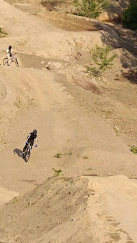
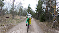

Recent Trail Reports
| status | trail | date | condition | info | user |
|---|---|---|---|---|---|
| Tornari Freeride | Oct 21, 2026 @ 2:06pm (Europe/Helsinki) Oct 21, 2026 | Variable | mcharza | ||
| Tornari JumpLine | Oct 21, 2026 @ 2:06pm (Europe/Helsinki) Oct 21, 2026 | Ideal | mcharza | ||
| Tornari HyppySivu | Oct 21, 2026 @ 2:06pm (Europe/Helsinki) Oct 21, 2026 | Ideal | mcharza | ||
| Tornari Ryttis | Aug 20, 2026 @ 12:13pm (Europe/Helsinki) Aug 20, 2026 | Very Dry | mcharza | ||
| Tornari KurreEnd | Aug 20, 2026 @ 12:13pm (Europe/Helsinki) Aug 20, 2026 | Very Dry | mcharza | ||
| Tornari EK1 | Aug 20, 2026 @ 12:13pm (Europe/Helsinki) Aug 20, 2026 | Very Dry | mcharza | ||
| Tornari EK3 | Aug 13, 2026 @ 12:16pm (Europe/Helsinki) Aug 13, 2026 | Very Dry | mcharza | ||
| Vesitorni Peltomyyrä | Aug 11, 2026 @ 10:24am (Europe/Helsinki) Aug 11, 2026 | Ideal | appatus | ||
| Enskaa paskalaitoksella | Aug 10, 2026 @ 2:31pm (Europe/Helsinki) Aug 10, 2026 | Ideal | appatus | ||
| Mustamäki Itä-traili | Aug 10, 2026 @ 2:31pm (Europe/Helsinki) Aug 10, 2026 | Ideal | appatus |
Activity Feed
| username | action | type | title | date |
|---|---|---|---|---|
| mcharza | add | report | activity #106323354 and 2 more | Oct 21, 2026 @ 6:42am Oct 21, 2026 |
| mcharza | add | report | activity #104968223 and 1 more | Oct 1, 2026 @ 4:40am Oct 1, 2026 |
| mcharza | add | report | activity #101905508 and 4 more | Aug 20, 2026 @ 4:01am Aug 20, 2026 |
| mcharza | add | report | activity #101525145 and 4 more | Aug 15, 2026 @ 6:36am Aug 15, 2026 |
| mcharza | add | report | activity #101376402 and 4 more | Aug 13, 2026 @ 5:13am Aug 13, 2026 |
Recent Comments
| username | type | title | comment | date |
|---|---|---|---|---|
| trail | Nice low gradient fast downhill both sides. | Apr 20, 2023 @ 10:40am Apr 20, 2023 | ||
| trail | Polun on jakanut kahtia Klaukkalan uusi... | Sep 3, 2019 @ 10:56pm Sep 3, 2019 |
Local Badges
-

Top 10 Trails0 awarded -

Descent 100k Badge0 awarded -

Big Ride 30k118 awarded -

Epic Ride 50k70 awarded -

Descent 10k Badge9 awarded -

Completionist15 awarded
Activity Type Stats
| activitytype | trails | distance | descent | descent distance | total vertical | rating | global rank | state rank | photos | reports | routes | activity logs |
|---|---|---|---|---|---|---|---|---|---|---|---|---|
| Mountain Bike | 341 | 81 miles | 9,150 ft | 34 miles | 236 ft | #493 | #6 | 146 | 193 | 13 | 1,351 | |
| E-Bike | 340 | 81 miles | 9,108 ft | 34 miles | 236 ft | #452 | #10 | 193 | 13 | 321 | ||
| Gravel Bike | 35 | 9 miles | 682 ft | 3 miles | 220 ft | #725 | #7 | 3 | 25 | |||
| Adaptive Bike | 26 | 7 miles | 577 ft | 3 miles | 217 ft | #447 | #6 | 3 | ||||
| Winter Fat Bike | 5 | 1 mile | 33 ft | 1,217 ft | 98 ft | #658 | #15 | 2 | ||||
| Hike | 335 | 80 miles | 8,809 ft | 33 miles | 236 ft | #853 | #9 | 193 | 1 | 35 | ||
| Trail Running | 335 | 80 miles | 8,809 ft | 33 miles | 236 ft | #576 | #9 | 193 | 1 | 57 | ||
| Dirtbike/Moto | 9 | 4 miles | 315 ft | 2 miles | 138 ft | #457 | #5 | 16 | ||||
| Downhill Ski | 2 | 1,732 ft | 200 ft | 1,480 ft | 121 ft | 11 |
Frequently Asked Questions
▼
What are the best places to ride in Klaukkala?
Klaukkala has 1 areas to explore for mountain biking. The top rated areas are:
▼
What are the highest rated mountain biking trails in Klaukkala?
The highest rated mountain biking trails in Klaukkala are:
- Pietarinmäki Kalliopolku (4.2/5)
- Pietarinmäki BeissiBaana (4.2/5)
- Lintumetsä TR ura Lasku (4.1/5)
- Syrjälä E11 VäliPuikka (4.1/5)
- Paskalaitos E2 Röykkö Virtanen (4.1/5)
▼
Where can I park to ride in Klaukkala?
There are 1 parking locations listed in Klaukkala. The most popular parking spots are:
▼
What is the longest trail in Klaukkala?
The longest trail in Klaukkala is Metsäkylä Silta at 1.6 miles. View all trails sorted by distance.
▼
How many trails are in Klaukkala?
Klaukkala has a total of 341 trails. Browse top mountain biking trails in Klaukkala to find detailed information including difficulty ratings, distances, and trail conditions.
▼
Which trail has the most elevation gain in Klaukkala?
The trail with the most elevation gain in Klaukkala is Metsäkylä Kuusiniittu uphill with 155 ft of elevation gain. View all trails sorted by elevation gain.
▼
Which trail has the most elevation descent in Klaukkala?
The trail with the most elevation descent in Klaukkala is Tornari Kärmes with 171 ft of elevation descent. View all trails sorted by elevation descent.
▼
What activities are most popular in Klaukkala?
Klaukkala supports the following activities: Mountain Biking, E-Biking, Gravel Biking, Adaptive Biking, Winter Fat Biking, Hiking, Trail Running, Dirtbiking.
▼
What are the steepest mountain biking trails in Klaukkala?
The steepest mountain biking trail in Klaukkala is Syrjälä Enduro 10 Leppäralli with an average grade of 13.4%. View all trails sorted by grade.
▼
Are the trails open in Klaukkala?
The overall region status for Klaukkala is Clear / Green. Out of 58 trails:
- Clear / Green: 53
- Minor Issue / Yellow: 3
- Significant Issue / Amber: 2
▼
Can I ride an ebike in Klaukkala?
Yes, Klaukkala supports e-bike riding. There are 342 trails in Klaukkala that allow e-bikes. Check the e-bike trails listing for specific trail access details and any local regulations.
▼
What are the most popular mountain biking routes in Klaukkala?
The most popular mountain biking routes in Klaukkala are:
- ValkjärviHelpoinKokoKierto29kmLoop
- KlaukkalaLentokentänKierto59kmLoop2023
- KlaukkalaToHankoTrailsExtraLong160kmP2P
▼
What are the most popular Strava Segments in Klaukkala?
The most popular Strava segments in Klaukkala are:
- Kallion yli ja bermien kierto (856 athletes)
- Tornikeskus Kyy (556 athletes)
- Wallride (534 athletes)
▼
What are some popular technical trail features in Klaukkala?
There are 11 technical trail features (TTFs) in Klaukkala. Some popular features include:
- Trial rock steps. (Other)
- Rockface brake tester. (Rock Face)
- Harjulan koulu rockface. (Rock Face)
- Viinamäki (Other)
- Rhythm rock garden. TakaOG (Rock Garden)
▼
Are there accessible or adaptive trails in Klaukkala?
Yes, there are 27 accessible/adaptive trails in Klaukkala. View all adaptive trails in Klaukkala for specific accessibility information.
▼
What are the most popular mountain biking trails in Klaukkala?
The most popular mountain biking trails in Klaukkala are:
- Lintumetsä TR ura Lasku
- Syrjälä E11 VäliPuikka
- Paskalaitos E2 Röykkö Virtanen
- Tornari Ryttis
- Syrjälä Enduro 10 Leppäralli
▼
What are the best beginner ride trails in Klaukkala?
The best beginner mountain biking trails in Klaukkala are:
- Tornimäki MutaOja (1/5)
- Mäntysalo SivuVirta (5/5)
- Pietarinmäki YläLaaqee (4/5)
Activities
Trails
- By brenthillier
 NSMBA TRAILFORKS & contributors
- Admins: Bunabe, Bunabe
- #18027 - 6,948 views
- klaukkala activity log | embed map of Klaukkala mountain bike trails | klaukkala mountain biking points of interest
Downloading of trail gps tracks in kml & gpx formats is enabled for Klaukkala.
You must login to download files.
