
close
3D
Trail Conditions
- Unknown
- Snow Groomed
- Snow Packed
- Snow Covered
- Snow Cover Partial
- Freeze/thaw Cycle
- Icy
- Prevalent Mud
- Wet
- Variable
- Ideal
- Dry
- Very Dry
Trail Flow (Ridden Direction)
Trailforks scans users activity logs to determine the most popular direction each trail is ridden. A good flowing trail network will have most trails flowing in a single direction according to their intension.
The colour categories are based on what percentage of users are riding a trail in its intended direction.
The colour categories are based on what percentage of users are riding a trail in its intended direction.
- > 96%
- > 90%
- > 80%
- > 70%
- > 50%
- < 50%
- bi-directional trail
- no data
Trail Last Used
Trailforks scans activity logs to determine the last time a trail was ridden.
- < 2 days
- < 1 week
- < 2 weeks
- < 1 month
- < 6 months
- > 6 months
Trail Ridden Direction
The intended direction a trail should be ridden.
- Downhill Only
- Downhill Primary
- Both Directions
- Uphill Primary
- Uphill Only
- One Direction
Contribute Details
Colors indicate trail is missing specified detail.
- Description
- Photos
- Description & Photos
- Videos
Trail Popularity ?
Trailforks scans activity logs to determine which trails are ridden the most in the last 9 months.
Trails are compared with nearby trails in the same city region with a possible 25 colour shades.
Think of this as a heatmap, more activities = more kinetic energy = warmer colors.
- most popular
- popular
- less popular
- not popular
ATV/ORV/OHV Filter
Max Vehicle Width
inches
US Cell Coverage
Legend

Radar Time
Activity Recordings
Trailforks uses anonymized public activity data.
?
Activity Recordings
Trailforks uses anonymized public activity data.
?
Winter Trails
Warning
A routing network for winter maps does not exist. Selecting trails using the winter trails layer has been disabled.
Missing Trails
Most Popular
Least Popular
Trails are colored based on popularity. The more popular a trail is, the more red. Less popular trails trend towards green.
Jump Magnitude Heatmap
Heatmap of where users jump on trails. Zoom in to see individual jumps, click circles to view jump details.
BC Backroad Status
![map legend]()
Service Road Atlas is a free to use, community-driven service for viewing and creating reports on the numerous back-country service roads around B.C. and Alberta.

Slope Aspect
Direction the slope faces
Trails Deemphasized
Trails are shown in grey.
Only show trails with no bike usage.
Suggested Layers
Based on selected activity type
Save the current map location and zoom level as your default home location whenever this page is loaded.
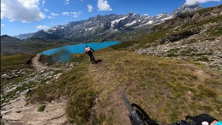
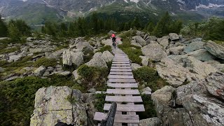
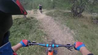
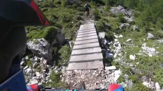
SaveValtournenche trails and routes are listed on Trailforks with interactive trail maps, difficulty ratings, photos, and user-reported trail conditions. The Trailforks community has shared hundreds of photos from this region. Supported activity types include Mountain Biking, E-Biking, Hiking, Trail Running, Gravel Biking, Adaptive Biking and Winter Fat Biking. Trails here are often rocky. Scenery includes views and alpine terrain. Common trail features include rock gardens, bridges and rock slabs. Many trails are family friendly. Popular destinations include Cervino.
This is an auto-generated description of Valtournenche.
Login or register to submit a custom description.
This region uses the Uk/Euro style trail grading system.
Trail info last updated
Activities Click to view
- Mountain Bike
32 trails
- E-Bike
28 trails
- Gravel Bike
16 trails
- Adaptive Bike
9 trails
- Winter Fat Bike
5 trails
- Hike
22 trails
- Trail Running
21 trails
Region Details
- 8
- 4
- 8
- 10
- 2
Region Status
Open as of Aug 22, 2026Stats
- Avg Trail Rating
- Trails (view details)
- 36
- Trails Mountain Bike
- 32
- Trails E-Bike
- 28
- Trails Gravel Bike
- 16
- Trails Adaptive Bike
- 9
- Trails Winter Fat Bike
- 5
- Trails Horse
- 3
- Trails Hike
- 22
- Trails Trail Running
- 21
- Trails Dirtbike/Moto
- 1
- Total Distance
- 66 miles
- Total Descent
- 31,138 ft
- Total Vertical
- 7,407 ft
- Highest Trailhead
- 9,233 ft
- Reports
- 162
- Photos
- 108
- Completed Counter
- 3,348
Articles

Video: Liam Moynihan & James Shirley Race the Maxi Avalanche Under the Matterhorn
Nov 13, 2019 from pinkbike.com
Thunderstorms rolled in on race day for some mass start carnage,
Sub Regions
-
Cervino
- 3
- 6
- 8
- 2
Popular Valtournenche Mountain Biking Trails
• 95 ★ 3.2 • 1 mile • 14 ft • 319 •
Intermediate level trail, ideal for those whom have a good technique of the downhill discipline. Along the trail numerous drops, parabolic curves and variants to try over and over again.
• 90 ★ 4.2 • 1 mile • 8 ft • 290 •
Intermediate level trail, ideal for the freeride enthusiasts. Man-made structures completing the technical aspects of the course.
• 85 ★ 4.8 • 2,543 ft • 5 ft • 286 •
With a length of about 1 km. 160 meters of negative gradient and an average gradient of 16.6%, can be considered the most challenging trail in the Cervino Bike Park. Made for the 30% with boardwalks, you will reach after about 3000...
• 60 ★ 4.7 • 4,741 ft • 0 ft • 197 •
This trail starts half way along Cime Bianche Laghi and unwinds through the woods in the area of the lake "Lago Bleu".
• 100 ★ 5.0 • 3,389 ft • 50 ft • 142 •
Nice singletrack on a old rail train. Nice view !
• 100 ★ 3.4 • 2 miles • 9 ft • 137 •
This long trail is very fun and a little technical. The first section isn't too steep. After a while there is an easy enough rock face with a chicken line option. After the little bridge there's a techy rock section which you might want...
• 50 ★ 3.5 • 1 mile • 0 ft • 101 •
This trail follows the winter ski runs in the Cieloalto area, it starts half way along Cime Bianche Laghi.
• 75 ★ 0.0 • 3 miles • 861 ft • 97 •
The Manda trail starts just under the chairlift "Motta" near the arrival station of the cable car Salette and crosses over the pastures between Cime Bianche and the roads that lead to the stables of the "Mande". The trail has a positive...
Valtournenche Mountain Bike Routes
★ 5.0 • 40 miles • 7,291 ft • 0 • Point to Point •
Percorso che si snoda per gran parte sopra i 2000 metri di altezza lungo il Ru Verrayes e gli alpeggi di...
★ 4.0 • 28 miles • 7,271 ft • 3 •
Nice sommet. Long climbing with 500m+ bike carrying shoulder. First trail tecnique and expo. +2000m...
★ 3.0 • 23 miles • 7,690 ft • 3 •
Hard climbing with a little poussing et carring bike, for a nice summit
18 miles • 4,664 ft • 0 •
Very scenic tour mostly on double track and very tough climbs...enjoy!
• 2 miles • 37 ft • 2 •
Photos of Valtournenche Mountain Bike
Videos of Valtournenche Mountain Bike
Recent Trail Reports
| status | trail | date | condition | info | user |
|---|---|---|---|---|---|
| Lago Di Lod | Aug 22, 2026 @ 9:26am (Europe/Zurich) Aug 22, 2026 | Variable | kardi13 TFSPAIN | ||
| Col Des Fontaines - Cheneil | Aug 22, 2026 @ 9:26am (Europe/Zurich) Aug 22, 2026 | Ideal | kardi13 TFSPAIN | ||
| Magdeleine-Promiod | Sep 6, 2026 @ 8:58am (Europe/Zurich) Sep 5, 2026 | Dry | Tibu70 | ||
| Champ Cellier-Col Pilaz | Sep 6, 2026 @ 8:58am (Europe/Zurich) Sep 5, 2026 | Dry | Tibu70 | ||
| Manda Trail | Aug 8, 2026 @ 10:17am (Europe/Zurich) Aug 8, 2026 | Ideal | montfort | ||
| Alpage | Aug 8, 2026 @ 10:17am (Europe/Zurich) Aug 8, 2026 | Ideal | montfort | ||
| Vecchia Linea Ferroviaria | Aug 8, 2026 @ 10:17am (Europe/Zurich) Aug 8, 2026 | Ideal | montfort | ||
| Cime Bianche | Aug 8, 2026 @ 10:17am (Europe/Zurich) Aug 8, 2026 | Ideal | montfort | ||
| Manda paved road | Aug 8, 2026 @ 10:17am (Europe/Zurich) Aug 8, 2026 | Ideal | montfort | ||
| Rock & Wood | Jul 30, 2026 @ 7:49pm (Europe/Rome) Jul 30, 2026 | Ideal | Pistolero79 |
Activity Feed
| username | action | type | title | date |
|---|---|---|---|---|
| tom-m82 | wishlist | route | activity #106124792 | Oct 18, 2026 @ 6:05am Oct 18, 2026 |
| lucafiF7Yl | comment | trail | activity #105921693 and 1 more | Oct 15, 2026 @ 5:40am Oct 15, 2026 |
| Pedromptorres | wishlist | trail | activity #104964746 | Oct 1, 2026 @ 2:53am Oct 1, 2026 |
| mlshredder | wishlist | trail | activity #104719124 | Sep 27, 2026 @ 10:35am Sep 27, 2026 |
| marcin-z | wishlist | trail | activity #104324593 | Sep 21, 2026 @ 6:09pm Sep 21, 2026 |
Recent Comments
| username | type | title | comment | date |
|---|---|---|---|---|
| trail | Interrupted for landslide and work in progress | Oct 15, 2026 @ 7:03am Oct 15, 2026 | ||
| trail | Attention!!!! Abrupt and not signaled... | Oct 15, 2026 @ 5:40am Oct 15, 2026 | ||
| trail | Amazing enduro/natural trail, long, beautiful... | Jul 20, 2026 @ 2:17am Jul 20, 2026 | ||
| trail | This trail is nonsense and it’s only way to... | Jul 13, 2026 @ 3:54am Jul 13, 2026 | ||
| trail | Please consider to rate the trail using the... | Sep 16, 2024 @ 1:39am Sep 16, 2024 |
Local Badges
-

Epic Ride Climb 2k266 awarded -

Climbing 10k Badge22 awarded -

Climbing 100k Badge0 awarded -

Epic Ride Descent 2k266 awarded -

Descent 10k Badge47 awarded -

Descent 100k Badge0 awarded
Bike & Skill Parks
| name | type | city | rating |
|---|---|---|---|
| Cervino | bike park | Valtournenche |
Activity Type Stats
| activitytype | trails | distance | descent | descent distance | total vertical | rating | global rank | state rank | photos | reports | routes | activity logs |
|---|---|---|---|---|---|---|---|---|---|---|---|---|
| Mountain Bike | 32 | 62 miles | 29,449 ft | 36 miles | 7,408 ft | #2,928 | #146 | 90 | 162 | 4 | 2,024 | |
| E-Bike | 28 | 59 miles | 27,169 ft | 33 miles | 7,408 ft | #699 | #80 | 158 | 1 | 565 | ||
| Gravel Bike | 16 | 36 miles | 6,621 ft | 12 miles | 4,173 ft | #1,604 | #68 | 17 | 4 | |||
| Adaptive Bike | 9 | 25 miles | 4,085 ft | 8 miles | 4,173 ft | #2,168 | #100 | 32 | ||||
| Winter Fat Bike | 5 | 13 miles | 2,963 ft | 5 miles | 2,720 ft | #1,873 | #92 | 9 | ||||
| Horse | 3 | 10 miles | 784 ft | 2 miles | 3,232 ft | 12 | ||||||
| Hike | 22 | 42 miles | 18,911 ft | 22 miles | 7,375 ft | #4,397 | #177 | 1 | 134 | 1,135 | ||
| Trail Running | 21 | 39 miles | 15,220 ft | 20 miles | 7,303 ft | #4,130 | #184 | 131 | 219 | |||
| Dirtbike/Moto | 1 | 2 miles | 1,257 ft | 17 | 12 |
Frequently Asked Questions
▼
What are the best places to ride in Valtournenche?
Valtournenche has 1 areas to explore for mountain biking. The top rated areas are:
▼
What are the highest rated mountain biking trails in Valtournenche?
The highest rated mountain biking trails in Valtournenche are:
- Rock & Wood (4.3/5)
- Vecchia Linea Ferroviaria (4.2/5)
- Alpage (4.2/5)
- La Spina (4.2/5)
- Layet (4.2/5)
▼
What is the best time of the year to ride in Valtournenche?
Based on activity log data, the most popular months to ride in Valtournenche are:
- August (96 activities)
- July (55 activities)
- September (15 activities)
▼
Where can I park to ride in Valtournenche?
Check the Valtournenche trail map for trailhead and parking information. Community members regularly update access and parking details for trails in the area.
▼
What is the longest trail in Valtournenche?
The longest trail in Valtournenche is La balconata at 3.4 miles. View all trails sorted by distance.
▼
What are the best & highest rated hiking trails in Valtournenche?
The best hiking trails in Valtournenche are: View all hiking trails sorted by popularity score.
▼
What are the best & highest rated trail running trails in Valtournenche?
The best trail running trails in Valtournenche are: View all trail running trails sorted by popularity score.
▼
How many trails are in Valtournenche?
Valtournenche has a total of 36 trails. Of those, 32 are designated for mountain biking. Browse top mountain biking trails in Valtournenche to find detailed information including difficulty ratings, distances, and trail conditions.
▼
Which trail has the most elevation gain in Valtournenche?
The trail with the most elevation gain in Valtournenche is Manda Trail with 861 ft of elevation gain. View all trails sorted by elevation gain.
▼
Which trail has the most elevation descent in Valtournenche?
The trail with the most elevation descent in Valtournenche is Mont Zerbion down with 3,689 ft of elevation descent. View all trails sorted by elevation descent.
▼
What activities are most popular in Valtournenche?
Valtournenche supports the following activities: Mountain Biking, E-Biking, Gravel Biking, Adaptive Biking, Winter Fat Biking, Hiking, Trail Running.
▼
What are the steepest mountain biking trails in Valtournenche?
The steepest mountain biking trail in Valtournenche is Manda Trail with an average grade of 2.4%. View all trails sorted by grade.
▼
What trails have the biggest jumps in Valtournenche?
The trails with the biggest jumps in Valtournenche are: Browse all mountain bike trails to find trails with jumps and technical features.
▼
Are the trails open in Valtournenche?
The overall region status for Valtournenche is Clear / Green. Out of 31 trails:
- Clear / Green: 31
▼
Can I ride an ebike in Valtournenche?
Yes, Valtournenche supports e-bike riding. There are 24 trails in Valtournenche that allow e-bikes. Check the e-bike trails listing for specific trail access details and any local regulations.
▼
What are the most popular mountain biking routes in Valtournenche?
The most popular mountain biking routes in Valtournenche are:
- Verrayes - Col des Bornes - Gillarney - Lago Cignana - Col des Bornes - Col du St. Pantaleon
- Chatillon-Becca d'Aver
- Chatilon-Mont Cervion-Chatillon
▼
What type of bike is most common in Valtournenche?
Based on activity log data, the most common bike types used in Valtournenche are:
- AM (8 activities)
▼
What is the highest summit in Valtournenche?
The highest summit in Valtournenche is Punta Lioy at 12,300 ft elevation.
▼
What are the most popular Strava Segments in Valtournenche?
The most popular Strava segments in Valtournenche are:
- Cielo alto 2024 pt 2 (1,884 athletes)
- pg1-2 ion cup 2025 (1,515 athletes)
- 1A mid section (1,342 athletes)
▼
Are there accessible or adaptive trails in Valtournenche?
Yes, there are 9 accessible/adaptive trails in Valtournenche. View all adaptive trails in Valtournenche for specific accessibility information.
▼
What are the most popular mountain biking trails in Valtournenche?
The most popular mountain biking trails in Valtournenche are: View all mountain biking trails sorted by popularity.
▼
What are the best beginner ride trails in Valtournenche?
The best beginner mountain biking trails in Valtournenche are:
- Maen Alternative (0/5)
- Manda Trail (0/5)
- Alpe Chateau-Alpe Courthod (0/5)
Activities
Trails
Points of Interest
- By brenthillier
 NSMBA TRAILFORKS & contributors
- Admins: apply
- #9493 - 4,548 views
- valtournenche activity log | embed map of Valtournenche mountain bike trails |
Downloading of trail gps tracks in kml & gpx formats is enabled for Valtournenche.
You must login to download files.
