close
-
Layers w
- Weather Layers
- Pro
- Pro
- Pro
- Pro
- Pro
- Pro
- More Layers
- Pro
- Pro
- Pro
- Pro
-
Upgrade to

3D
Trail Conditions
- Unknown
- Snow Groomed
- Snow Packed
- Snow Covered
- Snow Cover Partial
- Freeze/thaw Cycle
- Icy
- Prevalent Mud
- Wet
- Variable
- Ideal
- Dry
- Very Dry
Trail Flow (Ridden Direction)
Trailforks scans users ridelogs to determine the most popular direction each trail is ridden. A good flowing trail network will have most trails flowing in a single direction according to their intension.
The colour categories are based on what percentage of riders are riding a trail in its intended direction.
The colour categories are based on what percentage of riders are riding a trail in its intended direction.
- > 96%
- > 90%
- > 80%
- > 70%
- > 50%
- < 50%
- bi-directional trail
- no data
Trail Last Ridden
Trailforks scans ridelogs to determine the last time a trail was ridden.
- < 2 days
- < 1 week
- < 2 weeks
- < 1 month
- < 6 months
- > 6 months
Trail Ridden Direction
The intended direction a trail should be ridden.
- Downhill Only
- Downhill Primary
- Both Directions
- Uphill Primary
- Uphill Only
- One Direction
Contribute Details
Colors indicate trail is missing specified detail.
- Description
- Photos
- Description & Photos
- Videos
Trail Popularity ?
Trailforks scans ridelogs to determine which trails are ridden the most in the last 9 months.
Trails are compared with nearby trails in the same city region with a possible 25 colour shades.
Think of this as a heatmap, more rides = more kinetic energy = warmer colors.
- most popular
- popular
- less popular
- not popular
ATV/ORV/OHV Filter
Max Vehicle Width
inches
US Cell Coverage
Legend

Radar Time
Activity Recordings
Trailforks uses anonymized public activity data.
?
Activity Recordings
Trailforks uses anonymized public activity data.
?
Personal Heatmap
▶
Activity Types
all
/
none
▶
Options
2
Date range
month
–
Winter Trails
Warning
A routing network for winter maps does not exist. Selecting trails using the winter trails layer has been disabled.
Missing Trails
Most Popular
Least Popular
Trails are colored based on popularity. The more popular a trail is, the more red. Less popular trails trend towards green.
Jump Magnitude Heatmap
Heatmap of where riders jump on trails. Zoom in to see individual jumps, click circles to view jump details.
BC Backroad Status
![map legend]()
Service Road Atlas is a free to use, community-driven service for viewing and creating reports on the numerous back-country service roads around B.C. and Alberta.

Slope Aspect
Direction the slope faces
Trails Deemphasized
Trails are shown in grey.
Only show trails with no bike usage.
Suggested Layers
Based on selected activity type
Save the current map location and zoom level as your default home location whenever this page is loaded.
Save
No description for Vänersborg has been added yet!
Login or register to submit one.
This region uses the Uk/Euro style trail grading system.
Activities Click to view
- Mountain Bike
132 trails
- Adaptive Bike
0 trails
- Hike
132 trails
- Trail Running
132 trails
- Backcountry Ski
8 trails
- Nordic Ski
19 trails
Region Details
- 38
- 21
- 43
- 24
- 3
Region Status
Open as of May 30, 2026Stats
- Avg Trail Rating
- Trails (view details)
- 129
- Trails Mountain Bike
- 132
- Trails E-Bike
- 1
- Trails Hike
- 132
- Trails Trail Running
- 132
- Trails Backcountry Ski
- 8
- Trails Nordic Ski
- 19
- Total Distance
- 119 miles
- Total Descent Distance
- 50 miles
- Total Descent
- 5,898 ft
- Total Vertical
- 573 ft
- Highest Trailhead
- 719 ft
- Reports
- 301
- Photos
- 10
- Ridden Counter
- 1,817
Sub Regions
-
Granan
- 1
- 6
- 1
-
Halleberg / Hunneberg
- 13
- 19
- 14
- 2
-
Hunneberg Bike Park
-
Skidstugan Vänersborg
- 5
- 12
- 5
- 1
-
Vänersnäs
- 1
- 3
Popular Vänersborg Mountain Biking Trails
• 85 ★ 3.0 • 1 mile • 80 ft • 45 •
Popular green difficulty singletrack. This multi-use trail can be used both directions and has a easy overall physical rating with a 80 ft green climb. Winter use: Classic snow grooming. Trail visibility is always easy to follow. On average it takes 15 minutes to complete this trail.
• 100 ★ 0.0 • 630 ft • 3 ft • 44 •
Popular green difficulty singletrack. This multi-use trail can be used both directions. On average it takes minutes to complete this trail.
• 80 ★ 0.0 • 3,310 ft • 0 ft • 30 •
First trail on Hallebergsleden. Lots of roots. Otherwise nice.
Vänersborg Mountain Bike Routes
7 miles • 219 ft • 6 • Point to Point •
En rutt hittad på Strava. Enligt Strava körs den motsols.
9 miles • 202 ft • 5 • Loop •
Nice route around Halleberg, marked with yellow signs. Abt 15 km long. Mostly gravel road, two quite easy...
Photos of Vänersborg Mountain Bike
Videos of Vänersborg Mountain Bike
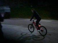
trail: Norra Skatebrostigen
0:09 |
24 |
Nov 9, 2025
Recent Trail Reports
| status | trail | date | condition | info | user |
|---|---|---|---|---|---|
| Tvärstigen | Apr 27, 2025 @ 10:36am Apr 27, 2025 | Wet | JimmyWkuAYL | ||
| Löefluget | Apr 27, 2025 @ 10:36am Apr 27, 2025 | Wet | JimmyWkuAYL | ||
| Experten 2 | Apr 27, 2025 @ 10:36am Apr 27, 2025 | Ideal | JimmyWkuAYL | ||
| Experten Avslutning 1 | Apr 27, 2025 @ 10:36am Apr 27, 2025 | Ideal | JimmyWkuAYL | ||
| Fyra Gubbars Tjärn | Apr 27, 2025 @ 10:36am Apr 27, 2025 | Ideal | JimmyWkuAYL | ||
| Hols Kvarnväg | Apr 27, 2025 @ 10:36am Apr 27, 2025 | Ideal | JimmyWkuAYL | ||
| Experten | Apr 15, 2025 @ 5:18pm Apr 15, 2025 | Ideal | JimmyWkuAYL | ||
| Barrstigen | Apr 15, 2025 @ 5:18pm Apr 15, 2025 | Ideal | JimmyWkuAYL | ||
| Terrängmilen Vänersborg Hunnerna | Aug 3, 2024 @ 5:23am Aug 3, 2024 | Ideal | tljunggren | ||
| MTB Blå Grus | Aug 3, 2024 @ 5:23am Aug 3, 2024 | Ideal | tljunggren |
Activity Feed
| username | action | type | title | date |
|---|---|---|---|---|
| update | event | activity #93207807 | Apr 23, 2026 @ 5:55am Apr 23, 2026 | |
| update | event | activity #90284827 | Mar 9, 2026 @ 1:30pm Mar 9, 2026 | |
| update | event | activity #86716803 | Jan 5, 2026 @ 3:48pm Jan 5, 2026 | |
| djendrek88 | add | video | activity #83839830 | Nov 9, 2025 @ 3:27am Nov 9, 2025 |
| ekebom | wishlist | region | activity #82263723 | Oct 13, 2025 @ 3:46am Oct 13, 2025 |
Recent Comments
| username | type | title | comment | date |
|---|---|---|---|---|
| trail | hmm trial åkare eller? | Aug 18, 2023 @ 6:42am Aug 18, 2023 | ||
| trail | Helt ur bruk, flertalet träd ligger över... | Jul 29, 2023 @ 12:21pm Jul 29, 2023 | ||
| trail | Blocked by many trees. Hard to get into the flow | Jul 9, 2023 @ 7:13am Jul 9, 2023 | ||
| trail | Tack för kommentar. Jag drar ned till blå... | Jun 22, 2023 @ 2:58am Jun 22, 2023 | ||
| trail | Hi, this is a blue trail. So quite easy level. | Jun 22, 2023 @ 2:37am Jun 22, 2023 |
Local Badges
-

Completionist0 awarded -

Epic Mountain Bike Climb 2k2 awarded -

Climbing 10k Badge10 awarded -

Mountain Biking 100k Badge0 awarded -

Epic Ride Descent 2k2 awarded -

Descent 10k Badge10 awarded
Activity Type Stats
| activitytype | trails | distance | descent | descent distance | total vertical | rating | global rank | state rank | photos | reports | routes | ridelogs |
|---|---|---|---|---|---|---|---|---|---|---|---|---|
| Mountain Bike | 132 | 119 miles | 5,899 ft | 50 miles | 574 ft | #3,128 | #113 | 10 | 301 | 5 | 4,094 | |
| E-Bike | 1 | 2,523 ft | 20 ft | 725 ft | 157 ft | 277 | 42 | |||||
| Hike | 132 | 119 miles | 5,899 ft | 50 miles | 574 ft | #1,831 | #82 | 301 | 3 | 103 | ||
| Trail Running | 132 | 119 miles | 5,899 ft | 50 miles | 574 ft | #1,370 | #85 | 301 | 3 | 208 | ||
| Backcountry Ski | 8 | 5 miles | 138 ft | 1 mile | 118 ft | #403 | #26 | 5 | ||||
| Nordic Ski | 19 | 11 miles | 430 ft | 4 miles | 430 ft | #841 | #90 | 103 |
Frequently Asked Questions About Vänersborg
▼
What are the best places to ride in Vänersborg?
Vänersborg has 5 areas to explore for mountain biking. The top rated areas are:
▼
What are the highest rated mountain biking trails in Vänersborg?
The highest rated mountain biking trails in Vänersborg are:
- Fyra Gubbars Tjärn (4.1/5)
- Terrängmilen Vänersborg (4.1/5)
- Svarta Guldet DH (4.1/5)
- Röda Spåret (4.1/5)
- Titta Inte Ned 1 (4/5)
▼
What is the best time of the year to ride in Vänersborg?
Based on ride log data, the most popular months to ride in Vänersborg are:
- July (29 activities)
- August (21 activities)
- September (20 activities)
▼
Where can I park to ride in Vänersborg?
Activities
Trails
Points of Interest
- By OrjanX
 TRAILFORKS Stgvrkt & contributors
 - Admins: ollesvenskonthetrail, JALLE, OrjanX, martinlindstr, nivis, Marleey, wikisara, JBohden
- #30268 - 3,482 views
- vänersborg activity log | embed map of Vänersborg mountain bike trails | vänersborg mountain biking points of interest
Downloading of trail gps tracks in kml & gpx formats is enabled for Vänersborg.
You must login to download files.