close
-
Layers w
- Weather Layers
- Pro
- Pro
- Pro
- Pro
- Pro
- Pro
- More Layers
- Pro
- Pro
- Pro
- Pro
-
Upgrade to

3D
Trail Conditions
- Unknown
- Snow Groomed
- Snow Packed
- Snow Covered
- Snow Cover Partial
- Freeze/thaw Cycle
- Icy
- Prevalent Mud
- Wet
- Variable
- Ideal
- Dry
- Very Dry
Trail Flow (Ridden Direction)
Trailforks scans users ridelogs to determine the most popular direction each trail is ridden. A good flowing trail network will have most trails flowing in a single direction according to their intension.
The colour categories are based on what percentage of riders are riding a trail in its intended direction.
The colour categories are based on what percentage of riders are riding a trail in its intended direction.
- > 96%
- > 90%
- > 80%
- > 70%
- > 50%
- < 50%
- bi-directional trail
- no data
Trail Last Ridden
Trailforks scans ridelogs to determine the last time a trail was ridden.
- < 2 days
- < 1 week
- < 2 weeks
- < 1 month
- < 6 months
- > 6 months
Trail Ridden Direction
The intended direction a trail should be ridden.
- Downhill Only
- Downhill Primary
- Both Directions
- Uphill Primary
- Uphill Only
- One Direction
Contribute Details
Colors indicate trail is missing specified detail.
- Description
- Photos
- Description & Photos
- Videos
Trail Popularity ?
Trailforks scans ridelogs to determine which trails are ridden the most in the last 9 months.
Trails are compared with nearby trails in the same city region with a possible 25 colour shades.
Think of this as a heatmap, more rides = more kinetic energy = warmer colors.
- most popular
- popular
- less popular
- not popular
ATV/ORV/OHV Filter
Max Vehicle Width
inches
US Cell Coverage
Legend

Radar Time
Activity Recordings
Trailforks uses anonymized public activity data.
?
Activity Recordings
Trailforks uses anonymized public activity data.
?
Personal Heatmap
▶
Activity Types
all
/
none
▶
Options
2
Date range
month
–
Winter Trails
Warning
A routing network for winter maps does not exist. Selecting trails using the winter trails layer has been disabled.
Missing Trails
Most Popular
Least Popular
Trails are colored based on popularity. The more popular a trail is, the more red. Less popular trails trend towards green.
Jump Magnitude Heatmap
Heatmap of where riders jump on trails. Zoom in to see individual jumps, click circles to view jump details.
BC Backroad Status
![map legend]()
Service Road Atlas is a free to use, community-driven service for viewing and creating reports on the numerous back-country service roads around B.C. and Alberta.

Slope Aspect
Direction the slope faces
Trails Deemphasized
Trails are shown in grey.
Only show trails with no bike usage.
Suggested Layers
Based on selected activity type
Save the current map location and zoom level as your default home location whenever this page is loaded.
Save
No description for Vantaa has been added yet!
Login or register to submit one.
Activities Click to view
- Mountain Bike
411 trails
- E-Bike
406 trails
- Adaptive Bike
0 trails
- Winter Fat Bike
0 trails
- Hike
409 trails
- Trail Running
409 trails
- Snowshoe
4 trails
- Nordic Ski
22 trails
Region Details
- 80
- 15
- 102
- 181
- 27
- 3
- 1
Region Status
Open as of May 11, 2026Stats
- Avg Trail Rating
- Trails (view details)
- 409
- Trails Mountain Bike
- 411
- Trails E-Bike
- 406
- Trails Hike
- 409
- Trails Trail Running
- 409
- Trails Dirtbike/Moto
- 3
- Trails Snowshoe
- 4
- Trails Backcountry Ski
- 3
- Trails Nordic Ski
- 22
- Total Distance
- 139 miles
- Total Descent
- 8,522 ft
- Total Vertical
- 255 ft
- Highest Trailhead
- 313 ft
- Reports
- 117
- Photos
- 4
- Ridden Counter
- 2,578
Popular Vantaa Mountain Biking Trails
• 100 ★ 0.0 • 860 ft • 0 ft • 28 •
Popular green difficulty singletrack. This mountain bike primary trail can be used both directions. On average it takes 2 minutes to complete this trail.
• 100 ★ 0.0 • 2,513 ft • 3 ft • 26 •
Perus polku voimalinjalta Ylästöntielle, lienee vanhaa moto spooria alunperin...
• 100 ★ 0.0 • 656 ft • 0 ft • 25 •
Popular green difficulty singletrack. This mountain bike primary trail can be used both directions. On average it takes 1 minutes to complete this trail.
• 100 ★ 0.0 • 623 ft • 23 ft • 24 •
Popular blue difficulty singletrack. This mountain bike primary trail can be used both directions. On average it takes minutes to complete this trail.
• 100 ★ 0.0 • 873 ft • 0 ft • 22 •
Popular blue difficulty singletrack. This mountain bike primary trail can be used both directions. On average it takes 2 minutes to complete this trail.
• 100 ★ 0.0 • 1,030 ft • 0 ft • 22 •
Popular green difficulty singletrack. This mountain bike primary trail can be used both directions. On average it takes 4 minutes to complete this trail.
• 100 ★ 0.0 • 1,010 ft • 6 ft • 20 •
Popular blue difficulty singletrack. This mountain bike primary trail can be used both directions. On average it takes 1 minutes to complete this trail.
• 100 ★ 0.0 • 587 ft • 0 ft • 20 •
Popular blue difficulty singletrack. This mountain bike primary trail can be used both directions.
Vantaa Mountain Bike Routes
46 miles • 2,248 ft • 26 •
Route going around the airport from Klaukkala. Cuttin Klaukkala off about 10km shorter. Plenty of...
Videos of Vantaa Mountain Bike
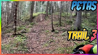
trail: Petikko SähköLinjaOffCamber
3:22 |
102 |
Jan 30, 2024 , Vantaa
Recent Trail Reports
| status | trail | date | condition | info | user |
|---|---|---|---|---|---|
| Mätäkivenmäki Access5 | May 11, 2026 @ 5:58pm (Europe/Helsinki) May 11, 2026 | Dry | Larppamatic | ||
| MätäkivenMäki Linja2 | May 6, 2026 @ 12:48pm (Europe/Helsinki) May 6, 2026 | Dry | mcharza | ||
| MätäkivenMäki Linja1 | May 6, 2026 @ 12:48pm (Europe/Helsinki) May 6, 2026 | Dry | mcharza | ||
| Vävarsin ToineMehtä | May 6, 2026 @ 12:48pm (Europe/Helsinki) May 6, 2026 | Dry | mcharza | ||
| Vävars Entry | May 6, 2026 @ 12:48pm (Europe/Helsinki) May 6, 2026 | Dry | mcharza | ||
| Väli4 | Apr 5, 2026 @ 12:33pm (Europe/Helsinki) Apr 5, 2026 | Variable | mcharza | ||
| FilipeKmuna | Apr 5, 2026 @ 12:33pm (Europe/Helsinki) Apr 5, 2026 | Variable | mcharza | ||
| Just moto | Apr 5, 2026 @ 12:33pm (Europe/Helsinki) Apr 5, 2026 | Variable | mcharza | ||
| Pirunkorpi Access11 | Mar 21, 2026 @ 1:05pm (Europe/Helsinki) Mar 21, 2026 | Variable | mcharza | ||
| PenkkiVoima | Dec 21, 2025 @ 11:55am (Europe/Helsinki) Dec 21, 2025 | Prevalent Mud | mcharza |
Activity Feed
| username | action | type | title | date |
|---|---|---|---|---|
| D5nbCC | ridden | trail | activity #95400455 and 2 more | May 24, 2026 @ 5:45am May 24, 2026 |
| Larppamatic | add | report | activity #94547057 | May 12, 2026 @ 3:05am May 12, 2026 |
| mcharza | add | report | activity #94148525 and 3 more | May 6, 2026 @ 5:07am May 6, 2026 |
| mcharza | add | report | activity #92387047 and 1 more | Apr 11, 2026 @ 6:56am Apr 11, 2026 |
| mcharza | add | report | activity #91968673 and 2 more | Apr 5, 2026 @ 5:04am Apr 5, 2026 |
Recent Comments
| username | type | title | comment | date |
|---|---|---|---|---|
| trail | Goes around frisbee lanes | May 19, 2025 @ 10:35am May 19, 2025 | ||
| trail | Tulossa ollaan. Toivottavasti tämä olisi... | May 3, 2020 @ 7:27am May 3, 2020 |
Local Badges
-

10 Black Trails2 awarded -

10 Blue Trails12 awarded -

10 Green Trails18 awarded -

Epic Mountain Bike Climb 2k2 awarded -

Climbing 10k Badge4 awarded -

Mountain Biking 100k Badge1 awarded
Bike & Skill Parks
| name | type | city | rating |
|---|---|---|---|
| Ylästön pumptrack | skill park | Vantaa |
Activity Type Stats
| activitytype | trails | distance | descent | descent distance | total vertical | rating | global rank | state rank | photos | reports | routes | ridelogs |
|---|---|---|---|---|---|---|---|---|---|---|---|---|
| Mountain Bike | 411 | 139 miles | 8,520 ft | 56 miles | 256 ft | #456 | #4 | 4 | 117 | 1 | 2,724 | |
| E-Bike | 406 | 138 miles | 8,415 ft | 56 miles | 256 ft | #143 | #3 | 117 | 1 | 561 | ||
| Hike | 409 | 139 miles | 8,520 ft | 56 miles | 256 ft | #584 | #5 | 117 | 71 | |||
| Trail Running | 409 | 139 miles | 8,520 ft | 56 miles | 256 ft | #403 | #5 | 117 | 82 | |||
| Dirtbike/Moto | 3 | 2 miles | 85 ft | 3,297 ft | 167 ft | 1 | ||||||
| Snowshoe | 4 | 2 miles | 79 ft | 2,815 ft | 102 ft | #260 | #8 | 1 | ||||
| Backcountry Ski | 3 | 2 miles | 46 ft | 2,297 ft | 98 ft | 1 | ||||||
| Nordic Ski | 22 | 4 miles | 259 ft | 1 mile | 200 ft | #283 | #12 | 104 |
Frequently Asked Questions About Vantaa
▼
What are the best places to ride in Vantaa?
▼
What are the highest rated mountain biking trails in Vantaa?
The highest rated mountain biking trails in Vantaa are:
- Rajakylä HerkkuMutka (4.1/5)
- MätäkivenMäki Linja2 (0/5)
- MätäkivenMäki Linja1 (0/5)
- Mätäkivenmäki EkaSiit (0/5)
- Mätäkivenmäki Linja3 (0/5)
▼
What is the best time of the year to ride in Vantaa?
Based on ride log data, the most popular months to ride in Vantaa are:
- November (8 activities)
- September (4 activities)
- May (3 activities)
▼
Where can I park to ride in Vantaa?
There are 2 parking locations listed in Vantaa. The most popular parking spots are:
Activities
Trails
- By samponiem & contributors
- Admins: Bunabe
- #23564 - 4,318 views
- vantaa activity log | embed map of Vantaa mountain bike trails | vantaa mountain biking points of interest
Downloading of trail gps tracks in kml & gpx formats is enabled for Vantaa.
You must login to download files.