close
-
Layers w
- Weather Layers
- Pro
- Pro
- Pro
- Pro
- Pro
- Pro
- More Layers
- Pro
- Pro
- Pro
- Pro
-
Upgrade to

3D
Trail Conditions
- Unknown
- Snow Groomed
- Snow Packed
- Snow Covered
- Snow Cover Partial
- Freeze/thaw Cycle
- Icy
- Prevalent Mud
- Wet
- Variable
- Ideal
- Dry
- Very Dry
Trail Flow (Ridden Direction)
Trailforks scans users ridelogs to determine the most popular direction each trail is ridden. A good flowing trail network will have most trails flowing in a single direction according to their intension.
The colour categories are based on what percentage of riders are riding a trail in its intended direction.
The colour categories are based on what percentage of riders are riding a trail in its intended direction.
- > 96%
- > 90%
- > 80%
- > 70%
- > 50%
- < 50%
- bi-directional trail
- no data
Trail Last Ridden
Trailforks scans ridelogs to determine the last time a trail was ridden.
- < 2 days
- < 1 week
- < 2 weeks
- < 1 month
- < 6 months
- > 6 months
Trail Ridden Direction
The intended direction a trail should be ridden.
- Downhill Only
- Downhill Primary
- Both Directions
- Uphill Primary
- Uphill Only
- One Direction
Contribute Details
Colors indicate trail is missing specified detail.
- Description
- Photos
- Description & Photos
- Videos
Trail Popularity ?
Trailforks scans ridelogs to determine which trails are ridden the most in the last 9 months.
Trails are compared with nearby trails in the same city region with a possible 25 colour shades.
Think of this as a heatmap, more rides = more kinetic energy = warmer colors.
- most popular
- popular
- less popular
- not popular
ATV/ORV/OHV Filter
Max Vehicle Width
inches
US Cell Coverage
Legend

Radar Time
Activity Recordings
Trailforks uses anonymized public activity data.
?
Activity Recordings
Trailforks uses anonymized public activity data.
?
Personal Heatmap
▶
Activity Types
all
/
none
▶
Options
2
Date range
month
–
Winter Trails
Warning
A routing network for winter maps does not exist. Selecting trails using the winter trails layer has been disabled.
Missing Trails
Most Popular
Least Popular
Trails are colored based on popularity. The more popular a trail is, the more red. Less popular trails trend towards green.
Jump Magnitude Heatmap
Heatmap of where riders jump on trails. Zoom in to see individual jumps, click circles to view jump details.
BC Backroad Status
![map legend]()
Service Road Atlas is a free to use, community-driven service for viewing and creating reports on the numerous back-country service roads around B.C. and Alberta.

Slope Aspect
Direction the slope faces
Trails Deemphasized
Trails are shown in grey.
Only show trails with no bike usage.
Suggested Layers
Based on selected activity type
Save the current map location and zoom level as your default home location whenever this page is loaded.
SaveDepartement du Var
This region uses the Uk/Euro style trail grading system.
Activities Click to view
- Mountain Bike
2,336 trails
- E-Bike
1,795 trails
- Gravel Bike
217 trails
- Horse
57 trails
- Hike
2,221 trails
- Trail Running
2,179 trails
- Dirtbike/Moto
18 trails
- ATV/ORV/OHV
16 trails
- Snowmobile
13 trails
- Snowshoe
14 trails
- Nordic Ski
14 trails
Stats
- Avg Trail Rating
- Trails (view details)
- 2,344
- Trails Mountain Bike
- 2,336
- Trails E-Bike
- 1,795
- Trails Gravel Bike
- 217
- Trails Horse
- 57
- Trails Hike
- 2,221
- Trails Trail Running
- 2,179
- Trails Dirtbike/Moto
- 18
- Trails ATV/ORV/OHV
- 16
- Trails Snowmobile
- 13
- Trails Snowshoe
- 14
- Trails Nordic Ski
- 14
- Total Distance
- 1,985 miles
- Total Descent
- 534,908 ft
- Total Vertical
- 5,463 ft
- Highest Trailhead
- 5,464 ft
- Reports
- 8,713
- Photos
- 896
- Ridden Counter
- 61,182
Articles
Les Arcs Enduro2 Opens 2021 Entries
Dec 29, 2020 from pinkbike.com
They're offering risk-free entry and guaranteed 100% refund if either you, or they, are forced to cancel for pandemic-related reasons.
Video: Vincent Pernin Gets Creative in Les Arcs in 'Overcome'
Dec 22, 2019 from pinkbike.com
Vincent Pernin jibs his way down Les Arcs trail network.
Popular Trail Networks
view all areas »Sub Regions
- Aups (5)
- Bagnols en Foret (104)
- La Bouverie (19)
- Bargemon (26)
- Bormes-les-Mimosas (9)
- Bras (15)
- Cochonduro (0)
- Callas (10)
- Claviers (10)
- Collobriere (34)
- Cotignac (2)
- Cuers (12)
- Draguignan (372)
- Entrecasteaux (8)
- Flayosc (5)
- Fréjus (77)
- Gassin (36)
- Giens (1)
- Ginasservis (1)
- Grimaud (41)
- Hyères (142)
- La Maunière (37)
- Le Fenouillet (60)
- La Garde-Freinet (32)
- La Garde Freinet (21)
- La Londe-les-Maures (18)
- La Mole (4)
- La Motte (114)
- Foret de Palayson (111)
- La Seyne Sur Mer (53)
- Janas (47)
- Le Cannet (7)
- Le luc en provence (4)
- Le Muy (1)
- Le Thoronet (3)
- Les Arcs (32)
- Lorgues (24)
- Berne (24)
- Mazaugues (2)
- Méounes (13)
- Moissac Bellevie (1)
- Mons (83)
- Haute Siagne (60)
- Montauroux (134)
- Nans Les Pins (2)
- Pierrefeu (53)
- Pignans (10)
- Plan d'Aups Sainte Baume (4)
- Plan de la Tour (3)
- Porquerolles (7)
- Pourcieux (23)
- Pourrieres (4)
- Puget Sur Argens (26)
- Cabran (0)
- Roquebrune sur Argens (99)
- Saint Antonin (2)
- Saint Maxime (3)
- Saint Paul En Foret (15)
- Salernes (12)
- Salernes (1)
- Seillans (17)
- Signes (18)
- Sillans La Cascade (1)
- Six-Fours-les-Plages (3)
- Solliès-Pont (53)
- St Paul en Foret (69)
- Lac de Meaulx (39)
- Tanneron (43)
- Taradeau (15)
- Toulon (38)
- Mont Coudon (4)
- Trans en Provence (35)
- Trans - La Motte (34)
- Trigance (9)
- Gorges du Verdon (8)
- Vidauban (4)
- Esterel (19)
- La Bouisse (14)
- Lachens (81)
- Le Dom (3)
- Massif des Maures (37)
- Parc Naturel Regional de la Sainte Beaume (159)
- Plan de la Tour (63)
- Trans en Provence (1)
- Trigance / Gorges du Verdon (17)
Popular Var Mountain Biking Trails
• 100 ★ 4.0 • 2,388 ft • 15 ft • 436 •
Popular green difficulty singletrack. This mountain bike primary trail can be used both directions and has a easy overall physical rating. On average it takes 2 minutes to complete this trail.
• 100 ★ 3.9 • 3,081 ft • 2 ft • 365 •
Popular red difficulty singletrack. This mountain bike primary trail can be used downhill only and has a moderate overall physical rating. On average it takes 4 minutes to complete this trail.
• 95 ★ 0.0 • 1,257 ft • 28 ft • 281 •
Popular red difficulty doubletrack. This multi-use trail can be used both directions and has a moderate overall physical rating with a 28 ft green climb. Trail visibility is always easy to follow. On average it takes 2 minutes to complete this trail.
• 100 ★ 0.0 • 1,165 ft • 48 ft • 277 •
Popular green difficulty singletrack. This mountain bike primary trail can be used uphill primary and has a easy overall physical rating with a 48 ft green climb. Trail visibility is always easy to follow. On average it takes 1 minutes to complete this trail.
• 90 ★ 2.7 • 4,803 ft • 0 ft • 274 •
Popular blue difficulty singletrack. This mountain bike primary trail can be used downhill only and has a hard overall physical rating. Trail visibility is always easy to follow. On average it takes 3 minutes to complete this trail.
• 100 ★ 0.0 • 758 ft • 3 ft • 269 •
Popular green difficulty singletrack. This mountain bike primary trail can be used both directions and has a easy overall physical rating with a 3 ft green climb. Trail visibility is always easy to follow. On average it takes 1 minutes to complete this trail.
• 100 ★ 0.0 • 1 mile • 134 ft • 265 •
Popular blue difficulty singletrack. This mountain bike primary trail can be used both directions and has a hard overall physical rating with a 134 ft black diamond climb. On average it takes 12 minutes to complete this trail.
• 100 ★ 0.0 • 2 miles • 295 ft • 255 •
Départ sur Piste et ensuite ça devient plus technique et plus raide.
Var Mountain Bike Routes
★ 5.0 • 28 miles • 4,661 ft • 14 • Loop •
Parcours du Roc d'azur 2015 faisable hors période de course en evitant les secteurs fermés et privés.
★ 4.0 • 20 miles • 3,717 ft • 21 • Loop •
Une boucle a faire entre Figanieres et Draguignan
4 miles • 662 ft • 3 • Loop •
Malmont - Le Une boucle de difficulté technique de type Bleu. Distance: 6.8 Kms pour 240m de denivelé....
20 miles • 2,783 ft • 11 • Point to Point •
A very nice route from the summit of the Lachens to Montauroux. Very technical descents with a lot of...
19 miles • 3,118 ft • 3 • Loop •
Boucle trés sympa au depart du petit village de Mons, avec quelques beaux passages technique en descente...
10 miles • 1,927 ft • 10 • Loop •
Difficulté technique: Noir. Plusieurs passages engagés avec des echapatoires possible pour les plus...
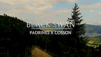
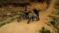
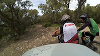
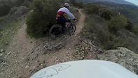
Photos of Var Mountain Bike
Videos of Var Mountain Bike
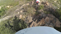
trail: Chateau D'Enfer
0:17 |
17 |
Nov 2, 2025

trail: Looking for grip
6:11 |
76 |
Jan 28, 2020
trail: Adrenaline
4:32 |
110 |
Jan 23, 2020
trail: Clash
0:16 |
101 |
Aug 8, 2019
trail: Clash
3:11 |
14 |
Aug 8, 2019
trail: la sous-bois
7:00 |
246 |
Mar 29, 2018
trail: Down du gros cailloux
4:03 |
368 |
Mar 29, 2018
trail: La Mine
4:39 |
224 |
Mar 29, 2018
Current Trail Warnings
| status | trail | date | condition | user | info |
|---|---|---|---|---|---|
| Porquerolles dh Porquerolles | Jun 7, 2026 @ 10:45am (Europe/Paris) Jun 7, 2026 | Dry | R7EkghRl | Large tree down across trail, blocking... | |
| DH croix des Pins Aups | May 23, 2026 @ 1:44pm (Europe/Paris) May 23, 2026 | Dry | Domischlachter | overgrown and not rideable |
Recent Trail Reports
Activity Feed
| username | action | type | title | date |
|---|---|---|---|---|
| freerider48 | add | route | activity #97308178 | Jun 19, 2026 @ 4:47am 1 day |
| TizianablokOw | ridden | trail | activity #97304866 | Jun 19, 2026 @ 3:00am 2 days |
| Subsith | ridden | trail | activity #97275745 | Jun 18, 2026 @ 2:18pm 2 days |
| ThibautDebrabandere | wishlist | region | activity #97233435 | Jun 17, 2026 @ 10:41pm 3 days |
| qavr83 | add | trail | activity #97088432 and 1 more | Jun 15, 2026 @ 10:31pm Jun 15, 2026 |
Recent Comments
| username | type | title | comment | date |
|---|---|---|---|---|
| trail | Proper tech line with some gnarly sections.... | May 27, 2026 @ 11:59pm May 27, 2026 | ||
| trail | Brilliant flowy tech trail with some amazing... | May 27, 2026 @ 11:54pm May 27, 2026 | ||
| trail | Unfortunately this has been made a hiking only... | May 27, 2026 @ 11:39pm May 27, 2026 | ||
| report | The tree is still lying across the trail | May 26, 2026 @ 11:33am May 26, 2026 | ||
| trail | One of the nicest trails in this area. I love... | May 26, 2026 @ 11:31am May 26, 2026 |
Local Badges
-
The Draguignan / Figanieres Gnar2 awarded -
The Flow2 awarded -

Top 10 Trails0 awarded -

Big Ride 30k218 awarded -

10 Green Trails7 awarded -

Epic Ride 50k119 awarded
Bike & Skill Parks
| name | type | city | rating |
|---|---|---|---|
| Bike Park de Figanieres | skill park | Draguignan | |
| Pumptrack Bargemon | skill park | Bargemon | |
| Pump Track | skill park | ||
| Pumptrack Pourrières | skill park | Pourrieres | |
| Pump Track | skill park | Draguignan |
Upcoming Local Events
Local Trail Supporters
- Cyril Lafont
- janko83
Local Trail Association
-

Local Trail Supporters
- Cyril Lafont
- janko83
Local Trail Association
Activity Type Stats
| activitytype | trails | distance | descent | descent distance | total vertical | rating | global rank | state rank | photos | reports | routes | ridelogs |
|---|---|---|---|---|---|---|---|---|---|---|---|---|
| Mountain Bike | 2,336 | 1,967 miles | 528,711 ft | 1,020 miles | 5,463 ft | 880 | 8,706 | 76 | 49,863 | |||
| E-Bike | 1,795 | 1,528 miles | 369,718 ft | 766 miles | 5,377 ft | 6 | 8,442 | 26 | 11,693 | |||
| Gravel Bike | 217 | 295 miles | 37,776 ft | 100 miles | 4,236 ft | 1,500 | 2 | 280 | ||||
| Horse | 57 | 80 miles | 14,560 ft | 34 miles | 4,199 ft | 3,854 | ||||||
| Hike | 2,221 | 1,901 miles | 492,480 ft | 967 miles | 5,463 ft | 10 | 8,573 | 1 | 2,653 | |||
| Trail Running | 2,179 | 1,863 miles | 480,420 ft | 949 miles | 5,463 ft | 8,575 | 1 | 3,917 | ||||
| Dirtbike/Moto | 18 | 23 miles | 3,645 ft | 8 miles | 4,121 ft | 3,843 | 6 | |||||
| ATV/ORV/OHV | 16 | 16 miles | 1,837 ft | 5 miles | 2,123 ft | 3,843 | 2 | |||||
| Snowmobile | 13 | 13 miles | 1,798 ft | 5 miles | 1,529 ft | 434 | ||||||
| Snowshoe | 14 | 13 miles | 1,798 ft | 5 miles | 1,529 ft | 434 | 16 | |||||
| Nordic Ski | 14 | 13 miles | 1,913 ft | 5 miles | 1,529 ft | 434 | 59 |
Frequently Asked Questions About Var
▼
What are the best places to ride in Var?
Var has 30 areas to explore for mountain biking. The top rated areas are:
▼
What are the highest rated mountain biking trails in Var?
The highest rated mountain biking trails in Var are:
- Paradis De L'Epingle (4.5/5)
- Notre Dame du Mai > Sémaphore (4.4/5)
- Full Speed (4.4/5)
- Roq'n Ride Upper (4.4/5)
- Mini Canyon (4.4/5)
▼
What is the best time of the year to ride in Var?
Based on ride log data, the most popular months to ride in Var are:
- October (253 activities)
- August (195 activities)
- July (156 activities)
▼
What is the longest trail in Var?
The longest trail in Var is Voie Verte Toulon - Carqueiranne at 8.4 miles. View all trails sorted by distance.
Activities
Trails
Points of Interest
- By hpman83
 TRAILFORKS TFFRANCE & contributors
 - Admins: TFFRANCE, elyari, freerider48, provencemb
- #7118 - 8,284 views
- var activity log | embed map of Var mountain bike trails | var mountain biking points of interest polygons
Downloading of trail gps tracks in kml & gpx formats is enabled for Var.
You must login to download files.