close
-
Layers w
- Weather Layers
- Pro
- Pro
- Pro
- Pro
- Pro
- Pro
- More Layers
- Pro
- Pro
- Pro
- Pro
-
Upgrade to

3D
Trail Conditions
- Unknown
- Snow Groomed
- Snow Packed
- Snow Covered
- Snow Cover Partial
- Freeze/thaw Cycle
- Icy
- Prevalent Mud
- Wet
- Variable
- Ideal
- Dry
- Very Dry
Trail Flow (Ridden Direction)
Trailforks scans users ridelogs to determine the most popular direction each trail is ridden. A good flowing trail network will have most trails flowing in a single direction according to their intension.
The colour categories are based on what percentage of riders are riding a trail in its intended direction.
The colour categories are based on what percentage of riders are riding a trail in its intended direction.
- > 96%
- > 90%
- > 80%
- > 70%
- > 50%
- < 50%
- bi-directional trail
- no data
Trail Last Ridden
Trailforks scans ridelogs to determine the last time a trail was ridden.
- < 2 days
- < 1 week
- < 2 weeks
- < 1 month
- < 6 months
- > 6 months
Trail Ridden Direction
The intended direction a trail should be ridden.
- Downhill Only
- Downhill Primary
- Both Directions
- Uphill Primary
- Uphill Only
- One Direction
Contribute Details
Colors indicate trail is missing specified detail.
- Description
- Photos
- Description & Photos
- Videos
Trail Popularity ?
Trailforks scans ridelogs to determine which trails are ridden the most in the last 9 months.
Trails are compared with nearby trails in the same city region with a possible 25 colour shades.
Think of this as a heatmap, more rides = more kinetic energy = warmer colors.
- most popular
- popular
- less popular
- not popular
ATV/ORV/OHV Filter
Max Vehicle Width
inches
US Cell Coverage
Legend

Radar Time
Activity Recordings
Trailforks uses anonymized public activity data.
?
Activity Recordings
Trailforks uses anonymized public activity data.
?
Personal Heatmap
▶
Activity Types
all
/
none
▶
Options
2
Date range
month
–
Winter Trails
Warning
A routing network for winter maps does not exist. Selecting trails using the winter trails layer has been disabled.
Missing Trails
Most Popular
Least Popular
Trails are colored based on popularity. The more popular a trail is, the more red. Less popular trails trend towards green.
Jump Magnitude Heatmap
Heatmap of where riders jump on trails. Zoom in to see individual jumps, click circles to view jump details.
BC Backroad Status
![map legend]()
Service Road Atlas is a free to use, community-driven service for viewing and creating reports on the numerous back-country service roads around B.C. and Alberta.

Slope Aspect
Direction the slope faces
Trails Deemphasized
Trails are shown in grey.
Only show trails with no bike usage.
Suggested Layers
Based on selected activity type
Save the current map location and zoom level as your default home location whenever this page is loaded.
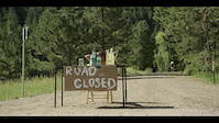
SaveThe Vasquez Creek and Leland Creek trails are located on the West and South side of the town of Winter Park. They are often accessed right from town but trailheads are also located on Vasquez Rd and Kings Crossing Ext (Xing).
Primary Trail Type: Cross-Country
eBikes Allowed:
No
Shuttleable: YES
AKA: Leland Creek Trails, Vasquez Rd Trails
Land Status: City Managed
Activities Click to view
- Mountain Bike
21 trails
- Hike
20 trails
- Trail Running
20 trails
- Dirtbike/Moto
2 trails
- Backcountry Ski
4 trails
Region Details
- 2
- 15
- 4
Region Status
Open as of Jun 21, 2026Stats
- Avg Trail Rating
- Trails (view details)
- 25
- Trails Mountain Bike
- 21
- Trails E-Bike
- 2
- Trails Horse
- 3
- Trails Hike
- 20
- Trails Trail Running
- 20
- Trails Dirtbike/Moto
- 2
- Trails Backcountry Ski
- 4
- Trails Nordic Ski
- 2
- Total Distance
- 23 miles
- Total Descent
- 5,173 ft
- Total Vertical
- 2,960 ft
- Highest Trailhead
- 11,723 ft
- Reports
- 443
- Photos
- 72
- Ridden Counter
- 10,874
Popular Vasquez Creek and Leland Creek Areas Trails
• 95 ★ 4.7 • 1 mile • 14 ft • 1,003 •
Purpose-built, downhill only flow trail from Akima's Way to . This downhill only bike trail has tons of fun berms and rollers with a few big rocks thrown in. A few big roller-doubles that can be linked, but everything rolls.
• 90 ★ 4.5 • 3,606 ft • 139 ft • 864 •
Highly rated popular black diamond difficulty singletrack. This mountain bike primary trail. It features bridge and roller coaster. On average it takes 8 minutes to complete this trail.
• 80 ★ 4.0 • 1 mile • 226 ft • 772 •
A very fun trail that features moments of chunk, baby heads, option rock rolls and skinnies. A must do if you're in the area and a great way to drop into
• 85 ★ 3.5 • 4,224 ft • 91 ft • 685 •
Smooth pedally singletrack with a bit of pedaling and some fun tight berms towards the bottom. The trail extends Take D' Leap down to at the trailhead.
• 70 ★ 3.7 • 4,140 ft • 0 ft • 671 •
is a fun technical descent with big boulder rollers and drops. Everything is optional and there are go-arounds but you can test your technical skills on this trail if you want to. I am willing to bet more over the bars face plants have...
• 75 ★ 4.2 • 1 mile • 51 ft • 553 •
Popular blue difficulty singletrack. This mountain bike primary trail can be used both directions. On average it takes 11 minutes to complete this trail.
• 75 ★ 2.5 • 3,711 ft • 91 ft • 526 •
Nice intermediate trail that used to be an old washed out trail. It has been rerouted and now climbs nice with some rock features and little alternate lines
Photos of Vasquez Creek and Leland Creek Areas Mountain Bike
Videos of Vasquez Creek and Leland Creek Areas Mountain Bike
trail: WTB
3:55 |
140 |
Oct 11, 2019

trail: WTB
7:08 |
195 |
Aug 4, 2015

trail: Razzmatazz
28:19 |
170 |
Aug 22, 2023 , Winter Park
trail: Sunset Pink
28:19 |
143 |
Aug 22, 2023 , Winter Park

trail: Lower Take D' Leap
28:19 |
122 |
Aug 22, 2023 , Winter Park
trail: Take D'Leap
28:19 |
127 |
Aug 22, 2023 , Winter Park

trail: Leap Frog
28:19 |
140 |
Aug 22, 2023 , Winter Park

trail: D4-WTB
28:19 |
146 |
Aug 22, 2023 , Winter Park
Recent Trail Reports
| status | trail | date | condition | info | user |
|---|---|---|---|---|---|
| WTB | Jun 21, 2026 @ 10:08am (America/Denver) Jun 21, 2026 | Ideal | Shawnsrides | ||
| Akima's Way | Jun 21, 2026 @ 10:08am (America/Denver) Jun 21, 2026 | Dry | Shawnsrides | ||
| Lower Take D' Leap | Jun 21, 2026 @ 10:08am (America/Denver) Jun 21, 2026 | Dry | Shawnsrides | ||
| Fire Cracker | Jun 21, 2026 @ 10:08am (America/Denver) Jun 21, 2026 | Dry | Shawnsrides | ||
| Sundog | May 24, 2026 @ 12:38pm (America/Denver) May 24, 2026 | Ideal | jemmons213 | ||
| D4-WTB | May 24, 2026 @ 12:37pm (America/Denver) May 24, 2026 | Ideal | jemmons213 | ||
| Razzmatazz | May 24, 2026 @ 12:37pm (America/Denver) May 24, 2026 | Ideal | jemmons213 | ||
| Leap Frog | Sep 7, 2024 @ 1:28pm Sep 7, 2024 | Dry | tomthetrailrider | ||
| D3 | Sep 7, 2024 @ 1:28pm Sep 7, 2024 | Dry | tomthetrailrider | ||
| Take D'Leap | Sep 1, 2024 @ 1:47pm Sep 1, 2024 | Dry | giniek27 |
Activity Feed
| username | action | type | title | date |
|---|---|---|---|---|
| CantMesWitDis | wishlist | trail | activity #98760450 and 1 more | Jul 8, 2026 @ 8:18pm 14 hours |
| mdk422 | ridden | trail | activity #98472639 | Jul 4, 2026 @ 9:59pm Jul 4, 2026 |
| lamsonh | vote | trail | activity #97808393 | Jun 25, 2026 @ 6:41pm Jun 25, 2026 |
| Laurenzswr72 | wishlist | trail | activity #97803658 | Jun 25, 2026 @ 5:18pm Jun 25, 2026 |
| Shawnsrides | add | report | activity #97509387 and 3 more | Jun 21, 2026 @ 12:17pm Jun 21, 2026 |
Recent Comments
| username | type | title | comment | date |
|---|---|---|---|---|
| trail | Fun trail when it’s actually going... | Aug 6, 2025 @ 4:20pm Aug 6, 2025 | ||
| trail | I rescind my earlier comment. Razzmatazz is... | Oct 12, 2024 @ 11:39am Oct 12, 2024 | ||
| trail | Best trail around WP by a large margin | Oct 12, 2024 @ 11:38am Oct 12, 2024 | ||
| trail | My favorite non-resort trail in the area. Flow... | Jul 25, 2024 @ 3:52pm Jul 25, 2024 | ||
| trail | Totally missed the sarcasm in some of these... | Jul 25, 2024 @ 3:51pm Jul 25, 2024 |
Nearby Areas
| name | distance | ||||
|---|---|---|---|---|---|
| Fraser Valley | 2 | 10 | 3 | 1.3 km | |
| Trestle Bike Park | 8 | 15 | 12 | 4 | 2 km |
| Idlewild | 12 | 11 | 3 km | ||
| Devil's Thumb Ranch | 2 | 3 | 3 | 4.5 km | |
| St. Louis Creek | 3 | 1 | 5.6 km |
Local Badges
-

Completionist5 awarded
Activity Type Stats
| activitytype | trails | distance | descent | descent distance | total vertical | rating | global rank | state rank | photos | reports | routes | ridelogs |
|---|---|---|---|---|---|---|---|---|---|---|---|---|
| Mountain Bike | 21 | 18 miles | 3,901 ft | 10 miles | 1,161 ft | #3,593 | #1,261 | 72 | 441 | 6,686 | ||
| E-Bike | 2 | 2 miles | 118 ft | 1,982 ft | 272 ft | #1,563 | 319 | 71 | ||||
| Horse | 3 | 3 miles | 482 ft | 2 miles | 433 ft | 94 | ||||||
| Hike | 20 | 17 miles | 3,553 ft | 9 miles | 1,161 ft | #9,126 | 412 | 312 | ||||
| Trail Running | 20 | 17 miles | 3,553 ft | 9 miles | 1,161 ft | #8,536 | 412 | 126 | ||||
| Dirtbike/Moto | 2 | 2 miles | 118 ft | 1,982 ft | 272 ft | #1,112 | #526 | 92 | 6 | |||
| Backcountry Ski | 4 | 5 miles | 1,273 ft | 1 mile | 1,257 ft | #364 | #99 | 2 | 531 | |||
| Nordic Ski | 2 | 4 miles | 30 ft | 554 ft | 1,220 ft | #567 | #238 | 3 | 143 |
Frequently Asked Questions About Vasquez Creek and Leland Creek Areas
▼
What are the highest rated mountain biking trails in Vasquez Creek and Leland Creek Areas?
The highest rated mountain biking trails in Vasquez Creek and Leland Creek Areas are:
- Razzmatazz (4.6/5)
- Eye to Eye (4.5/5)
- Akima's Way (4.3/5)
- Take D'Leap (4.1/5)
- Sundog (4.1/5)
▼
What is the best time of the year to ride in Vasquez Creek and Leland Creek Areas?
Based on ride log data, the most popular months to ride in Vasquez Creek and Leland Creek Areas are:
- July (250 activities)
- August (131 activities)
- June (116 activities)
▼
Where can I park to ride in Vasquez Creek and Leland Creek Areas?
Check the Vasquez Creek and Leland Creek Areas trail map for trailhead and parking information. Community members regularly update access and parking details for trails in the area.
▼
What is the longest trail in Vasquez Creek and Leland Creek Areas?
The longest trail in Vasquez Creek and Leland Creek Areas is Eye to Eye at 2.2 miles. View all trails sorted by distance.
Activities
Trails
Points of Interest
- By brenthillier
 NSMBA TRAILFORKS & contributors
 - Admins: FVMTB, FVMTB, FVMTB
- #9978 - 9,153 views
- vasquez creek and leland creek areas activity log | embed map of Vasquez Creek and Leland Creek Areas mountain bike trails | vasquez creek and leland creek areas mountain biking points of interest
Downloading of trail gps tracks in kml & gpx formats is enabled for Vasquez Creek and Leland Creek Areas.
You must login to download files.