close
-
Layers w
- Weather Layers
- Pro
- Pro
- Pro
- Pro
- Pro
- Pro
- More Layers
- Pro
- Pro
- Pro
- Pro
-
Upgrade to

3D
Trail Conditions
- Unknown
- Snow Groomed
- Snow Packed
- Snow Covered
- Snow Cover Partial
- Freeze/thaw Cycle
- Icy
- Prevalent Mud
- Wet
- Variable
- Ideal
- Dry
- Very Dry
Trail Flow (Ridden Direction)
Trailforks scans users activity logs to determine the most popular direction each trail is ridden. A good flowing trail network will have most trails flowing in a single direction according to their intension.
The colour categories are based on what percentage of users are riding a trail in its intended direction.
The colour categories are based on what percentage of users are riding a trail in its intended direction.
- > 96%
- > 90%
- > 80%
- > 70%
- > 50%
- < 50%
- bi-directional trail
- no data
Trail Last Ridden
Trailforks scans activity logs to determine the last time a trail was ridden.
- < 2 days
- < 1 week
- < 2 weeks
- < 1 month
- < 6 months
- > 6 months
Trail Ridden Direction
The intended direction a trail should be ridden.
- Downhill Only
- Downhill Primary
- Both Directions
- Uphill Primary
- Uphill Only
- One Direction
Contribute Details
Colors indicate trail is missing specified detail.
- Description
- Photos
- Description & Photos
- Videos
Trail Popularity ?
Trailforks scans activity logs to determine which trails are ridden the most in the last 9 months.
Trails are compared with nearby trails in the same city region with a possible 25 colour shades.
Think of this as a heatmap, more activities = more kinetic energy = warmer colors.
- most popular
- popular
- less popular
- not popular
ATV/ORV/OHV Filter
Max Vehicle Width
inches
US Cell Coverage
Legend

Radar Time
Activity Recordings
Trailforks uses anonymized public activity data.
?
Activity Recordings
Trailforks uses anonymized public activity data.
?
Personal Heatmap
▶
Activity Types
all
/
none
▶
Options
2
Date range
month
–
Winter Trails
Warning
A routing network for winter maps does not exist. Selecting trails using the winter trails layer has been disabled.
Missing Trails
Most Popular
Least Popular
Trails are colored based on popularity. The more popular a trail is, the more red. Less popular trails trend towards green.
Jump Magnitude Heatmap
Heatmap of where users jump on trails. Zoom in to see individual jumps, click circles to view jump details.
BC Backroad Status
![map legend]()
Service Road Atlas is a free to use, community-driven service for viewing and creating reports on the numerous back-country service roads around B.C. and Alberta.

Slope Aspect
Direction the slope faces
Trails Deemphasized
Trails are shown in grey.
Only show trails with no bike usage.
Suggested Layers
Based on selected activity type
Save the current map location and zoom level as your default home location whenever this page is loaded.
SavePopular singletrack located on the East side of Winter Park
Primary Trail Type: Cross-Country
eBikes Allowed:
No
AKA: Idlewild, Rendezvous
 google parking directions
 Activities Click to view
- Mountain Bike
31 trails
- Horse
6 trails
- Hike
30 trails
- Trail Running
30 trails
- Dirtbike/Moto
4 trails
Region Details
- 7
- 12
- 11
Region Status
Open as of Jul 26, 2026Stats
- Avg Trail Rating
- Trails (view details)
- 30
- Trails Mountain Bike
- 31
- Trails E-Bike
- 3
- Trails Horse
- 6
- Trails Hike
- 30
- Trails Trail Running
- 30
- Trails Dirtbike/Moto
- 4
- Trails ATV/ORV/OHV
- 2
- Trails Snowmobile
- 1
- Trails Snowshoe
- 2
- Trails Nordic Ski
- 2
- Total Distance
- 25 miles
- Total Descent
- 3,387 ft
- Total Vertical
- 2,898 ft
- Highest Trailhead
- 11,684 ft
- Reports
- 271
- Photos
- 34
- Completed Counter
- 7,856
Popular Idlewild Mountain Biking Trails
• 90 ★ 3.5 • 2,992 ft • 155 ft • 623 •
Great climbing trail, recently rerouted so you can avoid some of the double track and gravel road.
• 75 ★ 4.5 • 1 mile • 7 ft • 619 •
Highly rated popular blue difficulty singletrack. This mountain bike primary trail can be used downhill primary. On average it takes 6 minutes to complete this trail.
• 85 ★ 3.8 • 5,154 ft • 0 ft • 601 •
Popular green difficulty singletrack. This mountain bike primary trail and has a easy overall physical rating with a 0 ft green climb. On average it takes 7 minutes to complete this trail.
• 75 ★ 4.0 • 1 mile • 72 ft • 572 •
Highly rated popular blue difficulty singletrack. This mountain bike primary trail can be used downhill primary. On average it takes 12 minutes to complete this trail.
• 80 ★ 4.5 • 2,598 ft • 152 ft • 549 •
Popular green difficulty singletrack. This mountain bike primary trail. On average it takes 6 minutes to complete this trail.
• 45 ★ 3.7 • 3 miles • 872 ft • 475 •
Moderately popular blue difficulty singletrack. This mountain bike primary trail can be used both directions. On average it takes 38 minutes to complete this trail.
• 80 ★ 3.5 • 1,955 ft • 50 ft • 404 •
Popular green difficulty singletrack. This mountain bike primary trail. On average it takes 2 minutes to complete this trail.
• 60 ★ 3.7 • 1 mile • 235 ft • 383 •
Moderately popular green difficulty singletrack. This mountain bike primary trail can be used both directions. On average it takes 18 minutes to complete this trail.
Idlewild Mountain Bike Routes
15 miles • 1,196 ft • 1 •
Plenty of dirt roads to get your suspension and bike dialed before you hit the trails. Creekside, Chainsaw...
★ 5.0 • 11 miles • 1,215 ft • 2 •
This is the 2nd Loop and the Finish leg of the 3rd stage or the G3 Stage Race.
8 miles • 1,509 ft • 11 •
This is a good loop to ride the east side of Winter Park
7 miles • 906 ft • 0 •
14 miles • 1,459 ft • 0 •
8 miles • 819 ft • 0 • Loop • Race •
The Sunrise to Sunset Winter Park course race around the beautifully engineered trails on the System. The...
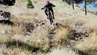
Photos of Idlewild Mountain Bike
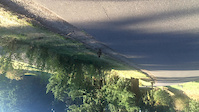
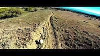
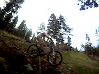
Videos of Idlewild Mountain Bike
trail: Chicken Hawk
0:28 |
213 |
Nov 20, 2019
trail: Hawk
0:47 |
186 |
Oct 9, 2014
trail: Bench
4:40 |
270 |
Jun 29, 2014
trail: Ditch
0:23 |
229 |
May 22, 2013

trail: Chicken Hawk
5:05 |
4962 |
Aug 1, 2011
youtuber
![CO MTB ♦︎ The tree blow down is sad, but...]()

trail: Broken Thumb
19:48 |
552 |
Sep 27, 2020 , Winter Park

trail: Yankee Doodle
12:06 |
516 |
Jul 16, 2019 , Winter Park
Recent Trail Reports
| status | trail | date | condition | info | user |
|---|---|---|---|---|---|
| Yankee Doodle | Jul 26, 2026 @ 9:51am (America/Denver) Jul 26, 2026 | Ideal | maynardco | ||
| Broken Thumb | Jul 15, 2026 @ 8:59am (America/Denver) Jul 15, 2026 | Dry | JamesFPsRR4 | ||
| Crosstrails Access | Jun 28, 2026 @ 9:34am (America/Denver) Jun 28, 2026 | Ideal | ClydesdaleMick SBA | ||
| Meadow | Jun 28, 2026 @ 9:34am (America/Denver) Jun 28, 2026 | Ideal | ClydesdaleMick SBA | ||
| Ditch | Jun 28, 2026 @ 9:34am (America/Denver) Jun 28, 2026 | Ideal | ClydesdaleMick SBA | ||
| Crosstrails | Jun 28, 2026 @ 9:34am (America/Denver) Jun 28, 2026 | Ideal | ClydesdaleMick SBA | ||
| Forest Service Road | Jun 23, 2026 @ 9:32am (America/Denver) Jun 23, 2026 | Dry | Shawnsrides | ||
| Riflesight Connector | Jun 23, 2026 @ 9:32am (America/Denver) Jun 23, 2026 | Ideal | Shawnsrides | ||
| Riflesight | Jun 23, 2026 @ 9:32am (America/Denver) Jun 23, 2026 | Ideal | Shawnsrides | ||
| Arrow | Jun 20, 2026 @ 8:33am (America/Denver) Jun 20, 2026 | Dry | Shawnsrides |
Activity Feed
| username | action | type | title | date |
|---|---|---|---|---|
| maynardco | add | report | activity #100068714 | Jul 26, 2026 @ 10:18am Jul 26, 2026 |
| Philip03asbq | wishlist | route | activity #99771545 | Jul 22, 2026 @ 1:13pm Jul 22, 2026 |
| JamesFPsRR4 | add | report | activity #99301790 | Jul 16, 2026 @ 6:03am Jul 16, 2026 |
| JamesFPsRR4 | wishlist | trail | activity #99168755 | Jul 14, 2026 @ 7:39am Jul 14, 2026 |
| KarissaF41yED | wishlist | region | activity #98901094 | Jul 10, 2026 @ 8:47pm Jul 10, 2026 |
Recent Comments
| username | type | title | comment | date |
|---|---|---|---|---|
| trail | Ride clockwise. The climb is steep but not... | Sep 12, 2025 @ 12:26pm Sep 12, 2025 | ||
| trail | In great shape as of mid September 2025.... | Sep 12, 2025 @ 12:25pm Sep 12, 2025 | ||
| trail | Roses better clockwise | Jul 16, 2024 @ 12:04pm Jul 16, 2024 | ||
| trail | Rode Aqueduct Rd. from Winter Park resort to... | Jun 23, 2024 @ 5:07pm Jun 23, 2024 | ||
| report | Downed trees in two spots | Jul 13, 2022 @ 12:41pm Jul 13, 2022 |
Nearby Areas
| name | distance | ||||
|---|---|---|---|---|---|
| Fraser Valley | 2 | 10 | 3 | 3 km | |
| Devil's Thumb Ranch | 2 | 3 | 3 | 3 km | |
| Vasquez Creek and Leland Creek Areas | 2 | 15 | 4 | 3 km | |
| Trestle Bike Park | 8 | 15 | 12 | 4 | 3.5 km |
| Phases | 8 | 3 | 7 km |
Local Badges
-

Completionist0 awarded
Activity Type Stats
| activitytype | trails | distance | descent | descent distance | total vertical | rating | global rank | state rank | photos | reports | routes | activity logs |
|---|---|---|---|---|---|---|---|---|---|---|---|---|
| Mountain Bike | 31 | 25 miles | 3,386 ft | 10 miles | 2,897 ft | #3,224 | #1,136 | 32 | 271 | 7 | 5,826 | |
| E-Bike | 3 | 4 miles | 840 ft | 2 miles | 1,424 ft | #1,930 | #455 | 1 | 223 | 235 | ||
| Horse | 6 | 3 miles | 840 ft | 2 miles | 817 ft | #3,231 | #1,900 | 52 | ||||
| Hike | 30 | 24 miles | 3,386 ft | 10 miles | 2,897 ft | #6,951 | #2,524 | 5 | 268 | 2 | 246 | |
| Trail Running | 30 | 24 miles | 3,386 ft | 10 miles | 2,897 ft | #6,322 | #2,000 | 268 | 2 | 116 | ||
| Dirtbike/Moto | 4 | 4 miles | 850 ft | 3 miles | 2,812 ft | #1,046 | #484 | 58 | 1 | 2 | ||
| ATV/ORV/OHV | 2 | 869 ft | 13 ft | 587 ft | 13 ft | #255 | 52 | 1 | 2 | |||
| Snowmobile | 1 | #230 | #94 | 1 | ||||||||
| Snowshoe | 2 | 5,108 ft | 194 ft | 4,498 ft | 194 ft | #1,088 | #576 | 2 | 4 | |||
| Nordic Ski | 2 | 5,108 ft | 194 ft | 4,498 ft | 194 ft | #496 | #193 | 1 | 186 |
Frequently Asked Questions About Idlewild
▼
What are the highest rated mountain biking trails in Idlewild?
The highest rated mountain biking trails in Idlewild are:
- Twisted Ankle (4.2/5)
- Chicken Hawk (4.1/5)
- Crosstrails (East) (4.1/5)
- Crosstrails Access (4.1/5)
- Arrow (4/5)
▼
What is the best time of the year to ride in Idlewild?
Based on activity log data, the most popular months to ride in Idlewild are:
- July (245 activities)
- August (117 activities)
- June (84 activities)
▼
Where can I park to ride in Idlewild?
There are 1 parking locations listed in Idlewild. The most popular parking spots are:
▼
What is the longest trail in Idlewild?
The longest trail in Idlewild is Broken Thumb at 3.5 miles. View all trails sorted by distance.
Activities
- By brenthillier
 NSMBA TRAILFORKS & contributors
 - Admins: FVMTB, FVMTB, FVMTB
- #9973 - 6,665 views
- idlewild activity log | embed map of Idlewild mountain bike trails | idlewild mountain biking points of interest
Downloading of trail gps tracks in kml & gpx formats is enabled for Idlewild.
You must login to download files.