close
-
Layers w
- Weather Layers
- Pro
- Pro
- Pro
- Pro
- Pro
- Pro
- More Layers
- Pro
- Pro
- Pro
- Pro
-
Upgrade to

3D
Trail Conditions
- Unknown
- Snow Groomed
- Snow Packed
- Snow Covered
- Snow Cover Partial
- Freeze/thaw Cycle
- Icy
- Prevalent Mud
- Wet
- Variable
- Ideal
- Dry
- Very Dry
Trail Flow (Ridden Direction)
Trailforks scans users ridelogs to determine the most popular direction each trail is ridden. A good flowing trail network will have most trails flowing in a single direction according to their intension.
The colour categories are based on what percentage of riders are riding a trail in its intended direction.
The colour categories are based on what percentage of riders are riding a trail in its intended direction.
- > 96%
- > 90%
- > 80%
- > 70%
- > 50%
- < 50%
- bi-directional trail
- no data
Trail Last Ridden
Trailforks scans ridelogs to determine the last time a trail was ridden.
- < 2 days
- < 1 week
- < 2 weeks
- < 1 month
- < 6 months
- > 6 months
Trail Ridden Direction
The intended direction a trail should be ridden.
- Downhill Only
- Downhill Primary
- Both Directions
- Uphill Primary
- Uphill Only
- One Direction
Contribute Details
Colors indicate trail is missing specified detail.
- Description
- Photos
- Description & Photos
- Videos
Trail Popularity ?
Trailforks scans ridelogs to determine which trails are ridden the most in the last 9 months.
Trails are compared with nearby trails in the same city region with a possible 25 colour shades.
Think of this as a heatmap, more rides = more kinetic energy = warmer colors.
- most popular
- popular
- less popular
- not popular
ATV/ORV/OHV Filter
Max Vehicle Width
inches
US Cell Coverage
Legend

Radar Time
Activity Recordings
Trailforks uses anonymized public activity data.
?
Activity Recordings
Trailforks uses anonymized public activity data.
?
Personal Heatmap
▶
Activity Types
all
/
none
▶
Options
2
Date range
month
–
Winter Trails
Warning
A routing network for winter maps does not exist. Selecting trails using the winter trails layer has been disabled.
Missing Trails
Most Popular
Least Popular
Trails are colored based on popularity. The more popular a trail is, the more red. Less popular trails trend towards green.
Jump Magnitude Heatmap
Heatmap of where riders jump on trails. Zoom in to see individual jumps, click circles to view jump details.
BC Backroad Status
![map legend]()
Service Road Atlas is a free to use, community-driven service for viewing and creating reports on the numerous back-country service roads around B.C. and Alberta.

Slope Aspect
Direction the slope faces
Trails Deemphasized
Trails are shown in grey.
Only show trails with no bike usage.
Suggested Layers
Based on selected activity type
Save the current map location and zoom level as your default home location whenever this page is loaded.
Save
No description for Västerås has been added yet!
Login or register to submit one.
This region uses the Uk/Euro style trail grading system.
Activities Click to view
- Mountain Bike
909 trails
- E-Bike
27 trails
- Gravel Bike
0 trails
- Adaptive Bike
0 trails
- Winter Fat Bike
0 trails
- Horse
60 trails
- Hike
936 trails
- Trail Running
939 trails
- Nordic Ski
15 trails
Region Details
- 291
- 192
- 337
- 82
- 4
Region Status
Open as of May 26, 2026Stats
- Avg Trail Rating
- Trails (view details)
- 930
- Trails Mountain Bike
- 921
- Trails E-Bike
- 27
- Trails Horse
- 60
- Trails Hike
- 936
- Trails Trail Running
- 939
- Trails Dirtbike/Moto
- 2
- Trails Nordic Ski
- 15
- Total Distance
- 435 miles
- Total Descent
- 20,102 ft
- Total Vertical
- 296 ft
- Highest Trailhead
- 309 ft
- Reports
- 2,154
- Photos
- 425
- Ridden Counter
- 46,247
Sub Regions
-
Ängsö
- 3
- 9
- 3
-
Björnön
- 1
- 4
-
Dingtuna
- 2
- 1
- 1
-
Gäddeholm
- 25
- 44
- 18
-
Irsta
- 31
- 43
- 7
-
Örtagården
- 4
- 40
- 4
-
Tortuna
- 8
- 22
- 7
-
Västerås
- 112
- 170
- 42
- 4
Popular Västerås Mountain Biking Trails
• 100 ★ 0.0 • 463 ft • 0 ft • 213 •
Popular blue difficulty singletrack. This mountain bike primary trail can be used downhill primary. On average it takes minutes to complete this trail.
• 100 ★ 0.0 • 1,306 ft • 7 ft • 202 •
Popular green difficulty singletrack. This mountain bike primary trail can be used both directions. On average it takes 1 minutes to complete this trail.
• 100 ★ 0.0 • 794 ft • 0 ft • 198 •
Popular blue difficulty singletrack. This mountain bike primary trail can be used downhill primary. On average it takes minutes to complete this trail.
• 100 ★ 4.0 • 1,266 ft • 3 ft • 186 •
Popular green difficulty singletrack. This multi-use trail can be used both directions. On average it takes 1 minutes to complete this trail.
• 100 ★ 0.0 • 1,496 ft • 13 ft • 181 •
Popular green difficulty singletrack. This mountain bike primary trail can be used both directions and has a moderate overall physical rating. On average it takes minutes to complete this trail.
• 100 ★ 0.0 • 1,394 ft • 35 ft • 178 •
Popular blue difficulty singletrack. This mountain bike primary trail can be used downhill primary. On average it takes 2 minutes to complete this trail.
• 100 ★ 0.0 • 571 ft • 2 ft • 175 •
Popular blue difficulty singletrack. This mountain bike primary trail can be used downhill primary. On average it takes minutes to complete this trail.
Västerås Mountain Bike Routes
★ 5.0 • 11 miles • 500 ft • 22 • Loop •
En av varianterna av Friluftsfrämjandets tur "Badelundaåsen-Ansta".
★ 4.0 • 7 miles • 403 ft • 12 • Loop •
En av varianterna av Friluftsfrämjandets tur "Lajvarnas skogar".
★ 4.0 • 10 miles • 473 ft • 58 • Point to Point •
En av varianterna av Friluftsfrämjandets tur "Badelundaåsen-Mälarparken".
★ 5.0 • 3 miles • 362 ft • 8 • Loop •
MTB-bana i södra Rocklundaskogen som är ca 5,5 km lång. Banan får anses som teknisk och svår. Någon...
★ 4.0 • 19 miles • 1,174 ft • 13 • Loop •
Mixed XC whit some hard parts but most of it in singel track.
★ 3.5 • 3 miles • 286 ft • 3 • Loop •
Fin runda på riktigt roliga och lagom utmande stigar. Rolig avslutning på slingan nerför vedbobackens...
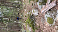
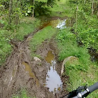
Photos of Västerås Mountain Bike
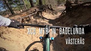
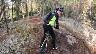
Videos of Västerås Mountain Bike
trail: S Björnö 3
0:08 |
|
May 13, 2020
trail: Harkie - Fröholmen
0:18 |
63 |
Jun 2, 2019

trail: Lunda 2.5
4:26 |
135 |
Jun 14, 2023 , Västerås
11:32 |
156 |
May 30, 2023
7:17 |
141 |
Jul 16, 2022
Recent Trail Reports
| status | trail | date | condition | info | user |
|---|---|---|---|---|---|
| Irsta Skogsstig 1 | May 26, 2026 @ 8:43pm (Europe/Stockholm) May 26, 2026 | Variable | CreMount | ||
| Gäddeholm 8 | May 26, 2026 @ 8:41pm (Europe/Stockholm) May 26, 2026 | Ideal | CreMount | ||
| Gäddeholm 13 | May 26, 2026 @ 8:39pm (Europe/Stockholm) May 26, 2026 | Unknown | CreMount | ||
| Gäddeholm 9 | May 26, 2026 @ 8:36pm (Europe/Stockholm) May 26, 2026 | Unknown | CreMount | ||
| Fredal 7 | May 26, 2026 @ 8:35pm (Europe/Stockholm) May 26, 2026 | Ideal | CreMount | ||
| Myrbo | May 26, 2026 @ 8:33pm (Europe/Stockholm) May 26, 2026 | Ideal | CreMount | ||
| Mickes Stig | May 26, 2026 @ 8:30pm (Europe/Stockholm) May 26, 2026 | Ideal | CreMount | ||
| Krasch-bom-bang | May 26, 2026 @ 8:30pm (Europe/Stockholm) May 26, 2026 | Ideal | CreMount | ||
| Fredal 2 | May 26, 2026 @ 8:28pm (Europe/Stockholm) May 26, 2026 | Unknown | CreMount | ||
| Fredal 5 | May 26, 2026 @ 8:27pm (Europe/Stockholm) May 26, 2026 | Ideal | CreMount |
Activity Feed
| username | action | type | title | date |
|---|---|---|---|---|
| IanuHBA1V | wishlist | badge | activity #97905542 | Jun 27, 2026 @ 8:19am 1 day |
| OrjanX | update | trail | activity #96972731 | Jun 14, 2026 @ 8:36am Jun 14, 2026 |
| OrjanX | update | trail | activity #96955620 and 1 more | Jun 14, 2026 @ 4:52am Jun 14, 2026 |
| Atler3JKt8 | wishlist | region | activity #95650913 | May 27, 2026 @ 11:49am May 27, 2026 |
| CreMount | add | report | activity #95580032 | May 26, 2026 @ 11:44am May 26, 2026 |
Recent Comments
| username | type | title | comment | date |
|---|---|---|---|---|
| trail | Gör en stigrapport (Trail report) istället.... | May 23, 2026 @ 5:17am May 23, 2026 | ||
| trail | Tyvärr svår att cykla pga växtligheten.... | May 22, 2026 @ 3:43am May 22, 2026 | ||
| trail | Gör en stigrapport (Trail report) istället.... | May 11, 2026 @ 8:36am May 11, 2026 | ||
| trail | Stigen finns knappt kvar. Högt gräs och... | May 10, 2026 @ 7:05am May 10, 2026 | ||
| trail | Kul och varierad med några knaggliga... | Apr 25, 2026 @ 1:25am Apr 25, 2026 |
Local Badges
-

Completionist1 awarded -

Top 10 Trails16 awarded -
Completionist0 awarded -
Completionist0 awarded -
Completionist0 awarded -
Completionist0 awarded
Bike & Skill Parks
| name | type | city | rating |
|---|---|---|---|
| Skultuna MTB & Parkour skillpark | skill park | Västerås | |
| Skills by ExE | skill park | Västerås | |
| Skills park Björnön | skill park | Västerås | |
| Dingtuna skillpark | skill park | Västerås | |
| MX indoor (her i byen) | skill park | Västerås |
Activity Type Stats
| activitytype | trails | distance | descent | descent distance | total vertical | rating | global rank | state rank | photos | reports | routes | ridelogs |
|---|---|---|---|---|---|---|---|---|---|---|---|---|
| Mountain Bike | 909 | 411 miles | 18,488 ft | 165 miles | 295 ft | #106 | #6 | 413 | 2,214 | 30 | 35,468 | |
| E-Bike | 27 | 11 miles | 446 ft | 4 miles | 171 ft | #1,113 | #34 | 1,984 | 951 | |||
| Horse | 60 | 23 miles | 1,063 ft | 8 miles | 236 ft | #199 | #22 | 422 | 1 | |||
| Hike | 936 | 431 miles | 19,685 ft | 172 miles | 295 ft | #115 | #7 | 2,204 | 4 | 2,686 | ||
| Trail Running | 939 | 432 miles | 19,797 ft | 173 miles | 295 ft | #64 | #5 | 17 | 2,209 | 8 | 10,004 | |
| Dirtbike/Moto | 2 | 1,929 ft | 3 ft | 292 ft | 13 ft | 416 | ||||||
| Nordic Ski | 15 | 15 miles | 919 ft | 7 miles | 184 ft | #165 | #17 | 1,399 |
Frequently Asked Questions About Västerås
▼
What are the best places to ride in Västerås?
Västerås has 8 areas to explore for mountain biking. The top rated areas are:
▼
What are the highest rated mountain biking trails in Västerås?
The highest rated mountain biking trails in Västerås are:
- Lunda 1 (4.1/5)
- Bjurhovda 3 (4.1/5)
- Vårdkasestigen (4.1/5)
- Bjurhovda 4 (4.1/5)
- Badelunda 12 (4.1/5)
▼
What is the best time of the year to ride in Västerås?
Based on ride log data, the most popular months to ride in Västerås are:
- August (318 activities)
- July (287 activities)
- June (246 activities)
▼
Where can I park to ride in Västerås?
Activities
Trails
Points of Interest
- By mattiasback
 & contributors
 - Admins: ollesvenskonthetrail, JALLE, OrjanX, martinlindstr, Tempokungen, curiousrage
- #18458 - 17,683 views
- västerås activity log | embed map of Västerås mountain bike trails | västerås mountain biking points of interest polygons
Downloading of trail gps tracks in kml & gpx formats is enabled for Västerås.
You must login to download files.