close
-
Layers w
- Weather Layers
- Pro
- Pro
- Pro
- Pro
- Pro
- Pro
- More Layers
- Pro
- Pro
- Pro
- Pro
-
Upgrade to

3D
Trail Conditions
- Unknown
- Snow Groomed
- Snow Packed
- Snow Covered
- Snow Cover Partial
- Freeze/thaw Cycle
- Icy
- Prevalent Mud
- Wet
- Variable
- Ideal
- Dry
- Very Dry
Trail Flow (Ridden Direction)
Trailforks scans users ridelogs to determine the most popular direction each trail is ridden. A good flowing trail network will have most trails flowing in a single direction according to their intension.
The colour categories are based on what percentage of riders are riding a trail in its intended direction.
The colour categories are based on what percentage of riders are riding a trail in its intended direction.
- > 96%
- > 90%
- > 80%
- > 70%
- > 50%
- < 50%
- bi-directional trail
- no data
Trail Last Ridden
Trailforks scans ridelogs to determine the last time a trail was ridden.
- < 2 days
- < 1 week
- < 2 weeks
- < 1 month
- < 6 months
- > 6 months
Trail Ridden Direction
The intended direction a trail should be ridden.
- Downhill Only
- Downhill Primary
- Both Directions
- Uphill Primary
- Uphill Only
- One Direction
Contribute Details
Colors indicate trail is missing specified detail.
- Description
- Photos
- Description & Photos
- Videos
Trail Popularity ?
Trailforks scans ridelogs to determine which trails are ridden the most in the last 9 months.
Trails are compared with nearby trails in the same city region with a possible 25 colour shades.
Think of this as a heatmap, more rides = more kinetic energy = warmer colors.
- most popular
- popular
- less popular
- not popular
ATV/ORV/OHV Filter
Max Vehicle Width
inches
US Cell Coverage
Legend

Radar Time
Activity Recordings
Trailforks uses anonymized public activity data.
?
Activity Recordings
Trailforks uses anonymized public activity data.
?
Personal Heatmap
▶
Activity Types
all
/
none
▶
Options
2
Date range
month
–
Winter Trails
Warning
A routing network for winter maps does not exist. Selecting trails using the winter trails layer has been disabled.
Missing Trails
Most Popular
Least Popular
Trails are colored based on popularity. The more popular a trail is, the more red. Less popular trails trend towards green.
Jump Magnitude Heatmap
Heatmap of where riders jump on trails. Zoom in to see individual jumps, click circles to view jump details.
BC Backroad Status
![map legend]()
Service Road Atlas is a free to use, community-driven service for viewing and creating reports on the numerous back-country service roads around B.C. and Alberta.

Slope Aspect
Direction the slope faces
Trails Deemphasized
Trails are shown in grey.
Only show trails with no bike usage.
Suggested Layers
Based on selected activity type
Save the current map location and zoom level as your default home location whenever this page is loaded.
Save
No description for Virgin has been added yet!
Login or register to submit one.
Activities Click to view
- Mountain Bike
17 trails
- Gravel Bike
0 trails
- Adaptive Bike
0 trails
- Hike
17 trails
- Trail Running
17 trails
Region Details
- 2
- 1
- 6
- 4
- 3
Region Status
Open as of 16 hoursStats
- Avg Trail Rating
- Trails (view details)
- 19
- Trails Mountain Bike
- 17
- Trails E-Bike
- 3
- Trails Horse
- 1
- Trails Hike
- 17
- Trails Trail Running
- 17
- Trails Dirtbike/Moto
- 3
- Trails ATV/ORV/OHV
- 3
- Total Distance
- 33 miles
- Total Descent
- 5,999 ft
- Total Vertical
- 3,943 ft
- Highest Trailhead
- 7,451 ft
- Reports
- 506
- Photos
- 528
- Ridden Counter
- 14,683
Articles
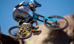
Video: Adolf Silva Shares POV From His Rampage Crash
Dec 1, 2025 from pinkbike.com
A sobering POV from one of the heaviest moments of Rampage. Viewer discretion is advised.
Video: Wes Sends & Remy Metailler Ride Utah's Gnarliest Sanctioned Trail
Nov 28, 2025 from pinkbike.com
Video: Reed Boggs' 2025 Rampage Recap
Nov 7, 2025 from pinkbike.com
A behind-the-scenes look at Reed’s final Rampage prep and his tough decision to sit out his second run during finals.
Video: Tomas Lemoine's Rampage 2025 Documentary
Nov 6, 2025 from pinkbike.com
Follow the Marseille native and his team as they prepare for competition day.
Sub Regions
-
Guacamole
- 5
- 4
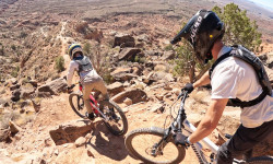
Popular Virgin Mountain Biking Trails
• 100 ★ 4.5 • 2 miles • 199 ft • 3,106 •
This is the fast section of the trails, where you transition between sandstone and petrified dunes and smooth dirt singletrack. Rock cairns in wire baskets mark the sections on the sandstone, but they are not always easy to see. Really...
• 95 ★ 4.1 • 1 mile • 31 ft • 2,945 •
This is the more difficult part of the main lollipop loop. Some of the intersections are not easy to see where the trail turns. Some difficult climbs and small rock drops.
• 90 ★ 4.6 • 3 miles • 385 ft • 2,915 •
This is mostly difficult riding as you round the bend, then it gets really easy for the west side cliff section. Some steep rock drops and sections of rock where you have to maneuver your bike up some steep punchy sections. The rock...
• 85 ★ 4.5 • 5,239 ft • 262 ft • 2,187 •
A fun alternate to the primary trail. Trail has some sections of exposure and varied technical and slickrock features. Make sure to do this loop either on the way out or back. It shouldn't be missed.
• 70 ★ 4.6 • 5,258 ft • 102 ft • 1,725 •
Quick ups followed by quick downs, twisty turns also in the mix. Keep your head on a swivel and don't leave new tracks in the dirt!
• 65 ★ 4.0 • 333 ft • 3 ft • 1,571 •
Moderately popular blue difficulty singletrack. This mountain bike primary trail can be used both directions and has a moderate overall physical rating with a 3 ft blue climb. On average it takes minutes to complete this trail.
• 50 ★ 4.9 • 1 mile • 0 ft • 557 •
Popular downhill trail hit by locals all year, drops you right down to the Virgin BMX track.
• 45 ★ 4.6 • 1,575 ft • 12 ft • 392 •
Highly rated moderately popular black diamond difficulty singletrack. This mountain bike primary trail can be used both directions. On average it takes 5 minutes to complete this trail.
Virgin Mountain Bike Routes
★ 3.2 • 10 miles • 600 ft • 12 •
This lollipop incorporates the best of the network. I like to ride the loop clockwise, but you could ride...
★ 3.5 • 5 miles • 305 ft • 6 •
This is a great intro to and Hurricane riding as a whole. It's perfect for beginner/novice riders. There's...
★ 2.0 • 15 miles • 1,140 ft • 2 •
15 Mile MTB in Virgin, UY near Zion and Starting from Red Coyote Cyclery
10 miles • 605 ft • 7 •
This lollipop incorporates the best of the network. I like to ride the loop clockwise, but you could ride...
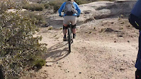
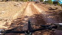
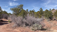
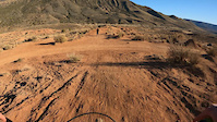
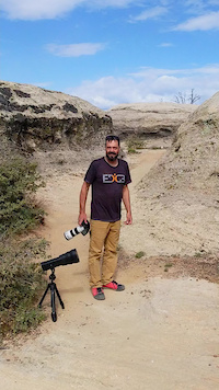
Photos of Virgin Mountain Bike
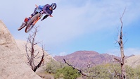
Videos of Virgin Mountain Bike
trail: Lime with a Twist
0:19 |
25 |
Mar 11, 2024
trail: Flying Monkey
0:14 |
135 |
Feb 16, 2022

trail: Flying Monkey
0:26 |
|
Feb 16, 2022

trail: Flying Monkey
0:26 |
|
Feb 16, 2022
trail: Flying Monkey
0:15 |
128 |
Feb 16, 2022
trail: Flying Monkey
0:20 |
108 |
Feb 5, 2022
trail: Guacamole
0:55 |
|
Jan 12, 2022
trail: Guacamole
2:16 |
9181 |
Jan 11, 2022
Recent Trail Reports
| status | trail | date | condition | info | user |
|---|---|---|---|---|---|
| Margarita | Jul 19, 2026 @ 7:44am (America/Phoenix) 16 hours | Ideal | Terrytidwell | ||
| Holy Guacamole | Apr 7, 2026 @ 6:39pm (America/Denver) Apr 7, 2026 | Dry | bizango-x | ||
| Salt on the Rim | Mar 7, 2026 @ 6:30pm (America/Denver) Mar 7, 2026 | Dry | UtahJohn TRAILFORKS | ||
| Lime with a Twist | Mar 7, 2026 @ 6:30pm (America/Denver) Mar 7, 2026 | Dry | UtahJohn TRAILFORKS | ||
| Guacamole West Link | Mar 7, 2026 @ 6:30pm (America/Denver) Mar 7, 2026 | Dry | UtahJohn TRAILFORKS | ||
| Connector | Mar 7, 2026 @ 6:30pm (America/Denver) Mar 7, 2026 | Dry | UtahJohn TRAILFORKS | ||
| Flying Monkey | Oct 17, 2025 @ 4:40pm (America/Phoenix) Oct 17, 2025 | Dry | MHartong | ||
| Toquerville Falls | May 11, 2024 @ 7:44am May 11, 2024 | Ideal | yrag98 | ||
| Virgin Loop | Dec 18, 2023 @ 8:04pm Dec 18, 2023 | Dry | UtahJohn TRAILFORKS | ||
| Monkey Road | Dec 18, 2023 @ 8:04pm Dec 18, 2023 | Dry | UtahJohn TRAILFORKS |
Activity Feed
| username | action | type | title | date |
|---|---|---|---|---|
| greenhough | wishlist | trail | activity #99589261 | Jul 19, 2026 @ 10:51pm 1 hours |
| Dallinshredaholics | ridden | trail | activity #99569673 | Jul 19, 2026 @ 2:24pm 10 hours |
| Terrytidwell | like | report | activity #99540967 | Jul 19, 2026 @ 9:22am 15 hours |
| Terrytidwell | add | report | activity #99540729 | Jul 19, 2026 @ 9:20am 15 hours |
| alloy1 | wishlist | trail | activity #97315759 | Jun 19, 2026 @ 7:26am Jun 19, 2026 |
Recent Comments
| username | type | title | comment | date |
|---|---|---|---|---|
| trail | The monkey, eating his banana sitting in a... | May 15, 2026 @ 6:26pm May 15, 2026 | ||
| trail | Ok i could not ride all the sections, well, i... | May 15, 2026 @ 6:20pm May 15, 2026 | ||
| trail | Fff | Apr 15, 2026 @ 11:51am Apr 15, 2026 | ||
| trail | I really like this trail. The first section is... | Apr 7, 2026 @ 5:46pm Apr 7, 2026 | ||
| trail | I rode this the opposite way from the... | Apr 7, 2026 @ 5:43pm Apr 7, 2026 |
Local Badges
-

Epic Ride Climb 2k12 awarded -

Climbing 10k Badge5 awarded -

Climbing 100k Badge0 awarded -

Epic Ride Descent 2k12 awarded -

Descent 10k Badge5 awarded -

Descent 100k Badge0 awarded
Bike & Skill Parks
| name | type | city | rating |
|---|---|---|---|
| Virgin BMX Track | skill park | Virgin |
Local Products
Activity Type Stats
| activitytype | trails | distance | descent | descent distance | total vertical | rating | global rank | state rank | photos | reports | routes | ridelogs |
|---|---|---|---|---|---|---|---|---|---|---|---|---|
| Mountain Bike | 17 | 21 miles | 4,249 ft | 11 miles | 1,368 ft | #2,085 | #752 | 521 | 505 | 5 | 10,257 | |
| E-Bike | 3 | 6 miles | 1,037 ft | 3 miles | 837 ft | 1 | 354 | 540 | ||||
| Horse | 1 | 5 miles | 909 ft | 2 miles | 837 ft | 82 | ||||||
| Hike | 17 | 32 miles | 5,240 ft | 15 miles | 3,944 ft | #1,206 | #554 | 7 | 499 | 2 | 1,301 | |
| Trail Running | 17 | 32 miles | 5,240 ft | 15 miles | 3,944 ft | #4,805 | #1,494 | 499 | 3 | 73 | ||
| Dirtbike/Moto | 3 | 6 miles | 1,037 ft | 3 miles | 837 ft | 79 | 11 | |||||
| ATV/ORV/OHV | 3 | 6 miles | 1,037 ft | 3 miles | 837 ft | 79 | 8 |
Frequently Asked Questions About Virgin
▼
What are the best places to ride in Virgin?
Virgin has 1 areas to explore for mountain biking. The top rated areas are:
▼
What are the highest rated mountain biking trails in Virgin?
The highest rated mountain biking trails in Virgin are:
- Flying Monkey (4.7/5)
- Lime with a Twist (4.5/5)
- Holy Guacamole (4.5/5)
- Salt on the Rim (4.4/5)
- Margarita (4.4/5)
▼
What is the best time of the year to ride in Virgin?
Based on ride log data, the most popular months to ride in Virgin are:
- April (181 activities)
- October (160 activities)
- November (124 activities)
▼
Where can I park to ride in Virgin?
There are 4 parking locations listed in Virgin. The most popular parking spots are: View all parking and trailhead locations on the map to plan your visit.
Trails
- By todd
 Trailforks & contributors
 - Admins: SUBA
- #5601 - 26,956 views
- virgin activity log | embed map of Virgin mountain bike trails | virgin mountain biking points of interest
Downloading of trail gps tracks in kml & gpx formats is enabled for Virgin.
You must login to download files.