close
-
Layers w
- Map Content
- More Layers
- Pro
- Pro
- Pro
- Pro
- Pro
- Pro
- Pro
- Pro
-
Upgrade to

3D
Trail Conditions
- Unknown
- Snow Groomed
- Snow Packed
- Snow Covered
- Snow Cover Partial
- Freeze/thaw Cycle
- Icy
- Prevalent Mud
- Wet
- Variable
- Ideal
- Dry
- Very Dry
Trail Flow (Ridden Direction)
Trailforks scans users ridelogs to determine the most popular direction each trail is ridden. A good flowing trail network will have most trails flowing in a single direction according to their intension.
The colour categories are based on what percentage of riders are riding a trail in its intended direction.
The colour categories are based on what percentage of riders are riding a trail in its intended direction.
- > 96%
- > 90%
- > 80%
- > 70%
- > 50%
- < 50%
- bi-directional trail
- no data
Trail Last Ridden
Trailforks scans ridelogs to determine the last time a trail was ridden.
- < 2 days
- < 1 week
- < 2 weeks
- < 1 month
- < 6 months
- > 6 months
Trail Ridden Direction
The intended direction a trail should be ridden.
- Downhill Only
- Downhill Primary
- Both Directions
- Uphill Primary
- Uphill Only
- One Direction
Contribute Details
Colors indicate trail is missing specified detail.
- Description
- Photos
- Description & Photos
- Videos
Trail Popularity ?
Trailforks scans ridelogs to determine which trails are ridden the most in the last 9 months.
Trails are compared with nearby trails in the same city region with a possible 25 colour shades.
Think of this as a heatmap, more rides = more kinetic energy = warmer colors.
- most popular
- popular
- less popular
- not popular
ATV/ORV/OHV Filter
Max Vehicle Width
inches
US Cell Coverage
Legend

Radar Time
x
Activity Recordings
Trailforks users anonymized public ridelogs from the past 6 months.
- mountain biking recent
- mountain biking (>6 month)
- hiking (1 year)
- moto (1 year)
Activity Recordings
Trailforks users anonymized public skilogs from the past 12 months.
- Downhill Ski
- Backcountry Ski
- Nordic Ski
- Snowmobile
Winter Trails
Warning
A routing network for winter maps does not exist. Selecting trails using the winter trails layer has been disabled.
x
Missing Trails
Most Popular
Least Popular
Trails are colored based on popularity. The more popular a trail is, the more red. Less popular trails trend towards green.
Jump Magnitude Heatmap
Heatmap of where riders jump on trails. Zoom in to see individual jumps, click circles to view jump details.
Trails Deemphasized
Trails are shown in grey.
Only show trails with NO bikes.
Save the current map location and zoom level as your default home location whenever this page is loaded.
SaveWadi Degla Protectorate (“wadi” means valley in Arabic) lies in the northern part of the Eastern Desert and runs east to west for 30km to drain into the Nile Valley at Maadi, south of of Cairo, Helwan Governorate. The area, which encompasses 60 km², was declared by the Egyptian Environmental Affairs Agency (EEAA) as Natural Protectorate in 1999.
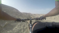
The Wadi Degla area offers a vast network of trails for hiking, running and biking.
The Wadi Degla area offers a vast network of trails for hiking, running and biking.
Primary Trail Type: Cross-Country
Land Status: State Park
 google parking directions
 Access Info:
The Wadi Degla Protectorate entrance, outside the Maadi suburb of Cairo.
Links
Region Supporters & Maintainers
![]()
Degla DudeSponsor![]()
MTB EgyptMaintainer
Activities Click to view
- Mountain Bike
209 trails
- E-Bike
2 trails
- Horse
2 trails
- Hike
202 trails
- Trail Running
204 trails
- Dirtbike/Moto
2 trails
- ATV/ORV/OHV
2 trails
- Snowmobile
0 trails
- Snowshoe
0 trails
- Downhill Ski
0 trails
- Backcountry Ski
0 trails
- Nordic Ski
0 trails
Region Details
- 16
- 1
- 43
- 102
- 45
- 2
Region Status
Caution as of May 13, 2024Stats
- Avg Trail Rating
- Trails (view details)
- 209
- Trails Mountain Bike
- 209
- Trails E-Bike
- 2
- Trails Horse
- 2
- Trails Hike
- 202
- Trails Trail Running
- 204
- Trails Dirtbike/Moto
- 2
- Trails ATV/ORV/OHV
- 2
- Total Distance
- 143 miles
- Total Descent
- 19,320 ft
- Total Vertical
- 782 ft
- Highest Trailhead
- 1,052 ft
- Reports
- 203
- Photos
- 67
- Ridden Counter
- 4,084
Popular Wadi Degla Mountain Biking Trails
Wadi Degla Mountain Bike Routes
| title | rating | distance |
|---|---|---|
| The Short Loop | 10 miles | |
| The Tour De Wadi | 19 miles | |
| Tour de Wadi clockwise | 17 miles | |
| MTB Egypt XCO Loop | 3 miles | |
| The Three Horsemen | 17 miles | |
| Eastern XCO loop race | 3 miles |
Photos of Wadi Degla Mountain Bike
trail: Good Dog
12 |
Jul 2, 2023 @ 2:39am
Jul 2, 2023
trail: Good Dog
12 |
Jul 2, 2023 @ 2:39am
Jul 2, 2023
trail: Good Dog
13 |
Jul 2, 2023 @ 2:39am
Jul 2, 2023
trail: Good Dog
13 |
Jul 2, 2023 @ 2:39am
Jul 2, 2023
trail: Good Dog
14 |
Jul 2, 2023 @ 2:39am
Jul 2, 2023
trail: Good Dog
17 |
Jul 2, 2023 @ 2:39am
Jul 2, 2023
trail: Golden Plates
92 |
May 22, 2021 @ 10:59am
May 22, 2021
trail: Open Range
85 |
Apr 24, 2020 @ 8:02am
Apr 24, 2020Videos of Wadi Degla Mountain Bike
trail: Dog Face
3:52 |
154 |
Jun 14, 2015

trail: Hosni's Hairline descent
868 |
Sep 28, 2016 , Cairo

trail: Hosni's Hairline descent
721 |
Sep 28, 2016 , Cairo
Recent Trail Reports
| status | trail | date | condition | info | user |
|---|---|---|---|---|---|
| Timmy's Twister | Dec 11, 2023 @ 9:27am Dec 11, 2023 | Wet | Beshoy | ||
| Desert Viper | Jul 14, 2023 @ 5:29am Jul 14, 2023 | Unknown | isPeter Trail Crew | ||
| Good Dog | Jul 2, 2023 @ 2:28am Jul 2, 2023 | Dry | himazmizo | ||
| Mo's Crack | Dec 27, 2022 @ 4:43am Dec 27, 2022 | Dry | himazmizo | ||
| The Crossover Express | Jul 23, 2022 @ 7:48am Jul 23, 2022 | Unknown | isPeter Trail Crew | ||
| The Falls | Jul 23, 2022 @ 7:48am Jul 23, 2022 | Unknown | isPeter Trail Crew | ||
| The Roller Coaster | Feb 12, 2022 @ 3:57am Feb 12, 2022 | Very Dry | KviZ8R | ||
| Snake's Back | ضهر الحية | Dec 18, 2021 @ 7:23am Dec 18, 2021 | Dry | isPeter Trail Crew | ||
| North Ridge to campsite | Jul 30, 2021 @ 10:46pm Jul 30, 2021 | Unknown | isPeter Trail Crew | ||
| Eastern connector 1 | Jul 30, 2021 @ 10:46pm Jul 30, 2021 | Unknown | isPeter Trail Crew |
Activity Feed
| username | action | type | title | date |
|---|---|---|---|---|
| Djoser0hTQ5c | wishlist | trail | activity #50988748 | Apr 9, 2024 @ 5:07pm Apr 9, 2024 |
| Ahmed-Hablass | ridden | route | activity #50339441 | Mar 23, 2024 @ 1:32am Mar 23, 2024 |
| psychool | wishlist | trail | activity #49956541 | Mar 12, 2024 @ 6:32pm Mar 12, 2024 |
| gonzalez64 | wishlist | trail | activity #45028135 | Oct 9, 2023 @ 12:14am Oct 9, 2023 |
| reda-maged | wishlist | route | activity #44200727 | Sep 17, 2023 @ 2:43am Sep 17, 2023 |
Recent Comments
| username | type | title | comment | date |
|---|---|---|---|---|
| report | Good afternoon | Feb 25, 2023 @ 2:37am Feb 25, 2023 | ||
| report | Hello | Feb 25, 2023 @ 12:18am Feb 25, 2023 | ||
| report | Thanks Peter. | Dec 19, 2021 @ 6:30pm Dec 19, 2021 | ||
| report | In a good shape. Although marked blue, it's... | May 28, 2021 @ 12:38pm May 28, 2021 | ||
| report | I still ride it frequently, so I think I might... | May 21, 2021 @ 11:54am May 21, 2021 |
Local Badges
-

Completionist0 awarded
Activity Type Stats
| activitytype | trails | distance | descent | descent distance | total vertical | rating | global rank | state rank | photos | reports | routes | ridelogs |
|---|---|---|---|---|---|---|---|---|---|---|---|---|
| Mountain Bike | 209 | 143 miles | 19,321 ft | 66 miles | 781 ft | #1,800 | #1 | 66 | 203 | 6 | 6,092 | |
| E-Bike | 2 | 2 miles | 43 ft | 1,539 ft | 174 ft | #4,215 | #1 | 125 | ||||
| Horse | 2 | 2 miles | 43 ft | 1,539 ft | 174 ft | #914 | #1 | 45 | ||||
| Hike | 202 | 140 miles | 18,858 ft | 65 miles | 781 ft | #1,385 | #1 | 193 | 156 | |||
| Trail Running | 204 | 140 miles | 19,075 ft | 65 miles | 781 ft | #1,388 | #1 | 193 | 1 | 146 | ||
| Dirtbike/Moto | 2 | 2 miles | 43 ft | 1,539 ft | 174 ft | #248 | #1 | 1 | 43 | |||
| ATV/ORV/OHV | 2 | 2 miles | 43 ft | 1,539 ft | 174 ft | #130 | #1 | 43 |
- By degladude
 MTB Egypt Trail Crew Wadi Ibex & contributors
 - Admins: MTB Egypt
- #16168 - 11,821 views
- wadi degla activity log | embed map of Wadi Degla mountain bike trails | wadi degla mountain biking points of interest
Downloading of trail gps tracks in kml & gpx formats is enabled for Wadi Degla.
You must login to download files.