close
-
Layers w
- Weather Layers
- Pro
- Pro
- Pro
- Pro
- Pro
- Pro
- More Layers
- Pro
- Pro
- Pro
- Pro
-
Upgrade to

3D
Trail Conditions
- Unknown
- Snow Groomed
- Snow Packed
- Snow Covered
- Snow Cover Partial
- Freeze/thaw Cycle
- Icy
- Prevalent Mud
- Wet
- Variable
- Ideal
- Dry
- Very Dry
Trail Flow (Ridden Direction)
Trailforks scans users ridelogs to determine the most popular direction each trail is ridden. A good flowing trail network will have most trails flowing in a single direction according to their intension.
The colour categories are based on what percentage of riders are riding a trail in its intended direction.
The colour categories are based on what percentage of riders are riding a trail in its intended direction.
- > 96%
- > 90%
- > 80%
- > 70%
- > 50%
- < 50%
- bi-directional trail
- no data
Trail Last Ridden
Trailforks scans ridelogs to determine the last time a trail was ridden.
- < 2 days
- < 1 week
- < 2 weeks
- < 1 month
- < 6 months
- > 6 months
Trail Ridden Direction
The intended direction a trail should be ridden.
- Downhill Only
- Downhill Primary
- Both Directions
- Uphill Primary
- Uphill Only
- One Direction
Contribute Details
Colors indicate trail is missing specified detail.
- Description
- Photos
- Description & Photos
- Videos
Trail Popularity ?
Trailforks scans ridelogs to determine which trails are ridden the most in the last 9 months.
Trails are compared with nearby trails in the same city region with a possible 25 colour shades.
Think of this as a heatmap, more rides = more kinetic energy = warmer colors.
- most popular
- popular
- less popular
- not popular
ATV/ORV/OHV Filter
Max Vehicle Width
inches
US Cell Coverage
Legend

Radar Time
Activity Recordings
Trailforks uses anonymized public activity data.
?
Activity Recordings
Trailforks uses anonymized public activity data.
?
Personal Heatmap
▶
Activity Types
all
/
none
▶
Options
2
Date range
month
–
Winter Trails
Warning
A routing network for winter maps does not exist. Selecting trails using the winter trails layer has been disabled.
Missing Trails
Most Popular
Least Popular
Trails are colored based on popularity. The more popular a trail is, the more red. Less popular trails trend towards green.
Jump Magnitude Heatmap
Heatmap of where riders jump on trails. Zoom in to see individual jumps, click circles to view jump details.
BC Backroad Status
![map legend]()
Service Road Atlas is a free to use, community-driven service for viewing and creating reports on the numerous back-country service roads around B.C. and Alberta.

Slope Aspect
Direction the slope faces
Trails Deemphasized
Trails are shown in grey.
Only show trails with no bike usage.
Suggested Layers
Based on selected activity type
Save the current map location and zoom level as your default home location whenever this page is loaded.
Save
No description for Ward has been added yet!
Login or register to submit one.
Activities Click to view
- Mountain Bike
34 trails
- E-Bike
7 trails
- Gravel Bike
0 trails
- Adaptive Bike
0 trails
- Winter Fat Bike
0 trails
- Horse
10 trails
- Hike
38 trails
- Trail Running
38 trails
- Dirtbike/Moto
7 trails
- ATV/ORV/OHV
7 trails
- Snowmobile
5 trails
- Snowshoe
31 trails
- Backcountry Ski
21 trails
- Nordic Ski
7 trails
Region Details
- 5
- 4
- 4
- 16
- 1
Region Status
Caution as of Jun 6, 2026Stats
- Avg Trail Rating
- Trails (view details)
- 38
- Trails Mountain Bike
- 34
- Trails E-Bike
- 7
- Trails Horse
- 10
- Trails Hike
- 38
- Trails Trail Running
- 38
- Trails Dirtbike/Moto
- 7
- Trails Observed Trials
- 1
- Trails ATV/ORV/OHV
- 7
- Trails Snowmobile
- 5
- Trails Snowshoe
- 31
- Trails Backcountry Ski
- 21
- Trails Nordic Ski
- 7
- Total Distance
- 68 miles
- Total Descent
- 7,425 ft
- Total Vertical
- 3,625 ft
- Highest Trailhead
- 12,172 ft
- Reports
- 506
- Photos
- 83
- Ridden Counter
- 4,196
Sub Regions
-
Brainard Lake and Peaceful Valley
- 6
- 3
- 12
- 1
Popular Ward Mountain Biking Trails
• 90 ★ 3.3 • 6 miles • 1,144 ft • 242 •
If you like rocks and chunky trails you will love this one. If you're looking for a smooth flow trail, this is not it. Some roots, lots of rocks, some loose some embedded. I would say this is more of Blue/Black than a black diamond....
• 95 ★ 3.0 • 2,884 ft • 51 ft • 213 •
Popular black diamond difficulty singletrack. This multi-use trail can be used both directions. On average it takes 7 minutes to complete this trail.
• 80 ★ 3.0 • 2 miles • 219 ft • 205 •
serves as a link in a larger loop at Brainard Lake. Rooty, loamy and rocky technical are abundant on this trail but very little grade change. Often snow filled into July. Watch out for moose!
• 75 ★ 4.1 • 6 miles • 10 ft • 133 •
If you like techy rock riding you will love this trail, if not, you will hate it. Best ridden from the Brainard Lake area as a downhill but can be ridden from Peak to Peak if you enjoy steep technical climbing. This could also be done...
• 95 ★ 4.4 • 4 miles • 1,071 ft • 127 •
The first 4.5 miles of this trail are outside the Wilderness Boundary, so you're free to ride them! Be sure to stop at the edge of the wilderness though. This trail features some gnarly rocks, especially in the upper half. If you push...
• 100 ★ 5.0 • 3,658 ft • 0 ft • 109 •
The is an extension of the Trail that cuts across from the east end of (National Forest System Road 507) to intersect the Trail just above the switchbacks south of Camp Dick.
• 70 ★ 3.2 • 6 miles • 283 ft • 87 •
This is considered North . This side is a bit less used and it shows. Some areas can be a little overgrown, loose and technical. Going from north to South is climbing and South to North is more downhill. Lots of rocky trail with some...
Ward Mountain Bike Routes
Buchanan Waterfall out-and-back Featured
★ 5.0 • 7 miles • 824 ft • 1 • Out & Back •
Located at Camp Dick, it’s no secret this is probably one of the best singletracks around for fat...
Coney Buchanan Loop Featured
★ 5.0 • 11 miles • 1,469 ft • 4 • Loop •
This loop is possible in the summer and winter and is difficult in each season for different reasons. Park...
South Saint Vrain - Figure 8 Featured
★ 3.5 • 16 miles • 2,150 ft • 7 • Loop •
This route is a true physical and technical test piece. Expect long, consistent rock gardens and baby...
Waldrop/Snowshoe Loop Featured
★ 5.0 • 5 miles • 606 ft • 3 • Loop •
This is a winter-only fatbike loop (the Snowshoe trail does not exist in the summer). Most people prefer...
Southdough to SSV Shuttle Featured
10 miles • 1,148 ft • 1 • Shuttled •
If you like to put a little bit of effort into your shuttle rides, this one is for you. Climb the less...
Easiest Brainard Fatbike Route Featured
5 miles • 386 ft • 2 • Loop •
This is a great choice for a first time fatbike ride at Brainard Lake. You'll park at the winter parking...
Photos of Ward Mountain Bike
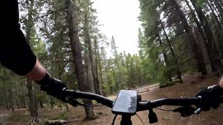
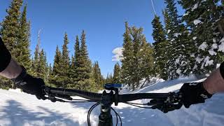
Videos of Ward Mountain Bike
trail: Sourdough (South)
5:57 |
113 |
Aug 7, 2024 , Ward
trail: Lefthand Park Reservoir Road
3:45 |
172 |
Mar 21, 2024 , Ward

trail: Buchanan Pass Trail
5:07 |
195 |
Dec 4, 2023 , Ward

trail: Sourdough (North)
0:03 |
241 |
Aug 10, 2023 , Ward
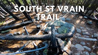
trail: South St Vrain
0:29 |
362 |
Nov 3, 2022 , Ward

trail: Sourdough (South)
2:00 |
362 |
Nov 9, 2020 , Ward

trail: Buchanan Pass Trail
4:51 |
340 |
Nov 9, 2020 , Ward
youtuber
![Vanlife, Dogs, and Backcountry Mountain...]()

trail: South St Vrain
10:59 |
520 |
Sep 6, 2020 , Ward
Recent Trail Reports
| status | trail | date | condition | info | user |
|---|---|---|---|---|---|
| Sourdough (North) | Jun 6, 2026 @ 11:36am (America/Denver) Jun 6, 2026 | Dry | JBlaze24 | ||
| Summer Snowshoe | May 30, 2026 @ 10:18am (America/Denver) May 30, 2026 | Variable | tshralper | ||
| Waldrop | May 30, 2026 @ 10:18am (America/Denver) May 30, 2026 | Variable | tshralper | ||
| Sourdough (South) | May 25, 2026 @ 11:51am (America/Denver) May 25, 2026 | Variable | j4ckn1ch0ls | ||
| Red Rock Lake Spur | Nov 10, 2025 @ 11:52am (America/Denver) Nov 10, 2025 | Ideal | darkcloud | ||
| Brainard Lake Cutoff | Nov 10, 2025 @ 11:52am (America/Denver) Nov 10, 2025 | Ideal | darkcloud | ||
| Little Raven | Nov 10, 2025 @ 11:52am (America/Denver) Nov 10, 2025 | Snow Cover Partial | darkcloud | ||
| Little Raven Extension Trail | Nov 10, 2025 @ 11:52am (America/Denver) Nov 10, 2025 | Wet | darkcloud | ||
| Lefthand Park Reservoir Road | Aug 10, 2025 @ 9:25am Aug 10, 2025 | Ideal | dmandave | ||
| Coney Creek Road | Jul 6, 2025 @ 8:07am Jul 6, 2025 | Dry | riderice |
Activity Feed
| username | action | type | title | date |
|---|---|---|---|---|
| JBlaze24 | add | report | activity #96454745 | Jun 7, 2026 @ 6:36am Jun 7, 2026 |
| tshralper | add | report | activity #95892217 and 1 more | May 30, 2026 @ 3:34pm May 30, 2026 |
| j4ckn1ch0ls | add | report | activity #95531372 | May 25, 2026 @ 4:25pm May 25, 2026 |
| Sethta | wishlist | trail | activity #95017223 | May 18, 2026 @ 7:31pm May 18, 2026 |
| Lauren4Pq36W | wishlist | trail | activity #90930248 | Mar 20, 2026 @ 10:56am Mar 20, 2026 |
Recent Comments
| username | type | title | comment | date |
|---|---|---|---|---|
| trail | Climb is not the worst in the area but also... | Aug 6, 2024 @ 4:50pm Aug 6, 2024 | ||
| report | I will not be denied! Mostly because I have... | Aug 5, 2024 @ 12:20pm Aug 5, 2024 | ||
| report | Thank you to BMA for keeping the trails clear.... | Aug 1, 2024 @ 8:42pm Aug 1, 2024 | ||
| report | Thank you, pin and photos are very helpful! | Aug 1, 2024 @ 7:39pm Aug 1, 2024 | ||
| report | Close a report by adding a new, current one | Oct 1, 2023 @ 8:56pm Oct 1, 2023 |
Local Badges
-

10 Black Trails28 awarded -

Epic Ride Climb 2k24 awarded -

Climbing 10k Badge10 awarded -

Climbing 100k Badge0 awarded -

Epic Ride Descent 2k28 awarded -

Descent 10k Badge11 awarded
Activity Type Stats
| activitytype | trails | distance | descent | descent distance | total vertical | rating | global rank | state rank | photos | reports | routes | ridelogs |
|---|---|---|---|---|---|---|---|---|---|---|---|---|
| Mountain Bike | 34 | 55 miles | 6,827 ft | 22 miles | 2,090 ft | #4,343 | #1,464 | 78 | 491 | 14 | 3,414 | |
| E-Bike | 7 | 14 miles | 541 ft | 2 miles | 1,909 ft | #6,367 | #1,932 | 238 | 84 | |||
| Horse | 10 | 20 miles | 594 ft | 3 miles | 2,090 ft | #2,046 | #1,142 | 169 | 8 | 1 | ||
| Hike | 38 | 61 miles | 7,005 ft | 22 miles | 3,625 ft | #1,203 | #554 | 5 | 478 | 12 | 1,118 | |
| Trail Running | 38 | 61 miles | 7,005 ft | 22 miles | 3,625 ft | #3,915 | #1,177 | 478 | 12 | 95 | ||
| Dirtbike/Moto | 7 | 14 miles | 541 ft | 2 miles | 1,909 ft | #1,094 | #432 | 26 | 7 | |||
| Observed Trials | 1 | 3 miles | 30 ft | 2,119 ft | 436 ft | |||||||
| ATV/ORV/OHV | 7 | 14 miles | 541 ft | 2 miles | 1,909 ft | #838 | #379 | 26 | ||||
| Snowmobile | 5 | 10 miles | 512 ft | 2 miles | 1,148 ft | #362 | #188 | 15 | ||||
| Snowshoe | 31 | 50 miles | 6,421 ft | 20 miles | 2,090 ft | #476 | #160 | 230 | 14 | 158 | ||
| Backcountry Ski | 21 | 32 miles | 1,673 ft | 7 miles | 2,090 ft | #445 | #107 | 197 | 746 | |||
| Nordic Ski | 7 | 54 miles | 6,680 ft | 21 miles | 2,090 ft | #589 | #196 | 230 | 8 | 491 |
Frequently Asked Questions About Ward
▼
What are the best places to ride in Ward?
Ward has 1 areas to explore for mountain biking. The top rated areas are:
▼
What are the highest rated mountain biking trails in Ward?
The highest rated mountain biking trails in Ward are:
- Beaver Reservoir Cutoff Trail (4.1/5)
- Middle Saint Vrain Trail (4.1/5)
- Buchanan Pass Trail (4.1/5)
- South St Vrain (4.1/5)
- Little Raven Extension Trail (3.8/5)
▼
What is the best time of the year to ride in Ward?
Based on ride log data, the most popular months to ride in Ward are:
- February (34 activities)
- July (31 activities)
- January (30 activities)
▼
Where can I park to ride in Ward?
There are 9 parking locations listed in Ward. The most popular parking spots are: View all parking and trailhead locations on the map to plan your visit.
Activities
Trails
- By canadaka
 Trailforks & contributors
 - Admins: BMA, amrosen, getvert, mpopetz, Pumpntrail, andrewbikeboulder, Skyryk, Iowegian, 303JL
- #4946 - 4,091 views
- ward activity log | embed map of Ward mountain bike trails | ward mountain biking points of interest
Downloading of trail gps tracks in kml & gpx formats is enabled for Ward.
You must login to download files.