close
-
Layers w
- Weather Layers
- Pro
- Pro
- Pro
- Pro
- Pro
- Pro
- More Layers
- Pro
- Pro
- Pro
- Pro
-
Upgrade to

3D
Trail Conditions
- Unknown
- Snow Groomed
- Snow Packed
- Snow Covered
- Snow Cover Partial
- Freeze/thaw Cycle
- Icy
- Prevalent Mud
- Wet
- Variable
- Ideal
- Dry
- Very Dry
Trail Flow (Ridden Direction)
Trailforks scans users activity logs to determine the most popular direction each trail is ridden. A good flowing trail network will have most trails flowing in a single direction according to their intension.
The colour categories are based on what percentage of users are riding a trail in its intended direction.
The colour categories are based on what percentage of users are riding a trail in its intended direction.
- > 96%
- > 90%
- > 80%
- > 70%
- > 50%
- < 50%
- bi-directional trail
- no data
Trail Last Ridden
Trailforks scans activity logs to determine the last time a trail was ridden.
- < 2 days
- < 1 week
- < 2 weeks
- < 1 month
- < 6 months
- > 6 months
Trail Ridden Direction
The intended direction a trail should be ridden.
- Downhill Only
- Downhill Primary
- Both Directions
- Uphill Primary
- Uphill Only
- One Direction
Contribute Details
Colors indicate trail is missing specified detail.
- Description
- Photos
- Description & Photos
- Videos
Trail Popularity ?
Trailforks scans activity logs to determine which trails are ridden the most in the last 9 months.
Trails are compared with nearby trails in the same city region with a possible 25 colour shades.
Think of this as a heatmap, more activities = more kinetic energy = warmer colors.
- most popular
- popular
- less popular
- not popular
ATV/ORV/OHV Filter
Max Vehicle Width
inches
US Cell Coverage
Legend

Radar Time
Activity Recordings
Trailforks uses anonymized public activity data.
?
Activity Recordings
Trailforks uses anonymized public activity data.
?
Personal Heatmap
▶
Activity Types
all
/
none
▶
Options
2
Date range
month
–
Winter Trails
Warning
A routing network for winter maps does not exist. Selecting trails using the winter trails layer has been disabled.
Missing Trails
Most Popular
Least Popular
Trails are colored based on popularity. The more popular a trail is, the more red. Less popular trails trend towards green.
Jump Magnitude Heatmap
Heatmap of where users jump on trails. Zoom in to see individual jumps, click circles to view jump details.
BC Backroad Status
![map legend]()
Service Road Atlas is a free to use, community-driven service for viewing and creating reports on the numerous back-country service roads around B.C. and Alberta.

Slope Aspect
Direction the slope faces
Trails Deemphasized
Trails are shown in grey.
Only show trails with no bike usage.
Suggested Layers
Based on selected activity type
Save the current map location and zoom level as your default home location whenever this page is loaded.
SaveNear Bandung
Region Details
- 28
- 19
- 41
- 28
- 3
Stats
- Avg Trail Rating
- Trails (view details)
- 119
- Trails Mountain Bike
- 120
- Trails E-Bike
- 10
- Trails Horse
- 2
- Trails Hike
- 73
- Trails Trail Running
- 74
- Trails Dirtbike/Moto
- 4
- Trails ATV/ORV/OHV
- 1
- Total Distance
- 191 miles
- Total Descent
- 75,222 ft
- Total Vertical
- 6,589 ft
- Highest Trailhead
- 6,655 ft
- Reports
- 138
- Photos
- 1,178
- Completed Counter
- 1,031
Popular Trail Networks
view all areas »Sub Regions
- Bandung (15)
- Bekasi (0)
- Cikarang (0)
- Bogor (57)
- Cihideung Gravity Park (1)
- Puncak (36)
- Cilegon (5)
- Cileungsi (0)
- Cibubur (0)
- Ciwidey (10)
- Depok (2)
- Garut (4)
- Jakarta (6)
- Lembang (9)
- Majalengka (3)
- Pangalengan (3)
- Tangerang (4)
- Tasikmalaya (1)
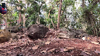
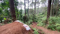
Popular West Java Mountain Biking Trails
• 100 ★ 0.0 • 4,659 ft • 0 ft • 39 •
Popular black diamond difficulty singletrack. This mountain bike primary trail can be used downhill only and has a moderate overall physical rating. It features berm, drop, jump and gap jump. On average it takes 9 minutes to complete this trail.
• 5 ★ 5.0 • 3,048 ft • 0 ft • 31 •
Less popular black diamond difficulty singletrack. This mountain bike primary trail can be used downhill only and has a moderate overall physical rating. It features berm, bridge, drop and jump. On average it takes 9 minutes to complete this trail.
• 90 ★ 5.0 • 1 mile • 9 ft • 28 •
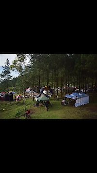
This *new* trail is built together by local cikole communities with both online fund-raising campaign (kitabisa.com/cikole) and offline contribution. Build process started in October and will be released (soft opening) on Nov 12, 2017....
• 100 ★ 5.0 • 4 miles • 464 ft • 27 •
Predominantly XC trail but also rideable for other types of bikes such as all mountain, enduro or gravel. Many roots and very slippery when wet. The dirt can be quite muddy too. Quite easy to ride if you take it slow. Can be challenging...
• 5 ★ 0.0 • 3 miles • 375 ft • 24 •
What can I say? The complete package if you just wanna go mountain biking.
• 5 ★ 5.0 • 3 miles • 182 ft • 23 •
Type of technical DH with lots of roots and very slippery when it wet.
• 5 ★ 5.0 • 1 mile • 158 ft • 22 •
Shorter but steeper alternative to . Lots of technical sections.
• 5 ★ 0.0 • 852 ft • 33 ft • 22 •
Less popular green difficulty singletrack. This mountain bike primary trail can be used both directions and has a easy overall physical rating. On average it takes 1 minutes to complete this trail.
West Java Mountain Bike Routes
Panglejar - Cirata Featured
8 miles • 102 ft • 0 • Point to Point •
Starts with a mellow climb and double track descending which then turn into flowy singletracks in the...
★ 3.0 • 12 miles • 1,092 ft • 0 • Point to Point •
Starting from the western slopes of Mt. Burangrang. Ends at interprovince main road near Purwakarta.
1 mile • 45 ft • 0 • Shuttled •
Adjacent to the Village of Arts & Culture Jelekong. The location is easily accessible to lovers Bike...
★ 1.0 • 10 miles • 291 ft • 0 •
this route can use as bike to work route. only single track
5 miles • 1,104 ft • 0 •
Tetap hati hati karena dibeberapa sections terdapat track licin dan curam
Photos of West Java Mountain Bike
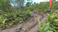
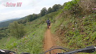
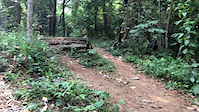
Videos of West Java Mountain Bike
0:13 |
7 |
Sep 11, 2024
0:17 |
19 |
Apr 5, 2023
trail: Cikole-2
0:07 |
11 |
Nov 3, 2022
trail: Galunggung Bike Park
0:10 |
17 |
Mar 16, 2022

trail: Galunggung Bike Park
0:12 |
18 |
Feb 15, 2022
trail: Galunggung Bike Park
0:06 |
17 |
Feb 14, 2022
trail: KTH AT
0:21 |
94 |
Apr 5, 2021
trail: Hutan UI Bike Park Trail
0:10 |
142 |
Aug 4, 2020
Recent Trail Reports
Activity Feed
| username | action | type | title | date |
|---|---|---|---|---|
| camdenb | ridden | trail | activity #90027721 | Mar 5, 2026 @ 1:31pm Mar 5, 2026 |
| DY7LzC | wishlist | trail | activity #89682860 | Feb 28, 2026 @ 5:06am Feb 28, 2026 |
| DY7LzC | wishlist | trail | activity #89682045 and 1 more | Feb 28, 2026 @ 4:52am Feb 28, 2026 |
| motokerry | wishlist | region | activity #84622273 | Nov 23, 2025 @ 12:57pm Nov 23, 2025 |
| jack-jacobs | add | report | activity #83611605 | Nov 5, 2025 @ 4:45am Nov 5, 2025 |
Recent Comments
| username | type | title | comment | date |
|---|---|---|---|---|
| trail | hi, does anyone have the updated gpx file for... | Oct 24, 2023 @ 6:58am Oct 24, 2023 | ||
| trail | Looking at the Video, someone must have been a... | Nov 16, 2022 @ 5:27am Nov 16, 2022 | ||
| trail | May 1, 2021. Past the crater, this trail has... | May 1, 2021 @ 7:04am May 1, 2021 | ||
| trail | Contact person? | Dec 15, 2019 @ 7:03pm Dec 15, 2019 | ||
| trail | Contact person? | Dec 15, 2019 @ 7:01pm Dec 15, 2019 |
Local Badges
-

Epic Ride 50k224 awarded -

Descent 100k Badge3 awarded -
Descent 100k Badge4 awarded -

Big Ride 30k611 awarded -
Big Ride 30k573 awarded -

Top 10 Trails0 awarded
Bike & Skill Parks
| name | type | city | rating |
|---|---|---|---|
| Puncak | bike park | Bogor | |
| Cihideung Gravity Park | bike park | Bogor | |
| Satharlan Bike Park | skill park | Jakarta | |
| Eleven Trees - APark | skill park | Jakarta | |
| Grand Wisata BMX Track | skill park | Bekasi |
Local Trail Supporters
- ROAM
![]()
- Cihideung Gravity Park
- Ride Bike Project
- Jack Jacobs
![]()
Activity Type Stats
| activitytype | trails | distance | descent | descent distance | total vertical | rating | global rank | state rank | photos | reports | routes | activity logs |
|---|---|---|---|---|---|---|---|---|---|---|---|---|
| Mountain Bike | 119 | 191 miles | 75,223 ft | 121 miles | 6,588 ft | 1,177 | 138 | 8 | 15,919 | |||
| E-Bike | 10 | 17 miles | 6,122 ft | 10 miles | 5,259 ft | 109 | 4 | 282 | ||||
| Horse | 2 | 5 miles | 1,716 ft | 2 miles | 3,783 ft | 40 | ||||||
| Hike | 73 | 119 miles | 40,236 ft | 71 miles | 6,572 ft | 1 | 125 | 474 | ||||
| Trail Running | 74 | 125 miles | 42,162 ft | 75 miles | 6,572 ft | 125 | 3 | 402 | ||||
| Dirtbike/Moto | 4 | 7 miles | 1,765 ft | 2 miles | 3,783 ft | 40 | 1 | |||||
| ATV/ORV/OHV | 1 | 2 miles | 10 ft | 407 ft | 817 ft | 40 | 1 |
Activities
Trails
- By wansbud & contributors
- Admins: jack-jacobs, rifu
- #17265 - 3,386 views
- west java activity log | embed map of West Java mountain bike trails | west java mountain biking points of interest
Downloading of trail gps tracks in kml & gpx formats is enabled for West Java.
You must login to download files.