close
-
Layers w
- Weather Layers
- Pro
- Pro
- Pro
- Pro
- Pro
- Pro
- More Layers
- Pro
- Pro
- Pro
- Pro
-
Upgrade to

3D
Trail Conditions
- Unknown
- Snow Groomed
- Snow Packed
- Snow Covered
- Snow Cover Partial
- Freeze/thaw Cycle
- Icy
- Prevalent Mud
- Wet
- Variable
- Ideal
- Dry
- Very Dry
Trail Flow (Ridden Direction)
Trailforks scans users ridelogs to determine the most popular direction each trail is ridden. A good flowing trail network will have most trails flowing in a single direction according to their intension.
The colour categories are based on what percentage of riders are riding a trail in its intended direction.
The colour categories are based on what percentage of riders are riding a trail in its intended direction.
- > 96%
- > 90%
- > 80%
- > 70%
- > 50%
- < 50%
- bi-directional trail
- no data
Trail Last Ridden
Trailforks scans ridelogs to determine the last time a trail was ridden.
- < 2 days
- < 1 week
- < 2 weeks
- < 1 month
- < 6 months
- > 6 months
Trail Ridden Direction
The intended direction a trail should be ridden.
- Downhill Only
- Downhill Primary
- Both Directions
- Uphill Primary
- Uphill Only
- One Direction
Contribute Details
Colors indicate trail is missing specified detail.
- Description
- Photos
- Description & Photos
- Videos
Trail Popularity ?
Trailforks scans ridelogs to determine which trails are ridden the most in the last 9 months.
Trails are compared with nearby trails in the same city region with a possible 25 colour shades.
Think of this as a heatmap, more rides = more kinetic energy = warmer colors.
- most popular
- popular
- less popular
- not popular
ATV/ORV/OHV Filter
Max Vehicle Width
inches
US Cell Coverage
Legend

Radar Time
Activity Recordings
Trailforks uses anonymized public activity data.
?
Activity Recordings
Trailforks uses anonymized public activity data.
?
Personal Heatmap
▶
Activity Types
all
/
none
▶
Options
2
Date range
month
–
Winter Trails
Warning
A routing network for winter maps does not exist. Selecting trails using the winter trails layer has been disabled.
Missing Trails
Most Popular
Least Popular
Trails are colored based on popularity. The more popular a trail is, the more red. Less popular trails trend towards green.
Jump Magnitude Heatmap
Heatmap of where riders jump on trails. Zoom in to see individual jumps, click circles to view jump details.
BC Backroad Status
![map legend]()
Service Road Atlas is a free to use, community-driven service for viewing and creating reports on the numerous back-country service roads around B.C. and Alberta.

Slope Aspect
Direction the slope faces
Trails Deemphasized
Trails are shown in grey.
Only show trails with no bike usage.
Suggested Layers
Based on selected activity type
Save the current map location and zoom level as your default home location whenever this page is loaded.
Save
No description for Willits has been added yet!
Login or register to submit one.
Activities Click to view
- Mountain Bike
67 trails
- E-Bike
13 trails
- Adaptive Bike
0 trails
- Hike
62 trails
- Trail Running
61 trails
Region Details
- 7
- 22
- 16
- 4
Region Status
Open as of Nov 1, 2025Stats
- Avg Trail Rating
- Trails (view details)
- 49
- Trails Mountain Bike
- 67
- Trails E-Bike
- 13
- Trails Hike
- 62
- Trails Trail Running
- 61
- Total Distance
- 41 miles
- Total Descent
- 10,578 ft
- Total Vertical
- 1,184 ft
- Highest Trailhead
- 2,581 ft
- Reports
- 138
- Photos
- 32
- Ridden Counter
- 1,878
Sub Regions
-
Brooktrails Greenbelt
- 16
- 6
- 4
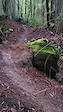
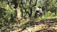
Popular Willits Mountain Biking Trails
• 80 ★ 5.0 • 3,146 ft • 29 ft • 142 •
Pretty fun singletrack descent with some small drops and jumps here and there, some steep bits, some narrow bits, and lots of gnomes if you keep your eyes peeled. In good conditions this trail rides like a pretty mellow blue. After...
• 90 ★ 3.4 • 1,234 ft • 33 ft • 64 •
Mellow doubletrack connector between Lake Ada Rose and Trail.
• 85 ★ 3.5 • 1,545 ft • 3 ft • 63 •
This is a more technical green trail. There are a couple of short bridges and a rocky section.
• 85 ★ 4.7 • 1,083 ft • 0 ft • 52 •
The trail starts at the Water Tower, and is a fast fun descent to the start of . There are a couple of steep sections that are black diamond difficulty.
• 75 ★ 5.0 • 3,770 ft • 0 ft • 49 •
The follows an old skid road, and is steep and technical in places. There are a few drops and jumps along with several technical obstacles, steep chutes, little ridge lines, and several bridges. It can be shuttled, or you can pedal up...
• 90 ★ 0.0 • 1,093 ft • 14 ft • 47 •
A fun little trail to end a ride if you parked at the Brooktrails Community Center.
• 75 ★ 5.0 • 2,454 ft • 0 ft • 47 •
is an awesome trail. It has some small jumps and drops, a little tech, and some flow. It's the best thing in Brooktrails!
Photos of Willits Mountain Bike
Videos of Willits Mountain Bike
trail: Miss Gnomer
0:10 |
276 |
Dec 26, 2022
trail: Flying Turkey
0:53 |
167 |
Jun 10, 2011
Recent Trail Reports
| status | trail | date | condition | info | user |
|---|---|---|---|---|---|
| Oregon Raisin | Nov 1, 2025 @ 6:14pm (America/Los_Angeles) Nov 1, 2025 | Ideal | burningpines WAC | ||
| Blackberry | Oct 20, 2025 @ 11:07am (America/Los_Angeles) Oct 20, 2025 | Unknown | burningpines WAC | ||
| Nutmeg | Oct 20, 2025 @ 11:03am (America/Los_Angeles) Oct 20, 2025 | Unknown | burningpines WAC | ||
| Miss Gnomer | Oct 4, 2025 @ 8:38pm (America/Los_Angeles) Oct 4, 2025 | Ideal | mommabikes24 | ||
| Thimbleberry | Sep 25, 2025 @ 12:53pm (America/Los_Angeles) Sep 25, 2025 | Ideal | burningpines WAC | ||
| Huckleberry | Sep 25, 2025 @ 12:46pm (America/Los_Angeles) Sep 25, 2025 | Unknown | burningpines WAC | ||
| Anchorage | Aug 25, 2025 @ 6:34pm Aug 25, 2025 | Ideal | itsalldownhillfrmhere | ||
| For Sale Trail | Aug 25, 2025 @ 6:34pm Aug 25, 2025 | Ideal | itsalldownhillfrmhere | ||
| Mike's Trail | Aug 25, 2025 @ 9:26pm Aug 25, 2025 | Dry | itsalldownhillfrmhere | ||
| Mossy Rock | Aug 25, 2025 @ 9:24pm Aug 25, 2025 | Dry | itsalldownhillfrmhere |
Activity Feed
| username | action | type | title | date |
|---|---|---|---|---|
| Singletrac1 | wishlist | region | activity #91710618 | Apr 1, 2026 @ 9:03am Apr 1, 2026 |
| atomess | wishlist | region | activity #91415810 | Mar 27, 2026 @ 10:06pm Mar 27, 2026 |
| a-sherf | update | trail | activity #88967071 and 1 more | Feb 15, 2026 @ 9:34am Feb 15, 2026 |
| KevyPedal | vote | trail | activity #87854785 and 1 more | Jan 26, 2026 @ 11:01am Jan 26, 2026 |
| KevyPedal | ridden | trail | activity #87854784 and 1 more | Jan 26, 2026 @ 11:01am Jan 26, 2026 |
Recent Comments
| username | type | title | comment | date |
|---|---|---|---|---|
| trail | New mtber here, trail is fast and fun. There... | Nov 3, 2025 @ 9:10am Nov 3, 2025 | ||
| trail | New mtber here, this trail is approachable,... | Nov 3, 2025 @ 9:08am Nov 3, 2025 | ||
| trail | Super fun trail to ride at a mellow pace and a... | Jun 24, 2025 @ 8:49pm Jun 24, 2025 | ||
| trail | I love this trail it's like a slalom course.... | Jun 24, 2025 @ 8:27pm Jun 24, 2025 | ||
| trail | Drops you off a cliff at the end if you carry... | May 23, 2025 @ 2:31pm May 23, 2025 |
Local Badges
-

10 Green Trails19 awarded -

Epic Ride Climb 2k87 awarded -

Climbing 10k Badge10 awarded -

Climbing 100k Badge1 awarded -

Epic Ride Descent 2k89 awarded -

Descent 10k Badge10 awarded
Activity Type Stats
| activitytype | trails | distance | descent | descent distance | total vertical | rating | global rank | state rank | photos | reports | routes | ridelogs |
|---|---|---|---|---|---|---|---|---|---|---|---|---|
| Mountain Bike | 67 | 41 miles | 10,577 ft | 20 miles | 1,184 ft | #2,823 | #997 | 30 | 137 | 2,324 | ||
| E-Bike | 13 | 19 miles | 4,564 ft | 10 miles | 1,158 ft | #5,664 | #1,749 | 80 | 30 | |||
| Hike | 62 | 39 miles | 10,302 ft | 19 miles | 1,184 ft | #5,401 | #1,903 | 1 | 137 | 83 | ||
| Trail Running | 61 | 37 miles | 9,931 ft | 18 miles | 1,184 ft | #4,936 | #1,538 | 3 | 137 | 18 |
Frequently Asked Questions About Willits
▼
What are the best places to ride in Willits?
Willits has 2 areas to explore for mountain biking. The top rated areas are:
▼
What are the highest rated mountain biking trails in Willits?
The highest rated mountain biking trails in Willits are:
- Oregon Grape (4.2/5)
- Beaver (4.2/5)
- Sacré Blue (4.1/5)
- Kabluey (4.1/5)
- Miss Gnomer (4.1/5)
▼
What is the best time of the year to ride in Willits?
Based on ride log data, the most popular months to ride in Willits are:
- June (22 activities)
- October (10 activities)
- May (8 activities)
▼
Where can I park to ride in Willits?
There are 7 parking locations listed in Willits. The most popular parking spots are: View all parking and trailhead locations on the map to plan your visit.
Activities
Trails
Points of Interest
- By a-sherf
 WAC & contributors
 - Admins: sanfret, MCC, UVTG, WAC
- #26603 - 3,391 views
- willits activity log | embed map of Willits mountain bike trails | willits mountain biking points of interest
Downloading of trail gps tracks in kml & gpx formats is enabled for Willits.
You must login to download files.