- Trail:
- Alpine Baldy Trail (Skykomish)
- Status:
- Minor Issue / Yellow
-
Issue status:
- Condition:
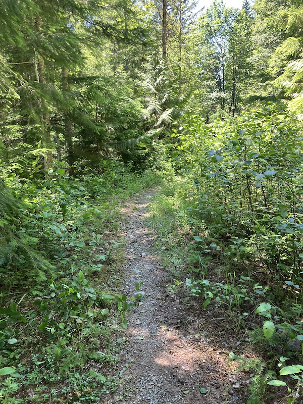
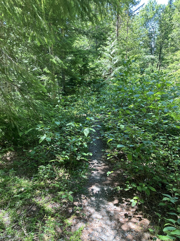
- Variable - some wet spots, or some dusty spots but overall good conditions
- Reporter Primary Activity:
- Mountain Bike
Description:
Overgrown vegetation
- Work Report:
- trail work done
close
3D
Trail Conditions
- Unknown
- Snow Groomed
- Snow Packed
- Snow Covered
- Snow Cover Partial
- Freeze/thaw Cycle
- Icy
- Prevalent Mud
- Wet
- Variable
- Ideal
- Dry
- Very Dry
Trail Flow (Ridden Direction)
Trailforks scans users activity logs to determine the most popular direction each trail is ridden. A good flowing trail network will have most trails flowing in a single direction according to their intension.
The colour categories are based on what percentage of users are riding a trail in its intended direction.
The colour categories are based on what percentage of users are riding a trail in its intended direction.
- > 96%
- > 90%
- > 80%
- > 70%
- > 50%
- < 50%
- bi-directional trail
- no data
Trail Last Used
Trailforks scans activity logs to determine the last time a trail was ridden.
- < 2 days
- < 1 week
- < 2 weeks
- < 1 month
- < 6 months
- > 6 months
Trail Ridden Direction
The intended direction a trail should be ridden.
- Downhill Only
- Downhill Primary
- Both Directions
- Uphill Primary
- Uphill Only
- One Direction
Contribute Details
Colors indicate trail is missing specified detail.
- Description
- Photos
- Description & Photos
- Videos
Trail Popularity ?
Trailforks scans activity logs to determine which trails are ridden the most in the last 9 months.
Trails are compared with nearby trails in the same city region with a possible 25 colour shades.
Think of this as a heatmap, more activities = more kinetic energy = warmer colors.
- most popular
- popular
- less popular
- not popular
ATV/ORV/OHV Filter
Max Vehicle Width
inches
US Cell Coverage
Legend

Radar Time
Activity Recordings
Trailforks uses anonymized public activity data.
?
Activity Recordings
Trailforks uses anonymized public activity data.
?
Winter Trails
Warning
A routing network for winter maps does not exist. Selecting trails using the winter trails layer has been disabled.
Missing Trails
Most Popular
Least Popular
Trails are colored based on popularity. The more popular a trail is, the more red. Less popular trails trend towards green.
Jump Magnitude Heatmap
Heatmap of where users jump on trails. Zoom in to see individual jumps, click circles to view jump details.
BC Backroad Status
![map legend]()
Service Road Atlas is a free to use, community-driven service for viewing and creating reports on the numerous back-country service roads around B.C. and Alberta.

Slope Aspect
Direction the slope faces
Trails Deemphasized
Trails are shown in grey.
Only show trails with no bike usage.
Suggested Layers
Based on selected activity type
Save the current map location and zoom level as your default home location whenever this page is loaded.
SaveCoordinates: 47.727497, -121.234117
Coordinates: 47.727231, -121.233969
Local Weather During Report
- Summary
MostlyClear - Temperature
19° (11°/26°) - Precip
0 mm/h - Wind
2.88 km/h - Cloud Cover
13% - Humidity
0.57
Previous Reports
5 Comments
- + 1
Tdancs
Jul 7, 2026 at 21:37
Rode and did some brushing work yesterday. Other than the 3 washed out creek crossings, trail is mostly brush free to about 2.5 miles from TH. Vehicle with clearance will get you around the short bit of road damage about 1.4 miles from the TH. Bring loppers and cut some brush. It’s quite satisfying.
- + 2
@kenobonn: sure thing. It’s gonna need a lot more brushing to make it enjoyable to ride again. I’m hoping to get back up there in a couple weeks to do some more. Maybe camp out for a couple days. TBD.
- + 1
@Tdancs: Ping me if / when you go if you need a partner. I've done a lot of brush work there in years past, wanting to make a dent in it soon now that all the trees are cleared. My buddy Ethan is planning to host a work party with EMBA for trimming, date is not set yet, considering july 25 or aug 1, but other options too, I think he's going to put in on their calendar in a week when he decides.