- Trail:
- Alpine Baldy Trail (Skykomish)
- Status:
- Minor Issue / Yellow
-
Issue status:
- Condition:
- Dry -
- Reporter Primary Activity:
- Mountain Bike
Description:
I rode Alpine Baldy to the end today. There are no trees on the trail to block you. Zero. Zip. Nada.
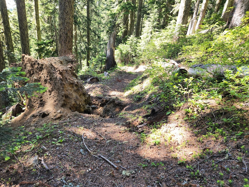
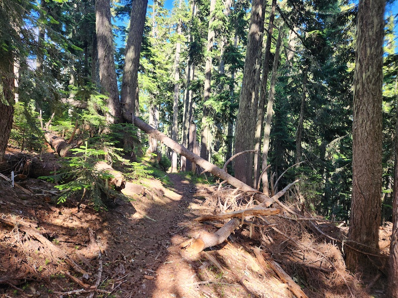
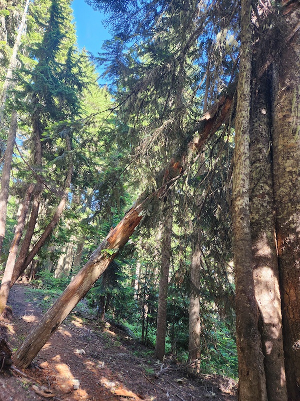
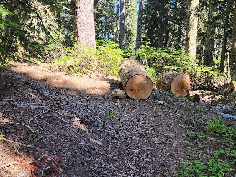
There are 4 hazards that I want to raise awareness of. Some will stay, some can be fixed, some are minor. We're MTB riders and used to hazards on the trail, it's part of the game. Only calling them out because you must pay attention as they come up quick on the descent. Pictures of each are included, explanations below. GPS coordinates are to the RootBall O'Death as that's the most significant hazard.
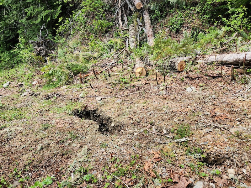
1. **San Andreas**. Mini-fault line if you use imagination. The ground is separating and currently a 4-inch difference on either side, with a gap that is aligned to the direction of the trail. As you are coming in hot just prior to the Avalanche Debris section on the return, it's easy to slip a front wheel into the gap and go over the bars. FIX: Not really possible, just clear vegetation nearby throughout the summer so it's clearly visible.
2. **Feats Of Strength**. This log needs a strong person to rock it over the embankment and off the trail. Not really a hazard as it's clearly visible and plenty of trail to ride around it. FIX: Need a rider who wants to test their "feats of strength" and roll this log another foot off the trail to meet required standards. Bragging rights deserving.
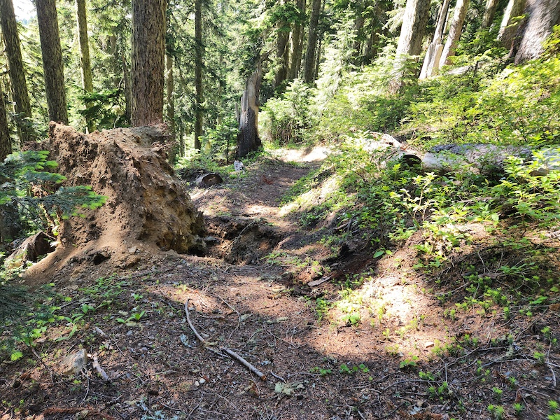
3. **Rootball O'Death**. It's easy to forget where this is located as you are zipping down the forest. Seriously, someone may not stop in time, please be aware. FIX: Bring a shovel, pick-mattock, and bucket to borrow soil from the root ball and fill in the hole.
4. **Duck Duck Tree**. Two leaners within 50 feet of each other. Super easy to duck under, but if you have tools such as a rake or similar sticking higher than your pack, it could catch. FIX: Well, someone may fix the lower one, but I question why bother, best to just be aware of it. The higher leaner is rotten and snagged and requires a certified sawyer of faller status, personally I think it's safest to let nature handle this.
There are 4 hazards that I want to raise awareness of. Some will stay, some can be fixed, some are minor. We're MTB riders and used to hazards on the trail, it's part of the game. Only calling them out because you must pay attention as they come up quick on the descent. Pictures of each are included, explanations below. GPS coordinates are to the RootBall O'Death as that's the most significant hazard.
1. **San Andreas**. Mini-fault line if you use imagination. The ground is separating and currently a 4-inch difference on either side, with a gap that is aligned to the direction of the trail. As you are coming in hot just prior to the Avalanche Debris section on the return, it's easy to slip a front wheel into the gap and go over the bars. FIX: Not really possible, just clear vegetation nearby throughout the summer so it's clearly visible.
2. **Feats Of Strength**. This log needs a strong person to rock it over the embankment and off the trail. Not really a hazard as it's clearly visible and plenty of trail to ride around it. FIX: Need a rider who wants to test their "feats of strength" and roll this log another foot off the trail to meet required standards. Bragging rights deserving.
3. **Rootball O'Death**. It's easy to forget where this is located as you are zipping down the forest. Seriously, someone may not stop in time, please be aware. FIX: Bring a shovel, pick-mattock, and bucket to borrow soil from the root ball and fill in the hole.
4. **Duck Duck Tree**. Two leaners within 50 feet of each other. Super easy to duck under, but if you have tools such as a rake or similar sticking higher than your pack, it could catch. FIX: Well, someone may fix the lower one, but I question why bother, best to just be aware of it. The higher leaner is rotten and snagged and requires a certified sawyer of faller status, personally I think it's safest to let nature handle this.
close
3D
Trail Conditions
- Unknown
- Snow Groomed
- Snow Packed
- Snow Covered
- Snow Cover Partial
- Freeze/thaw Cycle
- Icy
- Prevalent Mud
- Wet
- Variable
- Ideal
- Dry
- Very Dry
Trail Flow (Ridden Direction)
Trailforks scans users activity logs to determine the most popular direction each trail is ridden. A good flowing trail network will have most trails flowing in a single direction according to their intension.
The colour categories are based on what percentage of users are riding a trail in its intended direction.
The colour categories are based on what percentage of users are riding a trail in its intended direction.
- > 96%
- > 90%
- > 80%
- > 70%
- > 50%
- < 50%
- bi-directional trail
- no data
Trail Last Used
Trailforks scans activity logs to determine the last time a trail was ridden.
- < 2 days
- < 1 week
- < 2 weeks
- < 1 month
- < 6 months
- > 6 months
Trail Ridden Direction
The intended direction a trail should be ridden.
- Downhill Only
- Downhill Primary
- Both Directions
- Uphill Primary
- Uphill Only
- One Direction
Contribute Details
Colors indicate trail is missing specified detail.
- Description
- Photos
- Description & Photos
- Videos
Trail Popularity ?
Trailforks scans activity logs to determine which trails are ridden the most in the last 9 months.
Trails are compared with nearby trails in the same city region with a possible 25 colour shades.
Think of this as a heatmap, more activities = more kinetic energy = warmer colors.
- most popular
- popular
- less popular
- not popular
ATV/ORV/OHV Filter
Max Vehicle Width
inches
US Cell Coverage
Legend

Radar Time
Activity Recordings
Trailforks uses anonymized public activity data.
?
Activity Recordings
Trailforks uses anonymized public activity data.
?
Winter Trails
Warning
A routing network for winter maps does not exist. Selecting trails using the winter trails layer has been disabled.
Missing Trails
Most Popular
Least Popular
Trails are colored based on popularity. The more popular a trail is, the more red. Less popular trails trend towards green.
Jump Magnitude Heatmap
Heatmap of where users jump on trails. Zoom in to see individual jumps, click circles to view jump details.
BC Backroad Status
![map legend]()
Service Road Atlas is a free to use, community-driven service for viewing and creating reports on the numerous back-country service roads around B.C. and Alberta.

Slope Aspect
Direction the slope faces
Trails Deemphasized
Trails are shown in grey.
Only show trails with no bike usage.
Suggested Layers
Based on selected activity type
Save the current map location and zoom level as your default home location whenever this page is loaded.
SaveCoordinates: 47.739340, -121.245637
Coordinates: 47.739342, -121.245636
Coordinates: 47.737928, -121.241069
Coordinates: 47.737836, -121.241642
Coordinates: 47.739375, -121.245356
Coordinates: 47.739342, -121.245636
Local Weather During Report
- Summary
MostlyClear - Temperature
12° (9°/19°) - Precip
0 mm/h - Wind
5.46 km/h - Cloud Cover
27% - Humidity
0.76