- Trail:
- Freak On A Leash (Glenwood Forest Trails)
- Status:
- All Clear / Green
-
Issue status:
- Condition:
- Unknown - please contribute condition
- Reporter Primary Activity:
- Mountain Bike
Description:
TRAIL AUDIT 2026
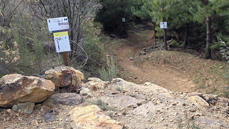
- Direction and rating signs in place at entries.
- Trail Filter, (skill check), in place at entries.
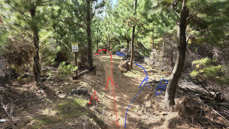
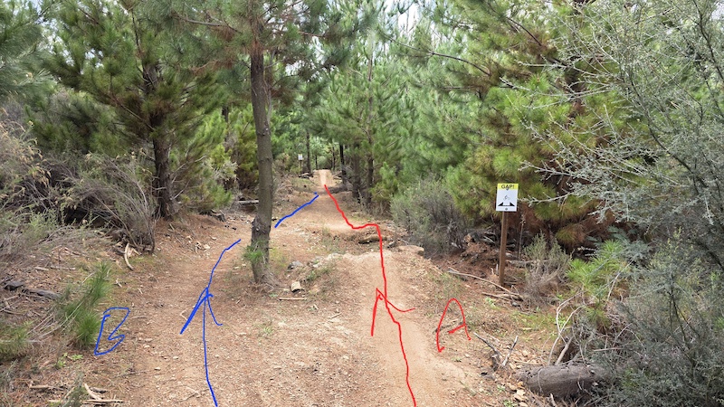
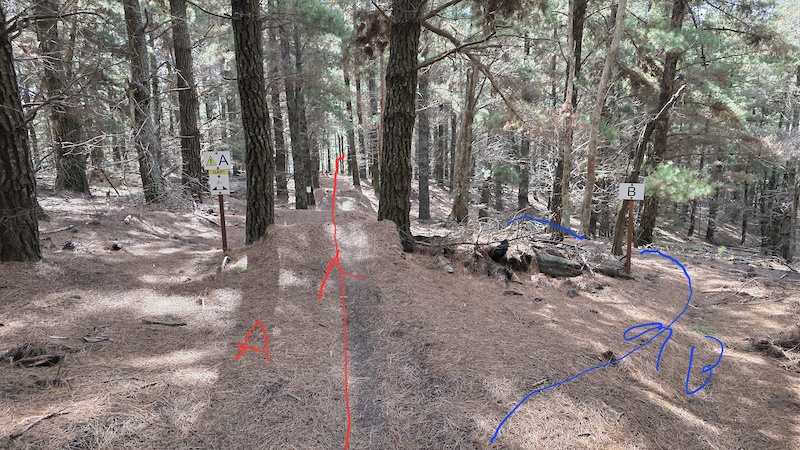
- Gap jumps in place with B line options to avoid.
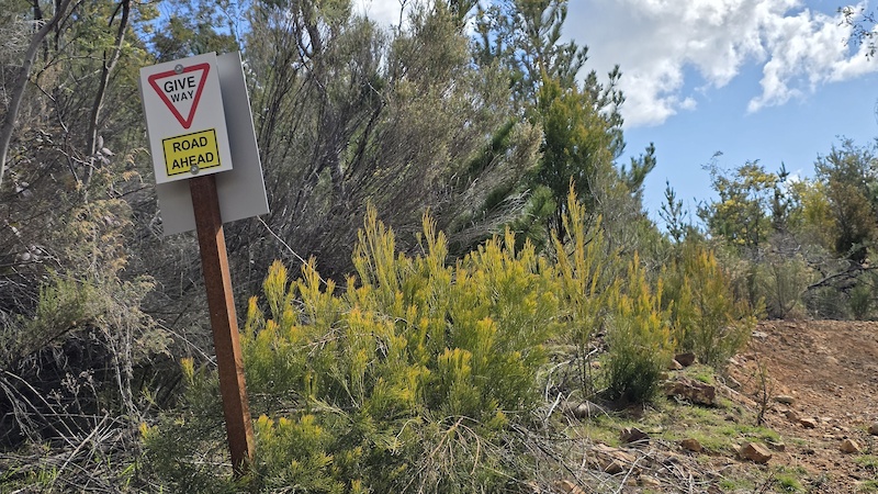
- Give way signs in place at fire trail crossings.
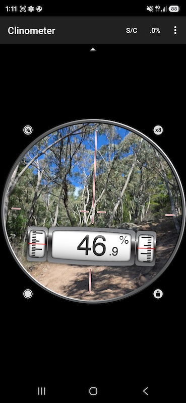
- Steepest section 47%, measured in the middle rock chute.
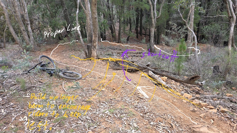
- Shortcut, 'French line', continues to form towards the bottom of the second block. This removes the chalanging corner section, which should be maintained to reward skilled riders. By placing a steeper berm here it will direct riders more to the left, detering them from shortcutting. A simpler solution would be placing a large non movable log in the parth.
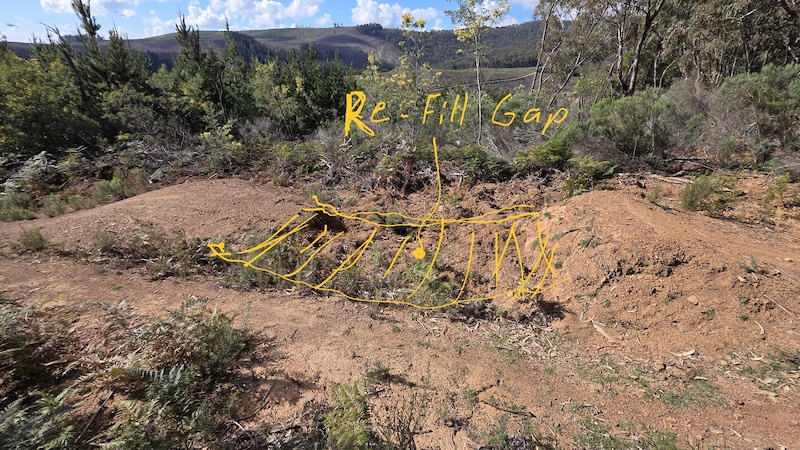
- At the gap jump, at the bottom of the second block, it appears have been digging in the gap. This could become a hazard if it gets deeper, if people land short it could catch their front wheel resulting in a over handle bar crash.
Fill gap to original height and smooth.
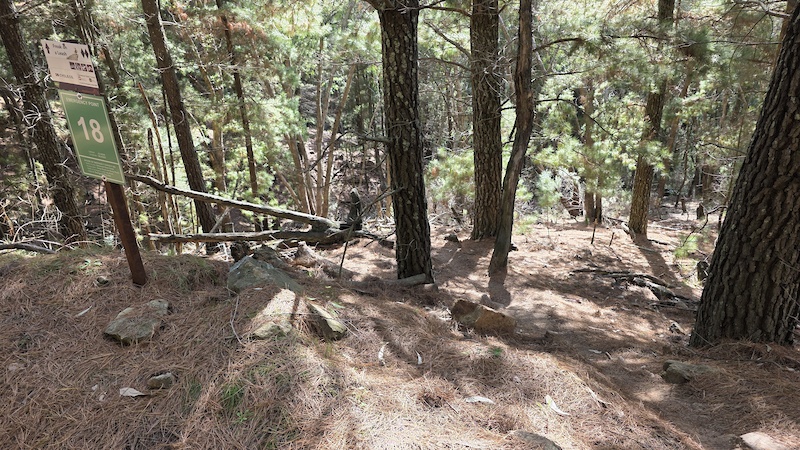
- 'DROP' sign needs replacing at entry to last block.
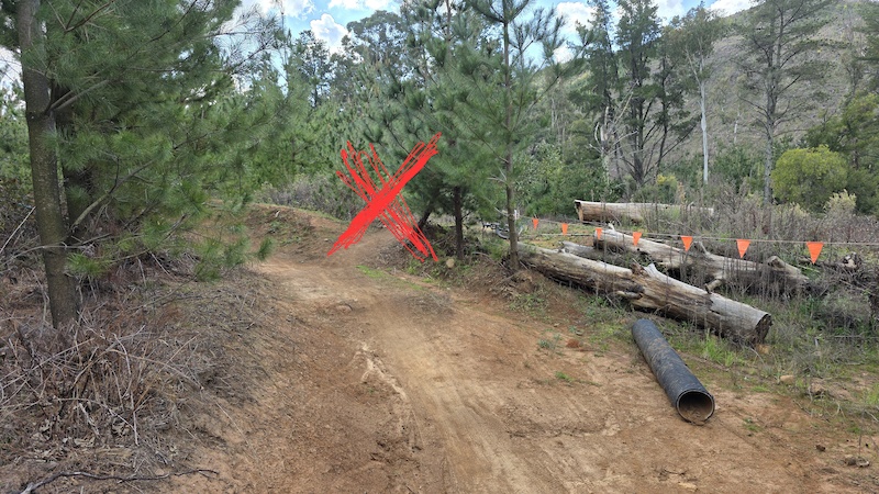
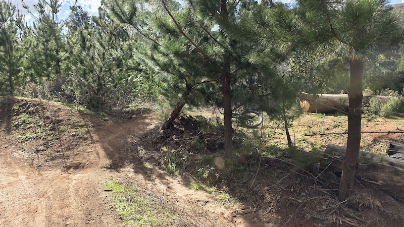
- At end, people have been shortcutting back to the fire trail, despite efforts to block it with large logs. The fastest line is fully blocked, but another section needs a large non movable log to stop riders. The shortcut is ruening the main line, and its a steep drop onto a relatively busy fire trail with a blind corner which risks a collision with a vehicle.
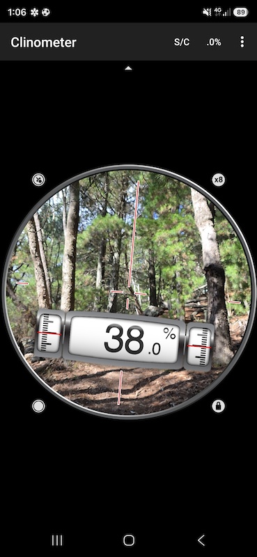
MAX GRADIENT (%): 38
TRAIL WIDTH (mm): 900 ± 300
TREAD SURFACE: Variable and challenging
LEVEL OF EXPOSURE: Steep downward slopes or freefall
MAX HEIGHT OF UNAVOIDABLE OBJECTS (mm): 500
JUMPS: Rollable jumps & Avoidable gap jumps to 2m high.
CORRIDOR WIDTH (mm): 1000-2000
MIN WIDTH OF UNAVOIDABLE BRIDGES (mm): NA
MOUNTAIN BIKE TRAIL RATING: Extreme (Double Black)
BIKE TYPE: Trail/AM/DH
- Direction and rating signs in place at entries.
- Trail Filter, (skill check), in place at entries.
- Gap jumps in place with B line options to avoid.
- Give way signs in place at fire trail crossings.
- Steepest section 47%, measured in the middle rock chute.
- Shortcut, 'French line', continues to form towards the bottom of the second block. This removes the chalanging corner section, which should be maintained to reward skilled riders. By placing a steeper berm here it will direct riders more to the left, detering them from shortcutting. A simpler solution would be placing a large non movable log in the parth.
- At the gap jump, at the bottom of the second block, it appears have been digging in the gap. This could become a hazard if it gets deeper, if people land short it could catch their front wheel resulting in a over handle bar crash.
Fill gap to original height and smooth.
- 'DROP' sign needs replacing at entry to last block.
- At end, people have been shortcutting back to the fire trail, despite efforts to block it with large logs. The fastest line is fully blocked, but another section needs a large non movable log to stop riders. The shortcut is ruening the main line, and its a steep drop onto a relatively busy fire trail with a blind corner which risks a collision with a vehicle.
MAX GRADIENT (%): 38
TRAIL WIDTH (mm): 900 ± 300
TREAD SURFACE: Variable and challenging
LEVEL OF EXPOSURE: Steep downward slopes or freefall
MAX HEIGHT OF UNAVOIDABLE OBJECTS (mm): 500
JUMPS: Rollable jumps & Avoidable gap jumps to 2m high.
CORRIDOR WIDTH (mm): 1000-2000
MIN WIDTH OF UNAVOIDABLE BRIDGES (mm): NA
MOUNTAIN BIKE TRAIL RATING: Extreme (Double Black)
BIKE TYPE: Trail/AM/DH
Local Weather During Report
- Summary
Clear - Temperature
1° (1°/13°) - Precip
0 mm/h - Wind
4.43 km/h - Cloud Cover
4% - Humidity
0.86
Previous Reports