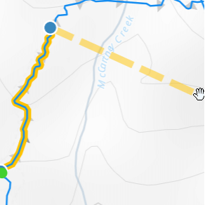
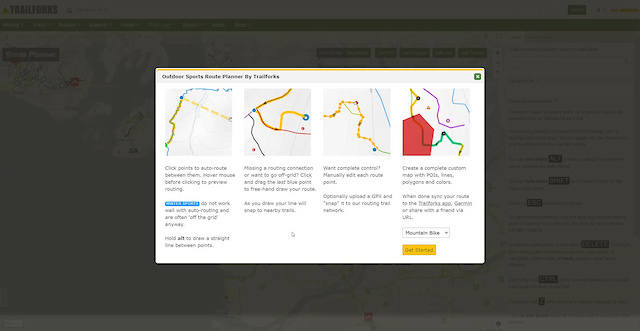
Click points to auto-route between them. Hover mouse before clicking to preview routing.
Winter Sports do not work well with auto-routing and are often 'off the grid' anyway.
Hold alt to draw a straight line between points.
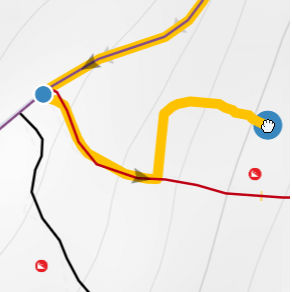
Missing a routing connection or want to go off-grid? Click and drag the last blue point to free-hand draw your route.
As you draw your line will snap to nearby trails.
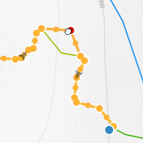
Want complete control? Manually edit each route point.
Optionally upload a GPX and "snap" it to our routing trail network.
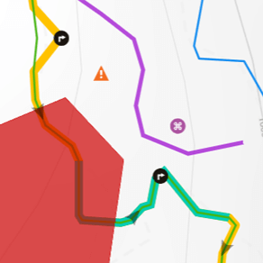
Create a complete custom map with POIs, lines, polygons and colors.
When done sync your route to the Trailforks app, Garmin or share with a friend via URL.
Touch and hold a spot on the map to auto-route between them.
Touch and drag the last blue point to free-hand draw your route.
Flip
Undo
3D
Trail Conditions
Trail Flow (Ridden Direction)
Trailforks scans users ridelogs to determine the most popular direction each trail is ridden. A good flowing trail network will have most trails flowing in a single direction according to their intension.
The colour categories are based on what percentage of riders are riding a trail in its intended direction.
Trail Last Ridden
Trailforks scans ridelogs to determine the last time a trail was ridden.
Trail Ridden Direction
The intended direction a trail should be ridden.
Contribute Details
Colors indicate trail is missing specified detail.
Trail Popularity ?
Trailforks scans ridelogs to determine which trails are ridden the most in the last 9 months.
Trails are compared with nearby trails in the same city region with a possible 25 colour shades.
Think of this as a heatmap, more rides = more kinetic energy = warmer colors.
ATV/ORV/OHV Filter
Max Vehicle Width
inches
US Cell Coverage
Legend

Radar Time
x
Activity Recordings
Trailforks users anonymized public ridelogs from the past 6 months.
Activity Recordings
Trailforks users anonymized public skilogs from the past 12 months.
Winter Trails
Warning
A routing network for winter maps does not exist. Selecting trails using the winter trails layer has been disabled.
x
Missing Trails
Most Popular
Least Popular
Trails are colored based on popularity. The more popular a trail is, the more red. Less popular trails trend towards green.
Jump Magnitude Heatmap
Heatmap of where riders jump on trails. Zoom in to see individual jumps, click circles to view jump details.
Trails Deemphasized
Trails are shown in grey.
Only show trails with NO bikes.
Save the current map location and zoom level as your default home location whenever this page is loaded. Save
|
Add POI to Route
Click on map to add POI to this route. These POIs will only show with this route and not the normal public map.
Delete POI
Add Polygon to Route
Click points to draw a polygon. Click last point added to finish the polygon.
Add Line to Route
Click points to draw a colored line. After you can click and drag points to edit the line.
Add Colored Section
This feature can be used to show race stages.
Drag the sliders so the desired section is marked in red.
Upload GPX
GPX, KML
16 miles
Distance
1,522 ft
Climb
2
Points
NEW
Add New
save
cancel
refresh
Trails
refresh
Duplicate Routes
Sections
Reports
refresh
Turn-by-Turn Directions
Surfaces
* these % are only for portions of the route that are "snapped" to trails and roads
Drawing Instructions
There are 3 ways to create a route, click points to auto-route between them, freehand draw with snapping, or selecting individual trail segments.
You can mix and match these methods to create the perfect route.
Auto-routing between clicked points is the default, click a starting point on the map. You can toggle Map Mode if you wish to interact with the map like normal. You can hold down ALT to draw a straight line between points, ignoring the auto-routing. A straight line is also drawn if no routing can be found to your clicked point. You can hold down SHIFT and auto-route to a point in Map Mode. Pressing ESC will exit Draw Mode or Selecting Mode. To start freehand drawing click and drag the last blue routing point in any mode. If drawing near trails your line will snap to the nearest trail after drawing. Click Selecting Mode to click individual trail segments in sequence, each segment will try and align correctly, but there is an optional flip button to flip the last segment. While in this mode, selectable segments have a pink glow and will highlight with mouse over. To remove points press or hold down DELETE. Clicking a blue routing point will remove it and the route will be re-calculated. There is also an undo option to revert some changes. Optionally hold CTRL while freehand drawing near parallel trails to stick to that current trail. Optionally hold Z while drawing to disable snapping to trails. Click the edit points button to manually edit or add points after drawing. When editing points, to delete a point, click it and press DELETE. Demo Video Routing Issues Trailforks auto-routing relies on trails connecting and valid direction data. You can help improve routing by editing trails and snapping their points to roads and nearby trails along with correctly specifying the preferred direction for that trail. If auto-routing isn't able to connect trails, you can always freehand draw the missing connection to complete your route. View status of routing network Calculate Isochrone
An isochrone visualizes all the places you could ride within blocks of time or distance from a point. Debug
Current costing model: Route method: routing |
The route has successfully been synced to your Garmin Connect account. Login to your Garmin account, click the 'Training & Planning' tab, then select courses. Locate the course you synced and click 'Send to Device' to send it to your Garmin device.
Garmin CoursesYour Garmin Connect account is linked with Trailforks, however the 'Courses' permission is not enabled. This permission is required to send routes to your Garmin Connect account.
To add the 'Courses' permission, click the button below and when prompted select the 'Courses' switch to grant access.
Your Garmin Connect account is not linked with Trailforks. To link your Garmin Connect account, click the button below and when prompted login to your Garmin account and authorize Trailforks to access your Garmin Connect account. Make sure the 'Courses' permission is enabled.
Your Garmin access and permissions have been updated. You may now send this route to your Garmin Connect account. Continue as before to send the route to your Garmin Connect account.
Unable to sync route to Garmin Connect. Please try again later.
