8.2 miles
Distance
1,512 ft
Climb
-1,170 ft
Descent
1,065 ft
High Point
342 ft
Altitude change
531 ft
Altitude min
686 ft
Altitude start
1,027 ft
Altitude end
0.8%
Grade
-64.7%
Grade max
32.8%
Grade min
5 miles
Distance climb
3 miles
Distance down
2,133 ft
Distance flat
This route is archived

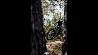
תחרות מס' 1 לשנת 2019
אנדורו שלושה סטייג'ים - חילזון, זאביק, פטרה
ספרינט - שני ראנים על החילזון

Detailed Description
תחרות #1 - אנדורו/ספרינט משמר העמק is a 8 mile intermediate race route located near Mishmar HaEmek. This mountain bike only route and has a moderate overall physical rating. This route includes 6 trails. This route climbs 1,512 ft with a max elevation of 1,065 ft then descends -1,170 ft.
Past Events

Stats

  • Distance
    8 miles
  • Avg time
    1 hr 8 min
  • Altitude change
    342 ft
  • Altitude min
    531 ft
  • Altitude start
    686 ft
  • Altitude end
    1,027 ft
  • Climb
    1,512 ft
  • Descent
    -1,170 ft
  • Grade
    0.8%
  • Grade max
    -64.7%
  • Grade min
    32.8%
  • Distance climb
    5 miles
  • Distance down
    3 miles
  • Distance flat
    2,133 ft

Comments


We hope you've been enjoying Trailforks!

Create a FREE account to view route comments and much more.

Route Sections

1 Stage 1
  • 3,564 ft distance
  • 0 ft climb
  • -368 ft descent
2 Stage 2
  • 3,053 ft distance
  • 11 ft climb
  • -324 ft descent
3 Stage 3
  • 1 mile distance
  • 0 ft climb
  • -377 ft descent

Trails in Route

Route POI

Aid StationAid StationAid Station
Mechanical StationMechanical StationMechanical Station

Details

  • Race Course
  • Race Date
    Saturday April 6, 2019 at 07:00am
  • Riding area
  • Primary Activity
    Mountain Bike
  • Difficulty rating
    Blue
  • Bike type
    AM
  • Physical rating
    Moderate
  • Ridelogs
    3
no votes yet
close
3D
Trail Conditions
  • Unknown
  • Snow Groomed
  • Snow Packed
  • Snow Covered
  • Snow Cover Partial
  • Freeze/thaw Cycle
  • Icy
  • Prevalent Mud
  • Wet
  • Variable
  • Ideal
  • Dry
  • Very Dry
Trail Flow (Ridden Direction)
Trailforks scans users ridelogs to determine the most popular direction each trail is ridden. A good flowing trail network will have most trails flowing in a single direction according to their intension.
The colour categories are based on what percentage of riders are riding a trail in its intended direction.
  • > 96%
  • > 90%
  • > 80%
  • > 70%
  • > 50%
  • < 50%
  • bi-directional trail
  • no data
Trail Last Ridden
Trailforks scans ridelogs to determine the last time a trail was ridden.
  • < 2 days
  • < 1 week
  • < 2 weeks
  • < 1 month
  • < 6 months
  • > 6 months
Trail Ridden Direction
The intended direction a trail should be ridden.
  • Downhill Only
  • Downhill Primary
  • Both Directions
  • Uphill Primary
  • Uphill Only
  • One Direction
Contribute Details
Colors indicate trail is missing specified detail.
  • Description
  • Photos
  • Description & Photos
  • Videos
Trail Popularity ?
Trailforks scans ridelogs to determine which trails are ridden the most in the last 9 months. Trails are compared with nearby trails in the same city region with a possible 25 colour shades. Think of this as a heatmap, more rides = more kinetic energy = warmer colors.
  • most popular
  • popular
  • less popular
  • not popular
ATV/ORV/OHV Filter
Max Vehicle Width
inches
US Cell Coverage
Legend
cell carrier legend

Radar Time
Activity Recordings
Trailforks uses anonymized public activity data. ?
Activity Recordings
Trailforks uses anonymized public activity data. ?
Personal Heatmap
Activity Types
all / none
Options
2
Date range month
Winter Trails
Warning A routing network for winter maps does not exist. Selecting trails using the winter trails layer has been disabled.
Missing Trails
Most Popular
Least Popular
Trails are colored based on popularity. The more popular a trail is, the more red. Less popular trails trend towards green.
Jump Magnitude Heatmap
Heatmap of where riders jump on trails. Zoom in to see individual jumps, click circles to view jump details.
BC Backroad Status

Service Road Atlas is a free to use, community-driven service for viewing and creating reports on the numerous back-country service roads around B.C. and Alberta.

map legend
Slope Aspect
Direction the slope faces
Flat N NE E SE S SW W NW
Trails Deemphasized
Trails are shown in grey.
disable
Only show trails with no bike usage.
Enable
Suggested Layers
Based on selected activity type

    Save the current map location and zoom level as your default home location whenever this page is loaded.

    Save
    Trail transparency
    • Singletrack
    • Unpaved
    271
    253
    293
    352
    ENDURO MTB ISRAEL LEAGUE  2019 - 2 weeks...
    ENDURO MTB ISRAEL LEAGUE 2019 - 2 weeks before race
    15:11 | 310 | comments: 0 | favs:
    Mar 25, 2019
    STAGE 2 ZEEVIK ISRAEL ENDURO SERIES 22/23 #2
    STAGE 2 ZEEVIK ISRAEL ENDURO SERIES 22/23 #2
    3:20 | 138 | comments: 0 | favs:
    Nov 23, 2022

    Recent Trail Reports Along Route

    statustraildateconditiondescription
    Snail of a Rabit
    Nov 24, 2025 @ 6:36am (Asia/Jerusalem)
    Nov 23, 2025
    some break bumps
    Snail Hunting
    Nov 24, 2025 @ 6:36am (Asia/Jerusalem)
    Nov 23, 2025
    some break bumps
    Forest Road
    Feb 28, 2025 @ 8:14am
    Feb 28, 2025
    Petra/ The Eagle
    Nov 29, 2024 @ 7:38am
    Nov 29, 2024
    Zeevik The Fox
    Nov 22, 2024 @ 9:10am
    Nov 22, 2024
    more reports »

    Hit the Trail

    Open in App

    Get this route on your phone instantly.

    Download Route

    Save to wishlist, Garmin & download.