


3.4 miles
Distance
200 ft
Climb
-195 ft
Descent
993 ft
High Point
7 ft
Altitude change
876 ft
Altitude min
911 ft
Altitude start
919 ft
Altitude end
-15.2%
Grade max
9.6%
Grade min
1 mile
Distance climb
1 mile
Distance down
3,822 ft
Distance flat

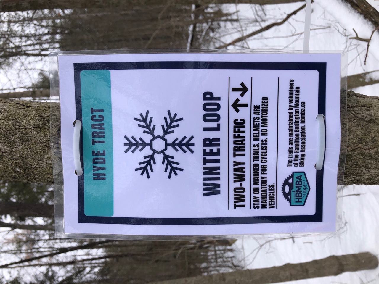
The trails are maintained by volunteers of the HBMBA

HBMBA's Winter Loop 2020
- Stay on marked trails
- Two-way traffic
- Helmets are mandatory
- No motorized vehicles

Detailed Description
2020 Winter Loop is a 3 mile moderately popular easy route located near Freelton Ontario. This mountain bike primary route can be used both directions and has a easy overall physical rating. This route includes 16 trails. This route climbs 200 ft with a max elevation of 993 ft then descends -195 ft.
Tags

Trail Issues on Route

  • Significant Issue / Amber: 1 trail (newest: Jan 31, 2021)
  • Minor Issue / Yellow: 2 trails (newest: Jan 2, 2021)

Local Trail Association

Local trail association
Hamilton Burlington Mountain Biking Association (hbmba.ca)
Please consider joining or donating to the local riding association to support trail development & maintenance.

Stats

  • Distance
    3 miles
  • Avg time
    44 min 23 sec
  • Altitude min
    876 ft
  • Altitude start
    911 ft
  • Altitude end
    919 ft
  • Climb
    200 ft
  • Descent
    -195 ft
  • Grade max
    -15.2%
  • Grade min
    9.6%
  • Distance climb
    1 mile
  • Distance down
    1 mile
  • Distance flat
    3,822 ft

2 Reviews & Comments

MelPoel MelPoel
No changes to Loop for 2021. Winter Loop marked Dec 27/20.

We hope you've been enjoying Trailforks!

Create a FREE account to view all route reviews and much more.
Details

  • Riding area
  • Primary Activity
    Mountain Bike
  • Other Activities
    • Snowshoe
  • Difficulty rating
    Green
  • Route Type
    Loop
  • Bike type
    Fat
  • Direction
    Both Directions
  • Physical rating
    Easy
  • Activity Logs
    7
Avg: 4 (1 votes)
close
Trail transparency
  • Singletrack
  • Unpaved
mtb
198
mtb
119
mtb
117
mtb
121

Recent Trail Reports Along Route

statustraildateconditiondescription
Pine Alley
Jun 8, 2026 @ 11:44am (America/Toronto)
Jun 8, 2026
some fallen brush had to pick up bike twice
North South Connector
Jun 8, 2026 @ 11:44am (America/Toronto)
Jun 8, 2026
trail not maintained past second fork . only option is to turn around or descend blue.
Tractor Way
Jun 8, 2026 @ 11:44am (America/Toronto)
Jun 8, 2026
Beverly Boogey
Jan 31, 2021 @ 8:11am
Jan 31, 2021
Falling tree reporter
Carolinian Can-can
Jan 2, 2021 @ 10:41am
Jan 2, 2021
more reports »
  • By MelPoelTF Pro & contributors
  • #17130 - 2,385 views

Hit the Trail

Open in App

Get this route on your phone instantly.

Download Route

Save to wishlist, Garmin & download.
