7.4 miles
Distance
829 ft
Climb
-827 ft
Descent
808 ft
High Point
2 ft
Altitude change
646 ft
Altitude min
690 ft
Altitude start
692 ft
Altitude end
-32.2%
Grade max
33.4%
Grade min
3 miles
Distance climb
3 miles
Distance down
1 mile
Distance flat

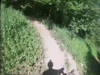
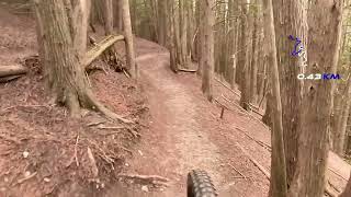
A look through all the different types of terrain at Harold Town. There are only a few spots where there is an overlap.

Detailed Description
7 Kingdoms is a 7 mile popular intermediate route located near Peterborough Ontario. This mountain bike only route can be used one direction and has a moderate overall physical rating. This route includes 15 trails. This route climbs 829 ft with a max elevation of 808 ft then descends -827 ft.
Local Trail Association
Local trail association
Peterborough Trailbuilders Association (www.ptbotrailbuilders.com)
Please consider joining or donating to the local riding association to support trail development & maintenance.
Donate to earn trail karma!

Stats

  • Distance
    7 miles
  • Avg time
    1 hr 4 min
  • Altitude min
    646 ft
  • Altitude start
    690 ft
  • Altitude end
    692 ft
  • Climb
    829 ft
  • Descent
    -827 ft
  • Grade max
    -32.2%
  • Grade min
    33.4%
  • Distance climb
    3 miles
  • Distance down
    3 miles
  • Distance flat
    1 mile

7 Reviews & Comments


We hope you've been enjoying Trailforks!

Create a FREE account to view route comments and much more.

Trails in Route

The Face1,591 ft
Funyun3,287 ft
Hot Breakfast1,886 ft
Barfa Lounger1,388 ft
Scrumpy955 ft
Laundry Chute4,186 ft
Honeymoon2,083 ft
Shack Wacky2,398 ft
Kessel Run1 mile
GeeWiliker-12 miles
GeeWiliker-32 miles
Porcupine Pie203 ft
Uptown5,177 ft
Screaming Trees2,533 ft
Uptown322 ft

Details

  • Riding area
  • Primary Activity
    Mountain Bike
  • Difficulty rating
    Blue
  • Route Type
    Loop
  • Bike type
    XC
  • Direction
    One Direction
  • Physical rating
    Moderate
  • Ridelogs
    2
Avg: 5 (1 votes)
close
3D
Trail Conditions
  • Unknown
  • Snow Groomed
  • Snow Packed
  • Snow Covered
  • Snow Cover Partial
  • Freeze/thaw Cycle
  • Icy
  • Prevalent Mud
  • Wet
  • Variable
  • Ideal
  • Dry
  • Very Dry
Trail Flow (Ridden Direction)
Trailforks scans users ridelogs to determine the most popular direction each trail is ridden. A good flowing trail network will have most trails flowing in a single direction according to their intension.
The colour categories are based on what percentage of riders are riding a trail in its intended direction.
  • > 96%
  • > 90%
  • > 80%
  • > 70%
  • > 50%
  • < 50%
  • bi-directional trail
  • no data
Trail Last Ridden
Trailforks scans ridelogs to determine the last time a trail was ridden.
  • < 2 days
  • < 1 week
  • < 2 weeks
  • < 1 month
  • < 6 months
  • > 6 months
Trail Ridden Direction
The intended direction a trail should be ridden.
  • Downhill Only
  • Downhill Primary
  • Both Directions
  • Uphill Primary
  • Uphill Only
  • One Direction
Contribute Details
Colors indicate trail is missing specified detail.
  • Description
  • Photos
  • Description & Photos
  • Videos
Trail Popularity ?
Trailforks scans ridelogs to determine which trails are ridden the most in the last 9 months. Trails are compared with nearby trails in the same city region with a possible 25 colour shades. Think of this as a heatmap, more rides = more kinetic energy = warmer colors.
  • most popular
  • popular
  • less popular
  • not popular
ATV/ORV/OHV Filter
Max Vehicle Width
inches
US Cell Coverage
Legend
cell carrier legend

Radar Time
Activity Recordings
Trailforks uses anonymized public activity data. ?
Activity Recordings
Trailforks uses anonymized public activity data. ?
Personal Heatmap
Activity Types
all / none
Options
2
Date range month
Winter Trails
Warning A routing network for winter maps does not exist. Selecting trails using the winter trails layer has been disabled.
Missing Trails
Most Popular
Least Popular
Trails are colored based on popularity. The more popular a trail is, the more red. Less popular trails trend towards green.
Jump Magnitude Heatmap
Heatmap of where riders jump on trails. Zoom in to see individual jumps, click circles to view jump details.
BC Backroad Status

Service Road Atlas is a free to use, community-driven service for viewing and creating reports on the numerous back-country service roads around B.C. and Alberta.

map legend
Slope Aspect
Direction the slope faces
Flat N NE E SE S SW W NW
Trails Deemphasized
Trails are shown in grey.
disable
Only show trails with no bike usage.
Enable
Suggested Layers
Based on selected activity type

    Save the current map location and zoom level as your default home location whenever this page is loaded.

    Save
    Trail transparency
    • Singletrack
    54
    43
    44
    54
    A Fast Ride with a Cracked Rib at the Bottom!
    A Fast Ride with a Cracked Rib at the Bottom!
    77 | comments: 0 | favs:
    Jun 11, 2025
    Screaming trees (reverse) (blue) - Harold Town...
    Screaming trees (reverse) (blue) - Harold Town Aug 2 2024
    5:06 | 95 | comments: 0 | favs:
    Sep 10, 2024

    Recent Trail Reports Along Route

    statustraildateconditiondescription
    Kessel Run
    Jun 27, 2026 @ 3:27pm (America/Toronto)
    3 days
    Signs and fences indicate closed but rides well!
    Funyun
    Jun 27, 2026 @ 12:56pm (America/Toronto)
    3 days
    Uptown
    Jun 27, 2026 @ 12:56pm (America/Toronto)
    3 days
    Hot Breakfast
    Jun 27, 2026 @ 12:56pm (America/Toronto)
    3 days
    Shack Wacky
    Jun 27, 2026 @ 12:56pm (America/Toronto)
    3 days
    more reports »
    • By StuPendousStuTF Pro & contributors
    • #36187 - 840 views

    Hit the Trail

    Open in App

    Get this route on your phone instantly.

    Download Route

    Save to wishlist, Garmin & download.