5.1 miles
Distance
128 ft
Climb
-124 ft
Descent
118 ft
High Point
3 ft
Altitude change
76 ft
Altitude min
102 ft
Altitude start
105 ft
Altitude end
-7.3%
Grade max
12.1%
Grade min
1 mile
Distance climb
1 mile
Distance down
3 miles
Distance flat

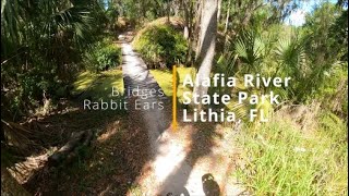
A great loop around Alafia hitting some easier/intermediate trails.

Detailed Description
Alafia Intermediate Loop is a 5 mile moderately popular intermediate route located near Lithia Florida. This mountain bike only route. This route includes 21 trails. This route climbs 128 ft with a max elevation of 118 ft then descends -124 ft.

Trail Issues on Route

  • Closed: 1 trail (newest: May 25, 2026)
Local Trail Association
Local trail association
Friends of Alafia (www.friendsofalafia.org)
Please consider joining or donating to the local riding association to support trail development & maintenance.
Donate to earn trail karma!

Stats

  • Distance
    5 miles
  • Avg time
    59 min 41 sec
  • Altitude change
    3 ft
  • Altitude min
    76 ft
  • Altitude start
    102 ft
  • Altitude end
    105 ft
  • Climb
    128 ft
  • Descent
    -124 ft
  • Grade max
    -7.3%
  • Grade min
    12.1%
  • Distance climb
    1 mile
  • Distance down
    1 mile
  • Distance flat
    3 miles

18 Reviews & Comments


We hope you've been enjoying Trailforks!

Create a FREE account to view route comments and much more.

Details

Avg: 2.35 (3 votes)
close
3D
Trail Conditions
  • Unknown
  • Snow Groomed
  • Snow Packed
  • Snow Covered
  • Snow Cover Partial
  • Freeze/thaw Cycle
  • Icy
  • Prevalent Mud
  • Wet
  • Variable
  • Ideal
  • Dry
  • Very Dry
Trail Flow (Ridden Direction)
Trailforks scans users ridelogs to determine the most popular direction each trail is ridden. A good flowing trail network will have most trails flowing in a single direction according to their intension.
The colour categories are based on what percentage of riders are riding a trail in its intended direction.
  • > 96%
  • > 90%
  • > 80%
  • > 70%
  • > 50%
  • < 50%
  • bi-directional trail
  • no data
Trail Last Ridden
Trailforks scans ridelogs to determine the last time a trail was ridden.
  • < 2 days
  • < 1 week
  • < 2 weeks
  • < 1 month
  • < 6 months
  • > 6 months
Trail Ridden Direction
The intended direction a trail should be ridden.
  • Downhill Only
  • Downhill Primary
  • Both Directions
  • Uphill Primary
  • Uphill Only
  • One Direction
Contribute Details
Colors indicate trail is missing specified detail.
  • Description
  • Photos
  • Description & Photos
  • Videos
Trail Popularity ?
Trailforks scans ridelogs to determine which trails are ridden the most in the last 9 months. Trails are compared with nearby trails in the same city region with a possible 25 colour shades. Think of this as a heatmap, more rides = more kinetic energy = warmer colors.
  • most popular
  • popular
  • less popular
  • not popular
ATV/ORV/OHV Filter
Max Vehicle Width
inches
US Cell Coverage
Legend
cell carrier legend

Radar Time
Activity Recordings
Trailforks uses anonymized public activity data. ?
Activity Recordings
Trailforks uses anonymized public activity data. ?
Personal Heatmap
Activity Types
all / none
Options
2
Date range month
Winter Trails
Warning A routing network for winter maps does not exist. Selecting trails using the winter trails layer has been disabled.
Missing Trails
Most Popular
Least Popular
Trails are colored based on popularity. The more popular a trail is, the more red. Less popular trails trend towards green.
Jump Magnitude Heatmap
Heatmap of where riders jump on trails. Zoom in to see individual jumps, click circles to view jump details.
BC Backroad Status

Service Road Atlas is a free to use, community-driven service for viewing and creating reports on the numerous back-country service roads around B.C. and Alberta.

map legend
Slope Aspect
Direction the slope faces
Flat N NE E SE S SW W NW
Trails Deemphasized
Trails are shown in grey.
disable
Only show trails with no bike usage.
Enable
Suggested Layers
Based on selected activity type

    Save the current map location and zoom level as your default home location whenever this page is loaded.

    Save
    Trail transparency
    • Singletrack
    • Unpaved
    359
    259
    278
    968 | 2 comments
    Bridges/Whoops/Rabbit Ears | Alafia River...
    Bridges/Whoops/Rabbit Ears | Alafia River State Park | Lithia Florida
    trail: Whoops
    6:42 | 83 | comments: 0 | favs:
    Aug 22, 2024
    Bridges/Whoops/Rabbit Ears | Alafia River...
    Bridges/Whoops/Rabbit Ears | Alafia River State Park | Lithia Florida
    6:42 | 150 | comments: 0 | favs:
    Aug 22, 2024

    Recent Trail Reports Along Route

    statustraildateconditiondescription
    Rollercoaster
    Jun 4, 2026 @ 9:47am (America/Havana)
    Jun 4, 2026
    Rollercoaster
    Jun 4, 2026 @ 9:47am (America/Havana)
    Jun 4, 2026
    Bridges (N)
    Jun 4, 2026 @ 9:47am (America/Havana)
    Jun 4, 2026
    Whoops
    Jun 4, 2026 @ 9:47am (America/Havana)
    Jun 4, 2026
    Lost Meadow
    May 25, 2026 @ 4:30pm (America/New_York)
    May 25, 2026
    more reports »
    • By LydonMatt & contributors
    • #6703 - 2,305 views

    Hit the Trail

    Open in App

    Get this route on your phone instantly.

    Download Route

    Save to wishlist, Garmin & download.