

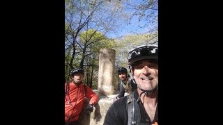
Ruta para conocer las mejores bajadas del monte Albertia, en todas sus vertientes. Partiendo del parking de Landa y tras un breve paso por la vía verde, remontaremos por la pista que va paralela a La Casita hasta llegar a la cima del monte Albertia (última parte por sendero). De la cumbre nacen 3 de las bajadas de la ruta, empezaremos por la bajada hacia Legutio, enlazando tramos con peraltes y saltos (alguno de ellos muy largo). Tras un tramo de pedaleo por sendero, remontaremos hasta el inicio de Legutio Flow, una maravilla de sendero donde se puede coger velocidad y aire, en función de las capacidades de cada uno. Hay varios saltos noblotes que se les puede dar a vista. Si está limpia de hojas y/o se conoce bien el trazado, es de las bajadas más fluidas y divertidas en kilómetros a la redonda.
Al finalizar, tocará remontar primero por pista y luego por la senda Helechos, hasta llegar al collado y de ahí remontar por segunda vez hasta la cumbre de nuestra referencia de hoy. Legor sale unos pocos metros antes de la cumbre, será nuestra segunda del día. Con más dificultad que Legutio Flow, tiene pasos de roca con cierta dificultad técnica, y algún tobogán empinado donde sentirás la fuerza G en tu cabeza. En otros tramos, es rápida y noble, pero no puedes confiarte si no quieres acabar en el fondo de una sima.
Llegados a la pista, remontamos a mano derecha, donde veremos el final de Simas, la tercera del día. El remonte es bastante amable, por pista a través del hayedo hasta enlazar con el collado de Albertia, donde enlazaremos por tercera y última vez con el sendero de subida hacia la cima. Simas sale un poco antes que Legor, y es también una bajada roja natural con algún tramo un pelín expuesto a las simas que va bordeando. Impresionante cómo se adapta a la orografía y elementos del monte. Hay un salto sobre una sima que hay que dar con decisión. Asusta más de lo que es, saltar sobre el "vacío" acojona, pero realmente con la inercia que traes del anterior tobogán se hace muy suave. Algún salto doble más y un par de pasos comprometidos de raíces antes de caer a la misma pista por la que hemos remontado al acabar Legor.
De nuevo, remonte hasta el collado, donde nos espera Golfa, otra bajada picantona que mira al sur. Empieza muy fuerte, con tres toboganes que se ruedan, pero hay que echarle huevos, son muy verticales. Luego el tema discurre de una manera mucho más fluída, y te animas a soltar los frenos, pero con cuidado, porque hay algunos puntos donde acabar abrazando un árbol no es en absoluto complicado. Algunos saltos dispersos, un par de ellos de darles con velocidad, no hay mucha inercia y no es dificil quedarse corto.
El remonte lo haremos de nuevo por sendero, hasta llegar a la pista de subida paralela a La Casita. No remontaremos hasta el inicio, sino únicamente hasta donde empieza la variante La Casita Jumps, una divertida línea de saltos facilitos que le dan un poco de picante a la por otro lado fluida y noble bajada de La Casita. Pasados los saltos, se trata de bajar pulsaciones por un La Casita, sendero facilito y con algunos tramos de pedaleo. La vuelta al partking la haremos por la vía verde que hemos cogido al principio.
Muy importante: para disfrutar esta ruta como merece, es preferible realizarla en primavera/verano, antes de que las hojas de las hayas oculten parcialmente los senderos. Esto es especialmente importante en Legutio Flow, Legor y Simas.
Local Trail Association
Kanpezuko Xenda GarbitzaileakStats
-
Distance14 miles
-
Altitude min1,794 ft
-
Altitude start1,794 ft
-
Altitude end1,795 ft
-
Climb3,318 ft
-
Descent-3,316 ft
-
Grade max-66%
-
Grade min50.9%
-
Distance climb7 miles
-
Distance down5 miles
-
Distance flat1 mile
28 Reviews & Comments
We hope you've been enjoying Trailforks!
Create a FREE account to view all route reviews and much more.
Trails in Route
| 394 ft | |||||
| 1 mile | |||||
| 1,142 ft | |||||
| 2,592 ft | |||||
| 4,268 ft | |||||
| 1,010 ft | |||||
| 1,834 ft | |||||
| 2,136 ft | |||||
| 522 ft | |||||
| 3 miles | |||||
| 2,805 ft | |||||
| 2 miles | |||||
| 2,687 ft | |||||
| 2,579 ft | |||||
| 2,569 ft | |||||
| 3,468 ft | |||||
| 3,967 ft | |||||
| 961 ft | |||||
| 384 ft |

Details
Directions
- Walk northeast on Bergarako errepidea/Carretera de Vergara.
- Continue for 300 meters.
- Make a sharp left onto Vasco Navarro Vitoria-Gasteiz-Landa.
- Continue for 1.5 kilometers.
- Walk northeast on Salida Casita.
- Continue for 10 meters.
- Keep left to stay on Salida Casita.
- Continue for 80 meters.
- Keep left to take Albertia.
- Continue for 2 kilometers.
- Turn right onto Helechos.
- Continue for 20 meters.
- Turn left onto Acceso Cima Albertia.
- Continue for 300 meters.
- Turn left to stay on Acceso Cima Albertia.
- Continue for 2 kilometers.
- Turn right onto Enlace Tantaidui Erreka - GR282.
- Continue for 400 meters.
- Make a sharp left onto Legutio Flow - Goiko Zatia.
- Continue for 400 meters.
- Turn right onto Cima Albertia-GR282.
- Continue for 400 meters.
- Keep left to take Legutio Flow -Beheko Zatia.
- Continue for 20 meters.
- Keep right to stay on Legutio Flow -Beheko Zatia.
- Continue for 30 meters.
- Keep right to stay on Legutio Flow -Beheko Zatia.
- Continue for 30 meters.
- Keep right to stay on Legutio Flow -Beheko Zatia.
- Continue for less than 10 meters.
- Keep left to stay on Legutio Flow -Beheko Zatia.
- Continue for 20 meters.
- Keep right to stay on Legutio Flow -Beheko Zatia.
- Continue for 10 meters.
- Keep right to stay on Legutio Flow -Beheko Zatia.
- Continue for 30 meters.
- Keep right to stay on Legutio Flow -Beheko Zatia.
- Continue for less than 10 meters.
- Keep left to stay on Legutio Flow -Beheko Zatia.
- Continue for 30 meters.
- Keep left to stay on Legutio Flow -Beheko Zatia.
- Continue for 20 meters.
- Keep left to stay on Legutio Flow -Beheko Zatia.
- Continue for less than 10 meters.
- Turn right to stay on Legutio Flow -Beheko Zatia.
- Continue for 10 meters.
- Keep straight to stay on Legutio Flow -Beheko Zatia.
- Continue for 20 meters.
- Keep straight to stay on Legutio Flow -Beheko Zatia.
- Continue for less than 10 meters.
- Keep right to stay on Legutio Flow -Beheko Zatia.
- Continue for 10 meters.
- Keep left to stay on Legutio Flow -Beheko Zatia.
- Continue for 20 meters.
- Keep straight to stay on Legutio Flow -Beheko Zatia.
- Continue for 10 meters.
- Keep straight to stay on Legutio Flow -Beheko Zatia.
- Continue for less than 10 meters.
- Keep straight to stay on Legutio Flow -Beheko Zatia.
- Continue for 10 meters.
- Keep left to stay on Legutio Flow -Beheko Zatia.
- Continue for 10 meters.
- Keep straight to stay on Legutio Flow -Beheko Zatia.
- Continue for 20 meters.
- Keep straight to stay on Legutio Flow -Beheko Zatia.
- Continue for 10 meters.
- Keep straight to stay on Legutio Flow -Beheko Zatia.
- Continue for less than 10 meters.
- Keep right to stay on Legutio Flow -Beheko Zatia.
- Continue for less than 10 meters.
- Keep right to stay on Legutio Flow -Beheko Zatia.
- Continue for 20 meters.
- Keep right to stay on Legutio Flow -Beheko Zatia.
- Continue for less than 10 meters.
- Keep right to stay on Legutio Flow -Beheko Zatia.
- Continue for 30 meters.
- Keep right to stay on Legutio Flow -Beheko Zatia.
- Continue for 20 meters.
- Keep left to stay on Legutio Flow -Beheko Zatia.
- Continue for less than 10 meters.
- Keep straight to stay on Legutio Flow -Beheko Zatia.
- Continue for 20 meters.
- Keep straight to stay on Legutio Flow -Beheko Zatia.
- Continue for 20 meters.
- Keep left to stay on Legutio Flow -Beheko Zatia.
- Continue for 10 meters.
- Keep left to stay on Legutio Flow -Beheko Zatia.
- Continue for 20 meters.
- Keep straight to stay on Legutio Flow -Beheko Zatia.
- Continue for 40 meters.
- Keep straight to stay on Legutio Flow -Beheko Zatia.
- Continue for 10 meters.
- Keep left to stay on Legutio Flow -Beheko Zatia.
- Continue for 20 meters.
- Keep straight to stay on Legutio Flow -Beheko Zatia.
- Continue for less than 10 meters.
- Keep straight to stay on Legutio Flow -Beheko Zatia.
- Continue for less than 10 meters.
- Keep left to stay on Legutio Flow -Beheko Zatia.
- Continue for less than 10 meters.
- Keep straight to stay on Legutio Flow -Beheko Zatia.
- Continue for less than 10 meters.
- Turn right to stay on Legutio Flow -Beheko Zatia.
- Continue for 20 meters.
- Keep right to stay on Legutio Flow -Beheko Zatia.
- Continue for 30 meters.
- Turn right to stay on Legutio Flow -Beheko Zatia.
- Continue for 10 meters.
- Keep straight to stay on Legutio Flow -Beheko Zatia.
- Continue for 20 meters.
- Keep right to stay on Legutio Flow -Beheko Zatia.
- Continue for less than 10 meters.
- Keep left to stay on Legutio Flow -Beheko Zatia.
- Continue for 10 meters.
- Keep straight to stay on Legutio Flow -Beheko Zatia.
- Continue for 20 meters.
- Walk southwest on Cima Albertia-GR282.
- Continue for less than 10 meters.
- Keep left to stay on Cima Albertia-GR282.
- Continue for 10 meters.
- Keep straight to stay on Cima Albertia-GR282.
- Continue for 30 meters.
- Keep right to stay on Cima Albertia-GR282.
- Continue for 20 meters.
- Keep right to stay on Cima Albertia-GR282.
- Continue for 20 meters.
- Keep left to stay on Cima Albertia-GR282.
- Continue for 30 meters.
- Keep straight to stay on Cima Albertia-GR282.
- Continue for 20 meters.
- Keep left to stay on Cima Albertia-GR282.
- Continue for 10 meters.
- Keep straight to stay on Cima Albertia-GR282.
- Continue for 60 meters.
- Keep straight to stay on Cima Albertia-GR282.
- Continue for 70 meters.
- Keep straight to stay on Cima Albertia-GR282.
- Continue for 20 meters.
- Keep left to stay on Cima Albertia-GR282.
- Continue for 10 meters.
- Keep straight to stay on Cima Albertia-GR282.
- Continue for 30 meters.
- Keep straight to stay on Cima Albertia-GR282.
- Continue for 10 meters.
- Keep straight to stay on Cima Albertia-GR282.
- Continue for 20 meters.
- Keep left to stay on Cima Albertia-GR282.
- Continue for 20 meters.
- Keep right to stay on Cima Albertia-GR282.
- Continue for 20 meters.
- Keep left to stay on Cima Albertia-GR282.
- Continue for 10 meters.
- Keep straight to stay on Cima Albertia-GR282.
- Continue for less than 10 meters.
- Keep straight to stay on Cima Albertia-GR282.
- Continue for 40 meters.
- Keep right to stay on Cima Albertia-GR282.
- Continue for 10 meters.
- Keep straight to stay on Cima Albertia-GR282.
- Continue for 50 meters.
- Keep straight to stay on Cima Albertia-GR282.
- Continue for less than 10 meters.
- Bear left to stay on Cima Albertia-GR282.
- Continue for 10 meters.
- Keep straight to stay on Cima Albertia-GR282.
- Continue for 70 meters.
- Keep right to stay on Cima Albertia-GR282.
- Continue for 40 meters.
- Keep straight to stay on Cima Albertia-GR282.
- Continue for 10 meters.
- Keep straight to stay on Cima Albertia-GR282.
- Continue for 40 meters.
- Keep right to stay on Cima Albertia-GR282.
- Continue for 30 meters.
- Keep straight to stay on Cima Albertia-GR282.
- Continue for 10 meters.
- Keep right to stay on Cima Albertia-GR282.
- Continue for 10 meters.
- Keep left to stay on Cima Albertia-GR282.
- Continue for 20 meters.
- Keep straight to stay on Cima Albertia-GR282.
- Continue for 30 meters.
- Keep right to stay on Cima Albertia-GR282.
- Continue for 20 meters.
- Turn right onto Final Helechos.
- Continue for 200 meters.
- Keep left to take Helechos.
- Continue for 2 kilometers.
- Turn left onto Acceso Cima Albertia.
- Continue for 300 meters.
- Turn left to stay on Acceso Cima Albertia.
- Continue for 500 meters.
- Walk northeast on Legor.
- Continue for 700 meters.
- Turn right onto Cantera Pagola.
- Continue for 400 meters.
- Turn right onto Remonte Albertia.
- Continue for 800 meters.
- Turn right onto Acceso Cima Albertia.
- Continue for 300 meters.
- Turn left to stay on Acceso Cima Albertia.
- Continue for 400 meters.
- Turn right onto Simas.
- Continue for 800 meters.
- Turn right onto Cantera Pagola.
- Continue for 300 meters.
- Turn right onto Remonte Albertia.
- Continue for 800 meters.
- Keep right to take Helechos.
- Continue for 60 meters.
- Unknown
- Snow Groomed
- Snow Packed
- Snow Covered
- Snow Cover Partial
- Freeze/thaw Cycle
- Icy
- Prevalent Mud
- Wet
- Variable
- Ideal
- Dry
- Very Dry
The colour categories are based on what percentage of users are riding a trail in its intended direction.
- > 96%
- > 90%
- > 80%
- > 70%
- > 50%
- < 50%
- bi-directional trail
- no data
- < 2 days
- < 1 week
- < 2 weeks
- < 1 month
- < 6 months
- > 6 months
- Downhill Only
- Downhill Primary
- Both Directions
- Uphill Primary
- Uphill Only
- One Direction
- Description
- Photos
- Description & Photos
- Videos
- most popular
- popular
- less popular
- not popular
Service Road Atlas is a free to use, community-driven service for viewing and creating reports on the numerous back-country service roads around B.C. and Alberta.
Save the current map location and zoom level as your default home location whenever this page is loaded.
Save- Singletrack
- Unpaved
Photos
Videos

